A heat wave over the Southwest will intensify this week, peaking and expanding into the Intermountain West and northern High Plains this weekend. Critical to extremely critical fire weather conditions are forecast from the Northwest and the northern Great Basin this weekend. Particularly Dangerous Situation Red Flag Warnings have been issued. Read More >
Pocatello, ID
Weather Forecast Office
The lightning strike graphics for Eastern Idaho are currently unavailable. We apologize for the inconvenience.
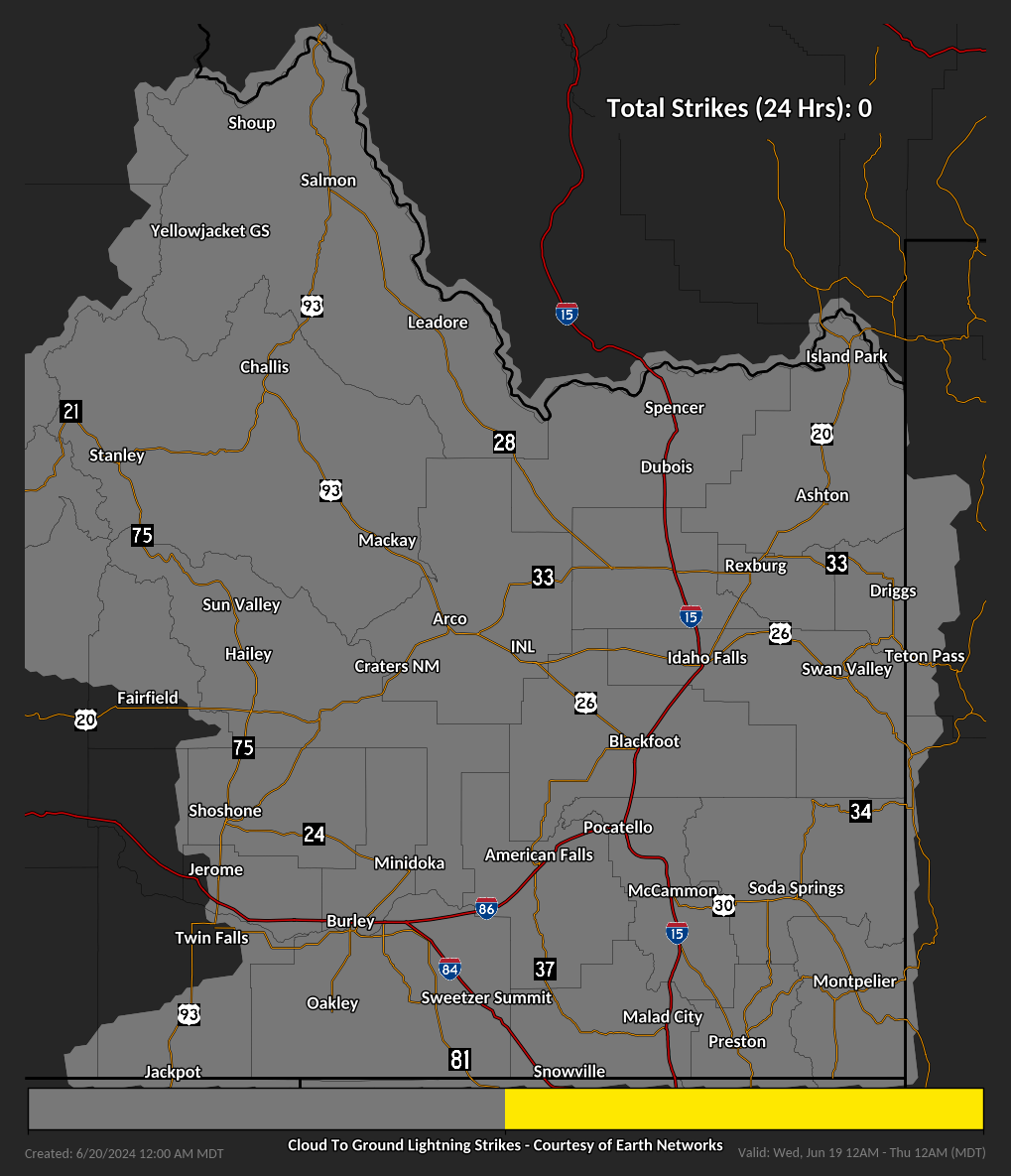
These graphics are cumulative lightning strike maps for eastern Idaho. Mouse-over each day to view the 24-Hour Cumulative Lightning Strike Map.
Updated daily at midnight, they are useful for determining where lightning has occurred over the previous 24 hour period, going back 6 days. This information could be helpful for determining where potential lightning-related fire starts may have occurred during recent thunderstorm activity. An individual strike shows up as a single yellow dot, multiple dots close together indicate an active thunderstorm moved through a particular area.
US Dept of Commerce
National Oceanic and Atmospheric Administration
National Weather Service
Pocatello, ID
1945 Beechcraft Ave
Pocatello, ID 83204
(208) 233-0834
Comments? Questions? Please Contact Us.