|
An RFC Map from 1959 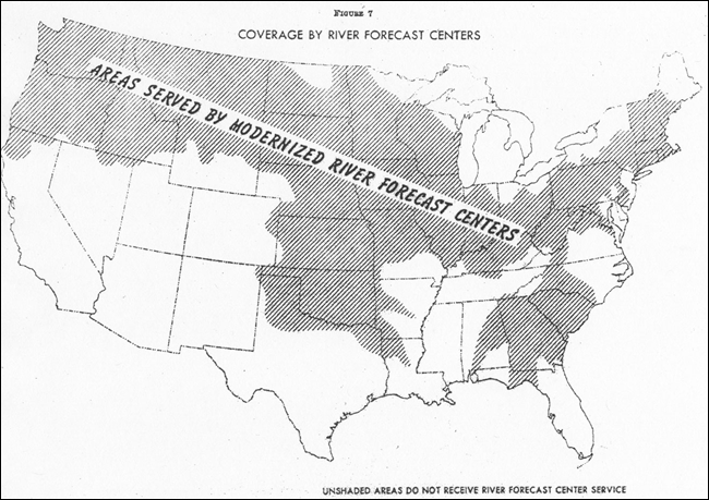
This map from 1969 shows the expanded coverage of the country’s rivers, just 10 years later 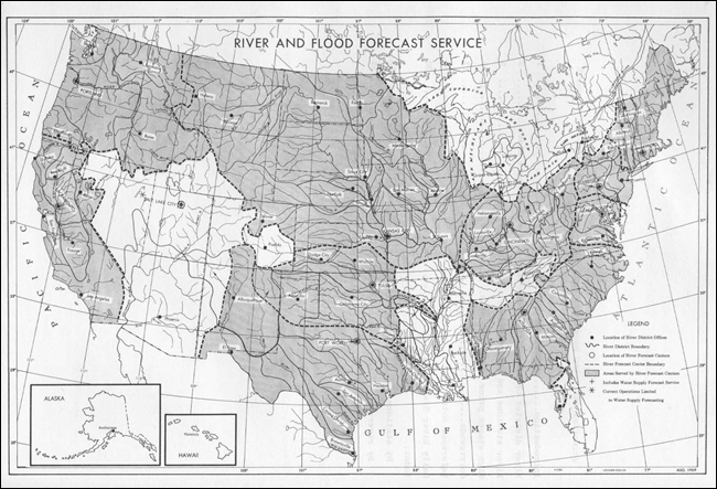
The RFC map as it stands today, covering the entire continental U.S. along with Alaska 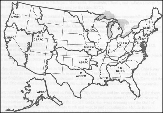
APRFC's area also includes Hawaii and other Pacific U.S.territories and SERFC's area also includes Puerto Rico. |

