National Weather Service United States Department of Commerce

Maine River Basins


Northern Maine River Basins


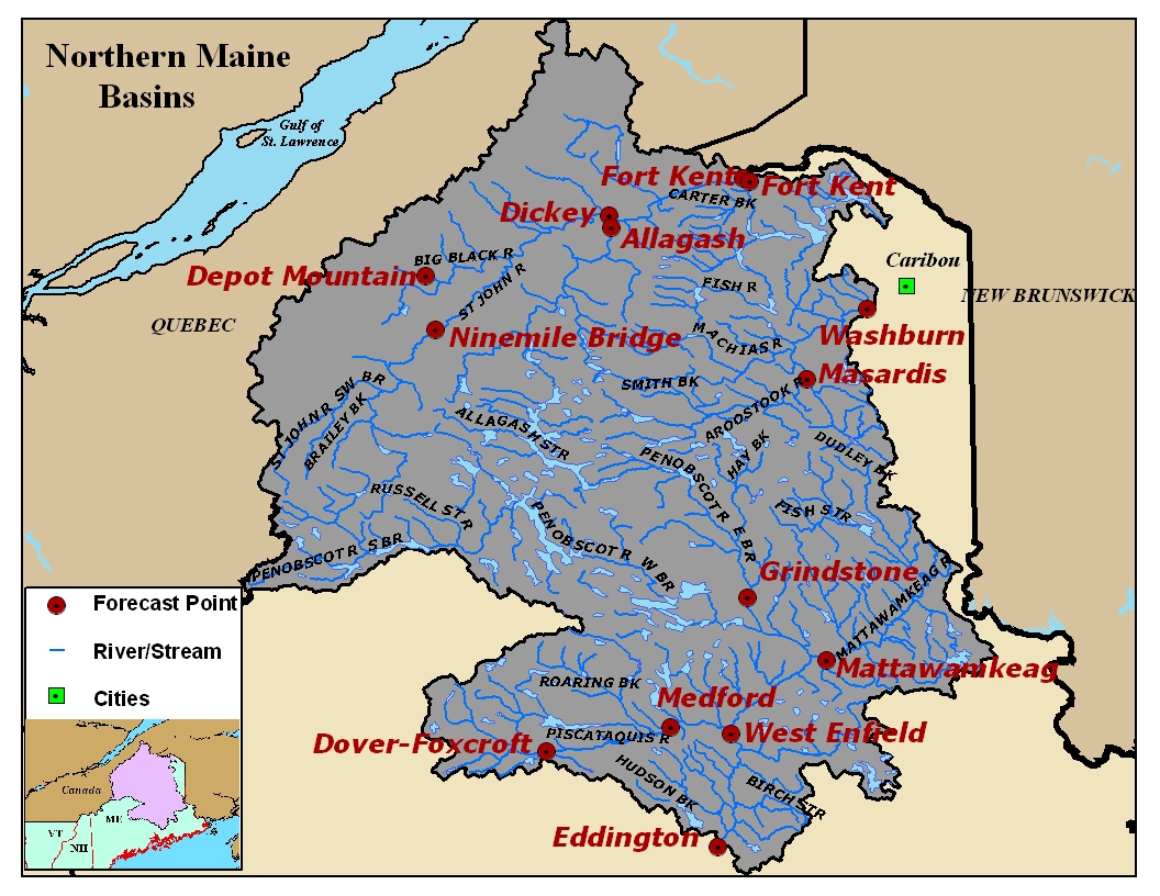
Map of the Northern Maine River Basins. Click on the image to go to the interactive AHPS page.
 

Big Black River at Big Black/Depot Mtn., ME (BBRM1) - High Flow Forecast Location


St. John River at Nine Mile Bridge, ME (NINM1) - High Flow Forecast Location


St. Francis River near Conners, New Brunswick (STFB3) - High Flow Forecast Location


St. John River at Dickey, ME (DICM1)


Allagash River at Allagash, ME (ALLM1) - High Flow Forecast Location


St. John River at Ft. Kent, ME (FTKM1)


Fish River at Ft. Kent, ME (FIHM1) - High Flow Forecast Location


Aroostook River at Masardis, ME (MASM1)


Aroostook River at Washburn, ME (WSHM1)


East Branch of the Penobscot River at Grindstone, ME (GRNM1)


Mattawamkeag River at Mattawamkeag, ME (MATM1)


Piscataquis River at Dover-Foxcroft, ME (DOVM1)


Piscataquis River at Medford, ME (MFDM1) - High Flow Forecast Location


Penobscot River at West Enfield, ME (WENM1)


Penobscot River at Eddington, ME (EDDM1) - High Flow Forecast Location


Southern Maine River Basins


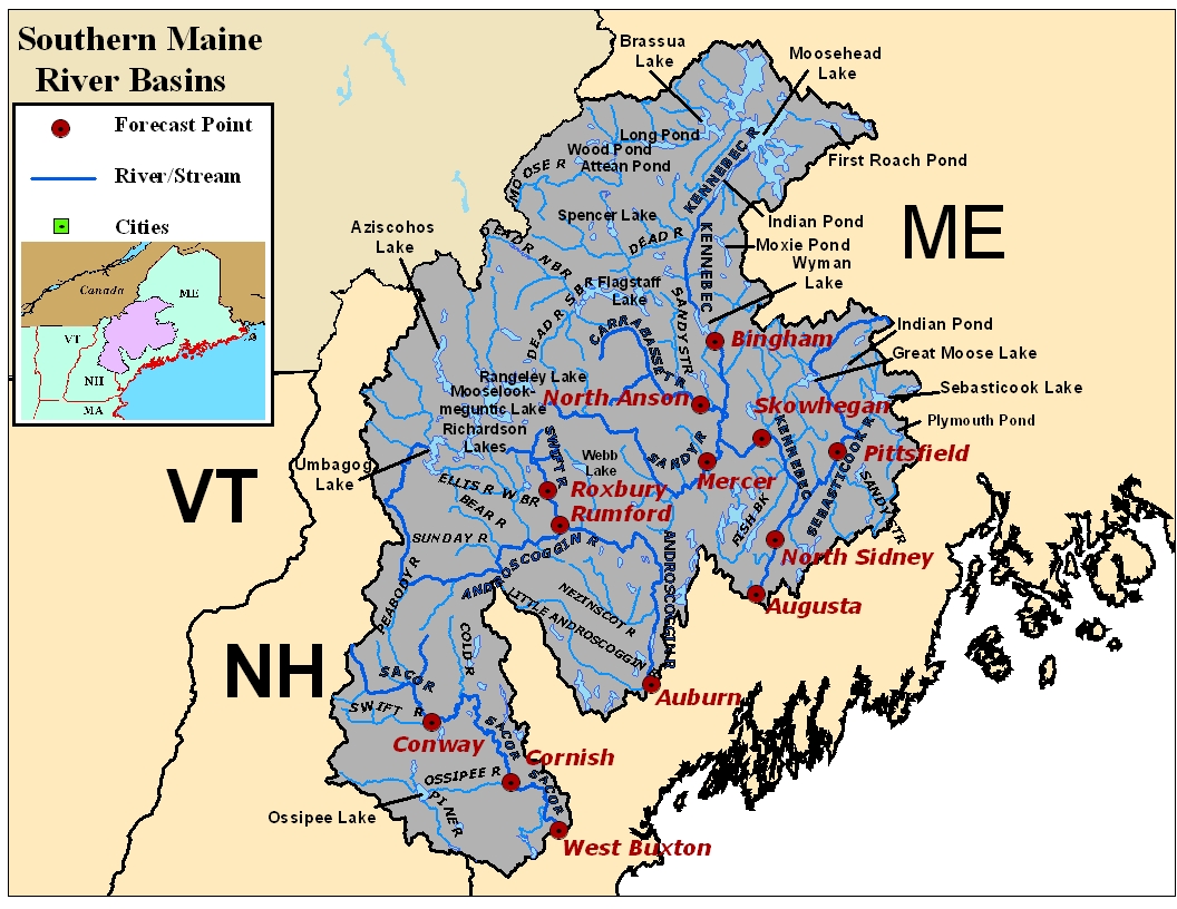
Map of the Southern Maine River Basins. Click on the image to go to the interactive AHPS page.
 

Kennebec River at Bingham Wyman Dam, ME (BNGM1)


Carrabassett River at North Anson, ME (NANM1)


Sandy River at Mercer, ME (MERM1)


Kennebec River at Skowhegan, ME (SKOM1)


Sebasticook River at Pittsfield, ME (PITM1)


Kennebec River at North Sidney, ME (SIDM1)


Kennebec River at Augusta, ME (AUGM1) - High Flow Forecast Location


Swift River at Roxbury, ME (ROXM1)


Androscoggin River at Rumford, ME (RMFM1)


Androscoggin River at Auburn, ME (AUBM1)


Saco River at Conway, NH (CNWN3)


Saco River at Cornish, ME (CNHM1) - High Flow Forecast Location


Saco River at West Buxton, ME (WBXM1)


Additional Photos


Record Flooding on the St. John, Fish, and Aroostook Rivers, April-May 2008