Thunderstorms, some severe, may produce heavy to excessive rainfall over portions of the Central/Southern Plains, Mississippi Valley and Southeast. Dry and windy conditions will pose an elevated fire weather risk over parts of western Florida. Read More >
Overview
|
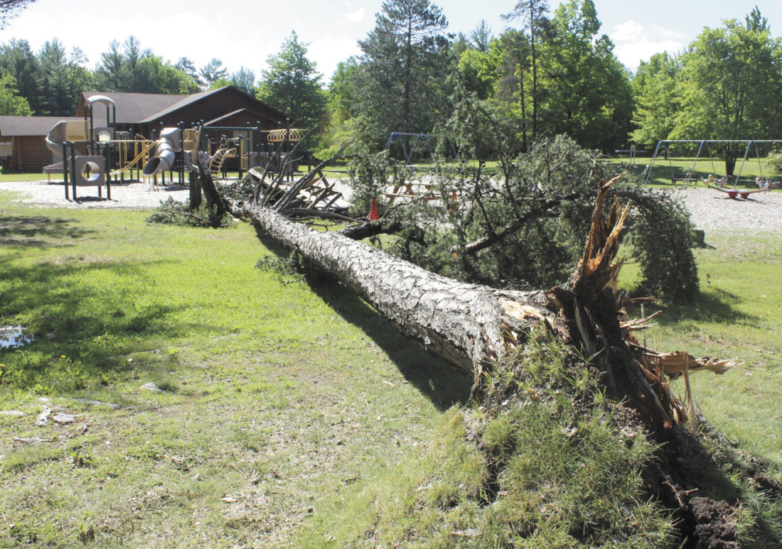
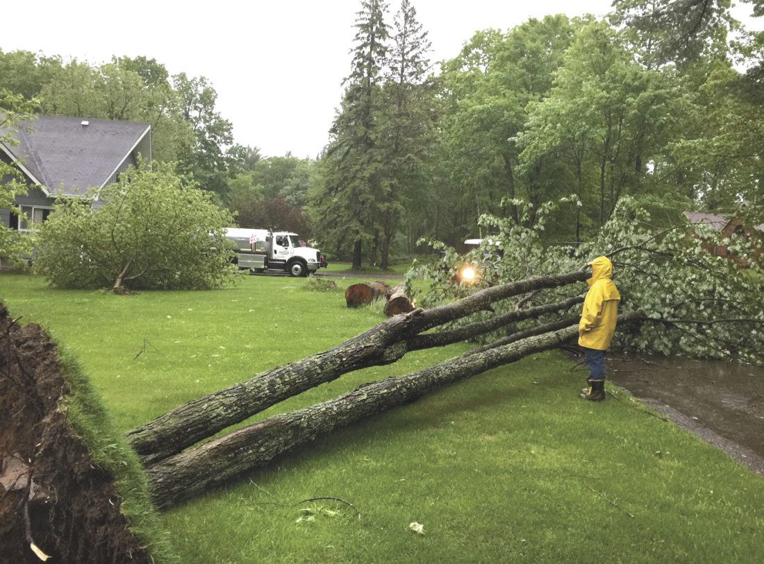
On Sunday, June 11th, a strong line of showers and thunderstorms pushed east across portions of the Upper Peninsula. This area of showers and thunderstorms originated early in the morning across the Central Plains and produced considerable severe weather over Minnesota/Wisconsin before clipping Iron/Dickinson/Delta/Menominee/Schoolcraft counties in the U.P early in the afternoon. Numerous trees were reported down with this strong line of thunderstorms, which ultimately led to several thousand residents without power and a few smaller buildings being damaged. |
|
Photos:
Storm Damage Photos
 |
 |
 |
 |
| Iron Mountain - City Park. Courtesy Mountain-Daily News | Russell Street Iron Mountain - Courtesy Tracey Steeple | M73 Culvert Washout - Courtesy of MDOT | M73 Culvert Washout - Courtesy of TV6 |
Storm Reports:
Environment/Meteorology:
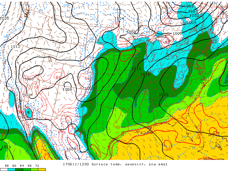
A warm moist frontal boundary started the day oriented across South-Central Minnesota to Central Wisconsin. In addition to this boundary, was a surface ridge centered over the Southeastern United States. As the day progressed, the frontal boundary began to lift north towards the U.P. with increasing instability from Minnesota to Wisconsin. Images below indicate the dewpoint (color shading), which was well above climatology with dewpoints in the lower to middle 60s. Meanwhile to the north of the boundary dewpoints were much cooler in the middle to upper 50s.
 |
 |
 |
 |
| Temp/Dewpoint/MSLP 12Z (8AM EDT) | Temp/Dewpoint/MSLP 15Z (11AM EDT) | Temp/Dewpoint/MSLP 18Z (2PM EDT) | Temp/Dewpoint/MSLP 21Z (5PM EDT) |
The upper level wind pattern supported deep layer flow from southwest to east/northeast from the analyzed 300hPa. Images below indicate the upper level winds (shading) and in pink is the upper level divergence. This divergence is in indication of where the strongest or most dynamic environment existed, and also suggests where the strongest low-level convergence may have been present.
 |
 |
 |
 |
| Jet Stream (300hPa) 12Z | Jet Stream (300hPa) 15Z | Jet Stream (300hPa) 18Z | Jet Stream (300hPa) 21Z |
With the surface ridge centered over the Southeast CONUS, the Gulf of America became the main source for moisture or what we call return flow moisture. This moisture feed was being pumped north through the Ozarks into the Ohio Valley and Western Great Lakes/Upper Midwest as the mid-level flow was from the south/southwest. The stronger mid-level shortwave that was producing extensive severe thunderstorms across the Central Plains slowly lifted northeast towards the Upper Midwest/Western Great Lakes later in the day.
 |
 |
 |
 |
| 850hPa HGHT/Temp/Td 12Z | 850hPa HGHT/Temp/Td 15Z | 850hPa HGHT/Temp/Td 18Z |
850hPa HGHT/Temp/Td 21Z |
In addition to the severe weather concerns of damaging winds and hail, was heavy rain. With the abnormally moist airmass, and the tropical origins of the Western Gulf of America, thunderstorms could easily produce heavy rainfall in a short period of time. The upper level pattern (300hPa images above), also suggest that as storms developed upstream (west/southwest) of the U.P. they would continue to follow northeast along this axis.
 |
 |
| 850hPa Moisture Transport 12Z | 850hPa Moisture Transport 15Z |
High-Resolution forecast models have continued to improve over the recent decade, and with technological advancements this allows forecasters to improve the ability to relay with higher confidence when/where weather will develop and impact. While there are still some limitations, on Sunday morning the HRRR forecast model performed relatively well in depicting the placement and timing of the expected storms later in the day. Below is the animation of what the radar may look like during the convective event. The timing ended up being about an hour early and slightly too far north.
 |
| HRRR Forecast Radar 11June2017 |
Other Links:
This area will continue to update with additional information about resources in regards to various items we have discussed above.
 |
Media use of NWS Web News Stories is encouraged! Please acknowledge the NWS as the source of any news information accessed from this site. |
 |