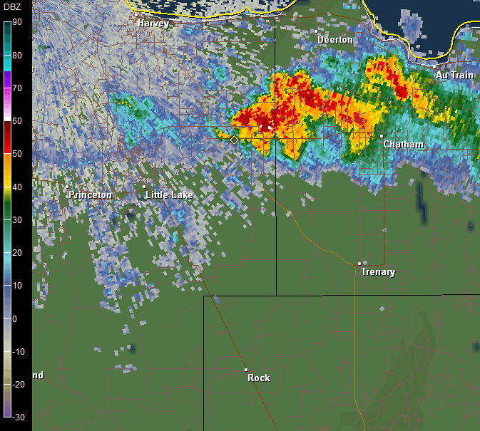
Thunderstorms developed along the Lake Superior lake breeze Sunday evening, July 29, 2012. The cluster of thunderstorms then moved south across eastern Marquette County, western Alger County, and northern Delta county. One of the thunderstorms developed supercell characteristics as it approached Kiva around 8:50 PM EDT in far western Alger County.
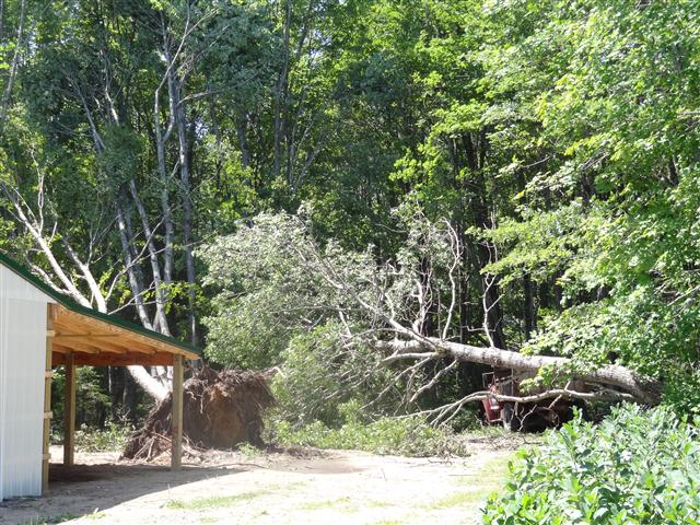
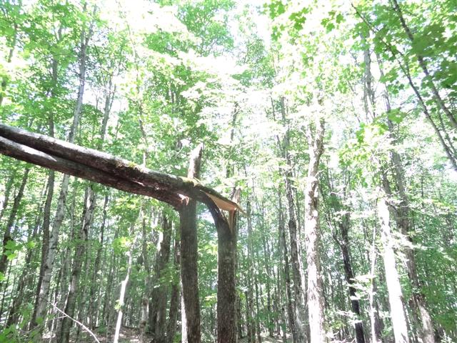
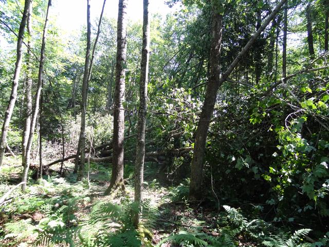
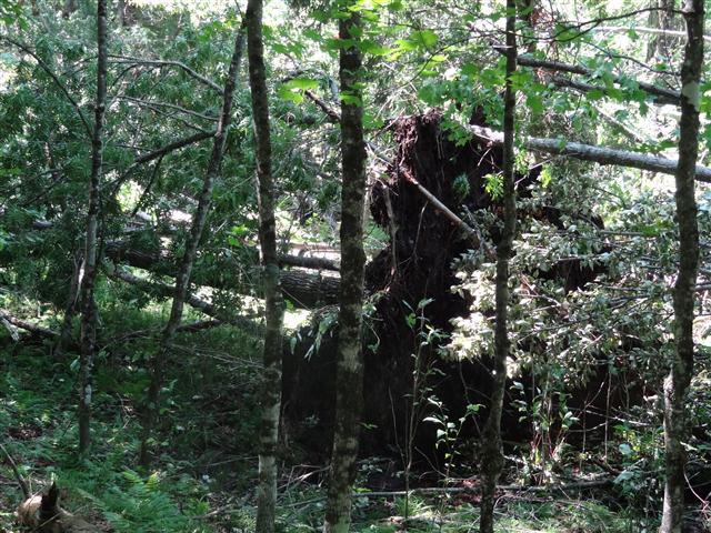
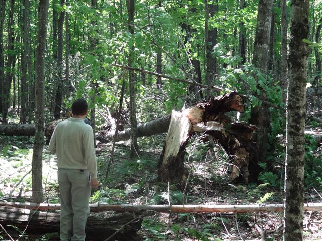
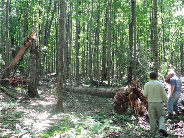
The National Weather Service was notified of an area where hundreds of trees were snapped or uprooted by strong winds from this severe thunderstorm in a very localized area a few miles south southwest of Kiva. The NWS surveyed the damage caused by this storm and determined the damage was caused by a microburst or straight line winds. The survey found a 100 yard wide and half a mile long area of concentrated tree damage where winds were estimated to have been around 80 mph. Surrounding this area the tree damage was more sporadic and wind gusts were estimated to be around 60 mph. The divergent nature of the damage made it clear that the damage was non-tornadic and caused by a microburst or straight line winds. Other than some minor roof damage there was no other damage to structures, but several uprooted trees narrowly missed some outbuildings.
 |
|
This map shows the general area where the microburst/wind damage occurred. The arrows show the divergent nature of the damage. |
 |
 |
| This is a reflectivity radar loop showing the evolution of the thunderstorms from just after they developed along the lake breeze to shortly after the microburst occurred. |
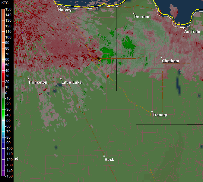
This is a radar loop showing the ground relative velocity as the storms moved to the south. The green colors on the image are precipitation particles moving towards the radar and the red are precipitation particles moving away from the radar. The brighter the reds and pinks, the stronger the winds. |
 |
 |
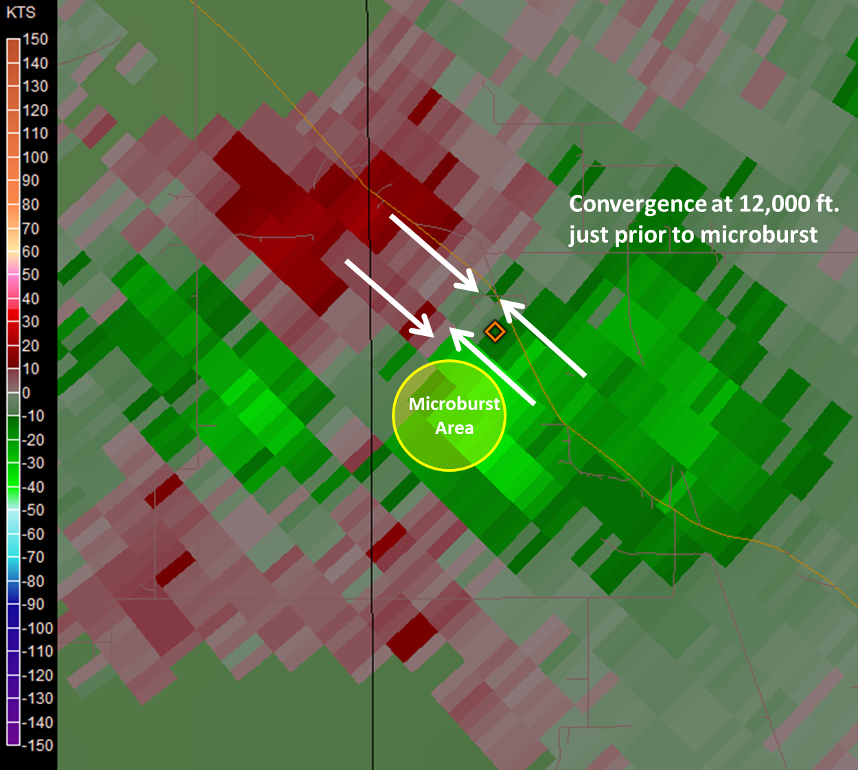
| Here is a velocity radar image from 8:50 PM EDT, just prior to the microburst. This image shows a signature that is often a precursor to strong winds occurring at the ground. This image shows an area of converging winds (green towards the radar, red away) in the mid levels of the thunderstorms around 12,000 feet above the ground. As winds converge in the mid levels of the storm they enhance the downdraft within the thunderstorm which have the potential to produce damaging winds on the ground. |
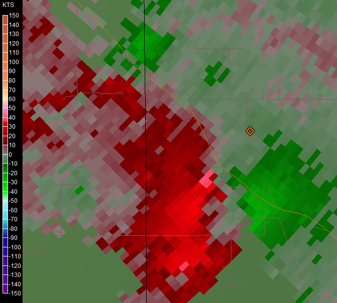
Here is a velocity image from the lowest scan of the radar a few minutes after the microburst occurred. The radar does show an area of enhanced winds moving away from the radar (red) in excess of 40 knots shortly after the damaging winds occurred. |
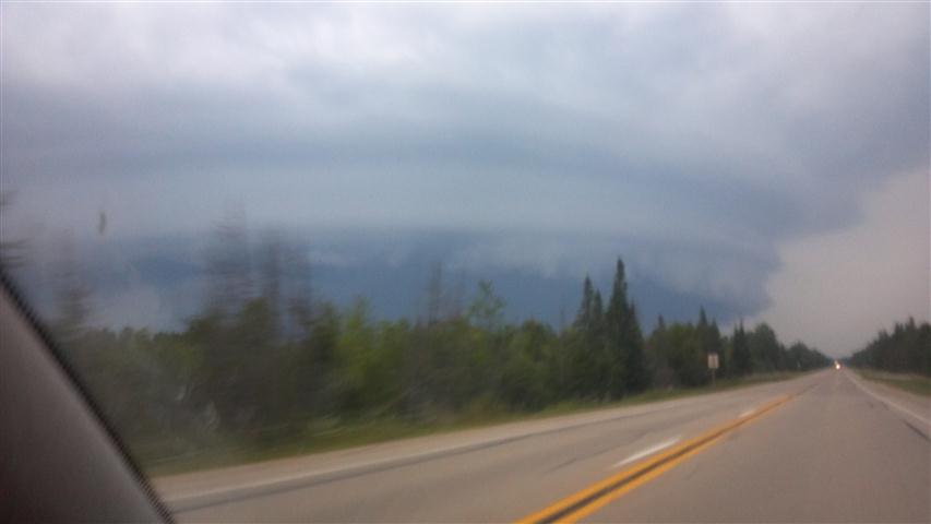
Below are several damage pictures along with a picture courtesy of Todd Skinner of the storm taken from U.S. 41 around the time of the microburst.
 |
 |
 |
 |
 |
 |
 |
 |
 |

