A storm system will track from the southern Plains to the Upper Midwest today. Severe thunderstorms are expected from east Texas into far southeast Iowa and Illinois. A strong tornado and damaging wind potential will exist from central Arkansas into central Missouri. Heavy to excessive rainfall from eastern Texas into the Midwest states may bring new or renewed areas of flooding. Read More >
Marquette, MI
Weather Forecast Office
Duck Lake Fire May 2012
The following two images show a look at the fire from approximately 1pm on May 25th. The image on the left is a visible image and shows the broad smoke plume pushing east across Whitefish Bay and into southern Ontario. This eastward push of the fire and the smoke was caused by winds shifting to the west-northwest this morning behind a cold front. The image on the right is a "false" color image using the same satellite. This allows the burn scar to become more visible compared to the growing vegetation (in green) surrounding the fire. You can view larger versions by clicking on the image.
 |
 |
The satellite images above come from the MODIS Satellite and are from the SSEC at University of Wisconsin-Madison.
Original Post on 5/24/12:
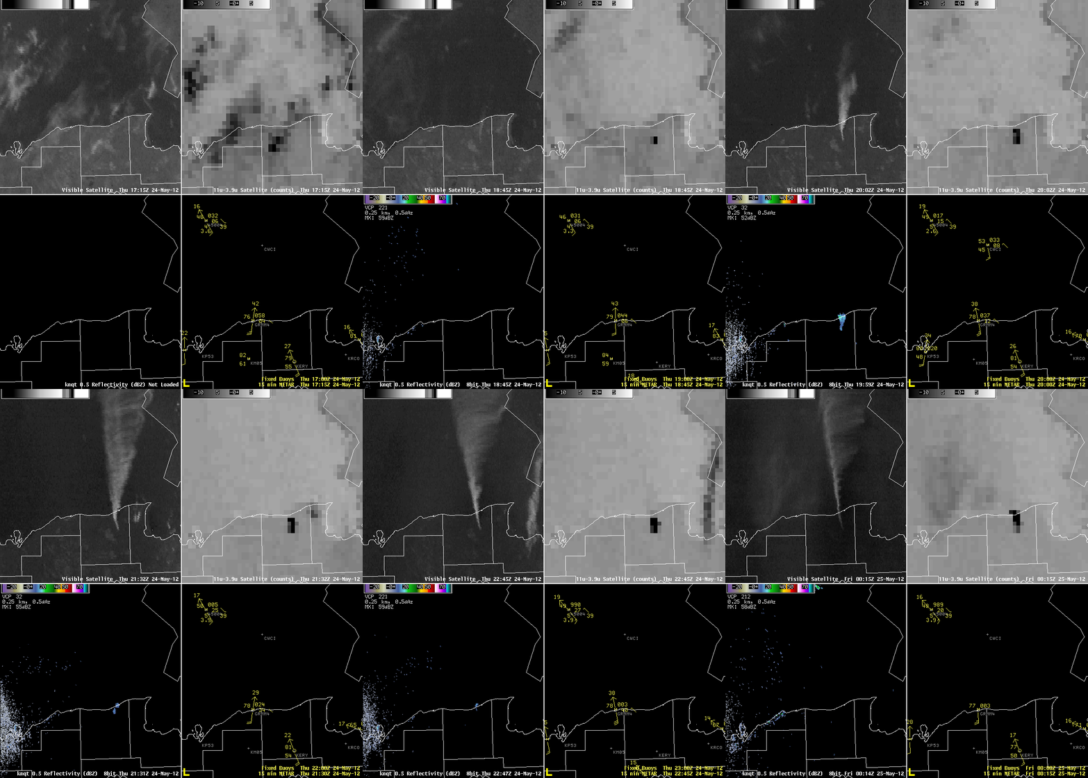
A wildfire that grew in northeastern Luce County on May 24th showed up well on satellite and radar.
- Upper Left: Visible Satellite - Smoke plume moving northward and dispersing outwards
- Upper Right: "Nighttime" Satellite - Fire shows up as a dark "hot spot"
- Lower Left: Reflectivity - Smoke appears well above the ground
- Lower Right: Observations - Strong south winds of 20-30mph sent smoke over Lake Superior
 |
US Dept of Commerce
National Oceanic and Atmospheric Administration
National Weather Service
Marquette, MI
112 Airpark Drive South
Negaunee, MI 49866
906-475-5212
Comments? Questions? Please Contact Us.

