On July 5th, the National Weather Service in Marquette conducted a storm damage survey of thunderstorm wind damage in Dickinson County near Channing. The thunderstorms that caused the damage occurred during the evening of Wednesday, July 4th, between 6:30 PM and 6:40 PM CDT.
Upon completion of the survey, it was determined that most of the wind damage was caused by straight line winds along the leading edge of a thunderstorm moving into the area. In the yellow area on the map below, most of the damage was confined to sporadic tree damage (uprooted trees and snapped smaller trees) and was consistent with wind speeds in the 60 to 75 mph range.

There were some areas of localized enhanced damage inside the orange area on the map. Inside this area, the tree damage was more widespread. Several of the trees fell on houses and vehicles. In addition, several power lines and poles were blown down. Wind speeds in this area were estimated at 75 to 95 mph.
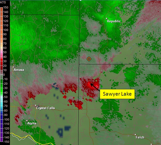
While most of the damage was consistent with straight line winds, there was some evidence of some circulation in the damage pattern along the eastern side of the enhanced (orange) damage area. The signs of circulation in these areas were attributed to swirling winds along and to the east of the apex of the strongest straight line winds. Numerous eye witness accounts indicated several small vortices crossing Sawyer Lake as the strongest wind gusts pushed across the area. Since these circulations are on the leading edge of the thunderstorm outflow, they are often referred to as gustnadoes since they do not form like classic tornadoes.
The following two images show radar data from the time that the wind damage and gustnado occurred. The first image is of radar velocity and is from 634 pm CT. The green colors indicate winds that are blowing toward the radar while the red colors indicate winds are blowing away from the radar. Note that the radar location in the images is off the upper right corner of the images. Notice on this first image that an area of winds up to 50 mph developed just north of Sawyer Lake. The second image shows the largest core of wind has already pushed past Sawyer Lake. Wind speeds increased to 60-70 mph in this image. Although a gustnado was likely present, the radar would likely not be able to sample such a small scale rotation at this distance from the radar. The main feature the radar indicates is the larger area of outbound (straight line) winds.
 |
 |
|
Tree damage near Sawyer Lake. |
Tree damage at Gust Newberg County Park on Sawyer Lake. |
|
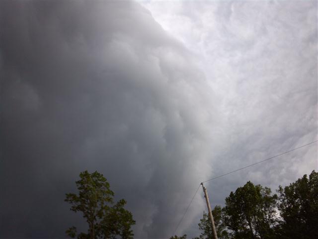
Shelf Cloud approaching Gust Newberg County Park just prior to the arrival of the strong winds. |
Tree damage along Sawyer Lake Road. |