Overview of the December 10-11, 2021 Winter Storm
|
A strong area of low pressure tracked northeastward from the Central Plains to northern Lake Michigan Friday December 10 into Saturday December 11. The low reached 980 mb east of the U.P. by Saturday afternoon. This storm brought significant snowfall to most of the area - the second significant widespread snowfall in 5 days. Precipitation had to fight through dry air initially, but once the atmosphere was saturated, snow fell heavily across the area Friday night. Snowfall rates of around an inch per hour were observed in many areas. This snow was wet and dense due to the atmosphere being relatively warm, with snow-to-liquid ratios of generally 10:1 or less. Snow mostly ended early Saturday morning. However, a secondary burst of heavy snow tracked northeastward along the Lake Michigan shoreline through Menominee, Escanaba, Manistique, and eventually into Newberry the following morning (Saturday). Snow also lingered longer in Marquette and Alger Counties due to lake effect snow behind the system. The heavy amounts of wet snow, along with gusty winds behind the storm, led to numerous power outages throughout south-central and eastern Upper Michigan. This same storm system was responsible for several long-track and violent tornadoes in Illinois, Missouri, Kentucky, and Arkansas. Reviews of the severe weather aspect of this storm can be found from NWS Paducah, NWS Memphis, and NWS St. Louis. |
Click here for a complete list of snowfall reports from this storm |
Wind & Power Outage Reports
 |
 |
| Highest wind reports | Updates on when power would be restored by Cloverland Electric |
 |
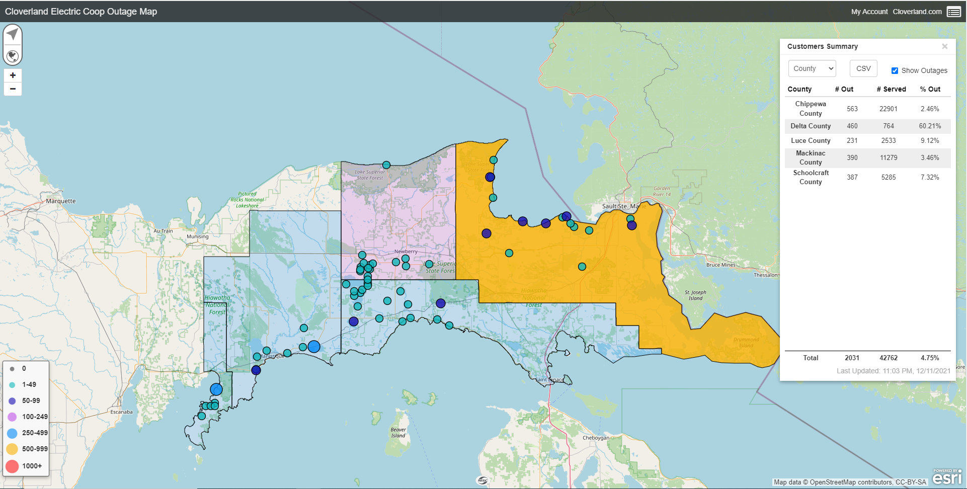 |
| Map of power outages reported by the Alger-Delta Electric CoOp as of 11 am EST Saturday December 11. | Map of power outages reported by Cloverland Electric as of 11 pm EST Saturday December 11. There were even more outages earlier in the day. |
Meteorology of this Storm
 |
 |
 |
| Synoptic plot at 10 pm Fri Dec 10 showing a developing low pressure system over the Midwest and broad mid-level WAA and Q-vector convergence about to overspread the area from the south | Multiple east-west oriented bands of frontogenesis pushed northward through the area at different levels of the atmosphere leading to multiple waves of heavy snow with light snow in between. | Precipitation pushing northward through Wisconsin and into the U.P. at 10 pm Fri Dec 10 |
 |
 |
 |
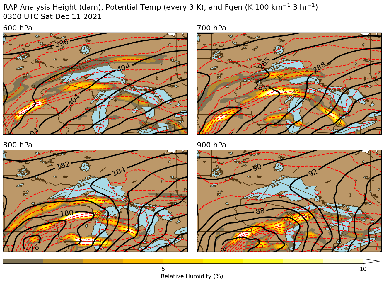
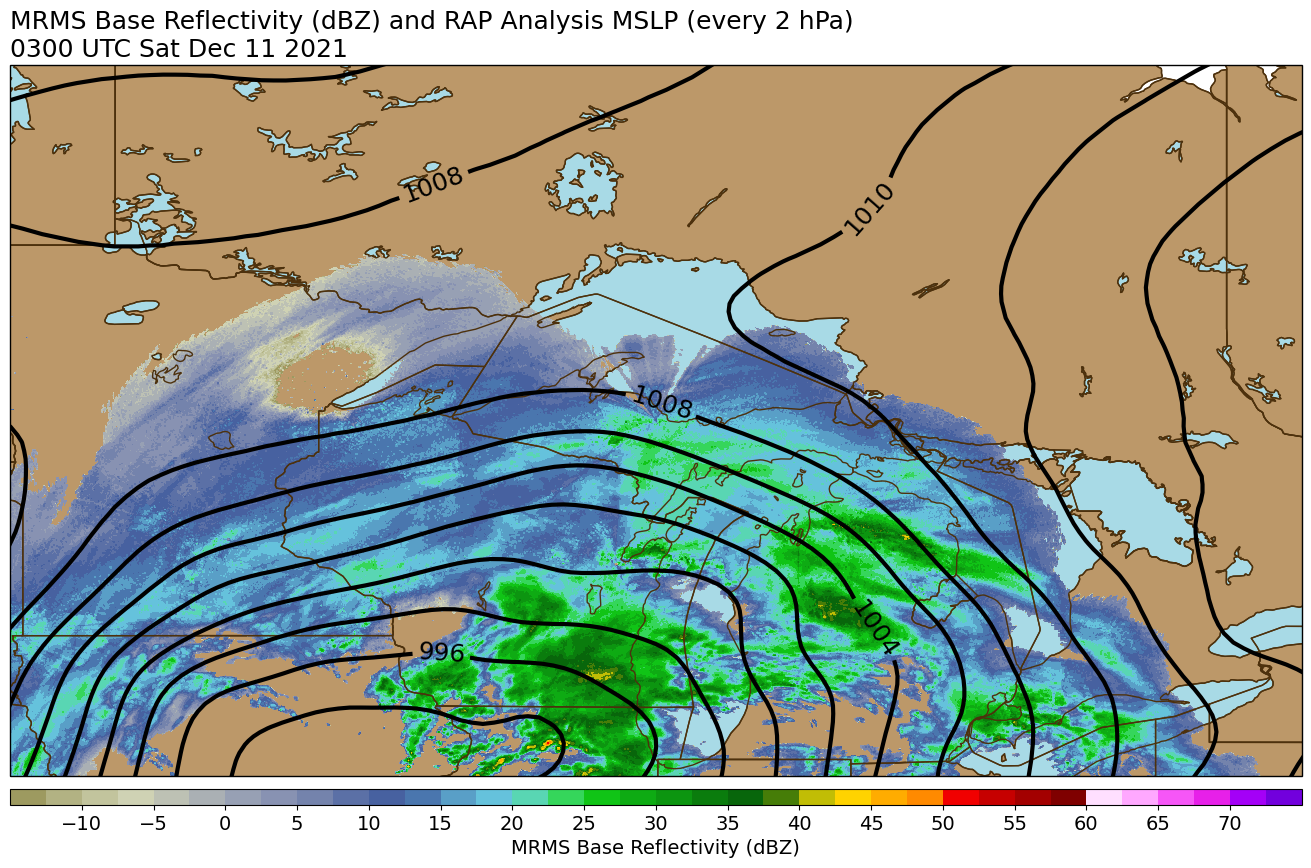
| Synoptic plot at 10 am Sat Dec 11 showing a strong upper-level jet and mid-level shortwave, and mature low pressure system over northern Lake Michigan | Strong frontogenesis continues over the eastern U.P. at 10 am Sat Dec 11 leading to continued heavy snow, while snow has mostly ended by this point elsewhere. | Moderate to heavy snow associated with the fgen band over the south-central and eastern U.P., and lake effect snow continuing north-central, at 10 am Sat Dec 11 |
 |
Media use of NWS Web News Stories is encouraged! Please acknowledge the NWS as the source of any news information accessed from this site. |
|


Social Media Messaging