
A storm system will track from the southern Plains to the Upper Midwest today. Severe thunderstorms are expected from east Texas into far southeast Iowa and Illinois. A strong tornado and damaging wind potential will exist from central Arkansas into central Missouri. Heavy to excessive rainfall from eastern Texas into the Midwest states may bring new or renewed areas of flooding. Read More >
Severe Thunderstorms July 18-19, 2020
|
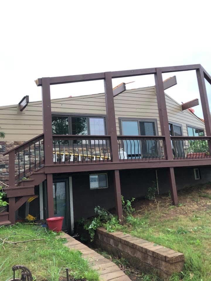
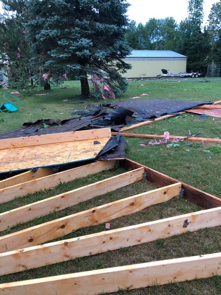
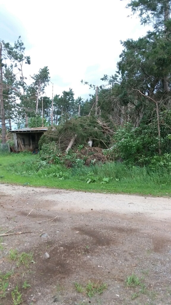
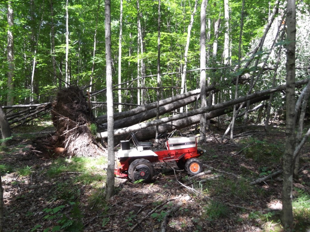
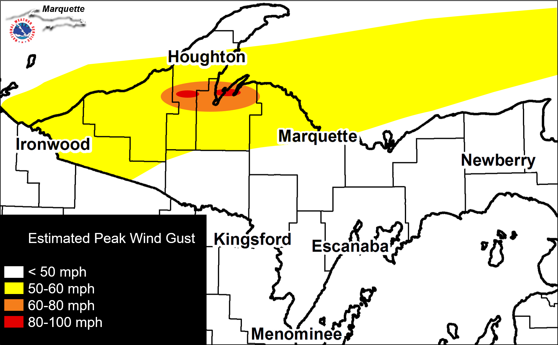
A line of strong to severe thunderstorms moved across nearly all of Upper Michigan in the late night hours of Saturday July 18 and into the early morning hours of Sunday July 19. Significant wind damage was observed in a narrow west-to-east swath from near Nisula, through Alston, Pelkie, Baraga, L'Anse, and Pequaming. Straight-line winds estimated at 90-100 mph in this narrow corridor caused a barn to collapse and other roof damage near Nisula, and a roof to be torn off a home in Pequaming. This segment of the line later produced a 76 mph wind gust at Stannard Rock in Lake Superior. Other less significant wind damage was scattered throughout western and central Upper Michigan. Widespread power outages and numerous snapped or uprooted trees were reported throughout Gogebic, Ontonagon, Houghton, Baraga, and Marquette counties. One injury was reported in Marenisco when a tree fell onto a vehicle that was occupied at the time. Heavy rainfall also accompanied these storms, with widespread reports of 1-2" of rain. This rainfall caused localized shoulder and trail washouts, but no major flooding was observed. |
Click this link for a complete list of reports of wind damage and heavy rainfall from this event. |
Environment
 |
 |
 |
 |
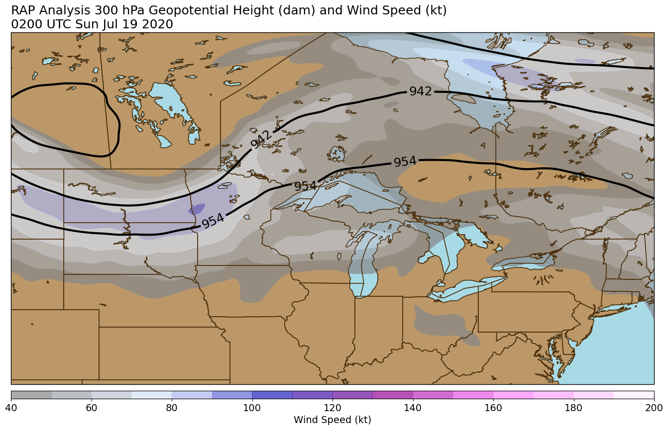
| 300 mb Height and Wind at 10 pm EDT July 18 | 500 mb Height and Vorticity at 10 pm EDT July 18 | 700 mb Height and Relative Humidity at 10 pm EDT July 18 | 850 mb Height and Temperature at 10 pm EDT July 18 |
 |
 |
 |
 |
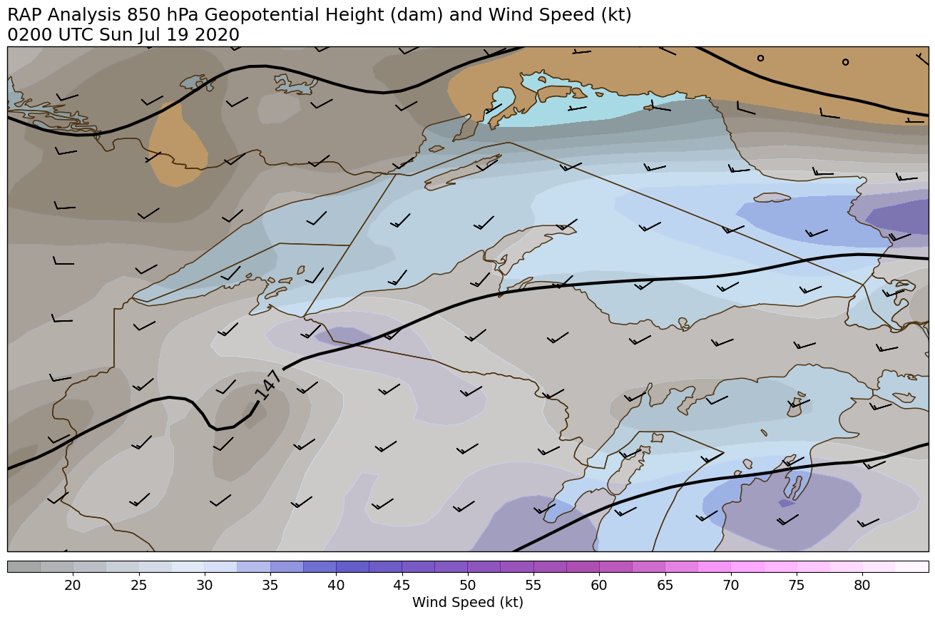
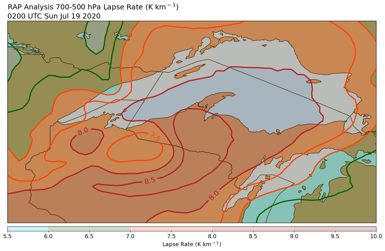
| 850 mb Height and Wind at 10 pm EDT July 18 | Mean Sea Level Pressure and Surface Dew Point at 10 pm EDT July 18 | 700-500 mb Lapse Rates at 10 pm EDT July 18 | Surface-based CAPE and 0-3 km Storm Relative Helicity at 10 pm EDT July 18 |
 |
 |
 |
 |
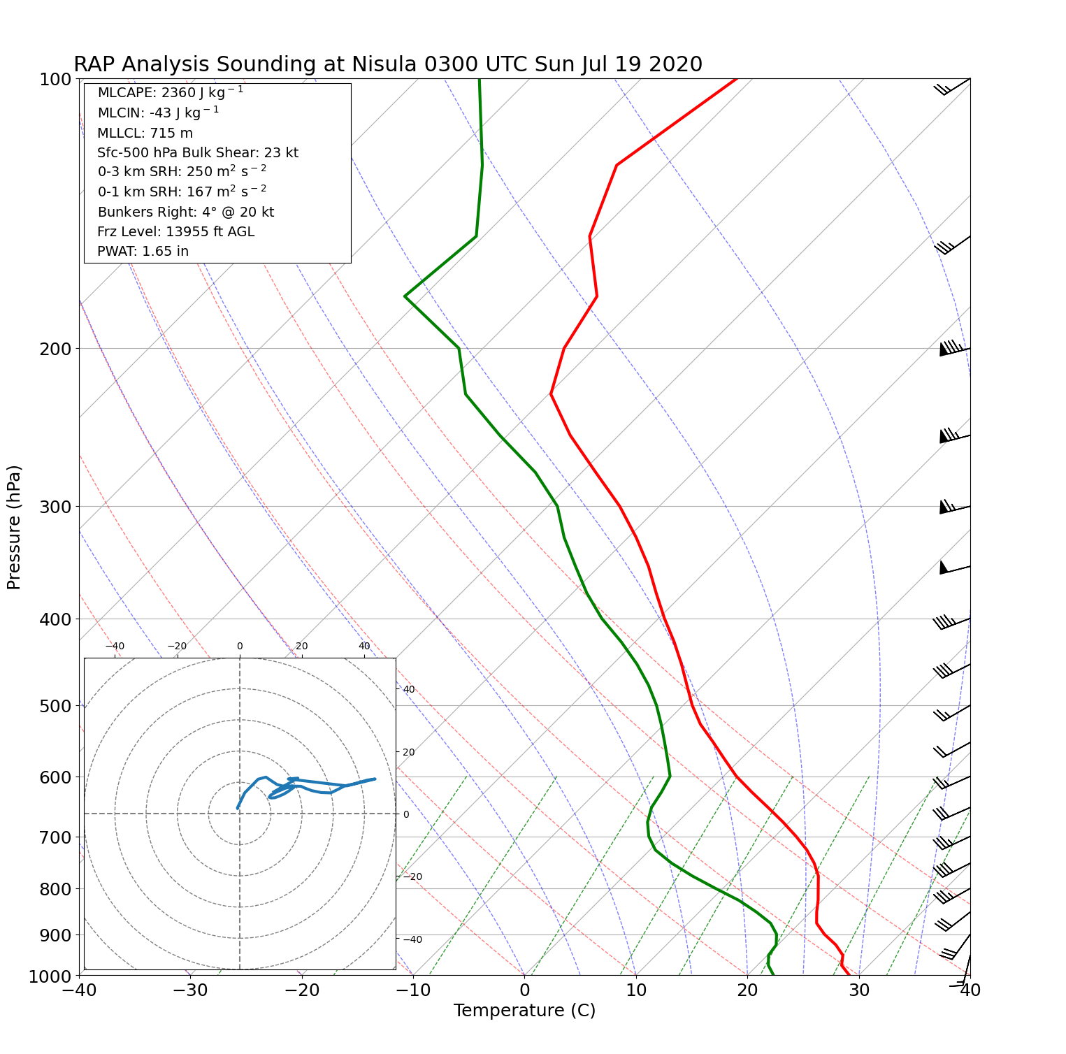
| Vertical profile near Nisula at 9 pm EDT July 18 | Vertical profile near Nisula at 10 pm EDT July 18 | Vertical profile near Nisula at 11 pm EDT July 18 | Vertical profile near Nisula at 12 am EDT July 19 |
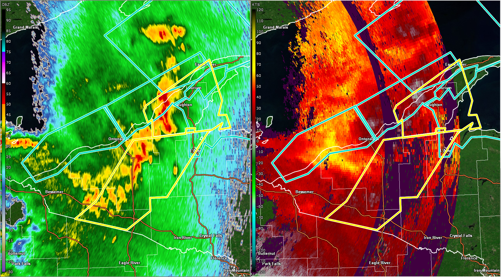
Radar
Note: Radar data from KMQT was not available for this event due to the System Life Extension Program (SLEP) maintenance that was underway at the time.
 |
 |
 |
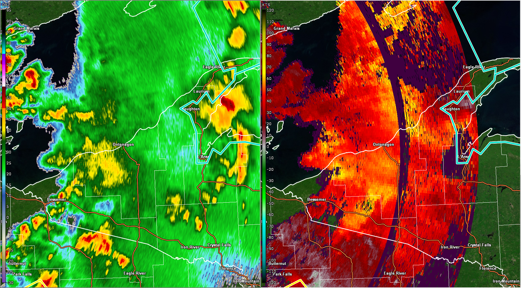 |
| KDLH Radar, reflectivity and velocity, at 12:00 am EDT July 19 | KDLH Radar, reflectivity and velocity, at 12:21 am EDT July 19 | KDLH Radar, reflectivity and velocity, at 12:40 am EDT July 19 | KDLH Radar, reflectivity and velocity, at 1:00 am EDT July 19 |
 |
 |
 |
 |
| KGRB Radar, reflectivity and velocity, at 12:03 am EDT July 19 | KGRB Radar, reflectivity and velocity, at 12:21 am EDT July 19 | KGRB Radar, reflectivity and velocity, at 12:40 am EDT July 19 | KGRB Radar, reflectivity and velocity, at 1:00 am EDT July 19 |
Photos
 |
 |
 |
 |
| A house with its roof torn off in Pequaming, courtesy of Will Wiggins | Additional roof damage in Pequaming, courtesy of Will Wiggins | Tree damage 7 miles NW of Baraga, courtesy of our Co-Op Observer | Tree damage 7 miles NW of Baraga, courtesy of our Co-Op Observer |
 |
 |
 |
 |
| A collapsed barn in Nisula, courtesy of Keith Alan Almi II | Tree damage along Pequaming Rd, courtesy of Wayne Abba | Tree damage 7 miles NW of Baraga, courtesy of our Co-Op Observer | Tree damage in Keweenaw Bay, courtesy of Keweenaw Bay Fire Department |
 |
 |
 |
 |
| Downed trees blocking a road in Pelkie, courtesy of Warren Mattson | Tree snapped off in Nisula, courtesy of Philip Creech | Tree damage near the Dead River Basin, courtesy of Linda Derocher | Tree damage in Ironwood, courtesy of Rick Turonie |
 |
 |
 |
 |
| Tree toppled in Big Bay, courtesy of Mike Clawson | Roof damage, courtesy of Jeff Renshaw | Tree uprooted in Alston, courtesy of Lilly Antonia | Tree knocked down into a building in Marquette, courtesy of Erin Menhennick |
 |
Media use of NWS Web News Stories is encouraged! Please acknowledge the NWS as the source of any news information accessed from this site. |
|


Social Media Messaging