Twin Cities, MN
Weather Forecast Office
Updated: 1215 PM CDT Sept 21, 2016
Overview
Multiple rounds of heavy rain can be expected through Thursday. Several inches are likely which could result in flash flooding and significant rises on rivers and lakes. The heaviest rainfall amounts are likely to fall across east central/southeast Minnesota into west central/southwest Wisconsin.
There is also a chance for severe weather this afternoon and evening. As thunderstorms develop, they will be capable of producing large hail, damaging winds, and tornadoes.
Stay weather aware this week and monitor later forecasts closely.
Key Points
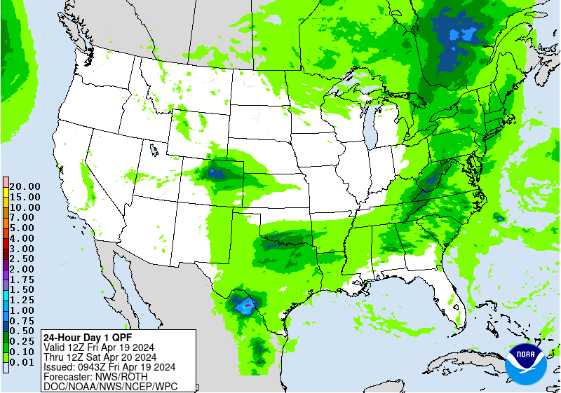
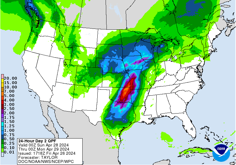
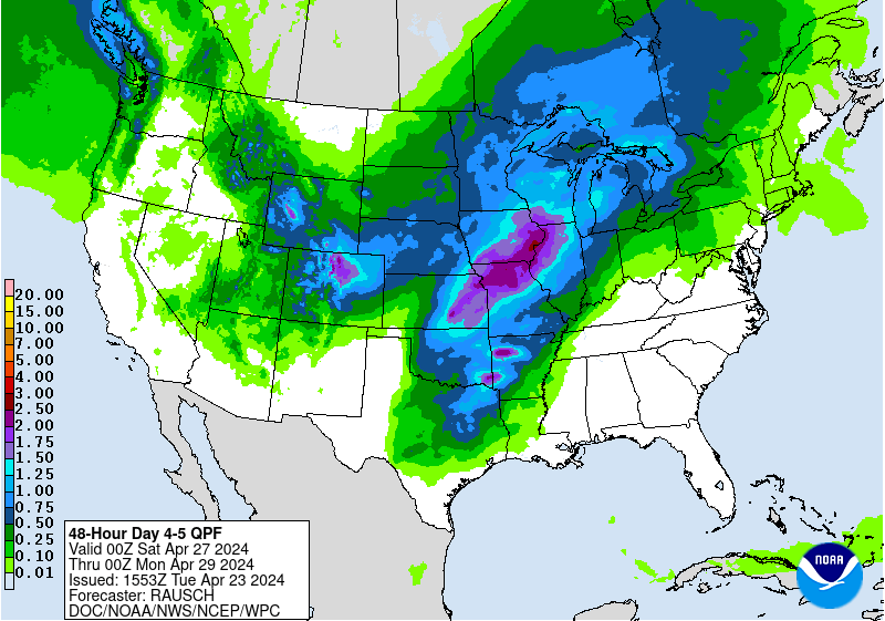
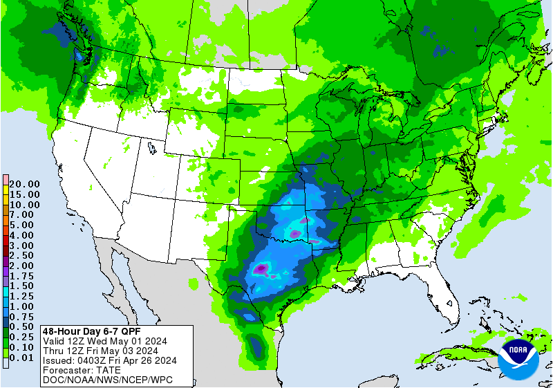
Rainfall Forecasts
Note: maps indicate an areal average. Locally higher and lower totals should be expected.
(click to enlarge)
 |
 |
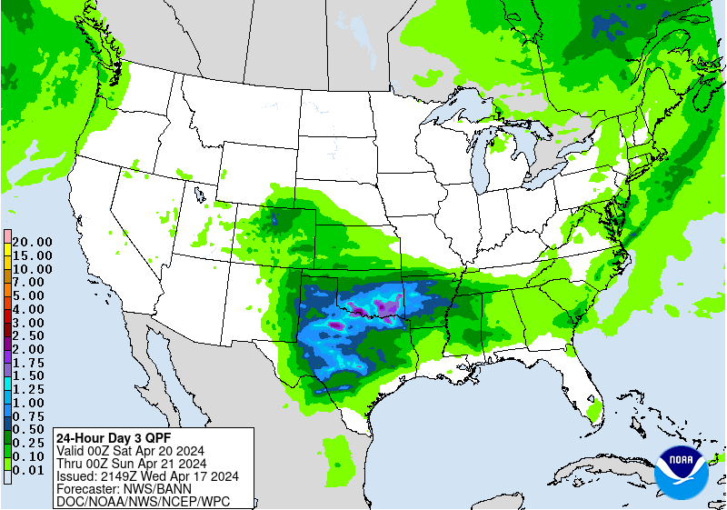 |
| Day 1 | Day 2 | Day 3 |
 |
 |
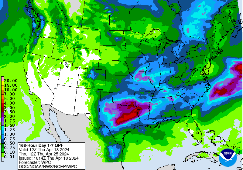 |
| Day 4-5 | Day 6-7 | Day 1-7 Total |
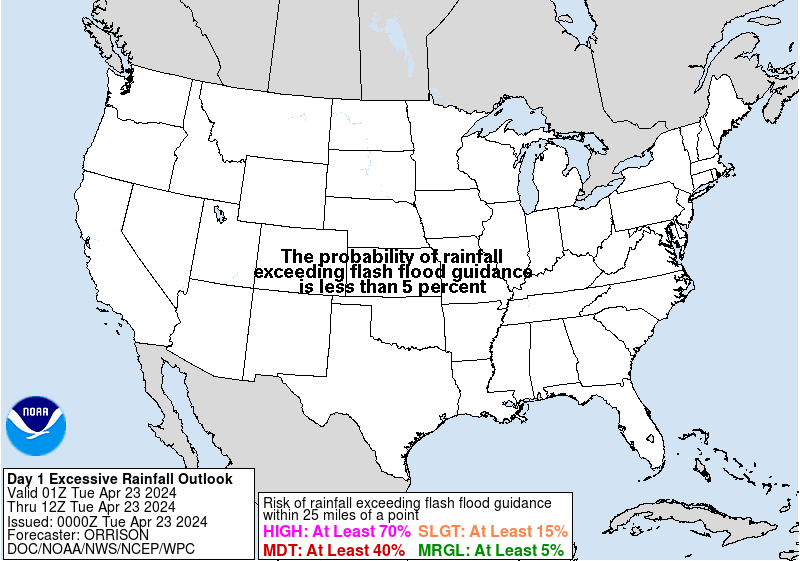
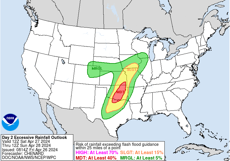
Excessive Rainfall Outlooks
(click to enlarge)
 |
 |
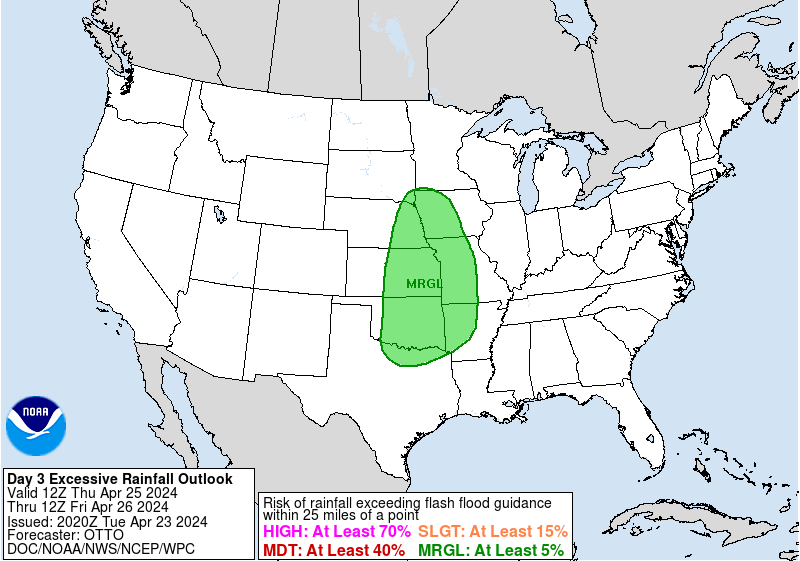 |
| Day 1 | Day 2 | Day 3 |
Today's Severe Weather Outlook
(click to enlarge)
 |
 |
 |
 |
| Severe Weather Risk | Tornado Risk | Damaging Wind Risk | Large Hail Risk |
Weather Forecasts
Snowfall/Winter Weather
Aviation Forecasts
Fire Weather
Wet Bulb Globe Temperature
Current Weather Conditions
Current Weather Observations
Yesterday's Temperatures and Precipitation
Current Radar
US Dept of Commerce
National Oceanic and Atmospheric Administration
National Weather Service
Twin Cities, MN
1733 Lake Drive West
Chanhassen, MN 55317-8581
952-361-6670
Comments? Questions? Please Contact Us.

