Storms developed in western Wisconsin, and produced damage on Prairie Lake in between Chetek and Cameron. The results of the damage survey was a microburst, with peak winds near 90 mph. This caused significant damage to trees along the western shore of the lake. Radar imagery from that time (below) did not indicate strong winds. However, the lowest radar scan is 8000 to 9000 ft above radar level, meanin it is quite possible the radar was overshooting the severe part of the storm.
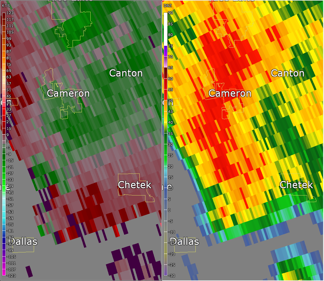
Figure 1) Radar image with base velocity (left) and base reflectivit (right) at 341pm.
A storm had developed in western Minnesota, and this storm showed better signs of rotation. Notice the close prodiximity of bright greens and reds next to each other. Meteorologist refer to this as a "couplet" and it signifies the potential for a tornado. This storm did indeed produce a brief touchdown, and several funnels Wednesday afternoon.

Figure 2) Radar image with base velocity (left) and base reflectivit (right) at 331pm.
For more information on the damage survey, visit this interactive display at https://apps.dat.noaa.gov/StormDamage/DamageViewer/
For a list of all severe weather reports that day, visit http://www.spc.noaa.gov/exper/archive/event.php?date=20160525

