Overview
Tornadoes:
|
Tornado #1- 3 NNW Milan, MN
|
||||||||||||||||
|
Tornado #2- 5 SW Danvers to 7 NW Clontarf, MN
|
||||||||||||||||
|
Tornado #3- 3 N Holloway, MN
|
||||||||||||||||
|
Tornado #4- Near Lake Emily, MN
|
||||||||||||||||
|
Tornado #5- 4 W Starbuck, MN
|
||||||||||||||||
|
Tornado #6 - Forada, MN
Track Map  
Downloadable KMZ File |
||||||||||||||||
|
Tornado #7 - Eagle Bend, MN
Track Map  
Downloadable KMZ File |
||||||||||||||||
|
Tornado #8 - Plato, MN
Track Map 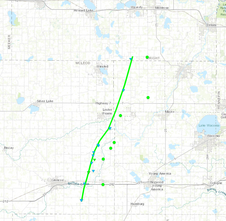 
Downloadable KMZ File |
||||||||||||||||
The Enhanced Fujita (EF) Scale classifies tornadoes into the following categories:
| EF0 Weak 65-85 mph |
EF1 Moderate 86-110 mph |
EF2 Significant 111-135 mph |
EF3 Severe 136-165 mph |
EF4 Extreme 166-200 mph |
EF5 Catastrophic 200+ mph |
 |
|||||
Photos & Video
Forada, MN Tornado
 |
 |
 |
 |
| Damage in Forada |
Tree Uprooted in Forada |
Building Damage in Forada | Building Damage in Forada |
McLeod County Tornado
 |
 |
 |
 |
| Pole Barn Damage near Plato, MN | Tree Damage near Plato, MN | Extensive Tree Damage near Plato, MN | Uprooted Trees southeast of Lester Prairie, MN |
Radar
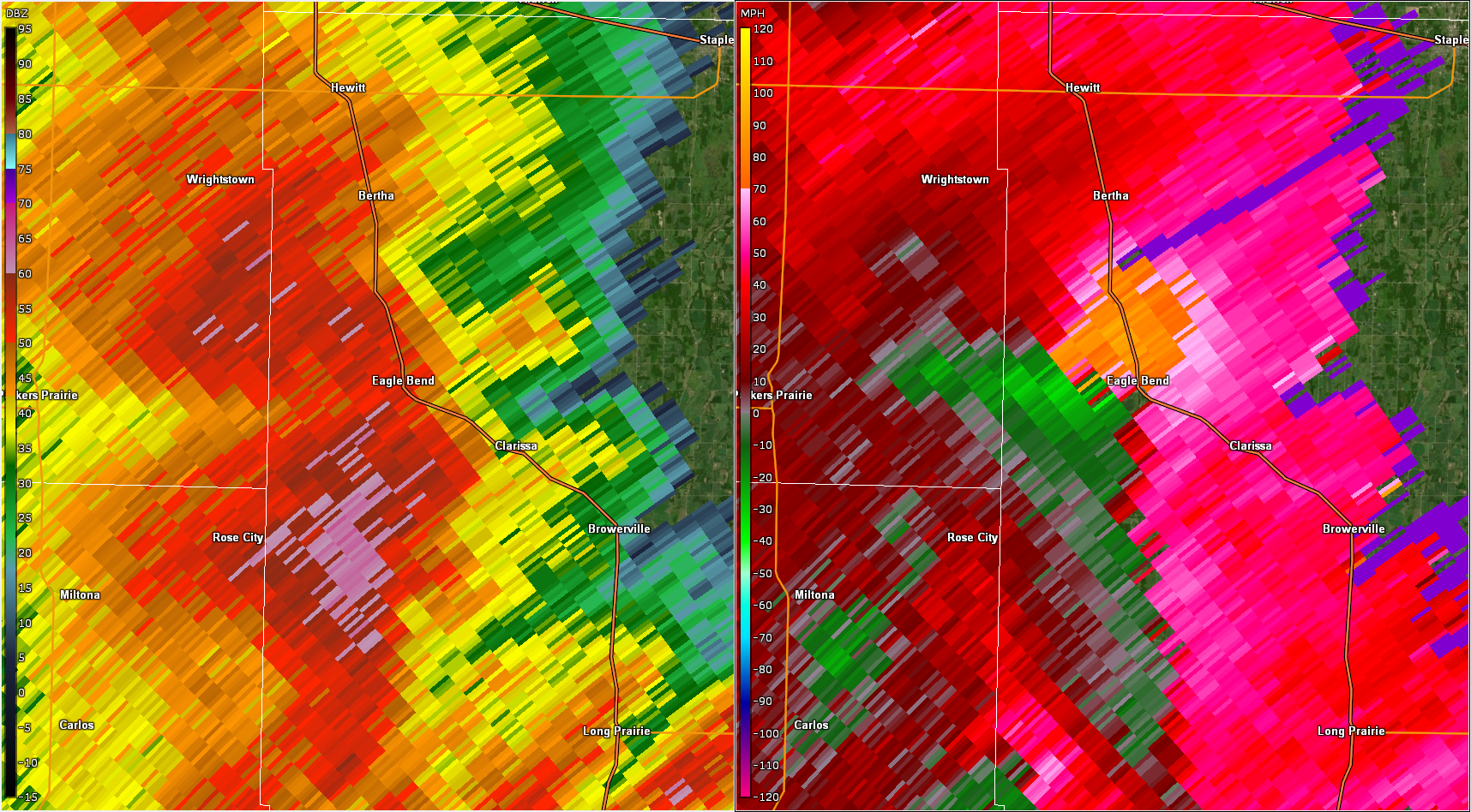
Radar imagery of confirmed tornadoes
 |
 |
 |
.png) |
| Radar reflectivity (left) and storm relative velocity (right) at 4:07pm. Velocity shows strong rotation near Cyrus, MN. (Radar beam is at 12kft) | Radar reflectivity (left) and storm relative velocity (right) at 4:29pm. Velocity shows strong rotation approaching Forada, MN. (Radar beam is at 11kft) | Radar reflectivity (left) and storm relative velocity (right) at 5:02pm Velocity shows strong rotation near Eagle Bend, MN. (Radar beam is at 12.5kft) | Radar reflectivity (left) and storm relative velocity (right) at 6:17pm Velocity shows rotational couplet near Plato, MN. (Radar beam is at 1.5kft) |
Storm Reports
Locations of preliminary reports of severe weather across the area, including damaging straight-line winds, large hail, and tornadoes.
Find the latest reports and information for each one at this updated interactive map. 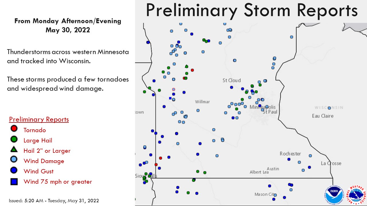
Environment
Insert synoptic summary.
 |
 |
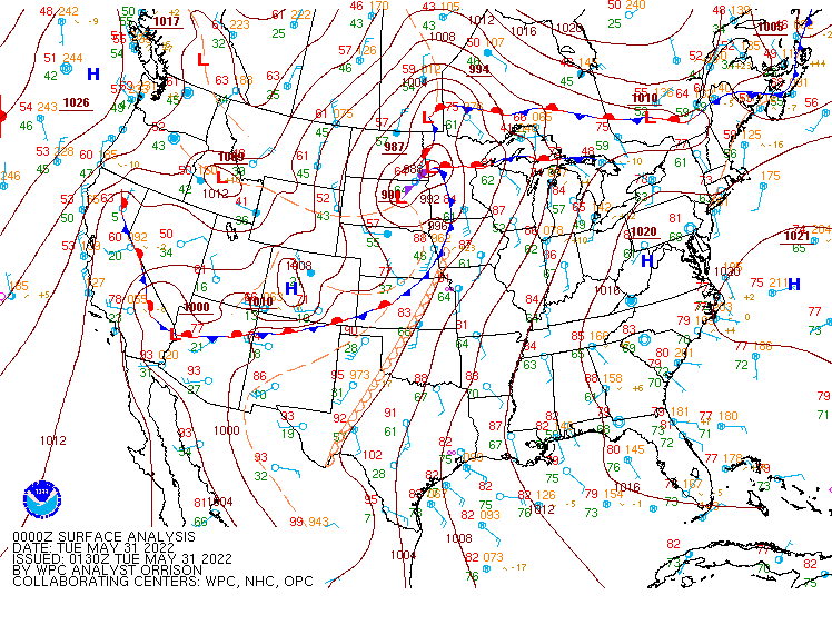 |
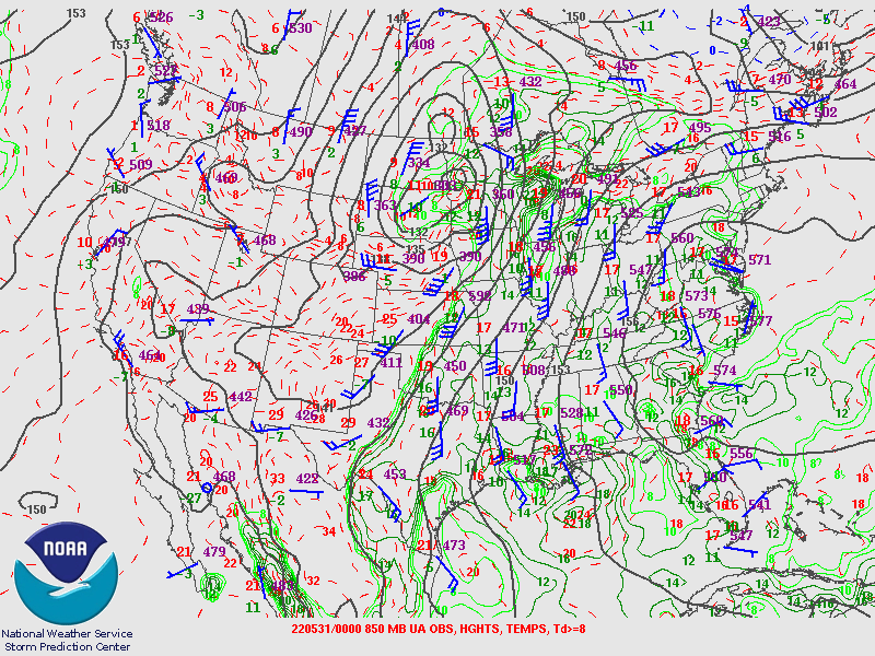
| 7pm 250mb map showing an amplified trough over the western CONUS. Strong synoptic-scale lift is implied over MN at the nose of the jetstreak and within the diffluence in the wind field. | 7pm 850mb map showing a deep, closed low over northwest MN. A very strong LLJ (45kt wind barb at MPX) has dragged ample moisture into the Upper Midwest. | 8:30pm surface map showing a deep surface low with a warm front extending east across MN while an arcing cold front trails south. |
Near-storm environment summary.
 |
 |
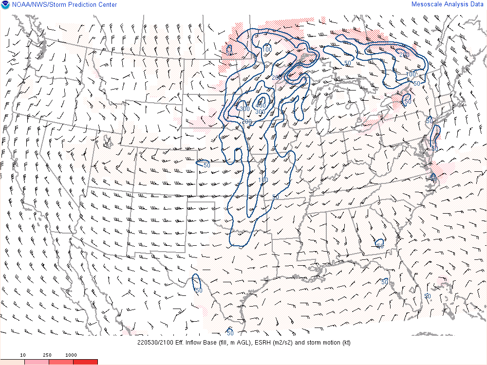 |
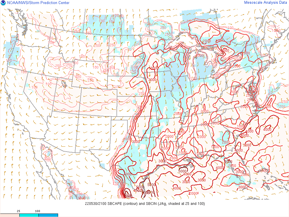
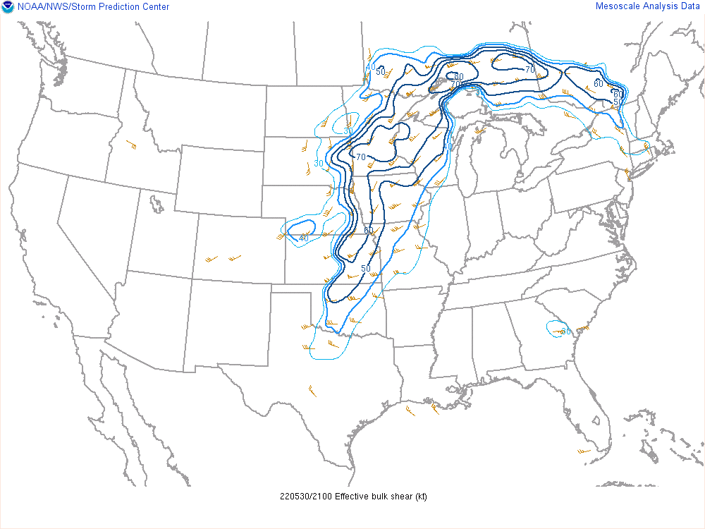
| 4pm map of surface-based CAPE. Strong instability is analyzed over southern to south-central MN with +3000 J/kg of CAPE. | 4pm map of effective bulk shear. 60 to +70 knots of shear across MN signals a very favorable environment for rotating thunderstorm updrafts. | 4pm map of effective storm relative helicity. Higher values mean a more favorable environment for faster rotating updrafts. |
Additional environmental data.
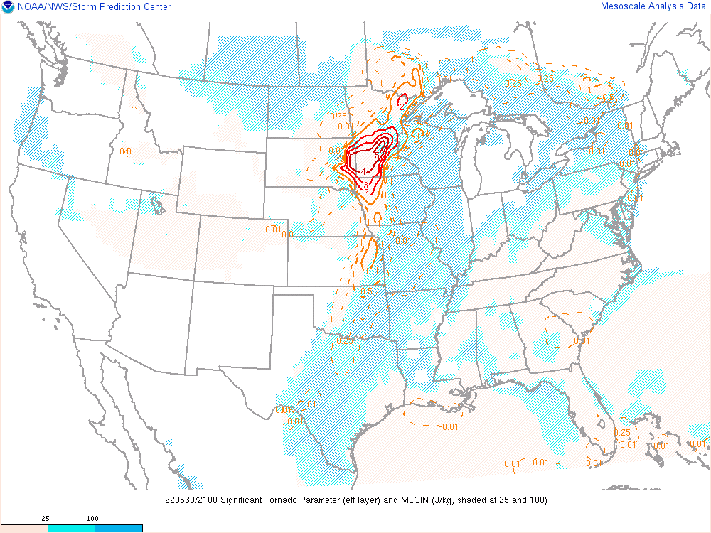 |
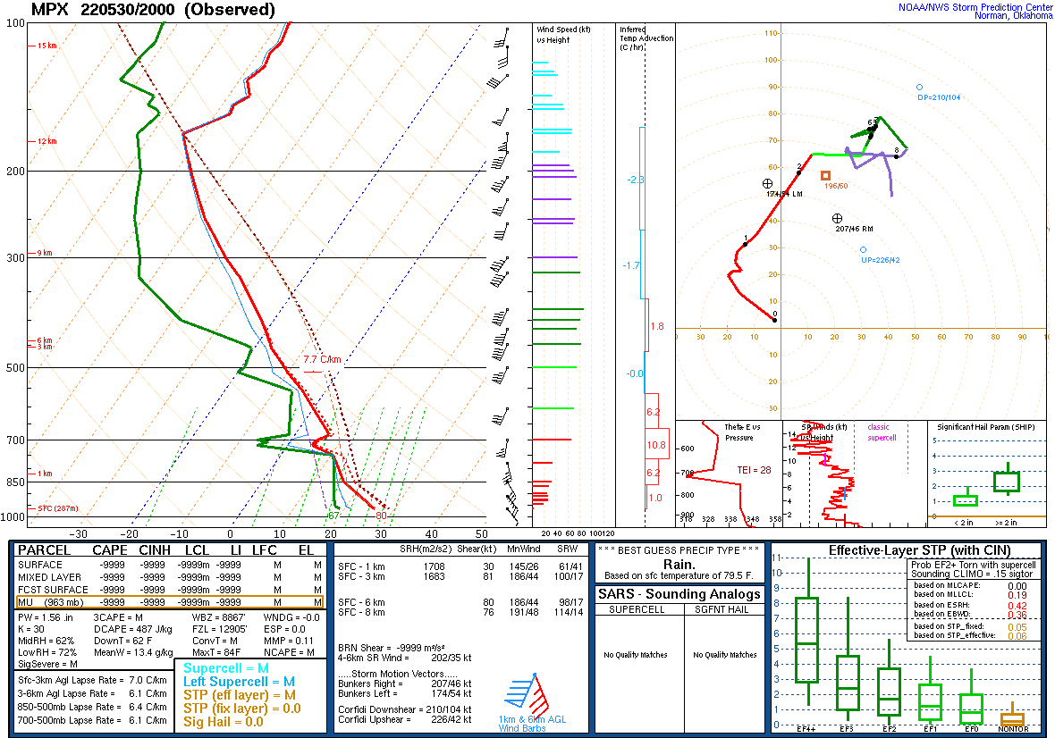 |
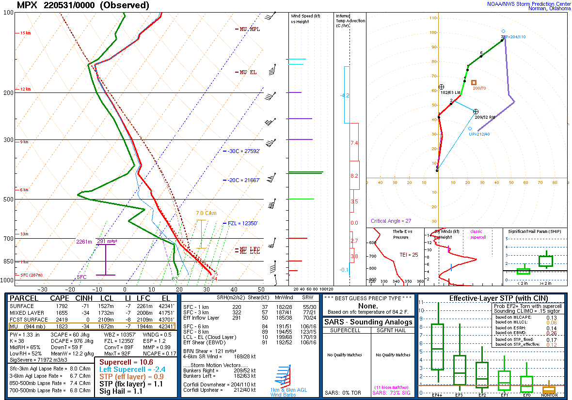 |
| 4pm map of the Significant Tornado Parameter showing a very favorable environment for tornadoes over western and south-central MN. | 3pm sounding from Chanhassen, MN. | 7pm sounding from Chanhassen, MN. |
 |
Media use of NWS Web News Stories is encouraged! Please acknowledge the NWS as the source of any news information accessed from this site. |
 |