***All information is considered preliminary until investigations are finalized***
Overview
|
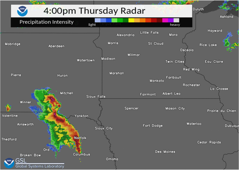
During the afternoon and evening hours of May 12, 2022, a strong line of thunderstorms developed across southern Nebraska and quickly raced northeast into eastern South Dakota and western Minnesota. As these storms moved north, they produced extreme winds across portions of the Northern Plains. Widespread straight-line winds between 50 and 70 mph were reported, with embedded areas of 80 to 100 mph winds. The highest wind gust reported included a measured 94 mph gust in Madison, MN. |
 Caption |
 |
(1).png) |
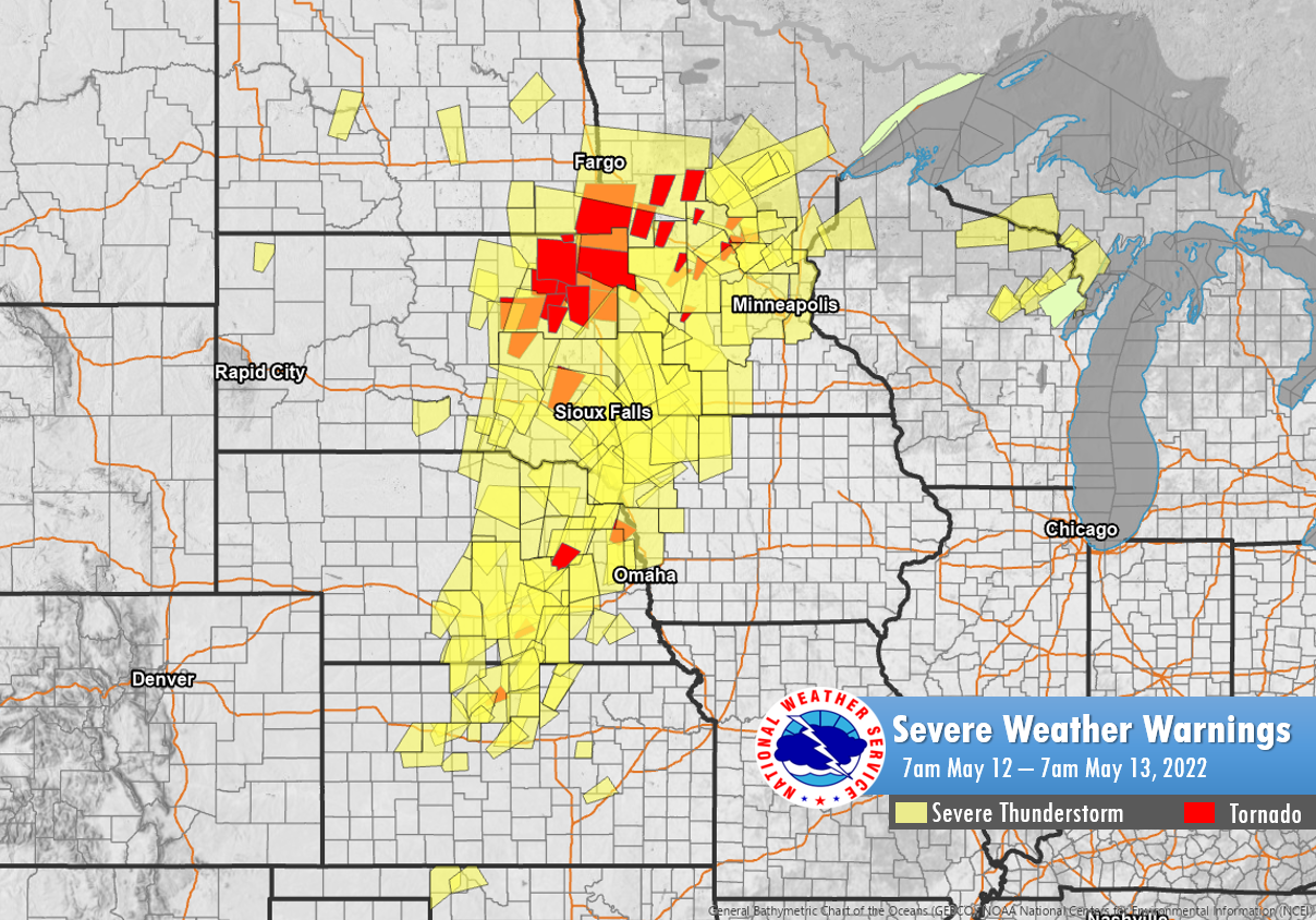 |
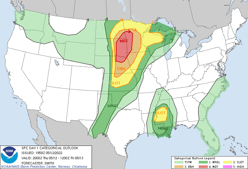
| SPC Day 1 Categorical Outlook | Local Storm Reports | Severe Weather Warnings |
Tornadoes: *Preliminary*
|
Tornado #1 - Madison, MN
Track Map 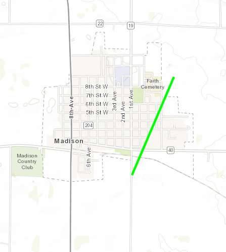 
Downloadable KMZ File |
||||||||||||||||
|
Tornado #2 - Louisburg, MN
Track Map 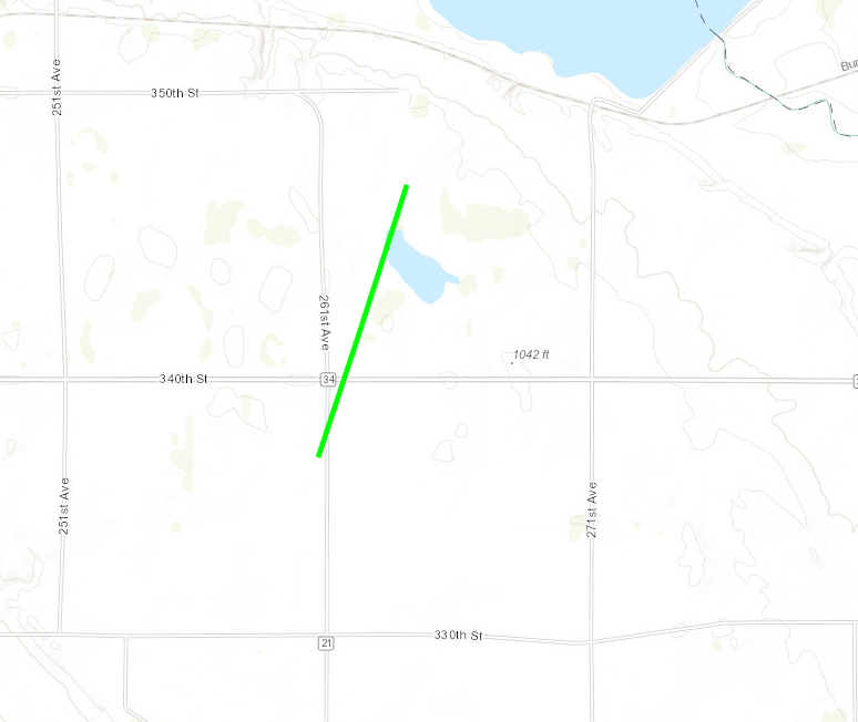
Downloadable KMZ File |
||||||||||||||||
|
Tornado #3 - Alexandria, MN
Track Map 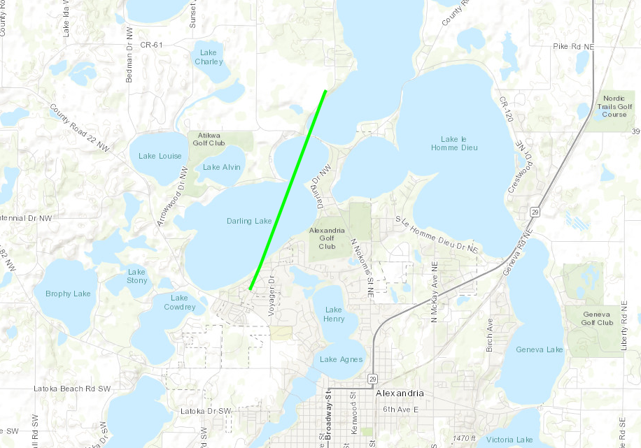
Downloadable KMZ File |
||||||||||||||||
|
Tornado #4 - Clarissa, MN
Track Map 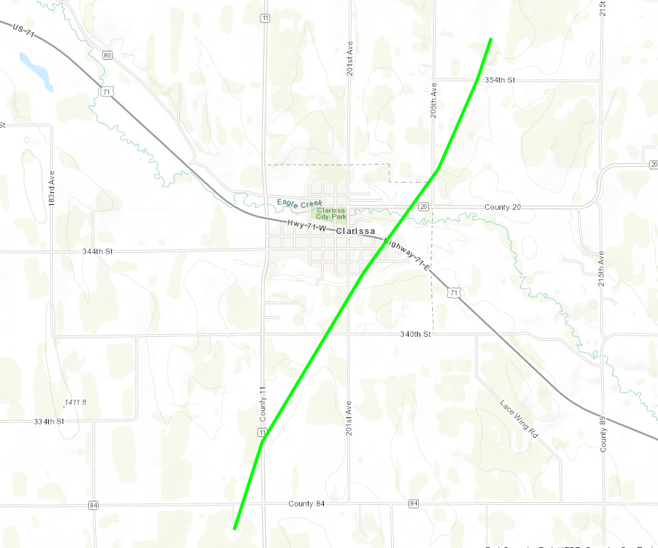
Downloadable KMZ File |
||||||||||||||||
|
Tornado #5 - Cushing, MN
Track Map 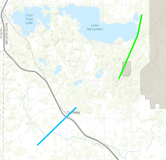
Downloadable KMZ File |
||||||||||||||||
|
Tornado #6 - 6N Randall, MN
Track Map
Downloadable KMZ File |
||||||||||||||||
The Enhanced Fujita (EF) Scale classifies tornadoes into the following categories:
| EF0 Weak 65-85 mph |
EF1 Moderate 86-110 mph |
EF2 Significant 111-135 mph |
EF3 Severe 136-165 mph |
EF4 Extreme 166-200 mph |
EF5 Catastrophic 200+ mph |
 |
|||||
Wind:
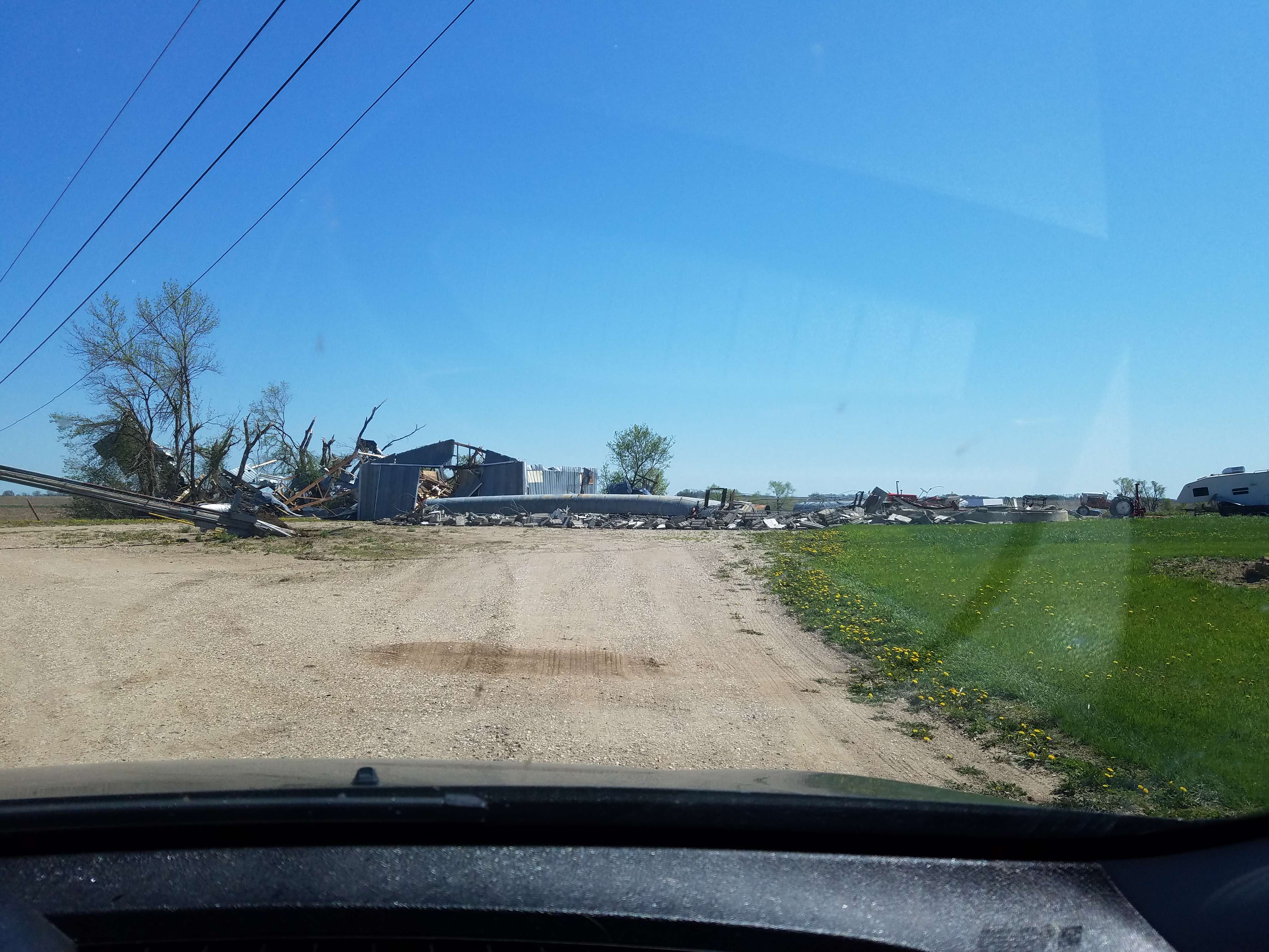
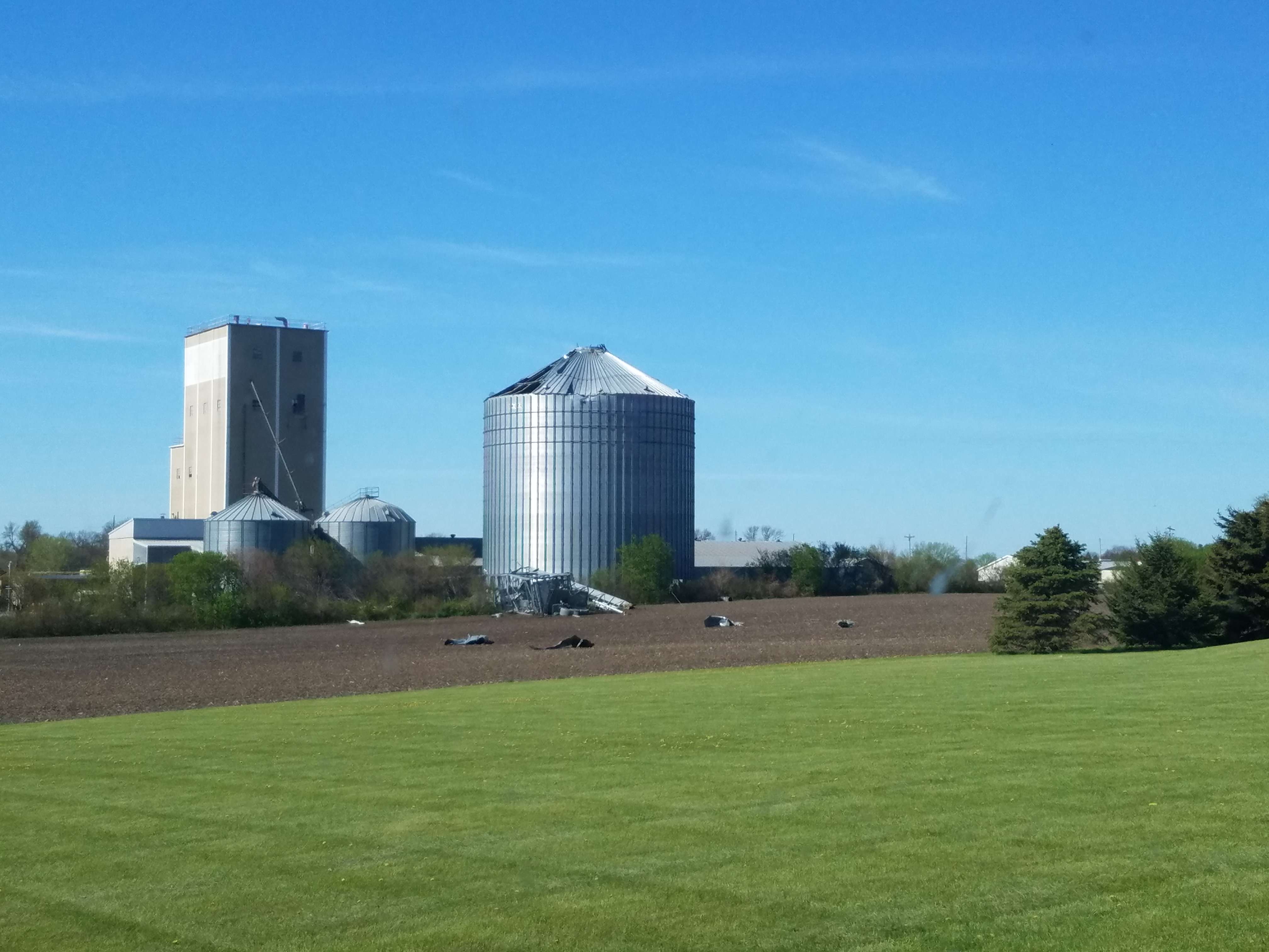
Widespread straight-line wind damage occurred throughout western Minnesota as the derecho moved through during the late afternoon and evening. Many sheds, outbuildings, and barns were badly damaged or destroyed along with numerous of trees snapped and uprooted. One fatality occurred near Blomkest, MN when a grain bin struck a vehicle with an occupant inside. Three weather stations in western Minnesota measured wind gusts over 74 mph; the strongest occurring in Madison, MN of 94 mph.
 |
 |
 |
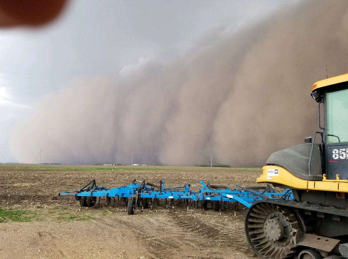 |
| A wall of dust along the leading edge of the derecho near Redwood Falls, MN. (Credit: Jon Markuson) | Photo of leading edge of the line of storms near Willmar, MN. (Credit: Doug Kiesling) | Shelf cloud near St. Augusta, MN. (Credit: Jacob Dvorak) | Wall of dust along leading edge of the derecho near Worthington, MN. (Credit: Darcy Ross Spies) |
Damage Photos
Tornado Damage
.jpg) |
.jpg) |
.jpg) |
.jpg) |
| Toppled stadium light pole in Madison, MN. | Badly damaged house with a destroyed garage near Louisburg, MN. | House with its roof torn off by Lake Darling near Alexandria, MN. | House with most of its roof lifted and destroyed by Lake Darling near Alexandria, MN. |
Wind Damage
.jpg) |
 |
 |
 |
| Large grain bins destroyed in Bellingham, MN. | Significant damage to farmstead northeast of Madison, MN. | Grain bins damaged and destroyed in Dawson, MN. | Hangar wall blown out at the airport in Morris, MN (Credit: Nick & Amanda Elms) |
Environment
Amplified upper-level troughing crossing the Rockies allowed for strong northward moisture and temperature advection into the Northern Plains. This allowed for the atmosphere to become very unstable before the trough slid east to supply lift for thunderstorms.
 |
 |
 |
| 7pm 250mb map shows an amplified, negatively-tilted trough over the High Plains. | 7pm 850mb map shows ample moisture along with a strong southerly LLJ over the Upper Midwest. | 7pm surface map shows a surface low over SD with a cold front extending south. Meanwhile, a warm front extends through central MN. Temperatures are in the 90s south of the warm front. |
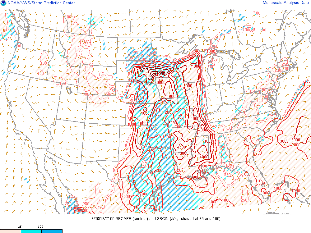
Atmospheric parameters showed a volatile environment for severe weather across the Northern Plains Thursday afternoon and evening.
 |
 |
 |
| 4pm map of CAPE shows very high instability over eastern SD and southwest MN. | Wind shear is very favorable for severe weather over the Dakotas and western MN at 4pm. | 4pm map showing a lot of spin in the low-levels of the atmosphere. This is generally considered to be favorable for tornadoes. |
Additional severe weather parameters and soundings from Chanhassen, MN and Aberdeen, SD supported the high likelihood of severe weather.
 |
 |
 |
| Significant Tornado Parameter at 4pm shows a bullseye over eastern SD and western MN. | 4pm sounding from Chanhassen, MN | 4pm sounding from Aberdeen, SD |
Additional Information
The Forecast
 |
 |
 |
 |
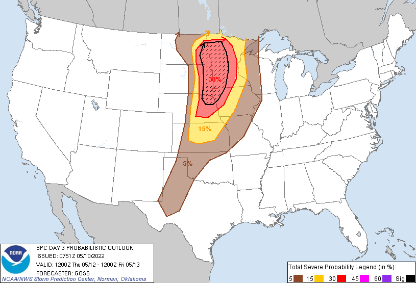
| SPC Day 3 Categorical Outlook | SPC Day 3 Probabilistic Outlook | SPC Day 2 Categorical Outlook | SPC Day 2 Wind Outlook |
 |
 |
 |
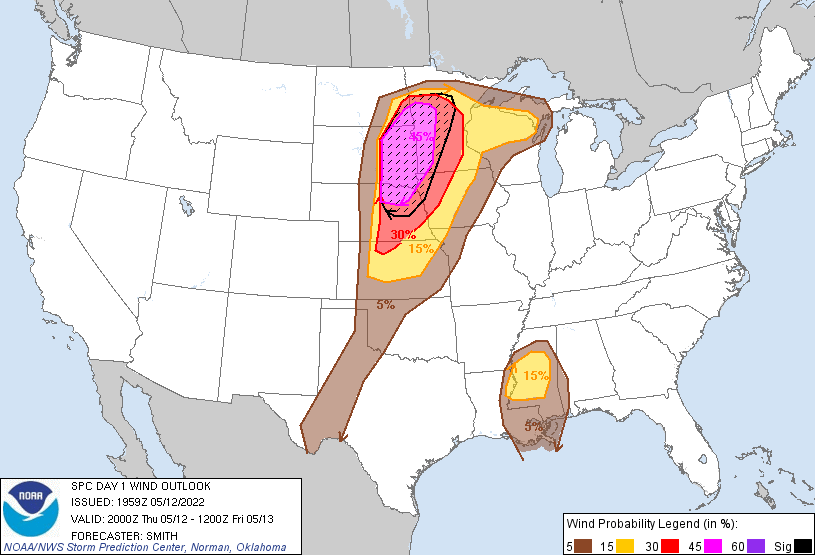 |
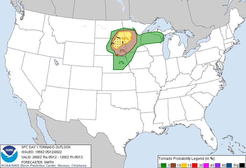
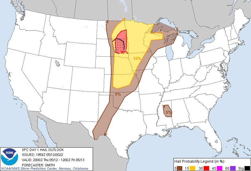
| SPC Day 1 Categorical Outlook | SPC Day 1 Tornado Outlook | SPC Day 1 Hail Outlook | SPC Day 1 Wind Outlook |
Warning Lead Time
| Counties & Issuance Time | Lead Time |
Summaries from other NWS Offices
 |
Media use of NWS Web News Stories is encouraged! Please acknowledge the NWS as the source of any news information accessed from this site. |
|

