
Overview
.
Tornadoes
In total on June 17, 2010 there were 74 tornadoes across four states, including 48 in Minnesota. There were a total of 15 EF2+ tornadoes (often considered "strong" tornadoes) and 4 EF4 tornadoes (often referred to as "violent" tornadoes). For more on the EF scale, see here.
|
|
Photos
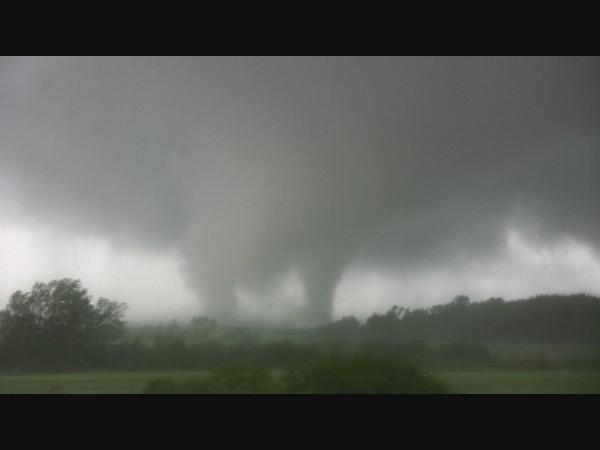
The following photos are from June 17, 2010. While there were many remarkable views of tornadoes on that day, it is always important to remember safety first, as many of these photos came from trained storm spotters who knew they were not in the direct path of the tornado and were extremely aware of their surroundings. Remember if in a tornado warning, ensure you are in the lowest level and centralized in a sturdy shelter. Also remember to not take photos while driving!
 |
|
| Leaf Valley, MN tornado, courtesy of Brad Nelson. | Wadena, MN tornado, courtesy of Bryan Howell. |
 |
|
| Conger, MN tornado in Freeborn County, courtesy of Danny Neal. | Conger, MN tornado in Freeborn County, courtesy of Skip Talbot. |
|
|
| Conger, MN tornado in Freeborn County near peak intensity, courtesy of Skip Talbot. |
 |
| Mammatus clouds that evening over the NWS Twin Cities office in Chanhassen, MN. |
Radar
 |
 |
|
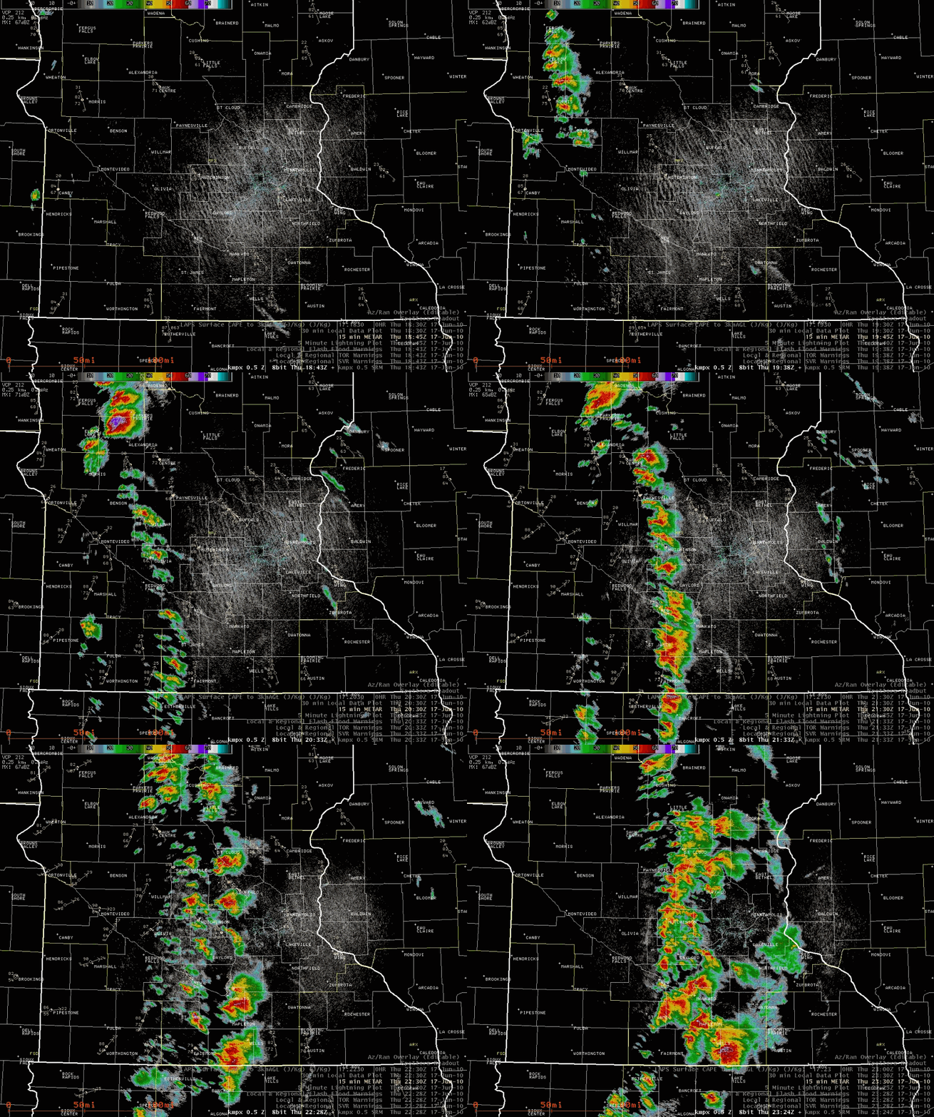
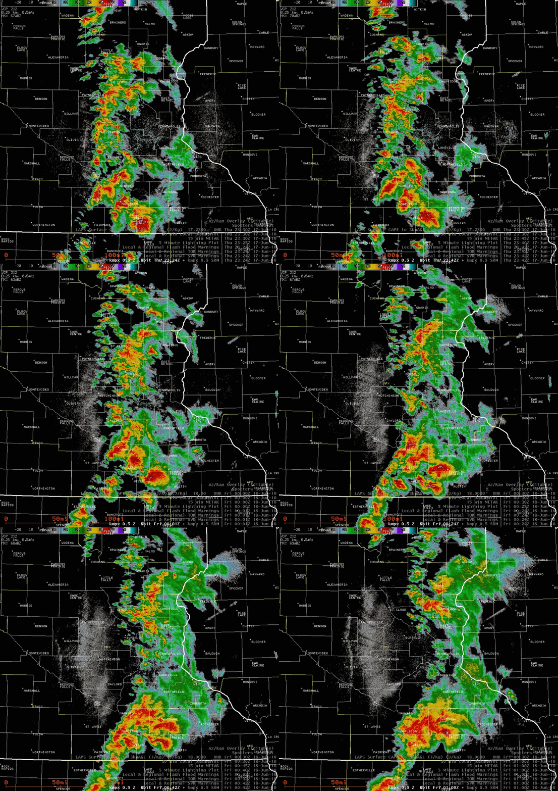
| NWS Twin Cities 0.5° reflectivity loop from ~2 p.m. - 6:30 p.m. on June 17, 2010 | NWS Twin Cities 0.5° reflectivity loop from ~6:30 p.m. until 8 p.m. on June 17, 2010 |
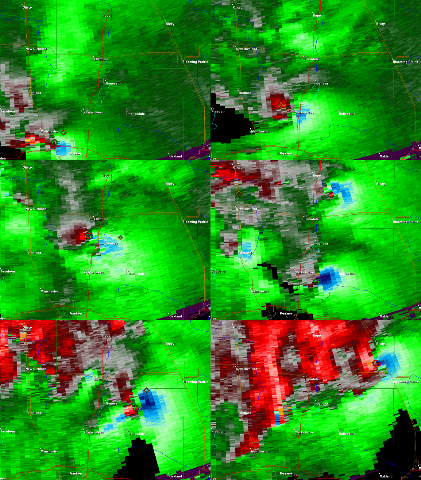 |
| NWS Twin Cities 0.5° velocity loop (from GR Analyst software) from Northern Freeborn County over an hour span early in the evening of June 17, 2010. The "blue against red" areas indicate strong rotation, or mesocyclonces, within the supercell thunderstorms. Note several strong rotation areas within close proximity, all that would be associated with tornadoes. |
Damage Survey
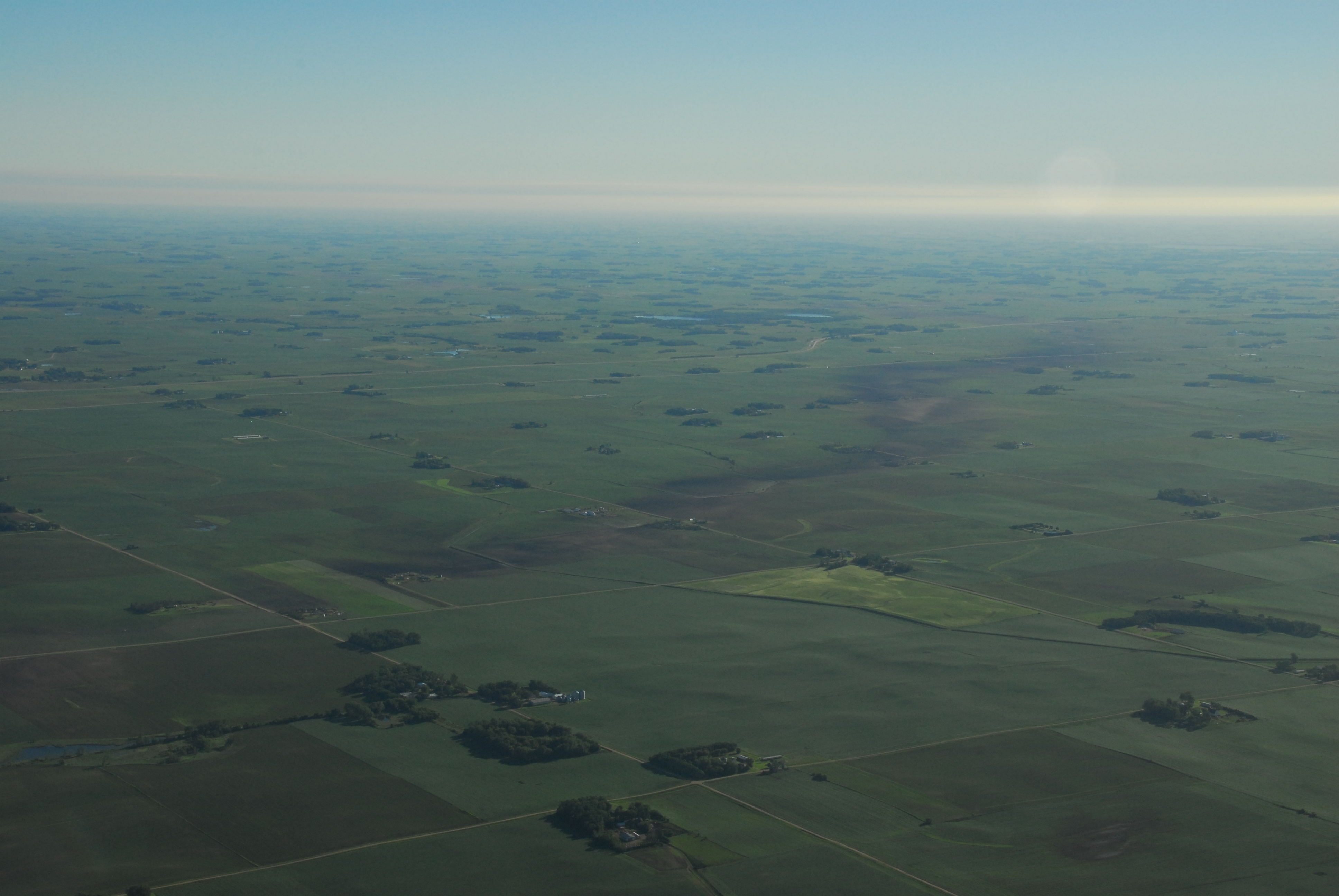
The NWS offices had boots on the ground for their survey, working closely with Emergency Management. For the NWS office in the Twin Cities, surveys took a week to complete, with several trips to and near Freeborn County where there were numerous tornadoes and a maze of widespread damage. The NWS also utilized aerial imagery to help determine the magnitude and extent of the tornadic damage.
For a detailed summary of the EF-4 Tornado in Freeborn County that struck near Conger and Albert Lea, please see here.
 |
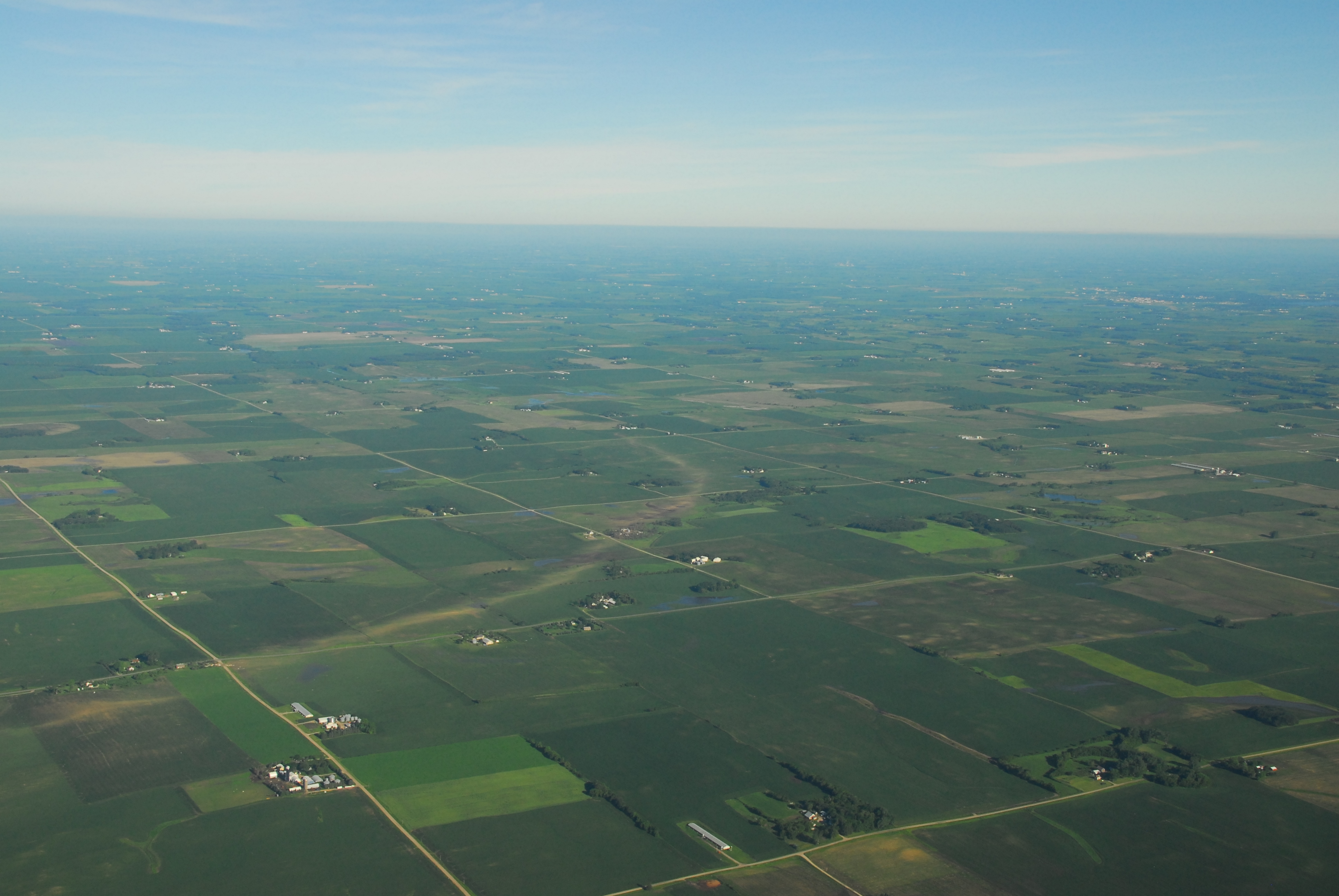 |
| Aerial imagery in Freeborn County of the EF4 Conger area tornado damage path. Courtesy of NOHRSC. | |
 |
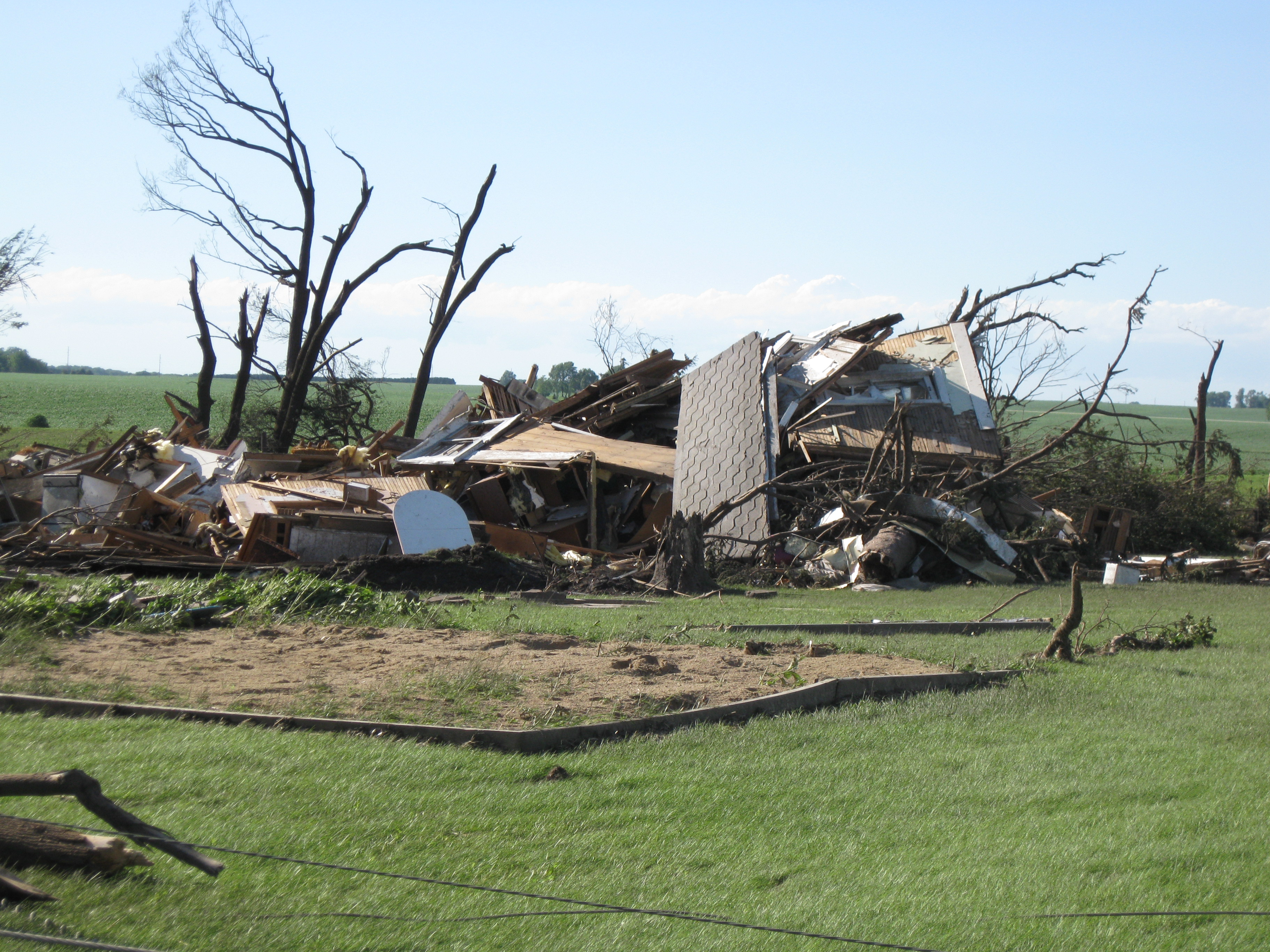 |
| Freeborn County tornado damage. | |
 |
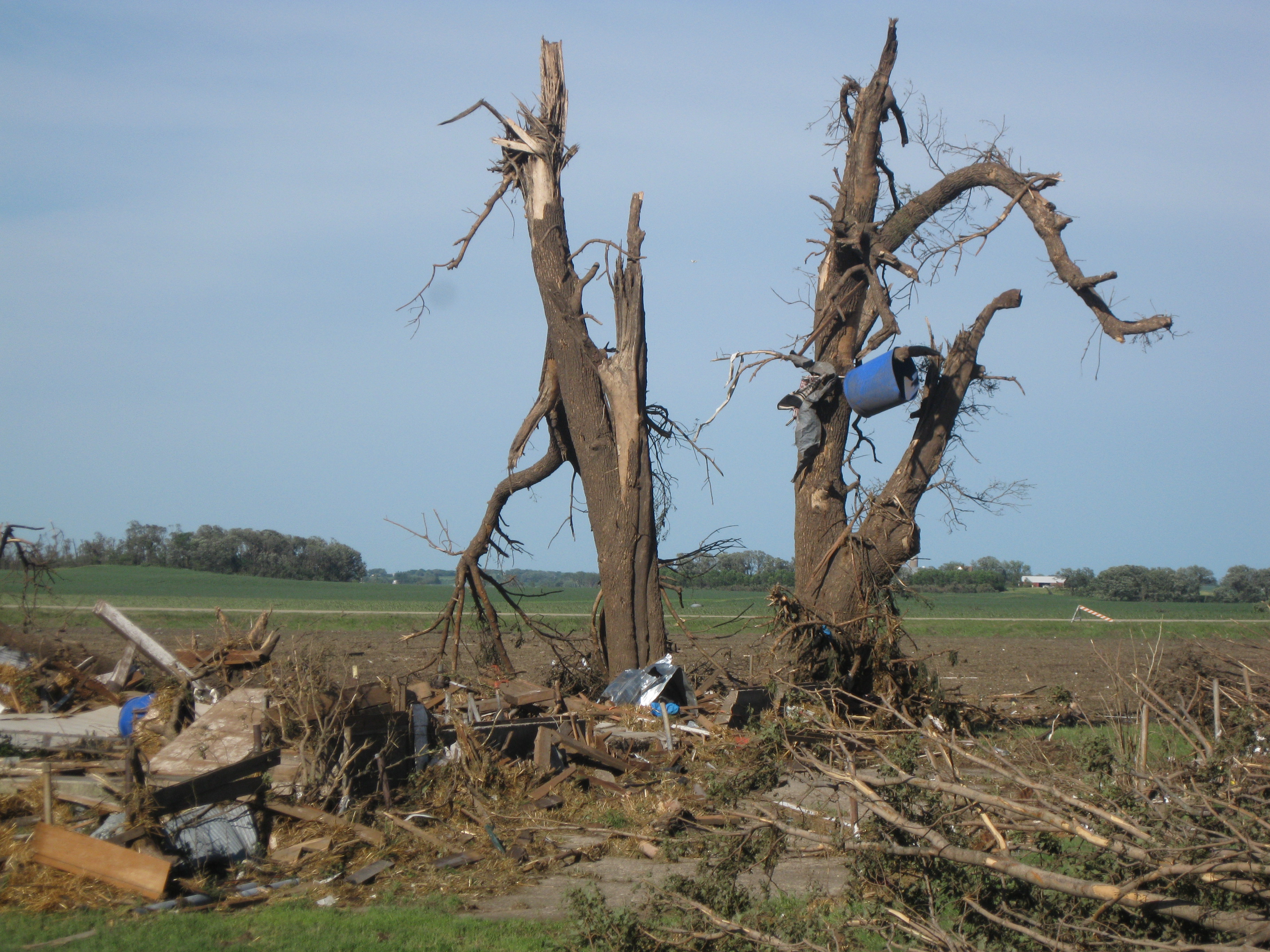 |
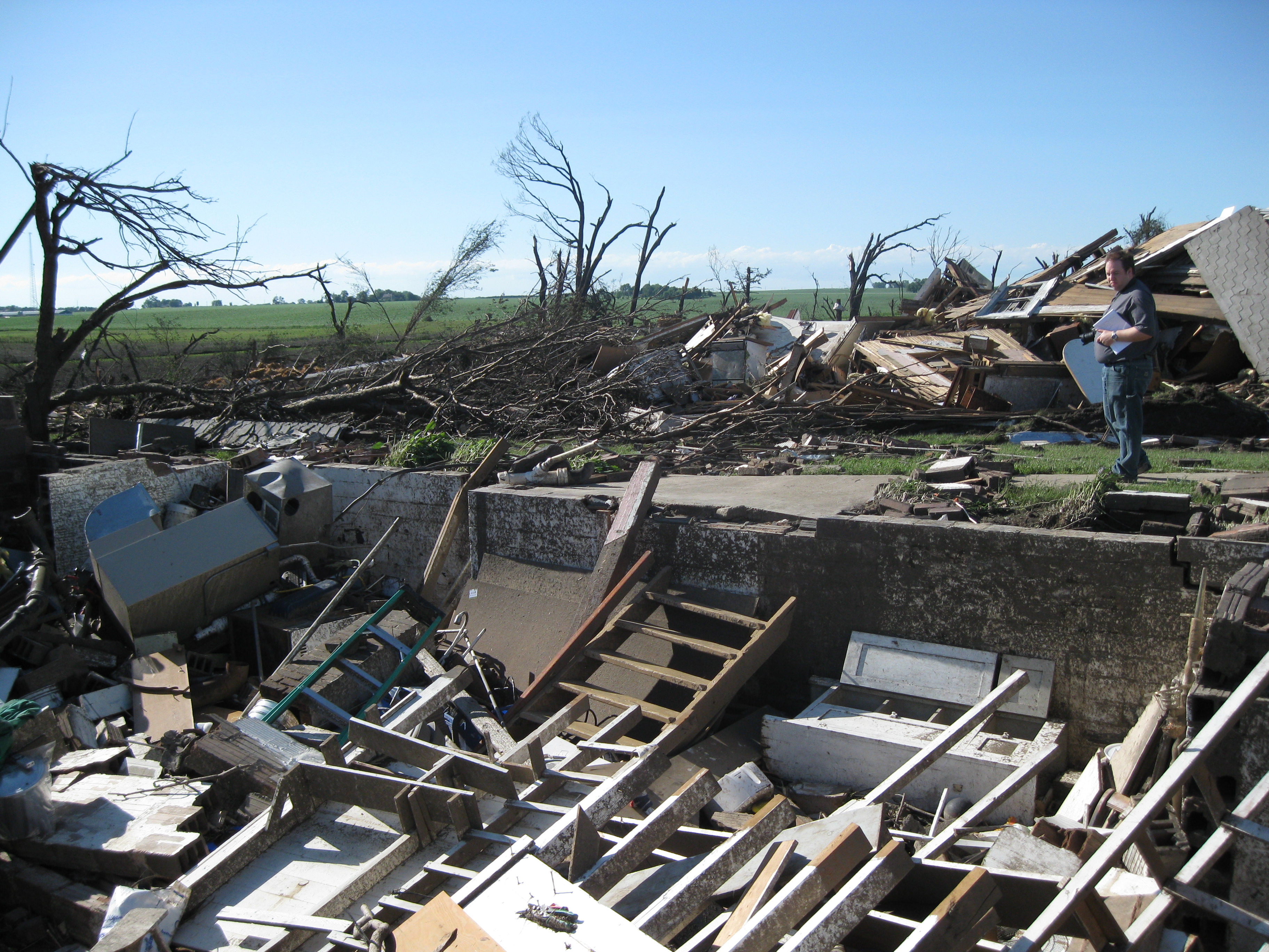
| Freeborn County tornado damage. | |
 |
 |
| Freeborn County tornado damage. | |
 |
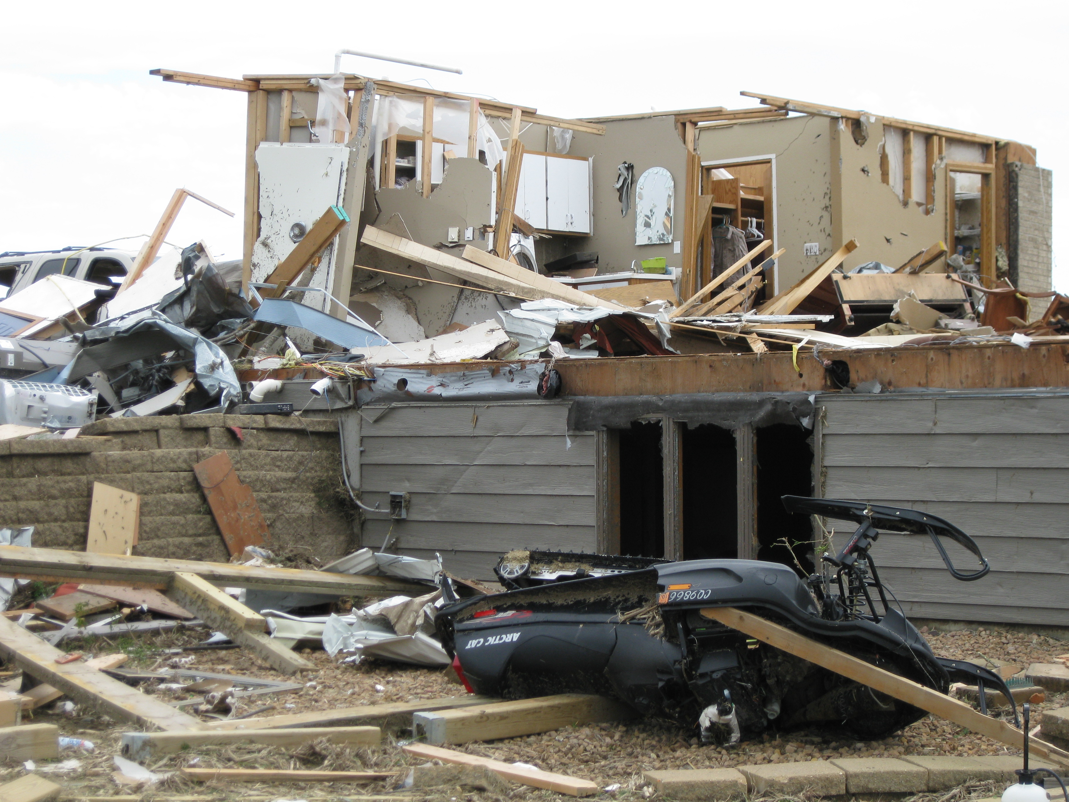 |
| Freeborn County and eastern Steel County tornado damage. | |
Service
NWS Storm Prediction Center Severe Weather Outlooks:
 |
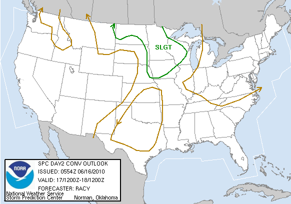 |
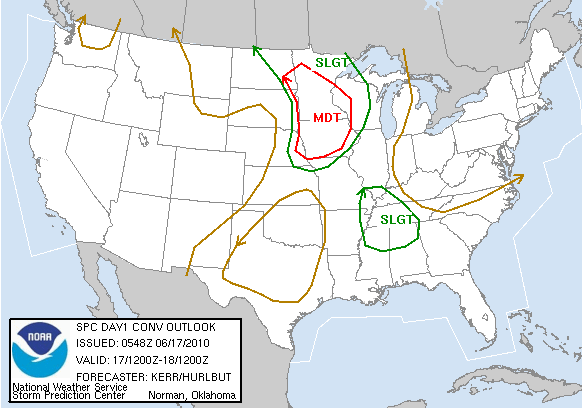 |
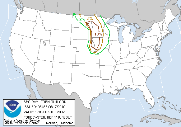 |
| Outlook for June 17 issued June 15 | Outlook for June 17 issued June 16 | Outlook for June 17 issued June 17, 1 a.m. | Tornado outlook for June 17 issued June 17, 1 a.m. |
NWS Twin Cities, MN Weather Story Graphics:
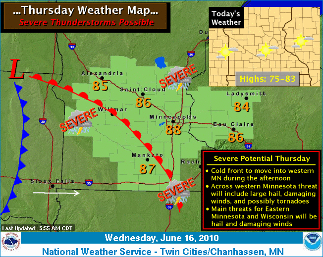 |
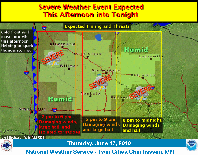 |
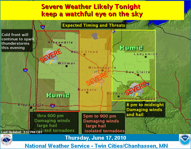 |
| For June 17 issued on morning of June 16 | For June 17 issued on morning of June 17 | Afternoon update on June 17 |
NWS Storm Prediction Center Mesoscale Discussion:
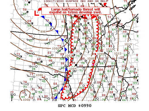 |
| See here for text. |
NWS Warnings:
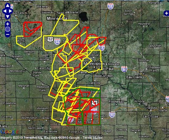 |
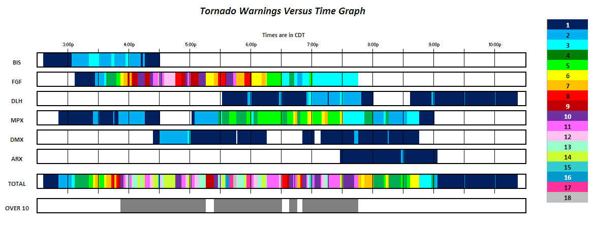 |
| NWS Twin Cities, MN Warning on June 17, 2010 | A timeline of tornado warnings issued by Upper Midwest NWS offices on June 17, 2010 |
Accounts
For accounts, see our Facebook post. More may be added to this section soon.
First hand account of the event by Rick Hiltbrand (former NWS Twin Cities lead forecaster)
First hand account of the event by Matt Friedlein (former NWS Twin Cities forecaster)
Links
Severe Weather Preparedness
Other NWS June 17, 2010 Pages
 |
Media use of NWS Web News Stories is encouraged! Please acknowledge the NWS as the source of any news information accessed from this site. |
 |