A major winter storm impacted Minnesota and west central Wisconsin from February 2-3, 2016, producing a band of heavy snow across our area along with blizzard conditions in southern MN. Here is a map of snowfall totals across our area:
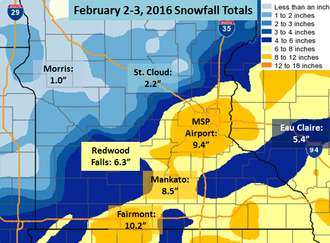
A list of individual snowfall totals are available here.
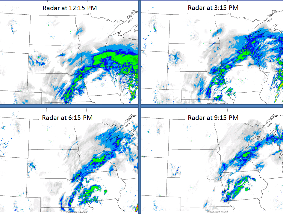
A band of moderate to heavy snow moved northward through southern Minnesota before stalling near the Twin Cities area during the evening of February 2. Here are a few radar images from 12:15 PM through 9:15 PM showing the progression of this snow band:
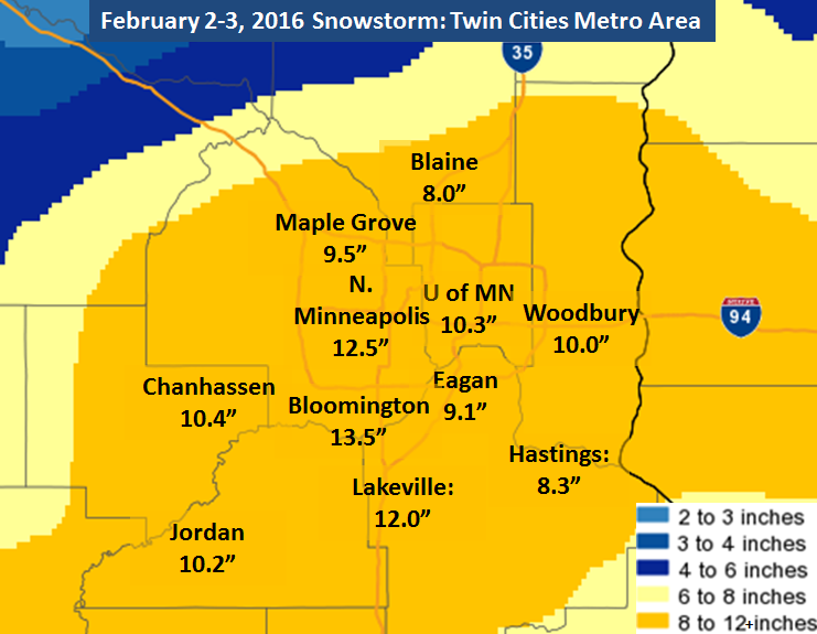
This storm produced the heaviest snow so far this season for the Twin Cities area, with accumulation ranging from 8" to over a foot. Here is a map of some snowfall totals from the Twin Cities metro area:
Southern Minnesota experienced blizzard conditions from the late morning through the evening on February 2. Wind gusts up to 40-45 mph, along with the heavy snow, led to the closure of numerous highways between Mankato and the MN/IA border. Here is a graphic we created Tuesday night with a map from MNDOT showing the large amount of highway closures in this area:
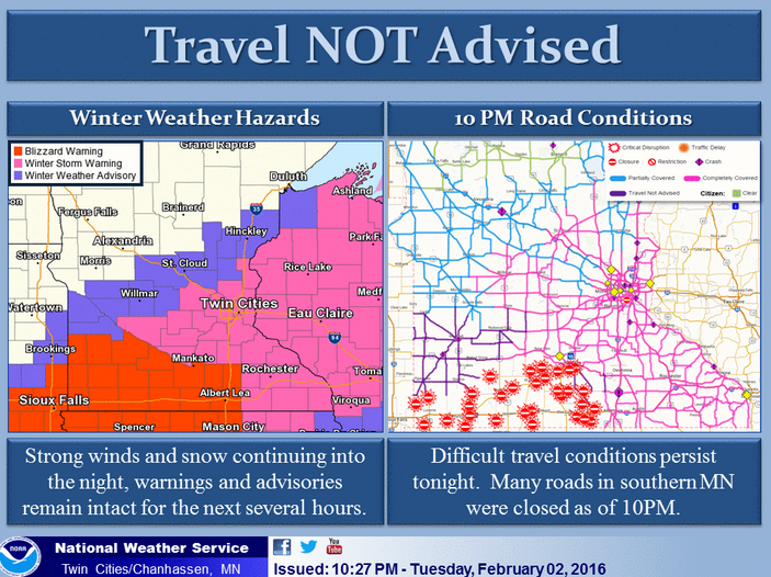
As you can see from the graphic above, blizzard warnings were in effect for almost all of the counties with road closures and where travel was not advised on Tuesday night. Winter Storm Warnings covered much of eastern/SE Minnesota and western Wisconsin, where winds were generally not strong enough to create whiteout conditions, but heavy snowfall rates up to 1-2" per hour created very poor travel around the Twin Cities.

