Overview
|
On Saturday, February 23 and Sunday, February 24 a very powerful winter storm brought whiteout conditions across much of Minnesota and Wisconsin. A narrow band of heavy snow fell from central Iowa, through southeast Minnesota, and up through northern Wisconsin. Several locations within this band saw over a foot of snow (orange shading). Very strong winds developed as the snow was ending Saturday night and these winds continued through Sunday. Many locations had wind gusts of 50 mph or stronger. This led to significant blowing and drifting snow, making travel very difficult or impossible. Most roads in southern Minnesota and western Wisconsin were impassable, and hundreds of motorists became stranded in the blizzard. Portions of Interstate 90 and Interstate 35 were closed for over 24 hours in south central Minnesota. |
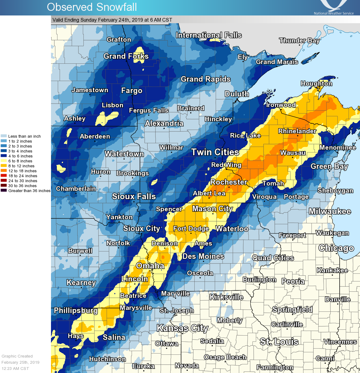 Map of observed snowfall from February 23,24. The yellow shading shows amounts over 6 inches, and the orange shading shows amounts in excess of a foot. The snow was difficult to measure due the very strong winds that accompanied this storm. |
Travel Impacts
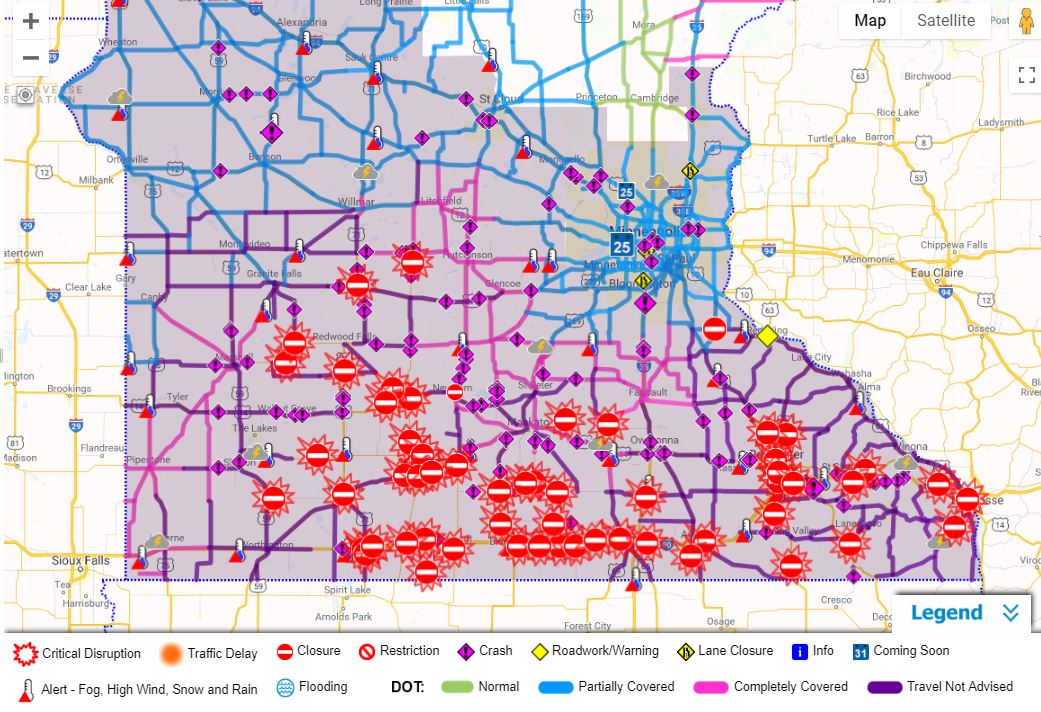
This blizzard brought significant travel impacts across Minnesota and Wisconsin. Drifting snow made most roads impassable. The Minnesota National Guard helped rescue stranded motorists, and hundreds of people were taken to temporary shelters until travel became safe.
 |
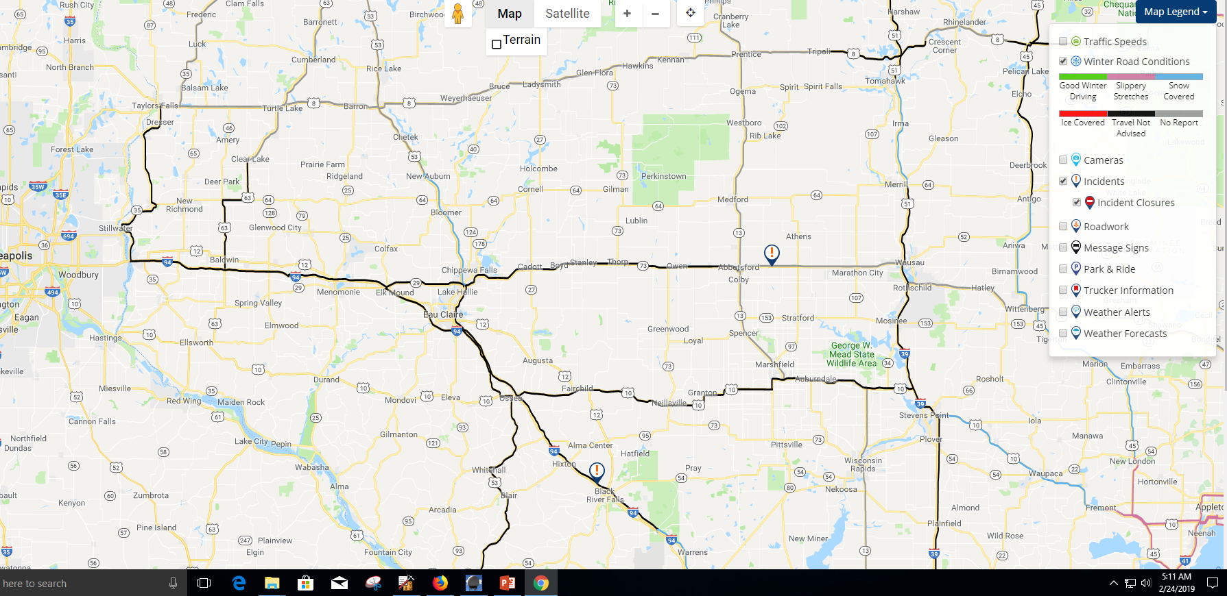 |
| Road conditions across Minnesota Sunday afternoon. Many roads were closed (red circles) and MNDOT was advising no travel. | Road conditions across Wisconsin Sunday morning. Travel was not advised across much of the main roadways (black). |
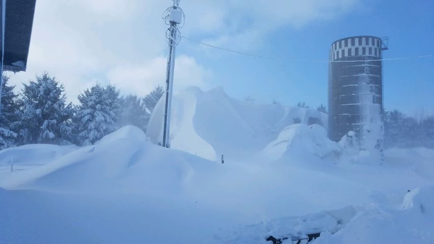
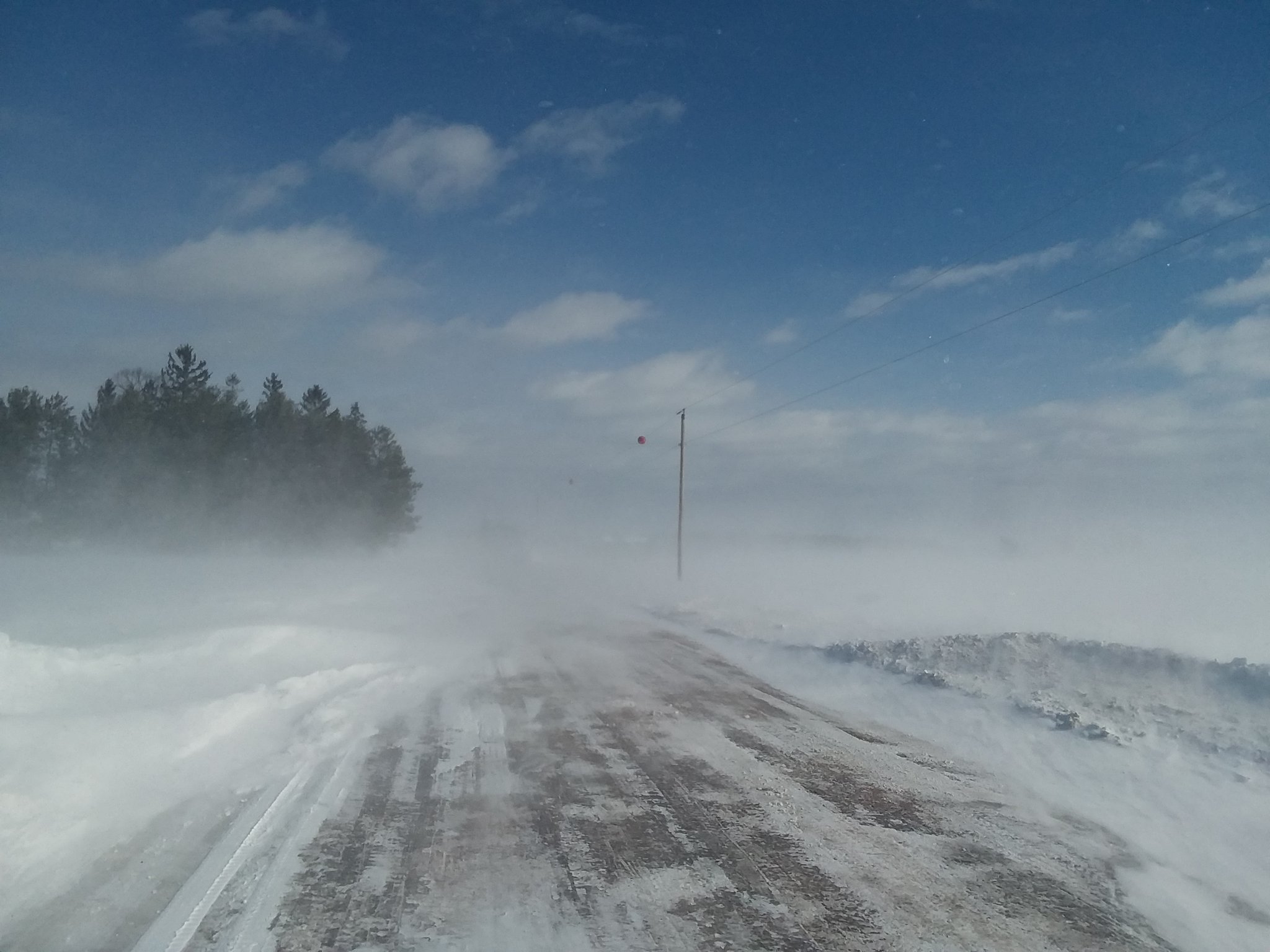
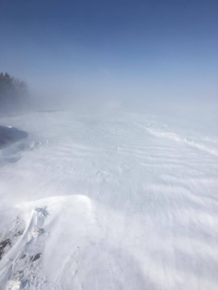
Photos
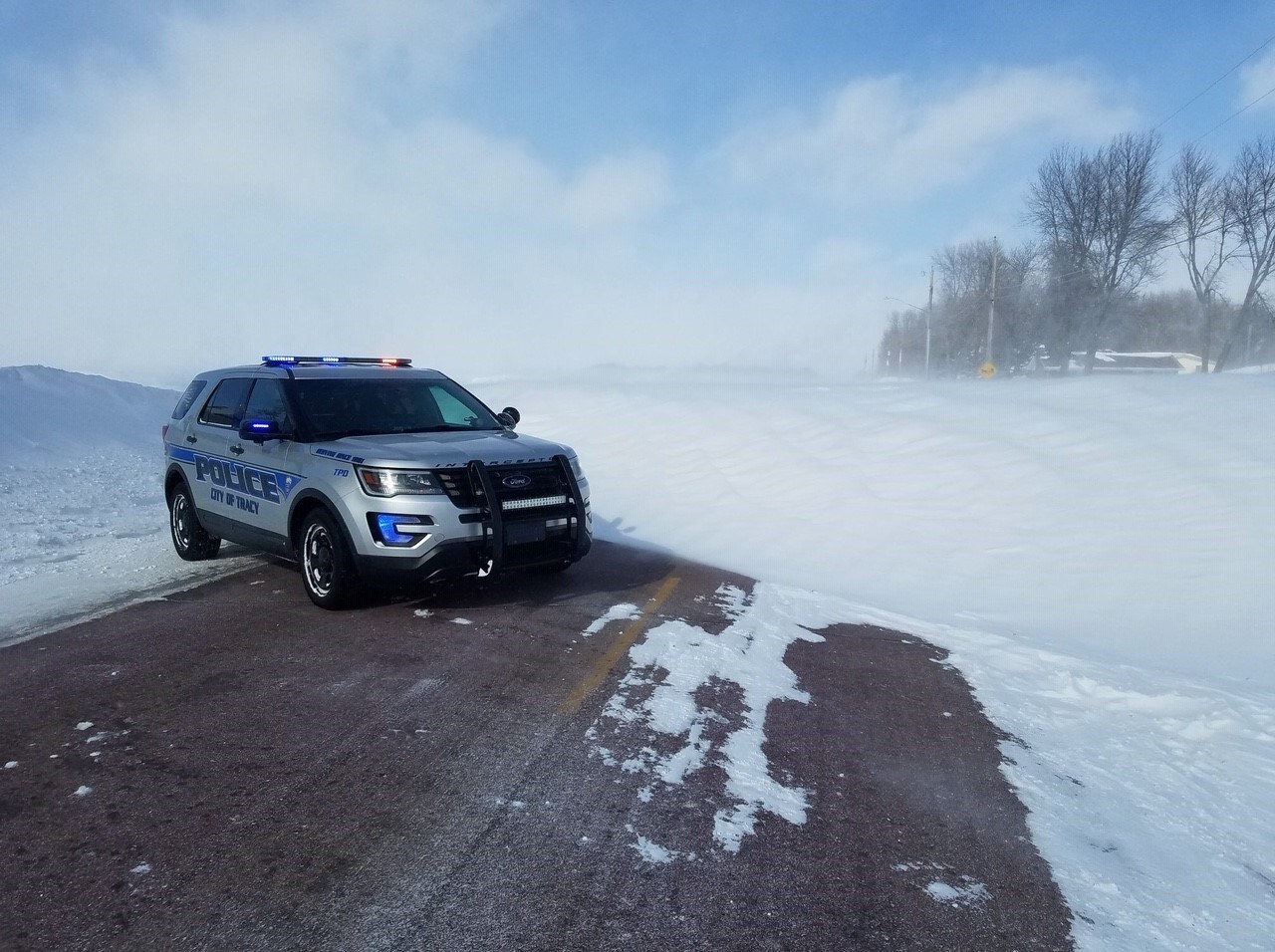
Snow drifts of several feet were common across southern Minnesota and western Wisconsin. Some locations had drifts of 10 feet or more.
 |
 |
 |
 |
| Road closed near Tracy MN with snow drifts several feet deep. Photo courtesy of HSEM. | Towering snow drift in southern MN. Photo courtesy of Staci Hinnenkamp. | Snow and blowing snow in western Wisconsin near Rice Lake. Photo courtesy of Dirk Miller. | Snow-covered road with near zero visibility in central Minnesota. Photo courtesy of HSEM. |
Meteorology and Radar
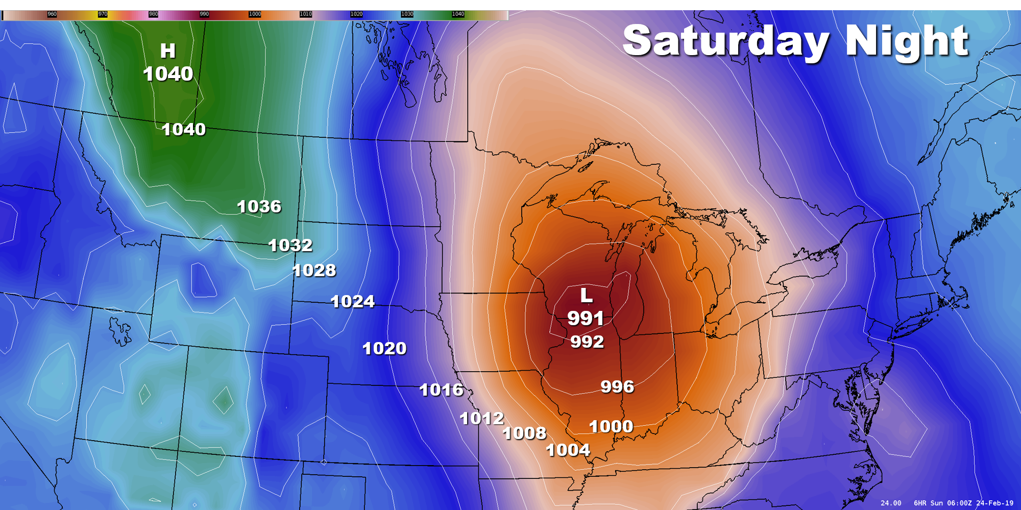
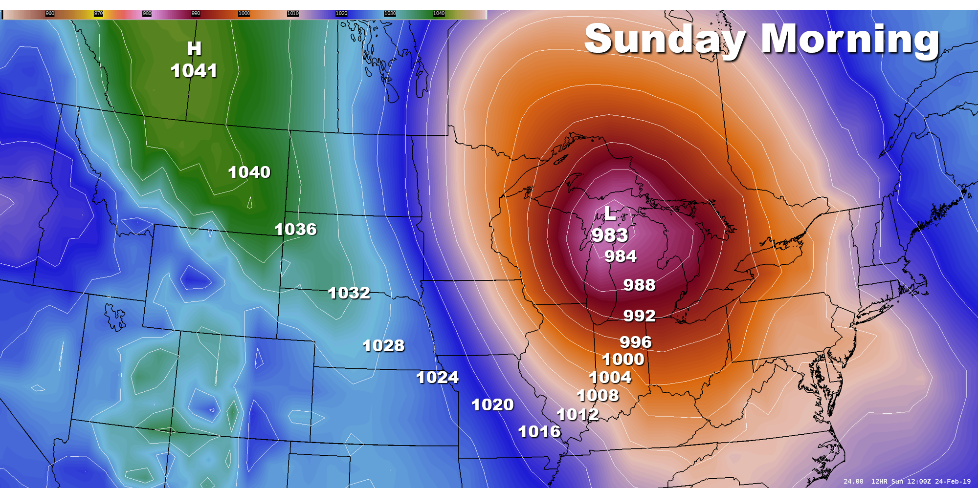
One of the more impressive traits about this storm was how quickly it strengthened. This can be seen by looking at the deepening that occurred in the mean sea level pressure (mslp). The maps below shows a model's depiction of the surface pressure from Saturday evening through Sunday afternoon. This rapid intensification was the primary reason why winds were so strong, and lasted for so long. Blizzard conditions prevailed many hours after the falling snow had ended.
.png) |
 |
 |
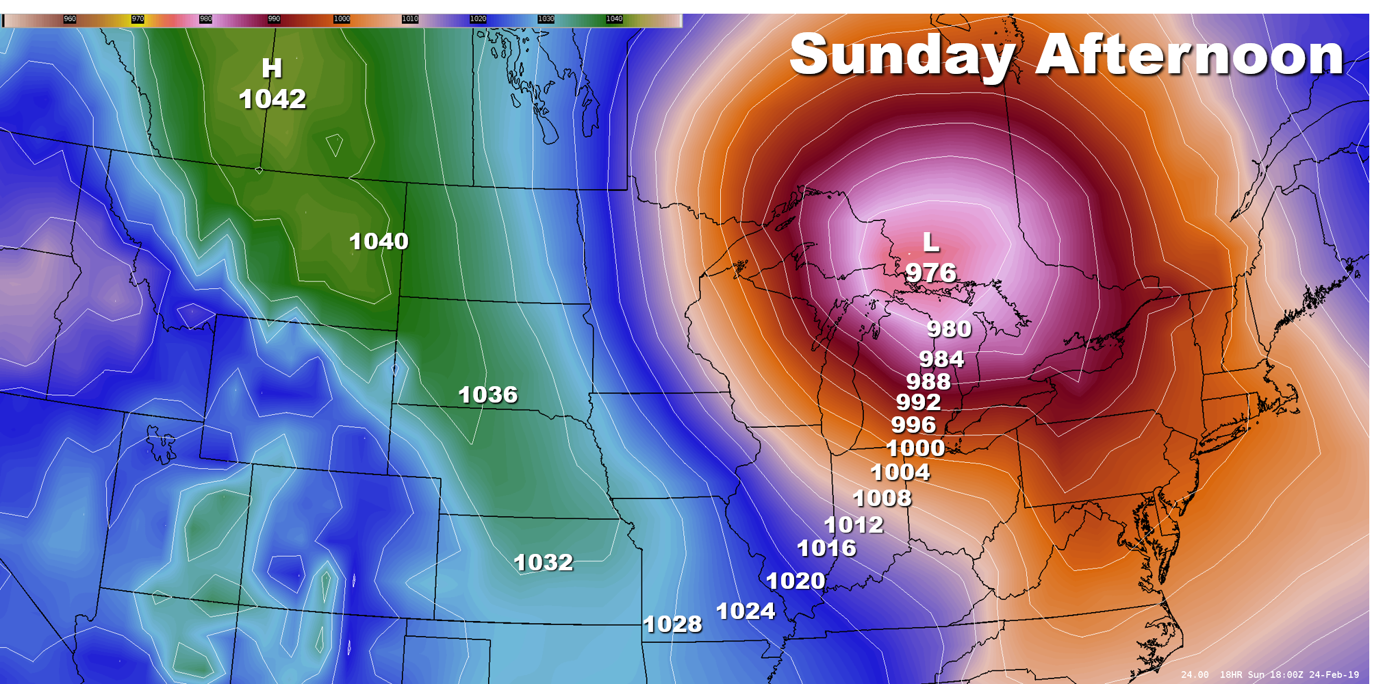 |
| Model depicted mean sea level pressure showing the Surface Low Saturday evening across southeast Iowa. The minimum pressure is 997 millibars (mb). | Model depicted mean sea level pressure showing the Surface Low Saturday night across southern Wisconsin.The storm is strengthening as it lifts northward across the Upper Midwest. | Model depicted mean sea level pressure showing the Surface Low Sunday morning across northern Michigan. The storm is quickly intensifying. | Model depicted mean sea level pressure showing the Surface Low Sunday afternoon across southern Ontario. The storm has rapidly intensified and its MSLP is less than 980 mb. That's over a 20 mb drop in 18 hours! |
 |
 |
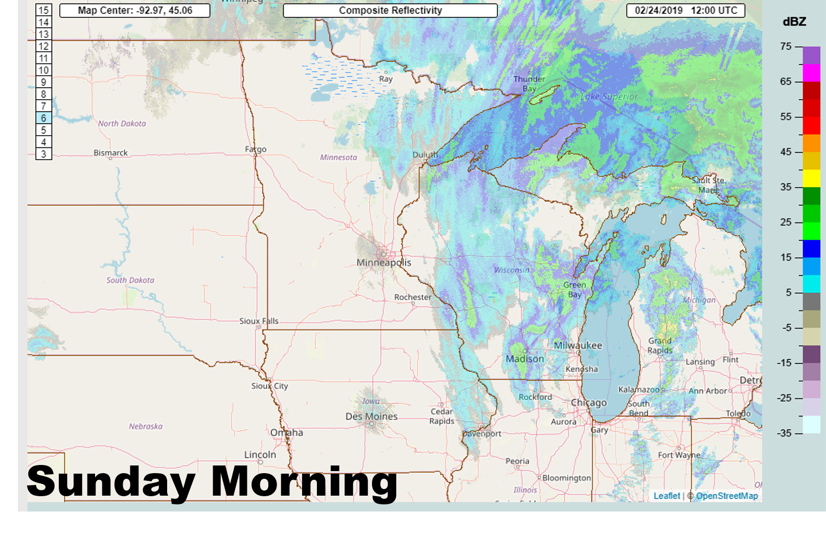 |
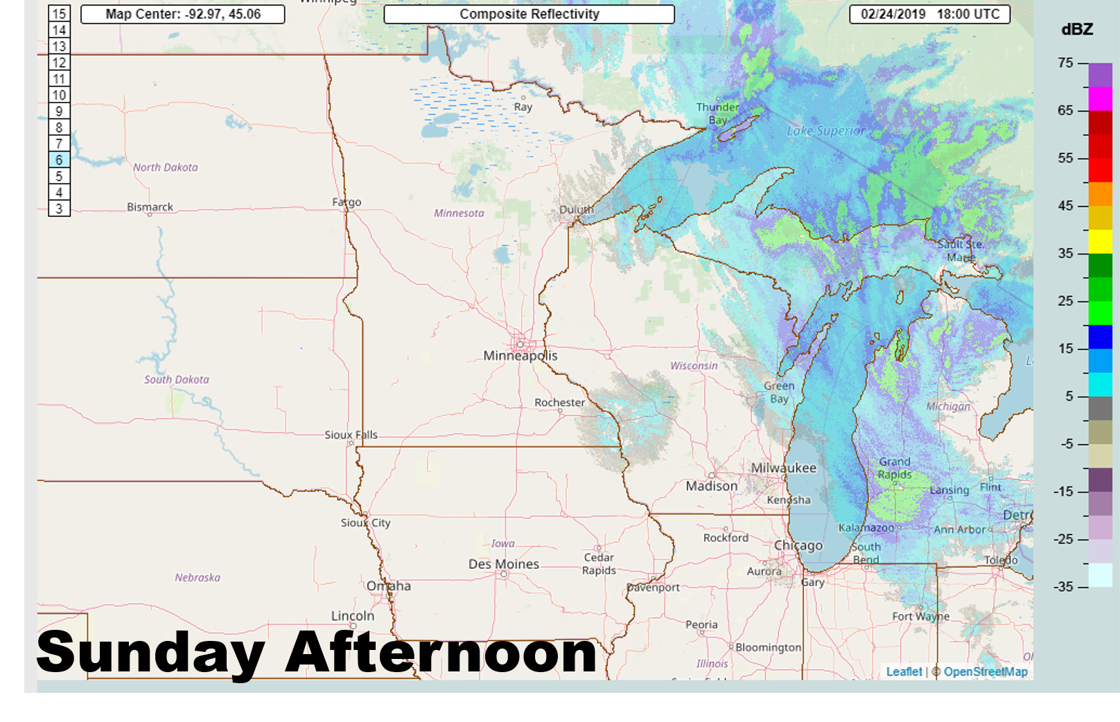 |
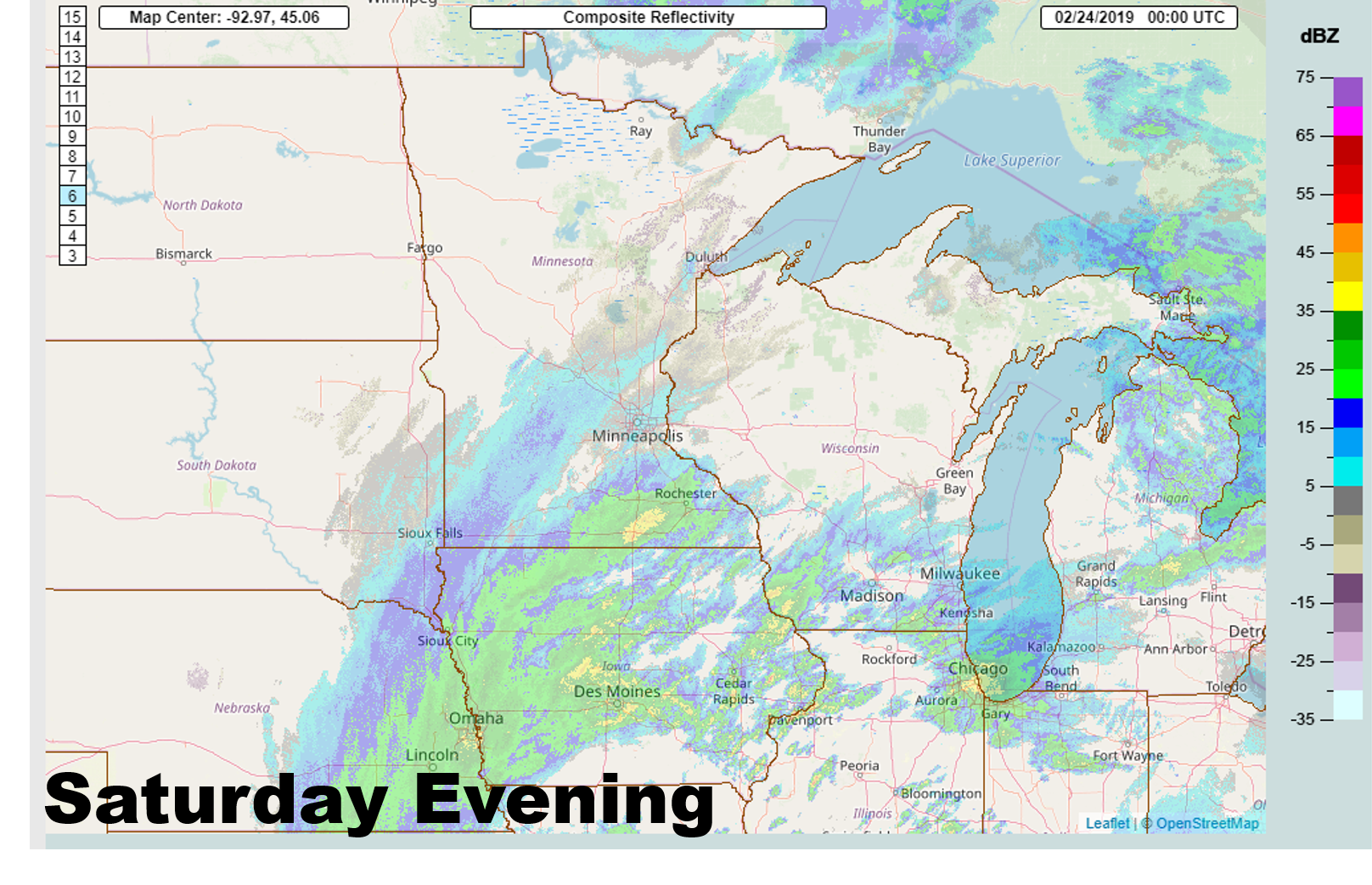
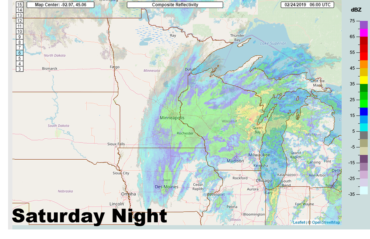
| Radar reflectivity showing the heavy snow across eastern Nebraska, western Iowa, and southern Minnesota Saturday evening. | Radar reflectivity showing the heavy snow across eastern Minnesota and Wisconsin Saturday night. | Radar reflectivity showing the lingering snow across Wisconsin Sunday morning. | Radar reflectivity showing little to no snow across the region, yet blizzard conditions were in full force as winds gusted to near 50 mph. |
Storm Reports
...PEAK WIND REPORTS AS OF 6 PM FEBRUARY 24 2019..

Location                     Speed     Time/Date       Provider
St. Paul Dwtn AP             62 MPH    1049 AM 02/24   ASOS
Clara City 2WSW              55 MPH    1005 AM 02/24   MNDOT
New Ulm AP                   55 MPH    1055 AM 02/24   AWOS
Waseca AP                    54 MPH    0119 PM 02/24   AWOS
Redwood Falls AP             54 MPH    1132 AM 02/24   ASOS
Willmar AP                   52 MPH    1036 AM 02/24   AWOS
Fairmont AP                  52 MPH    1109 AM 02/24   AWOS
Alexandria AP                51 MPH    1219 PM 02/24   ASOS
Ellendale 5NNE               51 MPH    1141 AM 02/24   MNDOT
Winthrop 2W                  50 MPH    1145 AM 02/24   MNDOT
Cannon Falls 7SSE            50 MPH    1215 PM 02/24   MNDOT
Benson AP                    49 MPH    1236 PM 02/24   AWOS
Eau Claire AP                49 MPH    0340 PM 02/24   ASOS
Mankato AP                   49 MPH    1025 AM 02/24   AWOS
Blue Earth 2NW               49 MPH    1110 AM 02/24   MNDOT
New Germany 1NW              49 MPH    0945 AM 02/24   MNDOT
Waseca 1SSE                  49 MPH    1120 AM 02/24   MNDOT
St. Cloud AP                 49 MPH    0211 PM 02/24   ASOS
Eden Prairie AP              48 MPH    1237 PM 02/24   ASOS
Glenwood AP                  48 MPH    1116 AM 02/24   AWOS
Litchfield 3S                48 MPH    1211 PM 02/24   RAWS
Crystal AP                   48 MPH    1246 PM 02/24   ASOS
Starbuck 8SSW                48 MPH    1100 AM 02/24   MNDOT
Morris AP                    48 MPH    1136 AM 02/24   AWOS
Minneapolis-St. Paul AP      48 MPH    1224 PM 02/24   ASOS
Alexandria 2SSE              47 MPH    1130 AM 02/24   MNDOT
Sauk Centre 2SE              47 MPH    1110 AM 02/24   MNDOT
Litchfield AP                46 MPH    1115 AM 02/24   AWOS
Lakeville AP                 46 MPH    1216 PM 02/24   AWOS
Hanley Falls                 46 MPH    1040 AM 02/24   MNDOT
Madelia 3ENE                 46 MPH    1045 AM 02/24   MNDOT
Olivia AP                    46 MPH    0259 PM 02/24   AWOS
Owatonna AP                  46 MPH    1052 AM 02/24   AWOS
Cumberland AP                46 MPH    0435 PM 02/24   AWOS
Long Prairie AP              45 MPH    1016 AM 02/24   AWOS
Granite Falls AP             45 MPH    1036 AM 02/24   AWOS
Rice 1NNW                    45 MPH    0320 PM 02/24   MNDOT
Stanley 1SSE                 45 MPH    1056 AM 02/24   WIDOT
Albert Lea AP                44 MPH    0456 PM 02/24   AWOS
Blaine AP                    44 MPH    0145 PM 02/24   AWOS
Menomonie AP                 44 MPH    0155 PM 02/24   AWOS
New Richmond AP              44 MPH    0235 PM 02/24   AWOS
Stanton AP                   44 MPH    0115 PM 02/24   AWOS
Sauk Centre AP               43 MPH    1155 AM 02/24   AWOS
Madison AP                   43 MPH    1055 AM 02/24   AWOS
Glencoe AP                   43 MPH    1115 AM 02/24   AWOS
Hutchinson AP                43 MPH    1035 AM 02/24   AWOS
1 NW Camp Ripley             43 MPH    0356 PM 02/24   NONFEDAWOS
Clearwater 1SE               43 MPH    1015 AM 02/24   MNDOT
Belgrade 3ESE                43 MPH    1045 AM 02/24   MNDOT
Red Wing 4W                  43 MPH    0900 AM 02/24   MNDOT
Marietta 5SSW                43 MPH    0820 AM 02/24   MNDOT
Montevideo AP                43 MPH    0135 PM 02/24   AWOS
Osceola AP                   43 MPH    0235 PM 02/24   AWOS
Princeton AP                 43 MPH    1256 PM 02/24   AWOS
Carver 3S                    43 MPH    1049 AM 02/24   RAWS
River Falls 4NW              43 MPH    0256 PM 02/24   WIDOT
Harding 3WNW                 42 MPH    1220 PM 02/24   MNDOT
Cambridge AP                 41 MPH    0356 PM 02/24   AWOS
Ladysmith 2SW                41 MPH    0505 PM 02/24   RAWS
Tony AP                      41 MPH    0335 PM 02/24   AWOS
Rice Lake AP                 41 MPH    0155 PM 02/24   AWOS
South St. Paul AP            41 MPH    0215 PM 02/24   AWOS
Lake Elmo AP                 40 MPH    0136 PM 02/24   AWOS
Mayer 1NE                    40 MPH    0400 PM 02/24   MNDOT
Chetek AP                    40 MPH    0135 PM 02/24   AWOS
 |
Media use of NWS Web News Stories is encouraged! Please acknowledge the NWS as the source of any news information accessed from this site. |
|

