Overview
|
**This information may still be updated if new information becomes available**
A well defined cold front associated with a strong upper level low produced widespread wind damage and some tornadoes throughout central and eastern Minnesota and western Wisconsin on August 29th, 2024. There were a number of downbursts, with some of the most significant downburst damage in Champlin, Anoka, and Cottage Grove. Some of the downburst winds ranged from 75 to 85 mph.
|
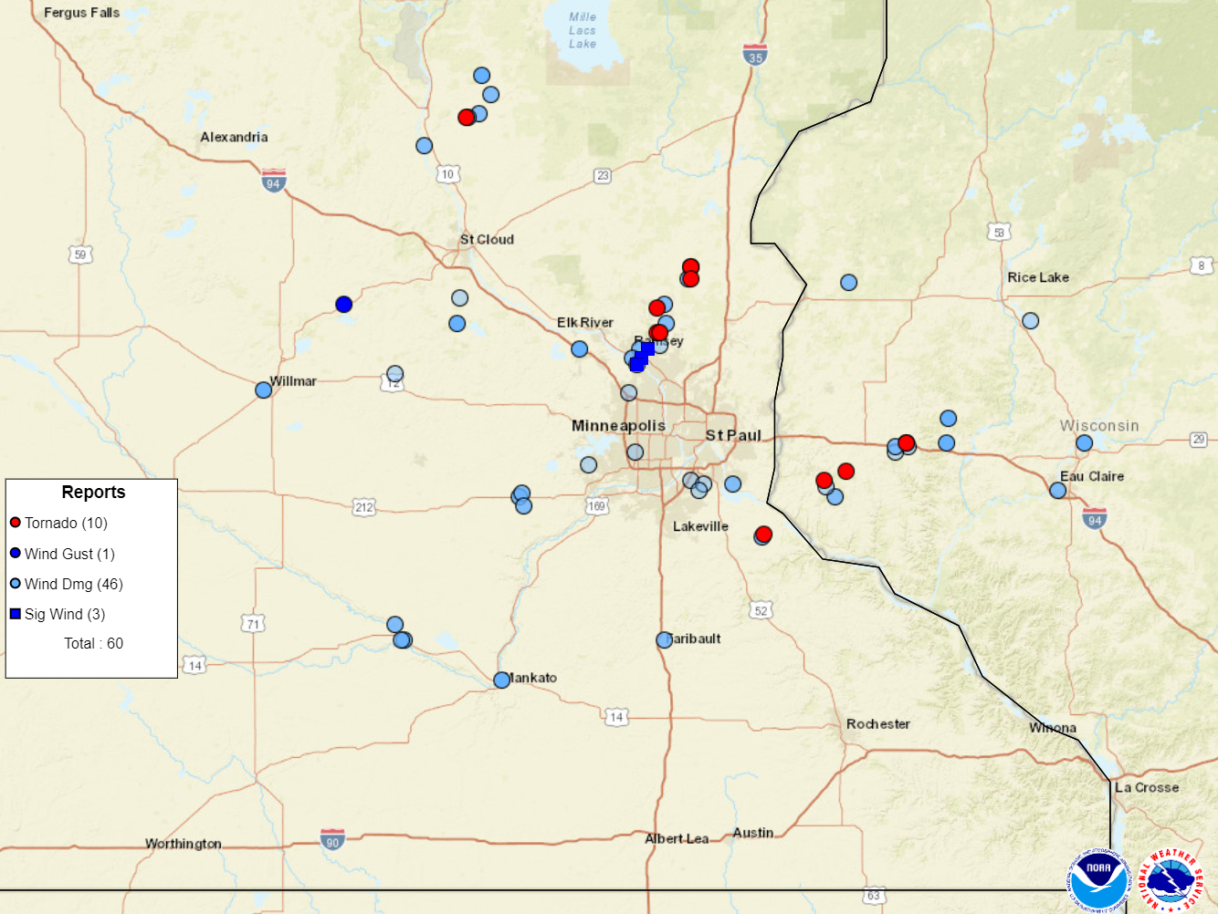 Preliminary storm reports from August 29, 2024. For the latest storm reports, please visit the Storm Prediction Center. |
Tornadoes:
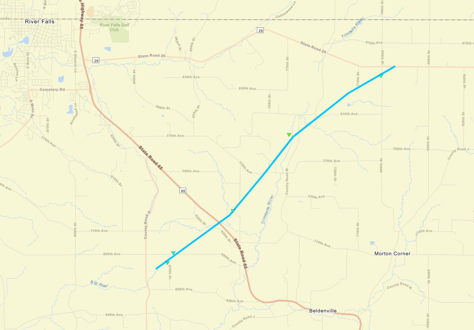
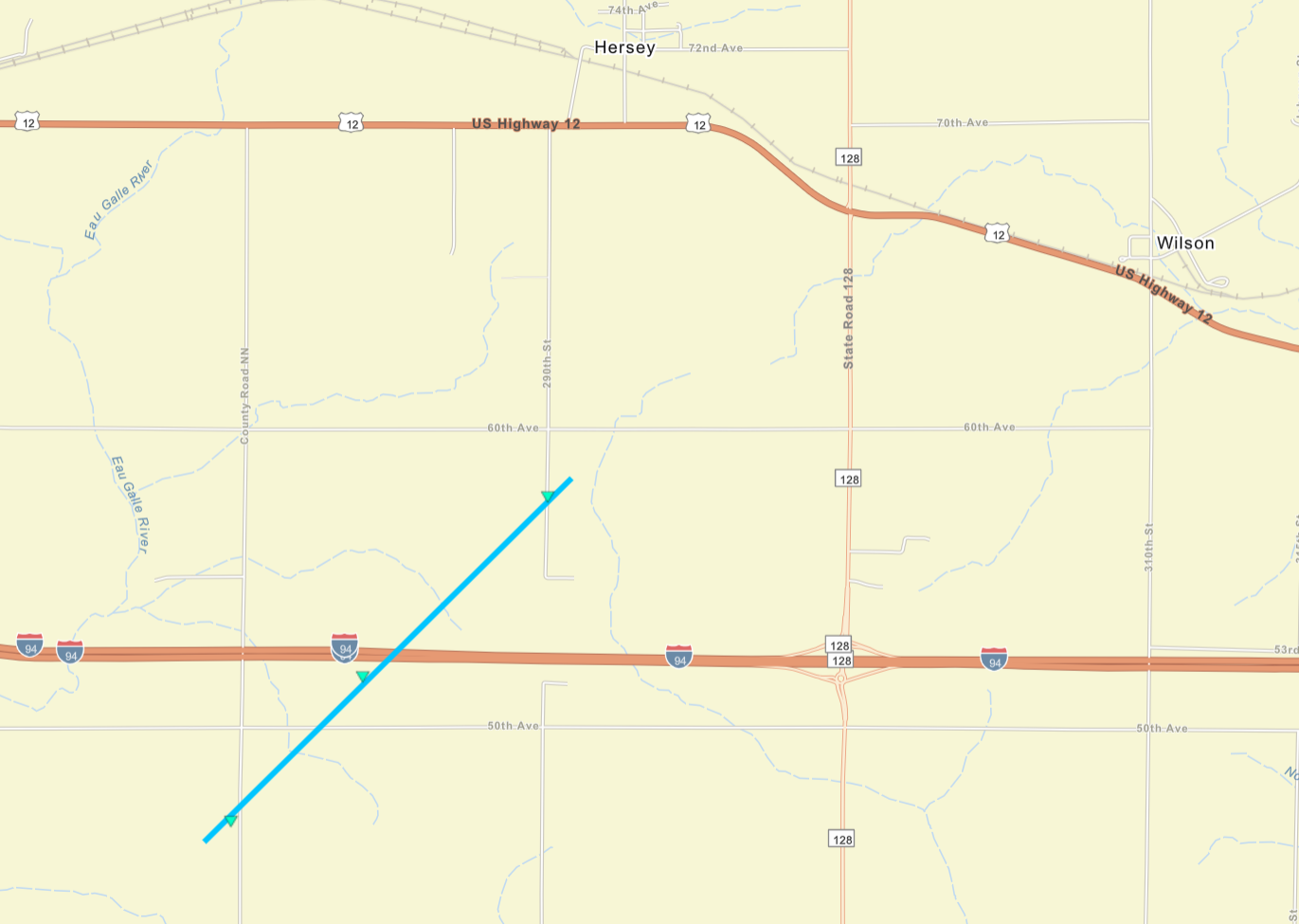
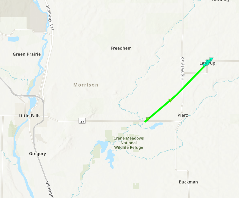
Six tornadoes have been confirmed by the NWS Twin Cities. In Minnesota, there was one in Morrison County, near Pierz and in Lastrup. Another was in Anoka County just north of Andover. One more was in northern Anoka and southern Isanti counties, and another in Dakota County south of Hastings (which moved into far western Wisconsin). In Wisconsin, the tornado south of Hastings ended southeast of Prescott. Another started between River Falls and Beldenville, with the other near Wilson. Some path lengths may still be updated if we receive more information.
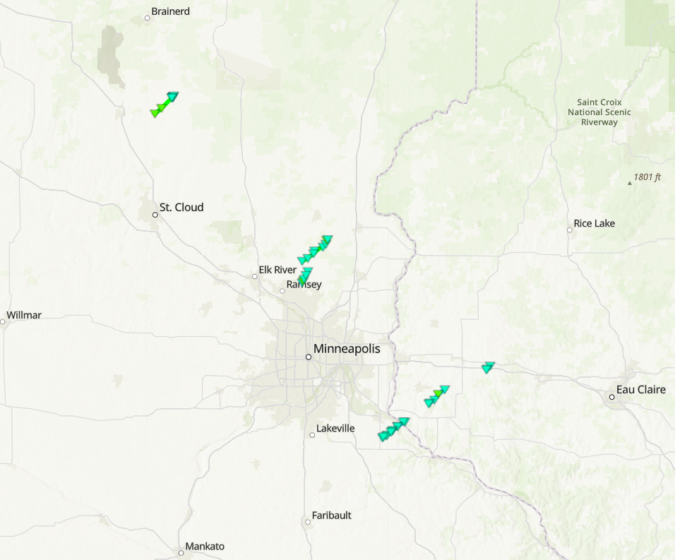
Overview of tornado tracks from August 29, 2024
|
Tornado - Andover
Track Map 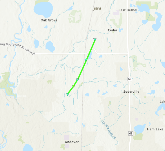 
Downloadable KMZ File |
||||||||||||||
|
Tornado - Bethel
Track Map 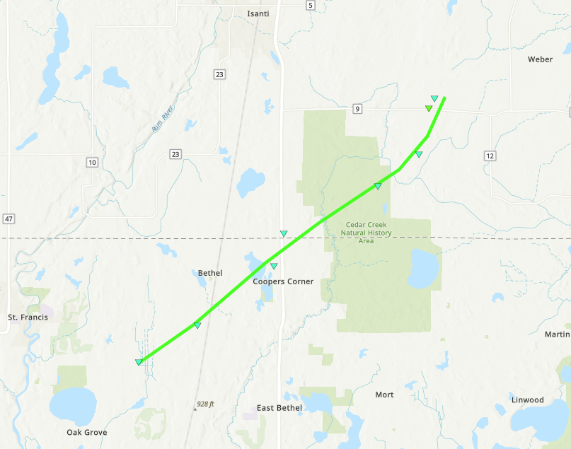
Downloadable KMZ File |
||||||||||||||
|
Tornado - North of Miesville
Track Map 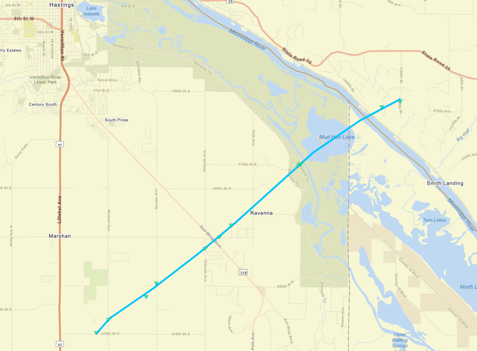
Downloadable KMZ File |
|||||||||||||||
|
Tornado - Near Beldenville
Track Map
Downloadable KMZ File |
||||||||||||||
|
Tornado - I-94 in near Wilson
Track Map
Downloadable KMZ File |
||||||||||||||
|
Tornado - Lastrup
Track Map
Downloadable KMZ File |
||||||||||||||
The Enhanced Fujita (EF) Scale classifies tornadoes into the following categories:
| EF0 Weak 65-85 mph |
EF1 Moderate 86-110 mph |
EF2 Significant 111-135 mph |
EF3 Severe 136-165 mph |
EF4 Extreme 166-200 mph |
EF5 Catastrophic 200+ mph |
 |
|||||
Wind:
There was extensive wind damage that occurred. There were a number of downbursts, with some of the most significant downburst damage in Champlin, Anoka, Cottage Grove, and many other areas. Some of the downburst winds ranged from 75 to 85 mph. This event affected a lot of the same areas as the storms of August 26/27, further exasperating power outages and response efforts.
 |
 |
 |
 |
| Large tree downed in Eden Prairie. Photo credit to Jay Wood. | Large tree snapped near its base, blocking a road in Willmar, MN. Photo credit to @gopherhockeysi on X. | Several large trees were downed and a pontoon boat and cover flipped near Weaver Lake in Maple Grove, MN. Photo credit to Andrew Siffert. | Large camper trailer tipped and blocking the road near 229th Avenue and Holly Street within St. Francis, MN. |
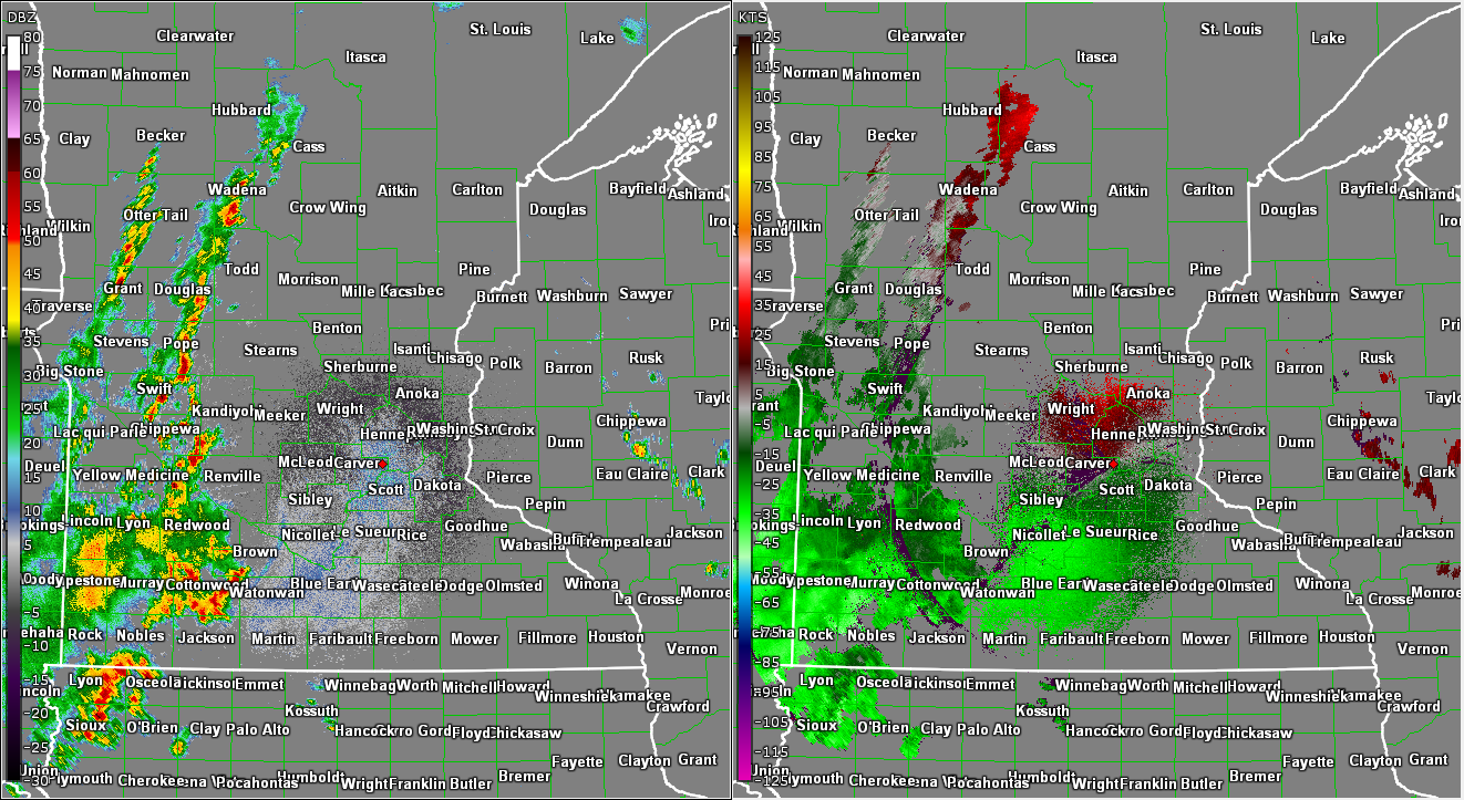
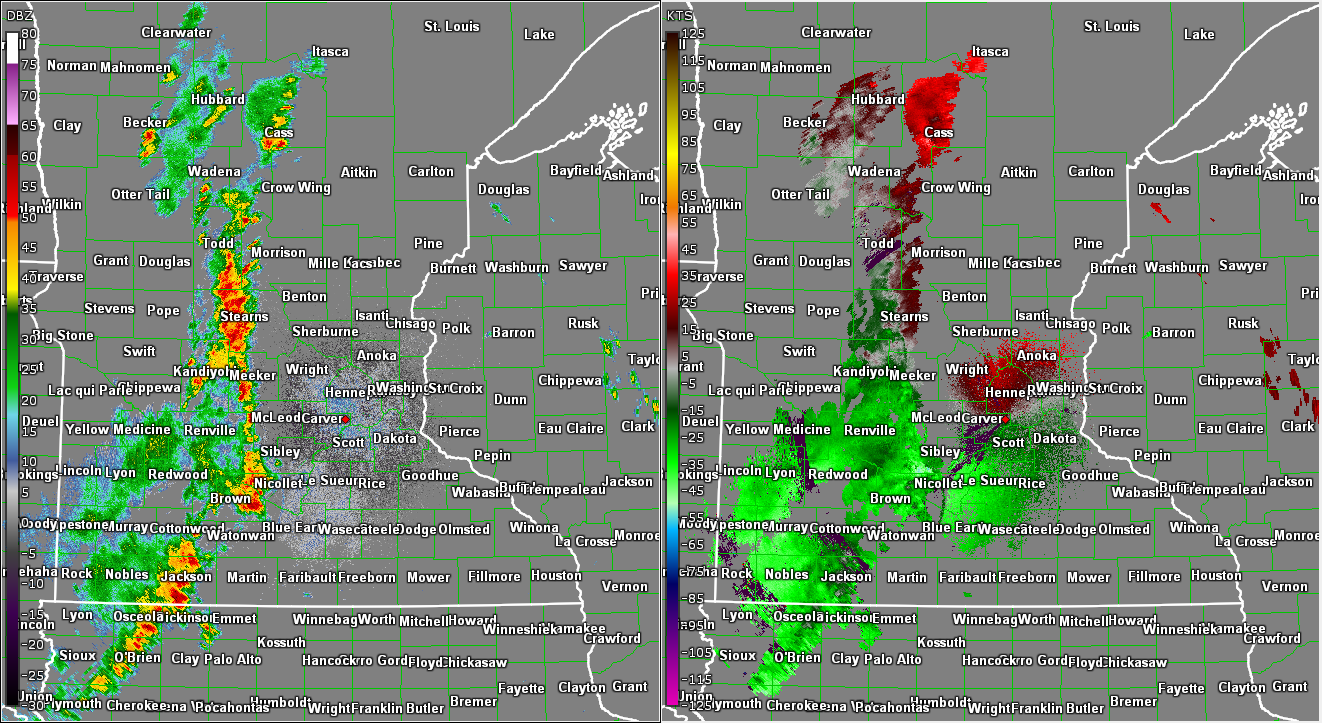
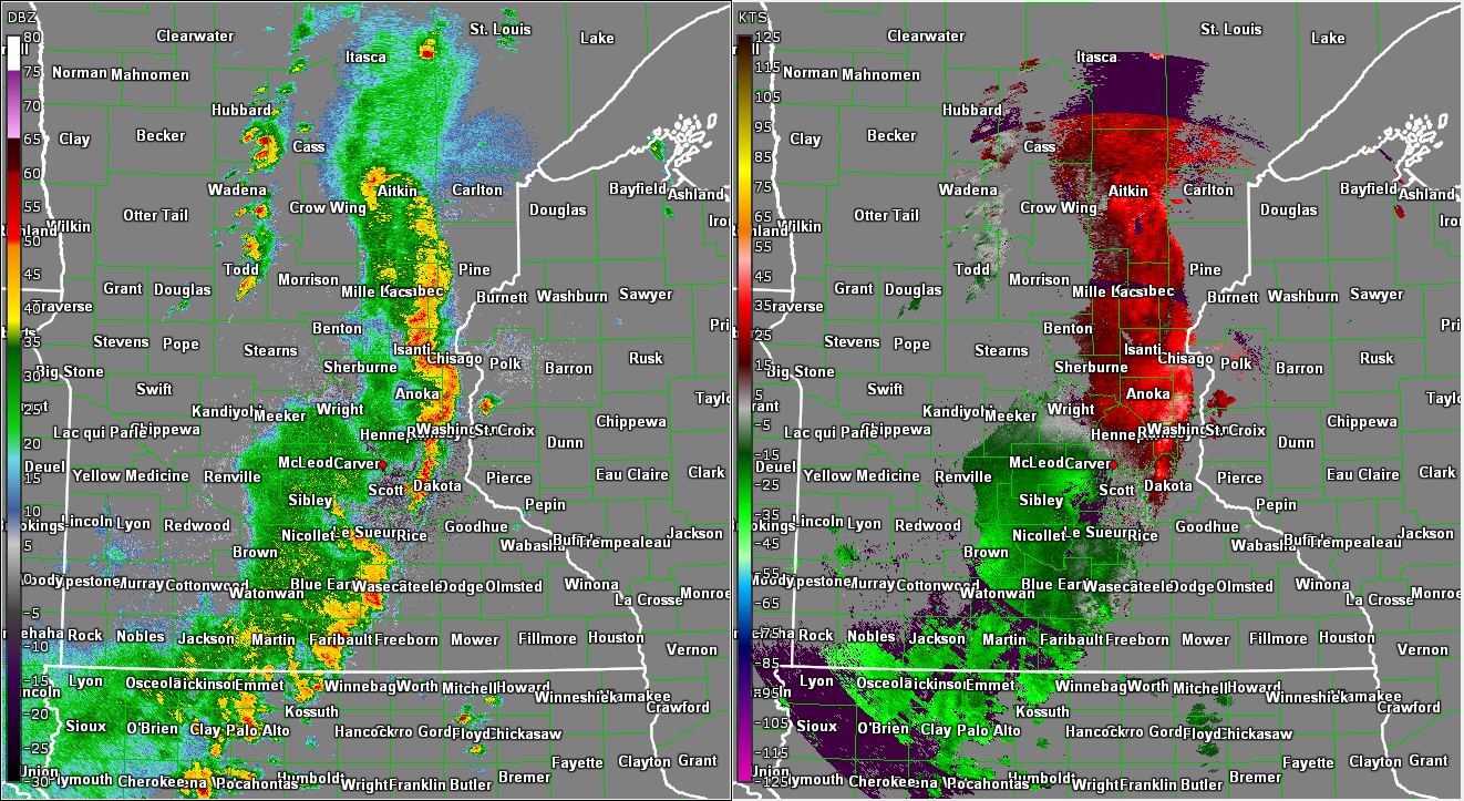
Radar
Hourly timesteps of Base Reflectivity and Base Velocity as the storms developed over western Minnesota and travelled east into western Wisconsin.
 |
 |
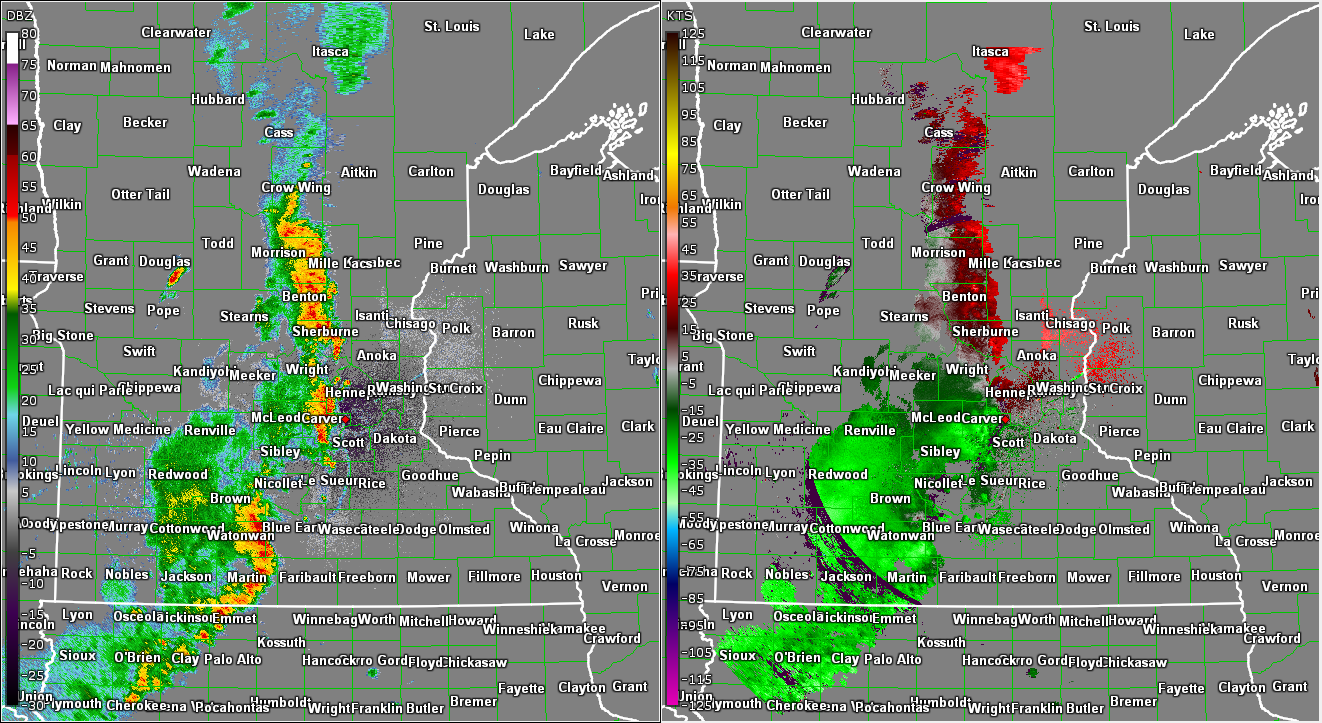 |
| Base Reflectivity (left) and Base Velocity (right) at 2PM CDT. Scattered storms began to develop during the afternoon over parts of western MN along the frontal boundary. | Base Reflectivity (left) and Base Velocity (right) at 3PM CDT. Storms began to congeal into a line, especially across central MN. | Base Reflectivity (left) and Base Velocity (right) at 4PM CDT. Winds intensified over Carver County as the line began to push into the Twin Cities Metro. |
 |
 |
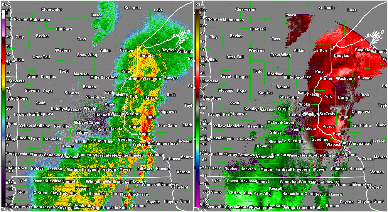 |
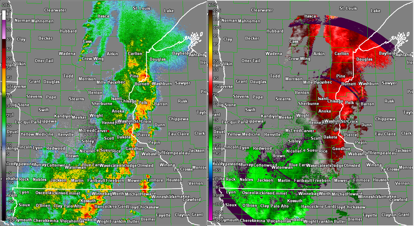
| Base Reflectivity (left) and Base Velocity (right) at 5PM CDT. The line intensified with strong winds stretching from Isanti County south towards northern Dakota County. | Base Reflectivity (left) and Base Velocity (right) at 6PM CDT. Overall strength of the winds weakened as the line moved into Wisconsin, however there was still a risk of embedded tornados along the line. | Base Reflectivity (left) and Base Velocity (right) at 7PM CDT. The line intensified again, resulting in widespread wind damage in Dunn, Pierce, and St. Croix Counties. |
 |
||
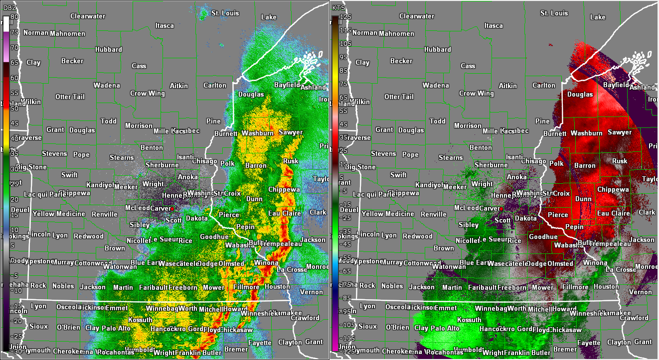
| Base Reflectivity (left) and Base Velocity (right) at 8PM CDT. The line began to weaken again as it moved further into Wisconsin. |
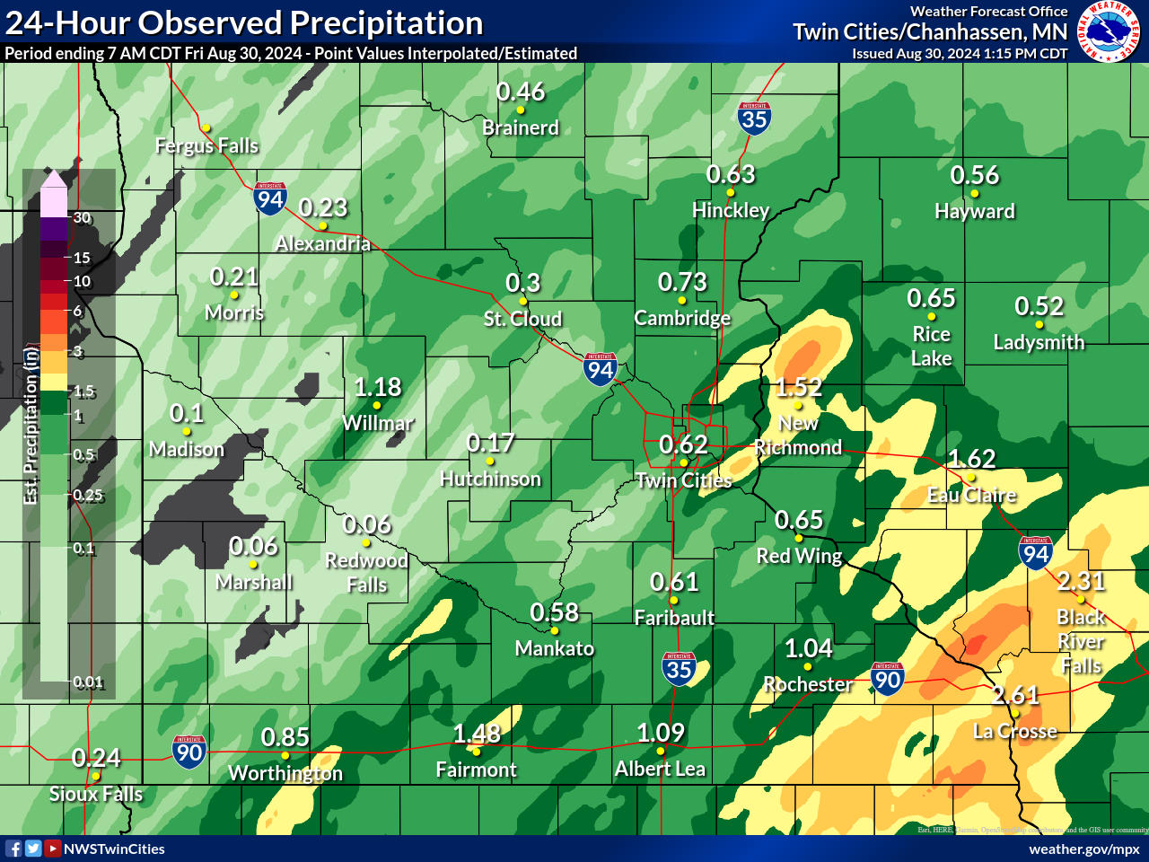
Rain Reports
The line of storms move quickly through western and central MN, limiting rainfall totals. Storm motion slow quite a bit as the line moved into Wisconsin, resulting in pockets of 2"+ of rain. Parts of southern Polk County received over 3" of rain, resulting in areas of flash flooding in some cities.
 |
Media use of NWS Web News Stories is encouraged! Please acknowledge the NWS as the source of any news information accessed from this site. |
|