Overview
A nearly stationary front was draped across southern Minnesota on the afternoon of Monday, August 5, 2024. A very unstable airmass with strong shear was present along and south of the front. Two supercells initially developed over Nicollet and Watonwan Counties, then strengthened while tracking southeast. Supercells eventually formed a line of severe thunderstorms, which continued to result in occasional tornadoes and damaging wind gusts across south central MN through 8:30 PM.
Damage survey crews have examined 4 tornado tracks, but more are possible in the coming days as more information becomes available.
***This page will continue to be updated as more information comes in***
Tornadoes
|
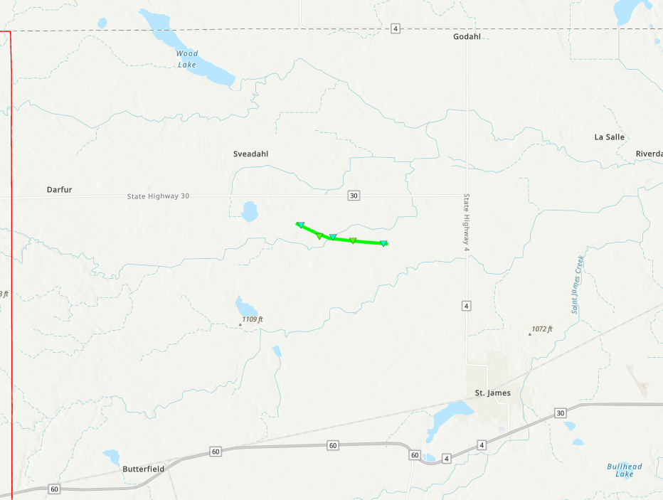
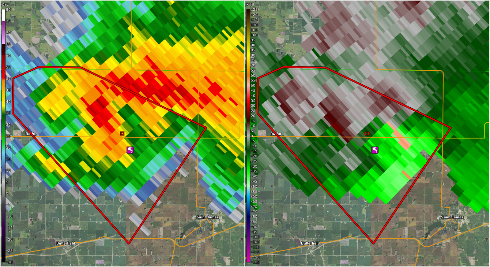
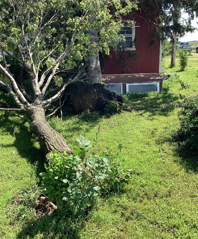
Tornado - St. James, MN
|
||||||||||||||
|
||||||||||||||
|
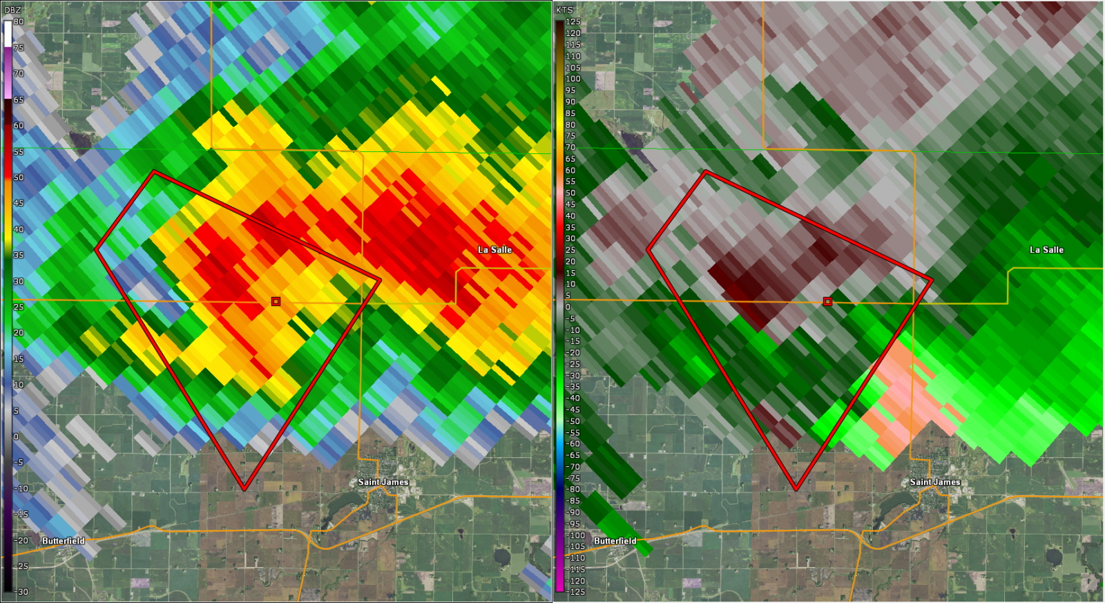
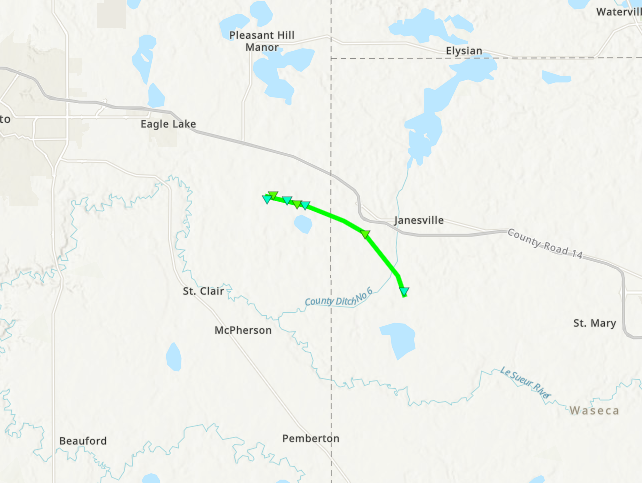
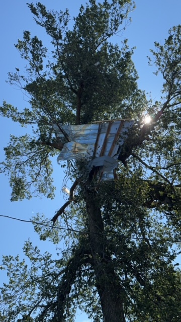
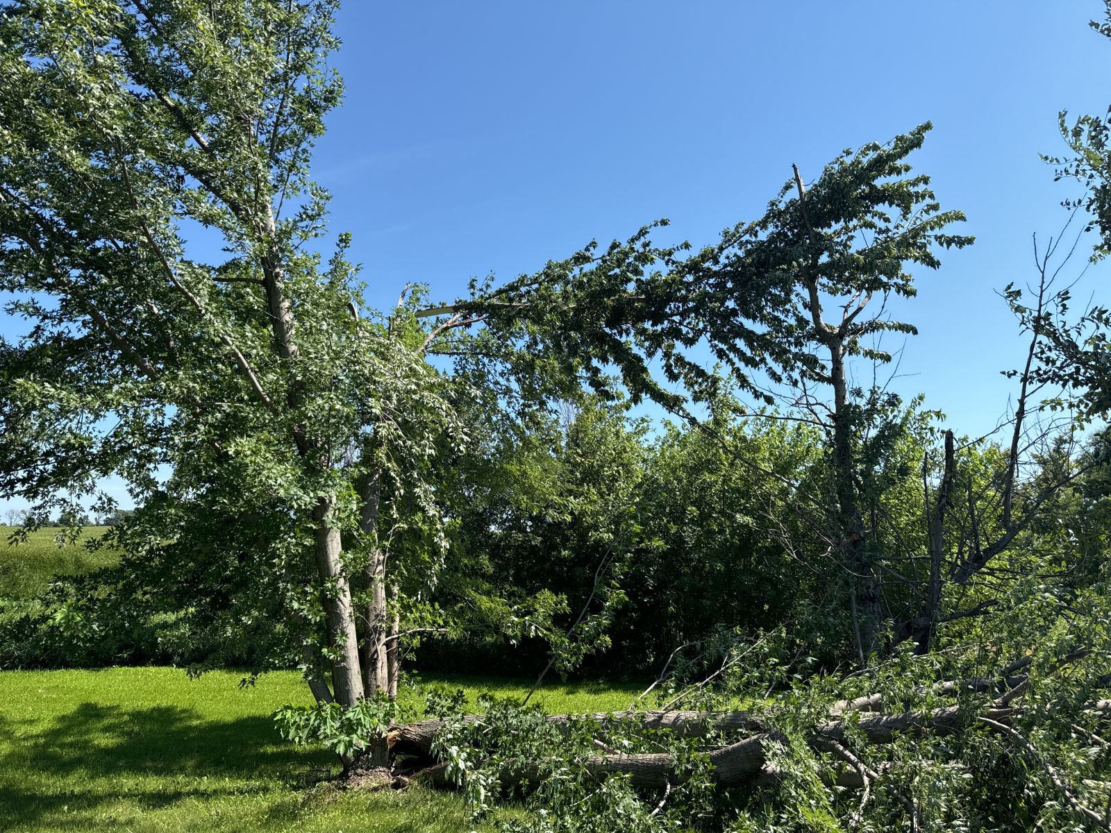
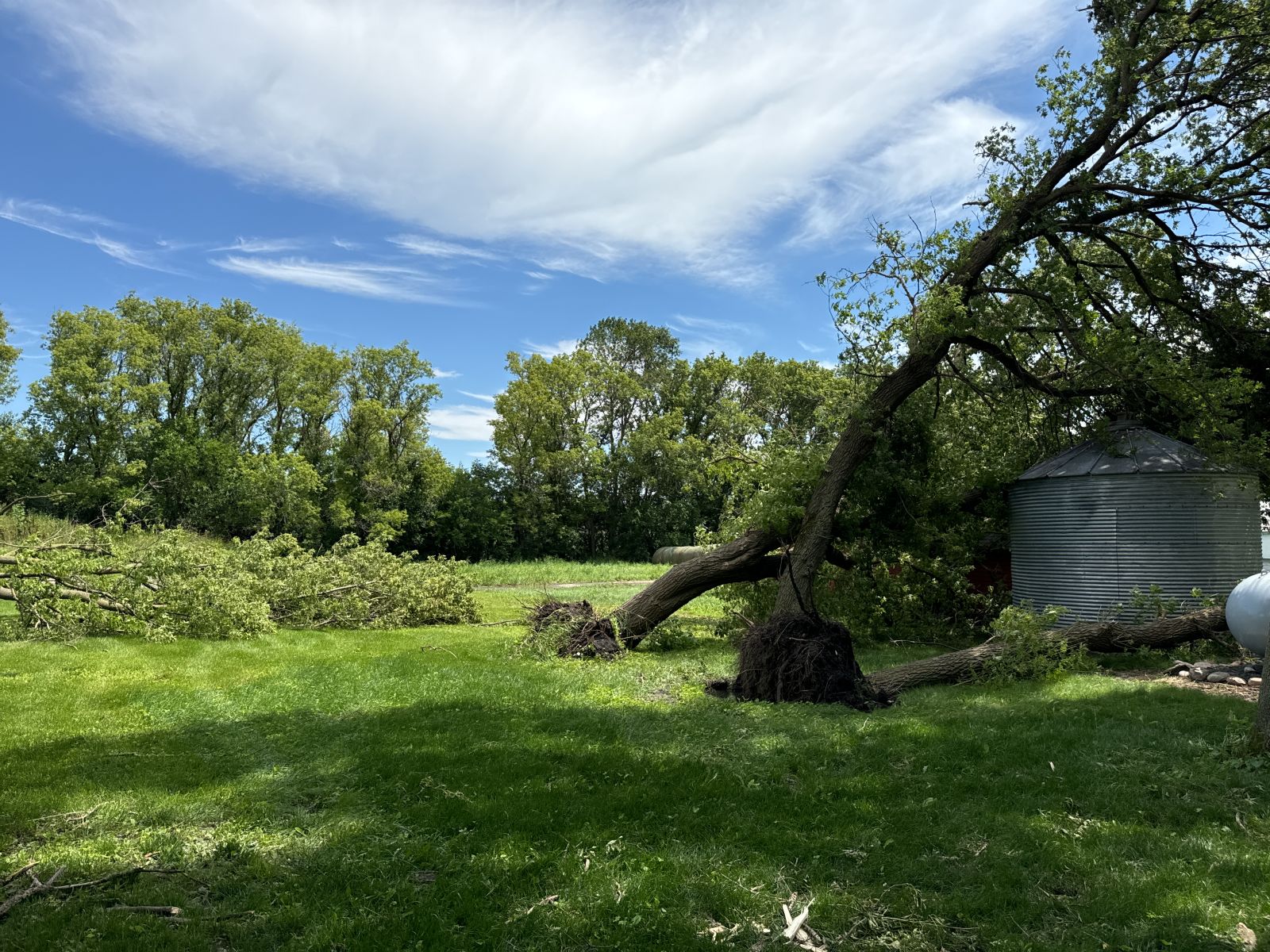
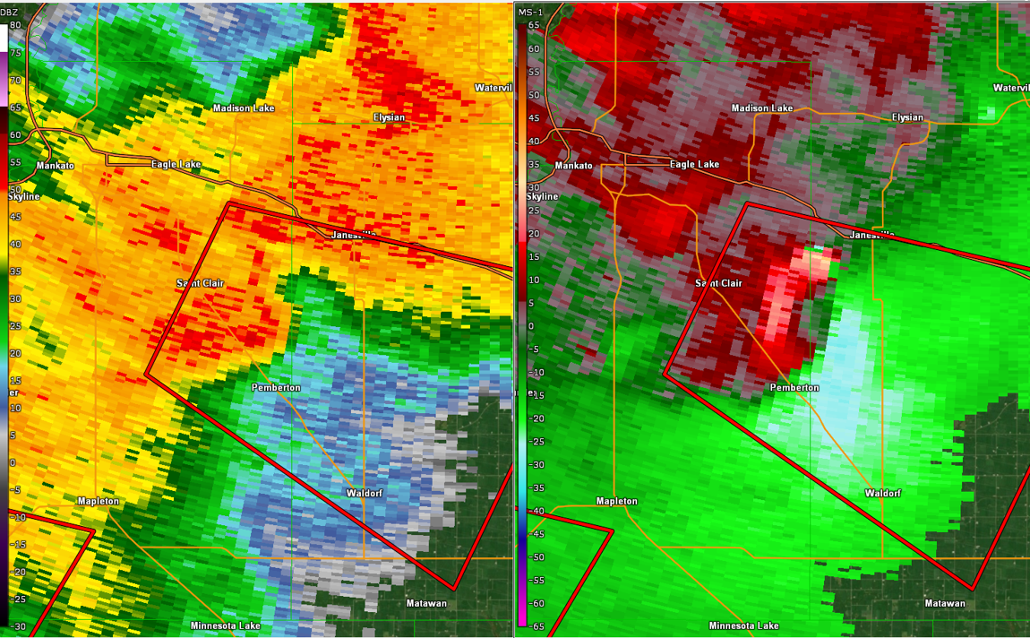
Tornado - Janesville, MN
|
||||||||||||||
|
||||||||||||||
|
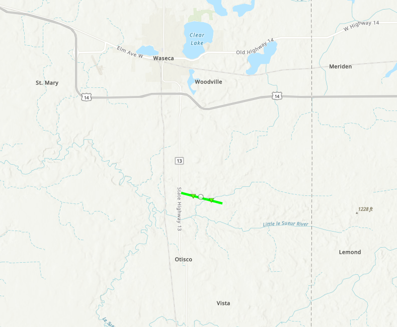
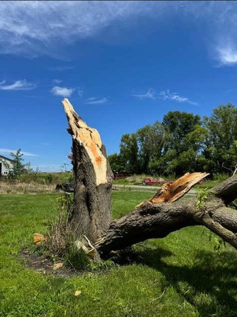
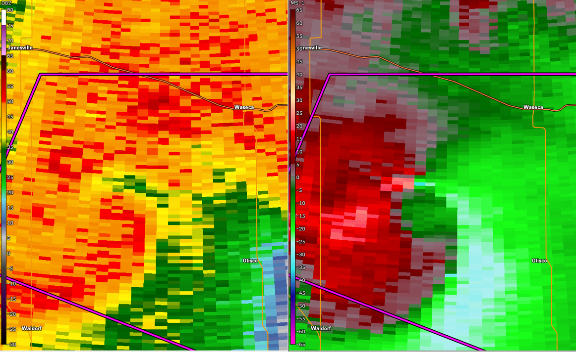
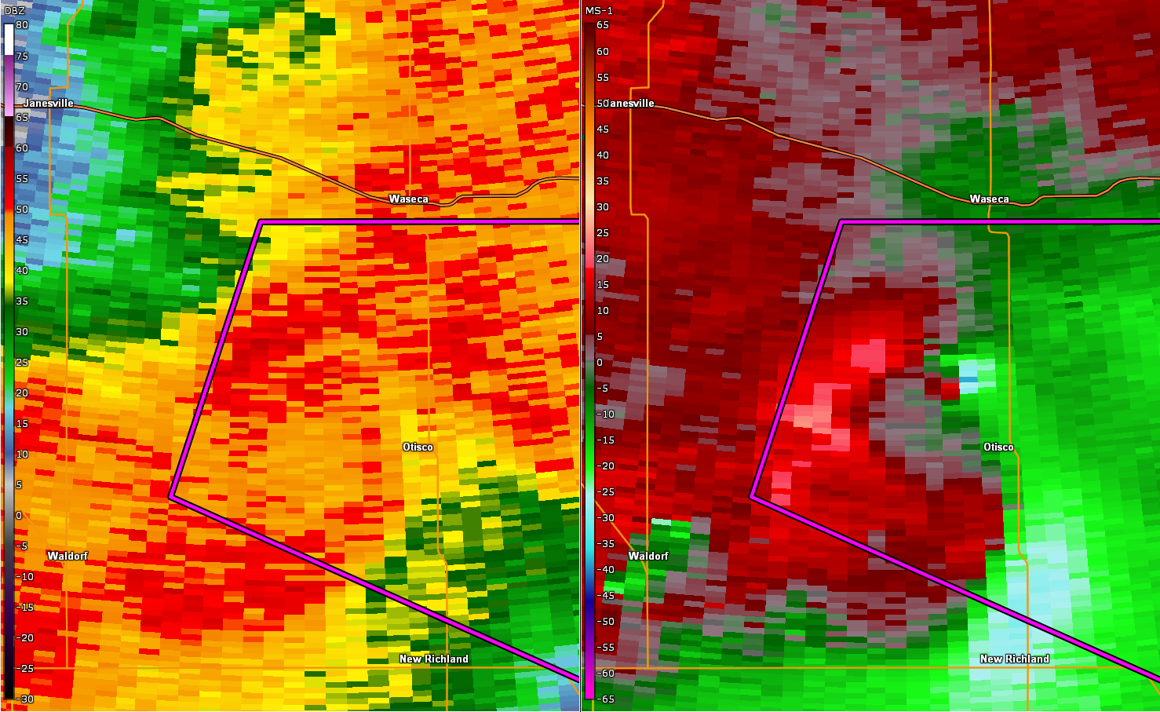
Tornado - Otisco/South of Waseca, MN
|
||||||||||||||
|
||||||||||||||
|
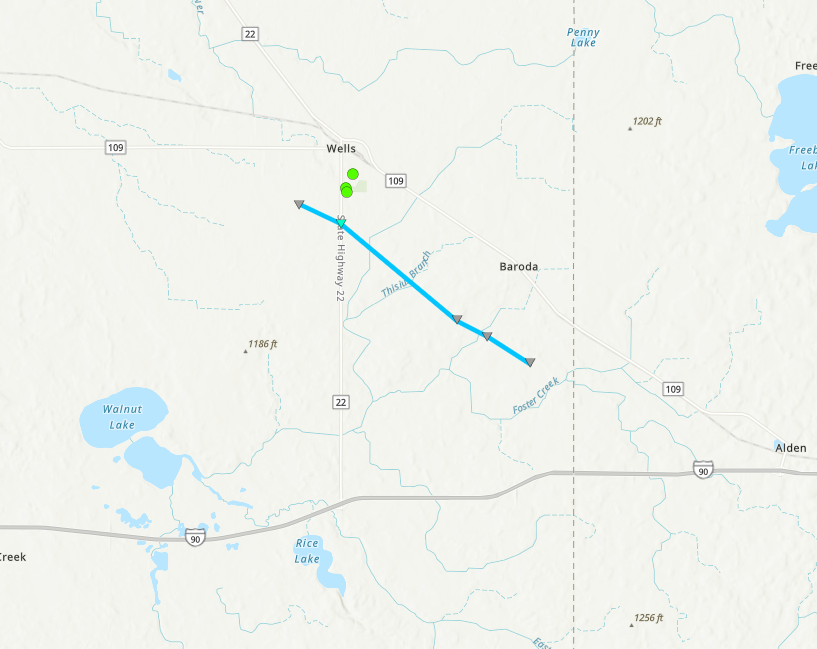
Tornado - Wells, MN
|
||||||||||||||
|
|
||||||||||||||
|
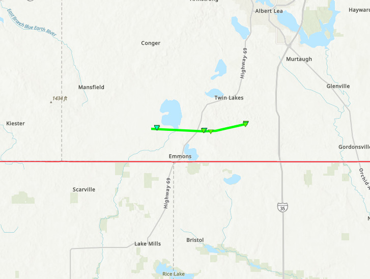
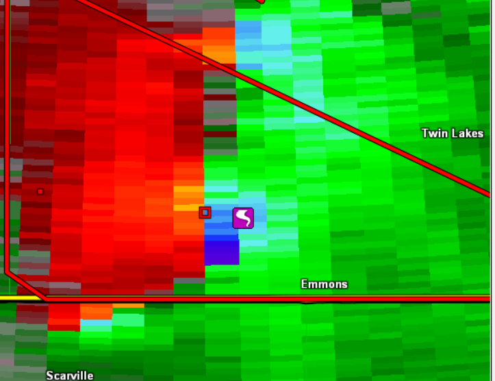
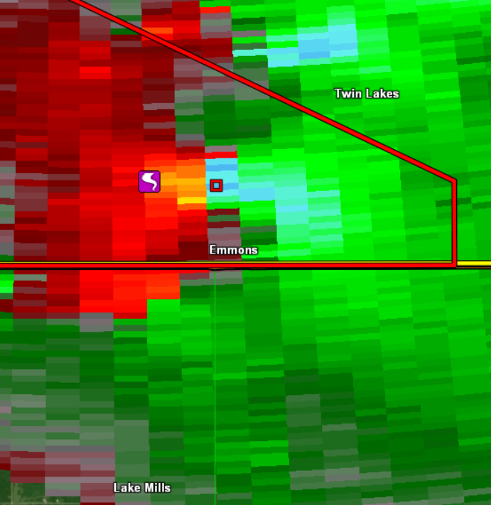
Tornado - Twin Lakes/Emmons, MN
|
||||||||||||||
|
||||||||||||||
The Enhanced Fujita (EF) Scale classifies tornadoes into the following categories:
| EF0 Weak 65-85 mph |
EF1 Moderate 86-110 mph |
EF2 Significant 111-135 mph |
EF3 Severe 136-165 mph |
EF4 Extreme 166-200 mph |
EF5 Catastrophic 200+ mph |
 |
|||||
Wind & Hail:
Add a written summary or simply an LSR map in this section. If writing an extensive report, you can break the report down into wind and hail below (otherwise delete).
Wind
Insert summary here.
| Caption | Caption | Caption | Caption |
Hail
Insert summary here.
| Caption | Caption | Caption | Caption |
Radar
Header
| Caption | Caption | Caption | Caption |
Storm Reports
Insert storm reports here. Copy in PNS or paste map.
 |
Media use of NWS Web News Stories is encouraged! Please acknowledge the NWS as the source of any news information accessed from this site. |
|


%20-%20Looking%20at%20692nd%20AV%20Between%20310th%20and%20320th%20St.jpg)

.jpg)