Overview
|
A warm and humid air mass out ahead of surface low pressure and an upper-level wave over the central South Dakota moved into Western Minnesota on July 31st, 2024. Surface temperatures reach the upper 80s/lower 90s over dew points in the low to mid 70s. This created an unstable environment, featuring instability exceeding 4000-5000 J/kg of MLCAPE and a stout elevated mixed layer with lapse rates between 8.0-9.0°C/km. ***This page will continue to be updated as more information comes in*** |
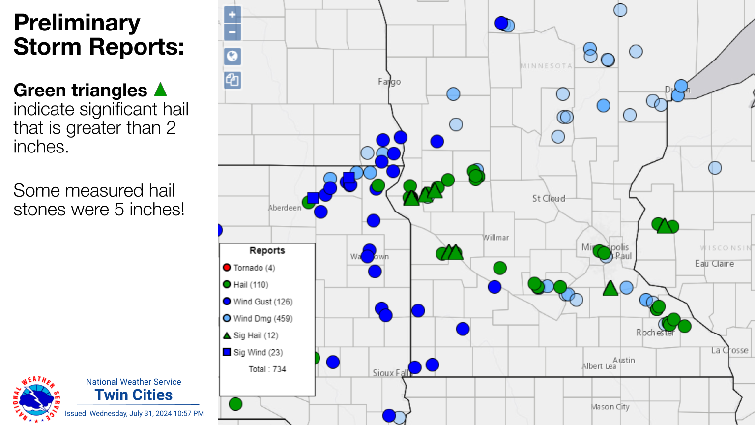 Preliminary storm reports as of 1100 PM on July 31, 2024. Additional reports will be gathered over the next few days. For the latest information, please visit the Storm Prediction Center Reports page. |
Wind & Rain:
Add a written summary or simply an LSR map in this section. If writing an extensive report, you can break the report down into wind and hail below (otherwise delete).
Wind and Rain
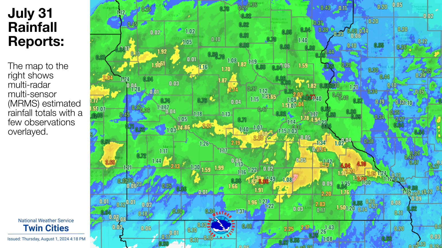
Multiple rounds of storms led to a few locations picking up 2 to 4 inches of rain, with a few locally higher amounts.
 |
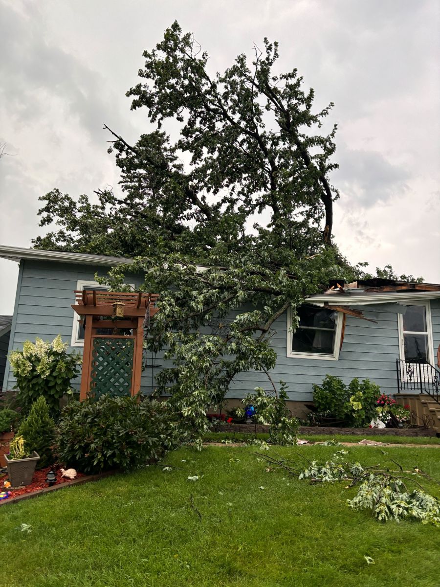 |
| Preliminary rainfall reports with an MRMS radar estimate. | A tree fell on a house in southern Goodue County. |
Hail
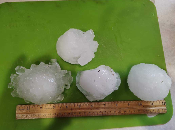
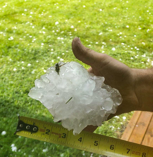
Each line of severe thunderstorms consisted of hail. A majority of the hail reports ranged between Penny (0.75") to half dollar sized (1.25") across Minnesota and parts of western Wisconsin. The largest hailstones mainly were found in western MN. Interestingly (and a rarity for MN) is giant hail be found just outside of the town of Chokio, MN in Stevens County. The largest hail stone measuring just shy of six inches in diameter! Please see the write up from the Minnesota State Climatology Office for additional information.
 |
 |
| Significant hail stones measuring 3-4 inches in diameter. Collected 3.5 NW of Chokio, MN (Stevens Co.) (Shared by Nick Elms) |
Giant hail stone measuring 5.7 inches in diameter. Collected 4 NW of Chokio, MN (Stevens Co.) (Shared by Nick Elms) |
Photos & Video
Header
| Caption (source) |
Caption (source) |
Caption (source) |
Caption (source) |
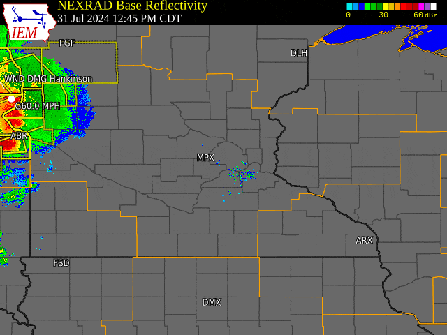
Radar
 |
|
KMPX Base Reflectivity Loop 7/31 2 PM to 8/1 5 AM |
Storm Reports
285
NOUS43 KMPX 011929
PNSMPX
MNZ041>045-047>070-073>078-082>085-091>093-WIZ014>016-023>028-020729-

Public Information Statement...Corrected
National Weather Service Twin Cities/Chanhassen MN
229 PM CDT Thu Aug 1 2024

...LARGE TO SIGNIFICANT SIZED HAIL REPORTS FROM JULY 31ST, 2024 STORMS...

Location                     Size      Time/Date
4 NW Chokio                  5.70 in   0511 PM 07/31
3 NW Chokio                  5.00 in   0448 PM 07/31
3 SSW Donnelly               2.75 in   0505 PM 07/31
4 SSW Watson                 2.50 in   0715 PM 07/31
Montevideo                   2.50 in   0728 PM 07/31
6 NNW Northfield             2.00 in   0545 PM 07/31
7 NE Farwell                 2.00 in   0605 PM 07/31
3 N Chokio                   1.75 in   0454 PM 07/31
2 N Forada                   1.50 in   0624 PM 07/31
1 WNW St. Louis Park         1.25 in   0453 PM 07/31
7 WSW Kensington             1.25 in   0538 PM 07/31
6 NNW Boyd                   1.25 in   0708 PM 07/31
5 NW Winthrop                1.25 in   0927 PM 07/31

Observations are collected from a variety of sources with varying
equipment and exposures. We thank all volunteer weather observers
for their dedication. Not all data listed are considered official.

$$
443
NOUS43 KMPX 011933
PNSMPX
MNZ041>045-047>070-073>078-082>085-091>093-WIZ014>016-023>028-020733-

Public Information Statement
National Weather Service Twin Cities/Chanhassen MN
233 PM CDT Thu Aug 1 2024

...HIGHEST WIND REPORTS FROM JULY 31ST STORMS...

Location                     Speed     Time/Date
2 ENE Redwood Falls          60 MPH    0833 PM 07/31
U.s.71 - Clarissa - Mp 197.5 53 MPH    0240 PM 07/31
Gibbon                       53 MPH    0915 PM 07/31
Crystal AP                   52 MPH    0553 PM 07/31
Olivia AP                    51 MPH    0836 PM 07/31
2 NNW Little Falls           50 MPH    0310 PM 07/31
Morris AP                    48 MPH    0615 PM 07/31

Observations are collected from a variety of sources with varying
equipment and exposures. We thank all volunteer weather observers
for their dedication. Not all data listed are considered official.

$$
Additional storm reports can be found on the NWS Storm Prediction Center's website.
 |
Media use of NWS Web News Stories is encouraged! Please acknowledge the NWS as the source of any news information accessed from this site. |
|

