Radar
 |
| Radar loop of storms as they moved across central and southern Wisconsin Tuesday morning into the early afternoon hours. |
Storm Reports
000
NWUS53 KMKX 072035
LSRMKX
PRELIMINARY LOCAL STORM REPORT...SUMMARY
NATIONAL WEATHER SERVICE MILWAUKEE/SULLIVAN WI
335 PM CDT TUE SEP 7 2021
..TIME... ...EVENT... ...CITY LOCATION... ...LAT.LON...
..DATE... ....MAG.... ..COUNTY LOCATION..ST.. ...SOURCE....
..REMARKS..
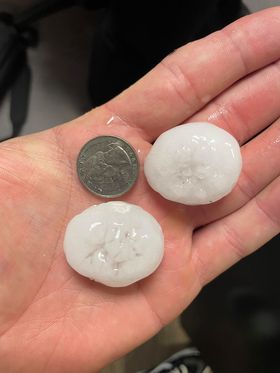
1045 AM HAIL 1 N KEWASKUM 43.53N 88.23W
09/07/2021 E1.00 INCH WASHINGTON WI PUBLIC
1122 AM HAIL ALLENTON 43.42N 88.33W
09/07/2021 M1.00 INCH WASHINGTON WI LAW ENFORCEMENT
SHERIFFS OFFICE REPORTED QUARTER SIZE HAIL
IN ALLENTON.
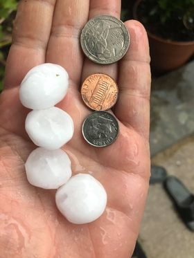
1232 PM HAIL DELAVAN 42.63N 88.63W
09/07/2021 E1.25 INCH WALWORTH WI TRAINED SPOTTER
CORRECTS PREVIOUS HAIL REPORT FROM DELAVAN.
1.0 TO 1.25 INCH HAIL REPORTED BY TRAINED
SPOTTER.
1233 PM HAIL 1 N DELAVAN 42.64N 88.63W
09/07/2021 M1.50 INCH WALWORTH WI PUBLIC
MULTIPLE REPORTS OF 1.0 TO 1.5 INCH HAIL
REPORTED AROUND DELAVAN WI.
1242 PM HAIL ELKHORN 42.67N 88.54W
09/07/2021 E1.00 INCH WALWORTH WI PUBLIC
1244 PM HAIL WILLIAMS BAY 42.58N 88.54W
09/07/2021 M1.50 INCH WALWORTH WI PUBLIC
PENNY SIZE TO PING PONG BALL SIZE. TIME
ESTIMATED FROM RADAR.
1244 PM HAIL 1 NNE COMO 42.62N 88.49W
09/07/2021 E1.00 INCH WALWORTH WI PUBLIC
1246 PM HAIL 1 S COMO 42.59N 88.49W
09/07/2021 E1.00 INCH WALWORTH WI PUBLIC
1248 PM HAIL 1 NNW WALWORTH 42.54N 88.60W
09/07/2021 E1.00 INCH WALWORTH WI PUBLIC
1112 AM HAIL 2 N KOHLER 43.76N 87.78W
09/07/2021 E1.00 INCH SHEBOYGAN WI PUBLIC
1135 AM HAIL EDGERTON 42.84N 89.06W
09/07/2021 M1.00 INCH ROCK WI PUBLIC
1152 AM HAIL MILTON 42.77N 88.96W
09/07/2021 U1.00 INCH ROCK WI PUBLIC
REPORT FROM MPING: QUARTER (1.00 IN.).
1235 PM HAIL 4 WSW CLINTON 42.54N 88.93W
09/07/2021 M1.00 INCH ROCK WI PUBLIC
0847 AM HAIL WESTFIELD 43.89N 89.49W
09/07/2021 E1.00 INCH MARQUETTE WI PUBLIC
TIME ESTIMATED FROM RADAR.
1124 AM HAIL 2 WSW WATERTOWN 43.18N 88.75W
09/07/2021 E1.00 INCH JEFFERSON WI PUBLIC
0918 AM HAIL BERLIN 43.97N 88.95W
09/07/2021 M1.00 INCH GREEN LAKE WI LAW ENFORCEMENT
1024 AM HAIL MARKESAN 43.71N 88.99W
09/07/2021 E1.00 INCH GREEN LAKE WI PUBLIC
PENNY TO QUARTER SIZE HAIL.
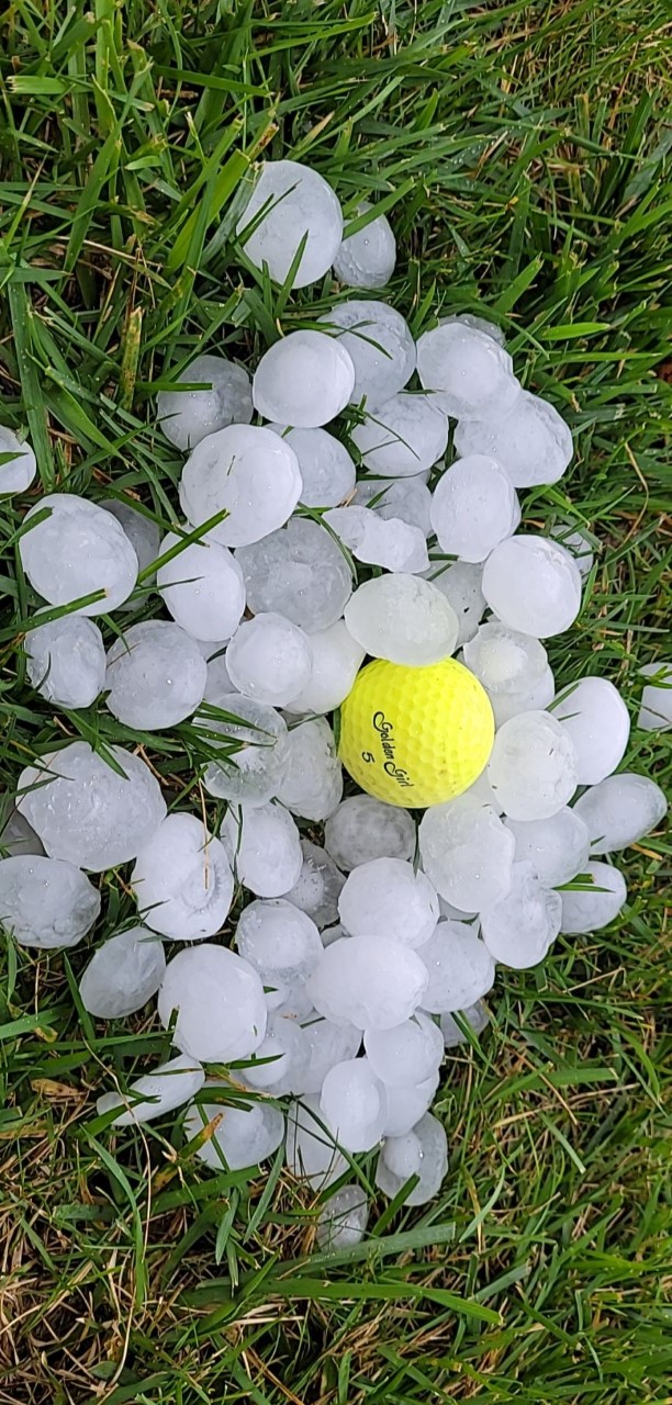
0943 AM HAIL RIPON 43.85N 88.84W
09/07/2021 E2.00 INCH FOND DU LAC WI PUBLIC
REPORTS OF 3/4 INCH UP TO 2 INCH HAIL.
1010 AM HAIL 2 NNE NORTH FOND DU LAC 43.84N 88.47W
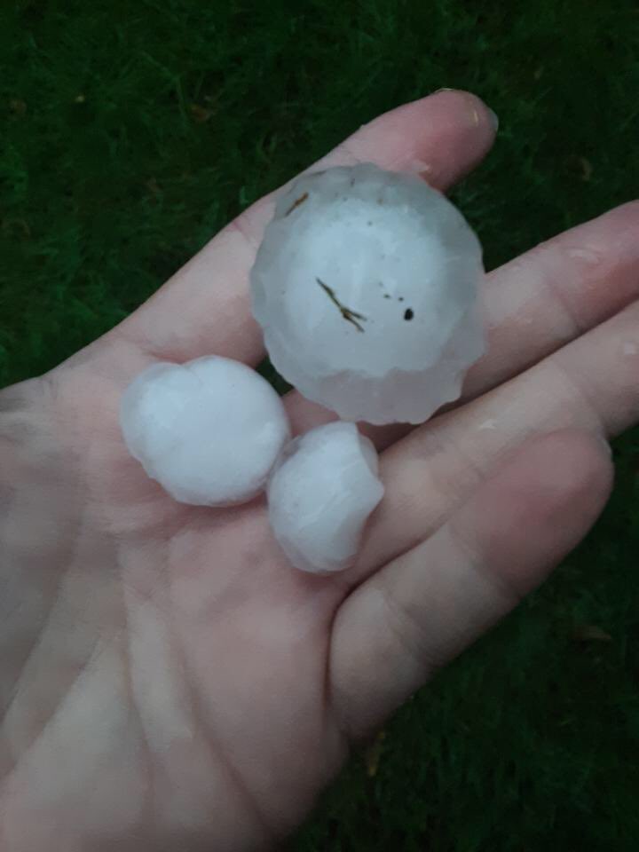
09/07/2021 M3.00 INCH FOND DU LAC WI PUBLIC
IMAGE SHARED WITH US ON SOCIAL MEDIA.
1024 AM HAIL 2 SSE ALTO 43.65N 88.77W
09/07/2021 M0.88 INCH FOND DU LAC WI PUBLIC
1037 AM HAIL FOND DU LAC 43.78N 88.45W
09/07/2021 M0.88 INCH FOND DU LAC WI PUBLIC
1039 AM HAIL 3 S FOND DU LAC 43.74N 88.45W
09/07/2021 E1.50 INCH FOND DU LAC WI TRAINED SPOTTER
SPOTTER REPORTED PING PONG BALL SIZE HAIL
NEAR THE INTERSECTION OF.
1042 AM HAIL 2 SSE FOND DU LAC 43.75N 88.43W
09/07/2021 M1.00 INCH FOND DU LAC WI PUBLIC
1045 AM HAIL FOND DU LAC 43.78N 88.45W
09/07/2021 E1.75 INCH FOND DU LAC WI PUBLIC
1056 AM HEAVY RAIN 2 ESE FOND DU LAC 43.77N 88.41W
09/07/2021 M0.80 INCH FOND DU LAC WI PUBLIC
0.8 INCHES OF RAIN REPORTED OVER HALF HOUR
DURATION IN EASTERN FOND DU LAC.
1107 AM HAIL JUNEAU 43.41N 88.70W
09/07/2021 M1.00 INCH DODGE WI LAW ENFORCEMENT
NICKEL TO QUARTER SIZE HAIL.
1030 AM HAIL MAZOMANIE 43.17N 89.80W
09/07/2021 M1.00 INCH DANE WI PUBLIC
REPORT OF QUARTER SIZE HAIL FROM MAZOMANIE.
TIME ESTIMATED FROM RADAR.
1051 AM HAIL 4 NNE CROSS PLAINS 43.17N 89.62W
09/07/2021 E1.00 INCH DANE WI PUBLIC
1055 AM HAIL 1 ESE MIDDLETON 43.10N 89.49W
09/07/2021 E1.00 INCH DANE WI PUBLIC
1055 AM HAIL 1 NNW WAUNAKEE 43.21N 89.46W
09/07/2021 M0.88 INCH DANE WI PUBLIC
1057 AM HAIL 1 NNE VERONA 43.00N 89.53W
09/07/2021 M1.00 INCH DANE WI PUBLIC
1058 AM HAIL 2 W VERONA 42.99N 89.57W
09/07/2021 E1.50 INCH DANE WI PUBLIC
1108 AM HAIL MCFARLAND 43.02N 89.29W
09/07/2021 M1.00 INCH DANE WI BROADCAST MEDIA
TIME ESTIMATED FROM RADAR.
1110 AM HAIL FITCHBURG 42.99N 89.43W
09/07/2021 M1.00 INCH DANE WI PUBLIC
1122 AM HAIL STOUGHTON 42.92N 89.23W
09/07/2021 M1.00 INCH DANE WI TRAINED SPOTTER
SPOTTER REPORTED QUARTER SIZE HAIL IN
STOUGHTON.
1038 AM HAIL DOYLESTOWN 43.43N 89.15W
09/07/2021 M1.50 INCH COLUMBIA WI PUBLIC
TIME ESTIMATED FROM RADAR.
&&
$$
Rain Reports
Map of rainfall reports from Co-op, CoCoRaHS, and airport observations.
 |
| Event total rainfall |