Aviation Page
|
Aviation Weather Center: |
|
|
|
|
TDA for: | |
|
|
||
| Hourly Forecasts: | ||
|
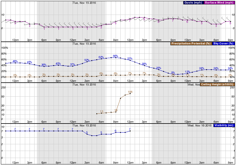
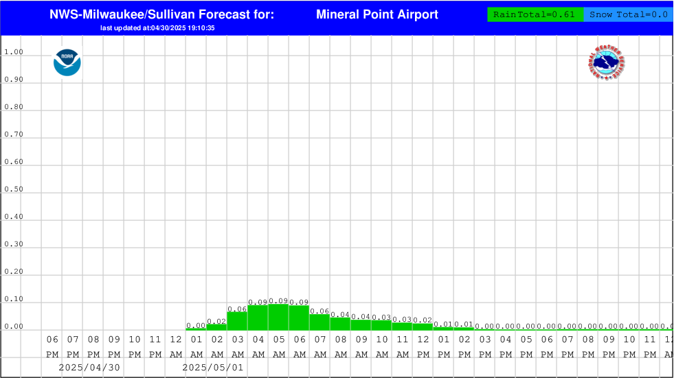
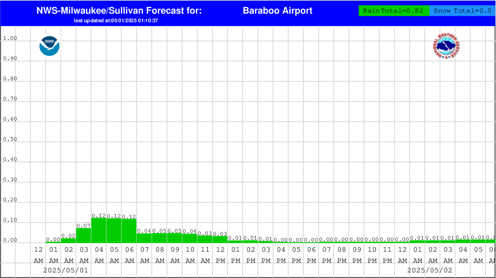
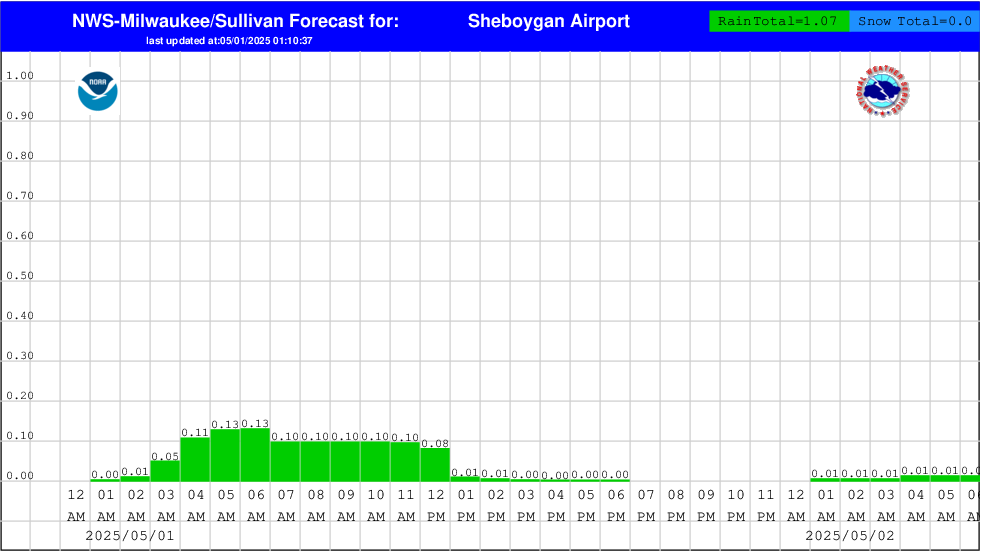
Hourly Weather Graph |
|
|
|
|
||
|
|
|
|
| TAFS: Using the pull down menu to the right, you can retrieve TAFS for Wisconsin, Michigan, Illinois, Minnesota and Iowa. Go here for help in Decoding the TAF |
| Aviation Forecast Discussions (scroll down to AVIATION section) |
||||||
| MKX | GRB | ARX | LOT | DVN | MSP | DLH |
| MQT | APX | GRR | DTX | IWX | ILX | DMX |
| Anywhere in the U.S. | ||||||
Other Useful Links:
Aviation Weather Presentations (geared toward general aviation) :
Summer Weather Impacts on Aviation and Safety (.pdf format)
Winter Weather Impacts on Aviation (.pdf)
NWS Mobile & Web Services (.pdf) (August 2014)
Radar & Satellite Interpretation (.pdf) (August 2014)
Useful Aviation/Weather Website Links (.pdf) (updated July 2014)
Weather forecasting for aviation is an extremely important, yet challenging task. Meteorologists at the local NWS Weather Forecast Office, located roughly halfway between Milwaukee and Madison, routinely issue terminal aerodrome forecasts (TAFs) for six airports in south central and southeast Wisconsin. TAFs are simply a 24- to 30- hour surface forecast for a five nautical mile radius around an airport, and include wind speed/direction, visibility, ceiling height and weather in a concise format.
The six airports are:
General Mitchell International Airport in Milwaukee (MKE)
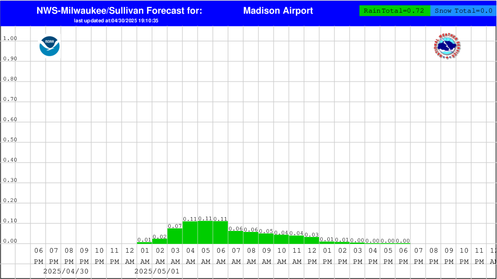
Dane County Regional Airport (Truax Field) in Madison (MSN)
Waukesha County Airport (Crites Field) in Waukesha (UES)
Kenosha Regional Airport in Kenosha (ENW)
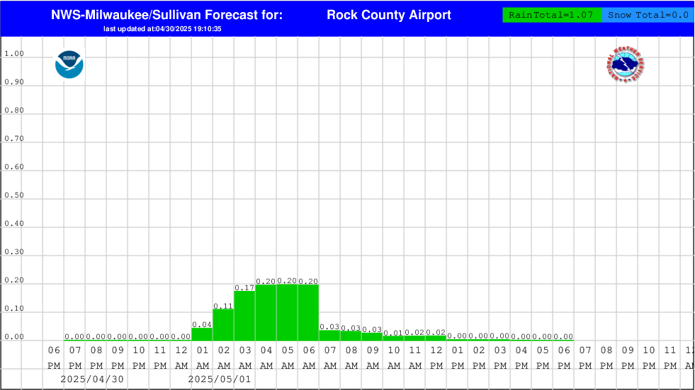
Southern Wisconsin Regional Airport near Janesville (JVL)
Sheboygan County Memorial Airport near Sheboygan (SBM)
In addition, the aviation forecasters continuously monitor the current weather conditions and issue amendments to the TAFs as new forecast information becomes available.
This page is maintained by the Aviation Focal Point at NWS-Milwaukee/Sullivan. If you have any questions regarding the aviation weather products and services from our office, please contact nws (dot) milwaukee @ noaa (dot) gov, Attn: AFP.


