Overview
|
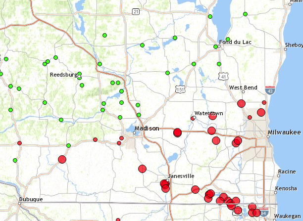
Multiple rounds of heavy rain moved through the southern half of Wisconsin during the first week in May, 2018. Wind driven hail occurred from Janesville to Genoa City on Wednesday evening, May 2nd. |
 Caption |
Wind & Hail:
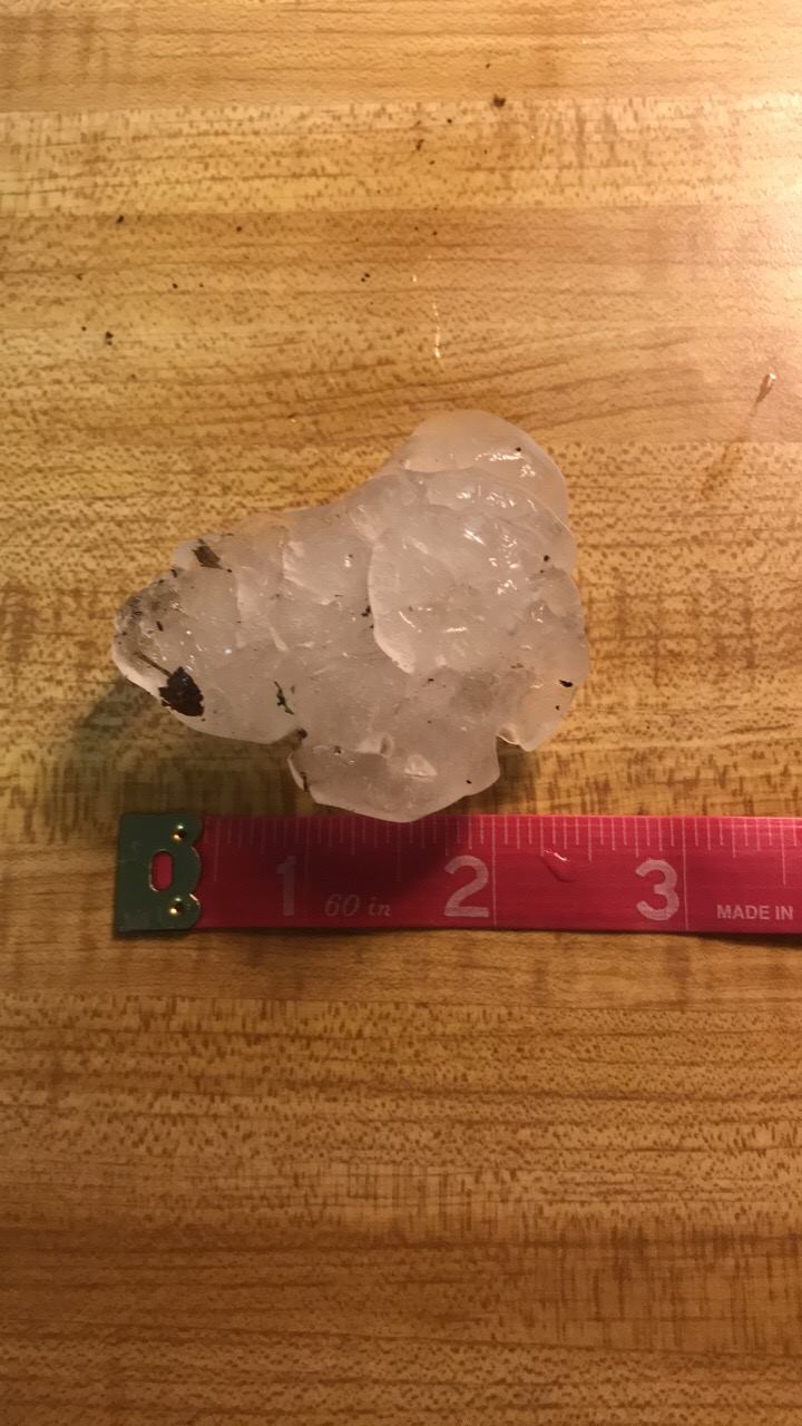
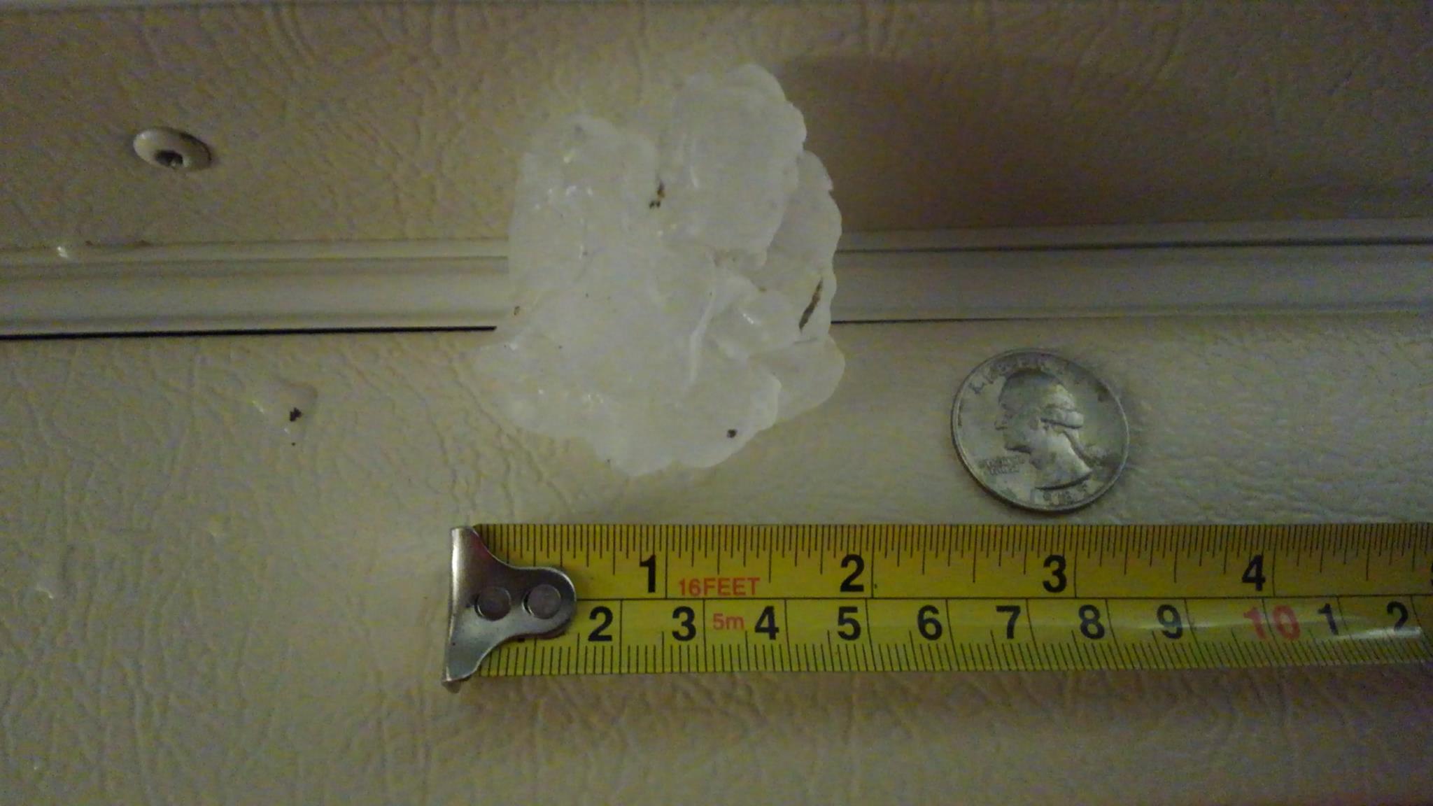
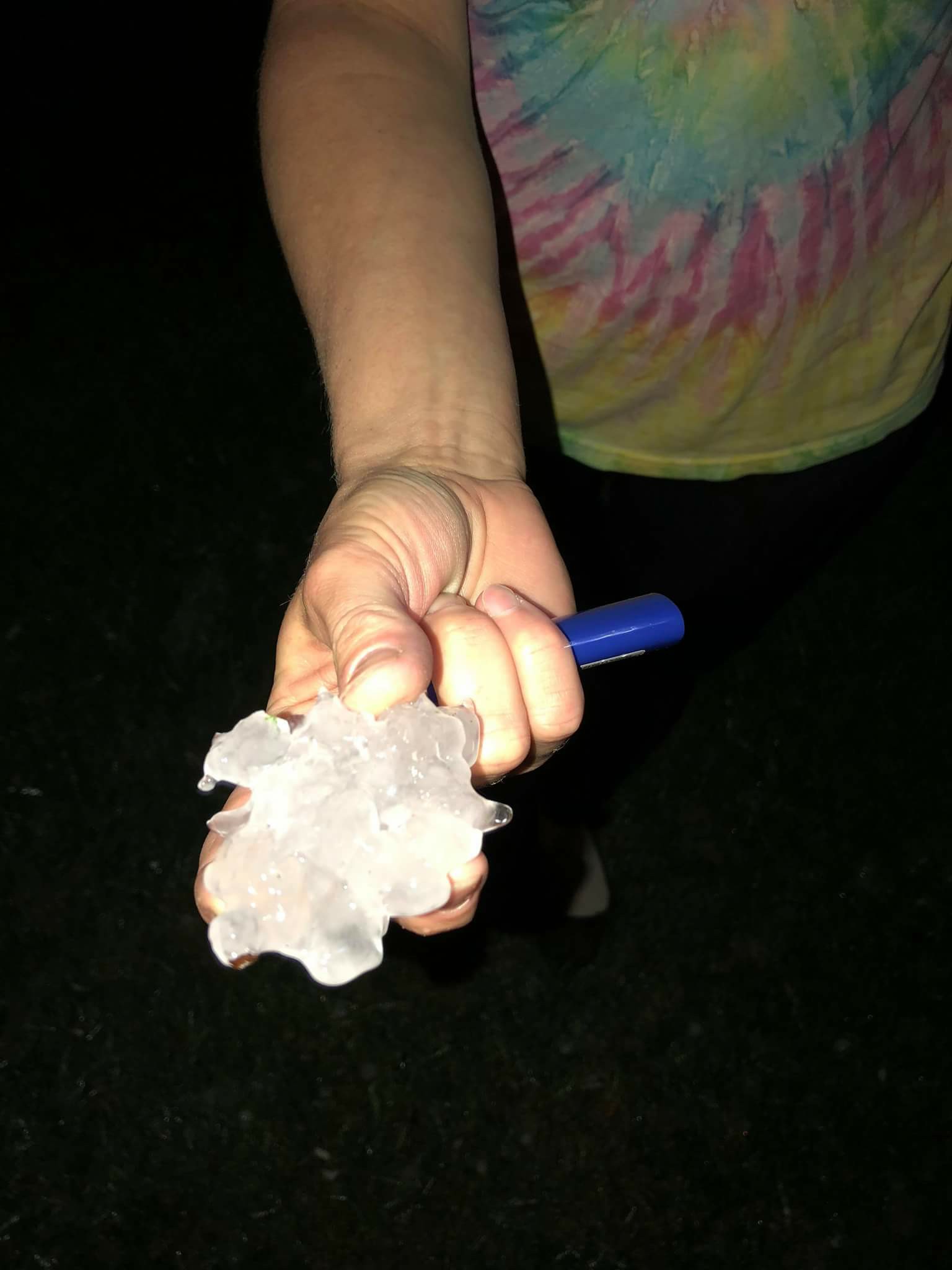
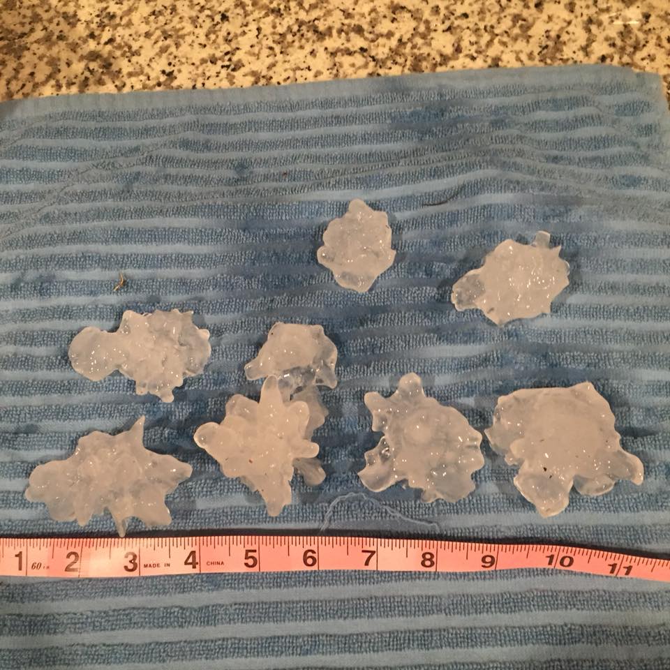
The main period for damaging winds and large hail was on Wednesday evening when a supercell thunderstorm tracked from Evansville, through Janesville and Williams Bay on through Genoa City. The largest reported hail was from Williams Bay where tennis ball sized hail fell. The worst damage was in Janesville where 60mph wind driven ping pong ball sized hail occurred.
Wind
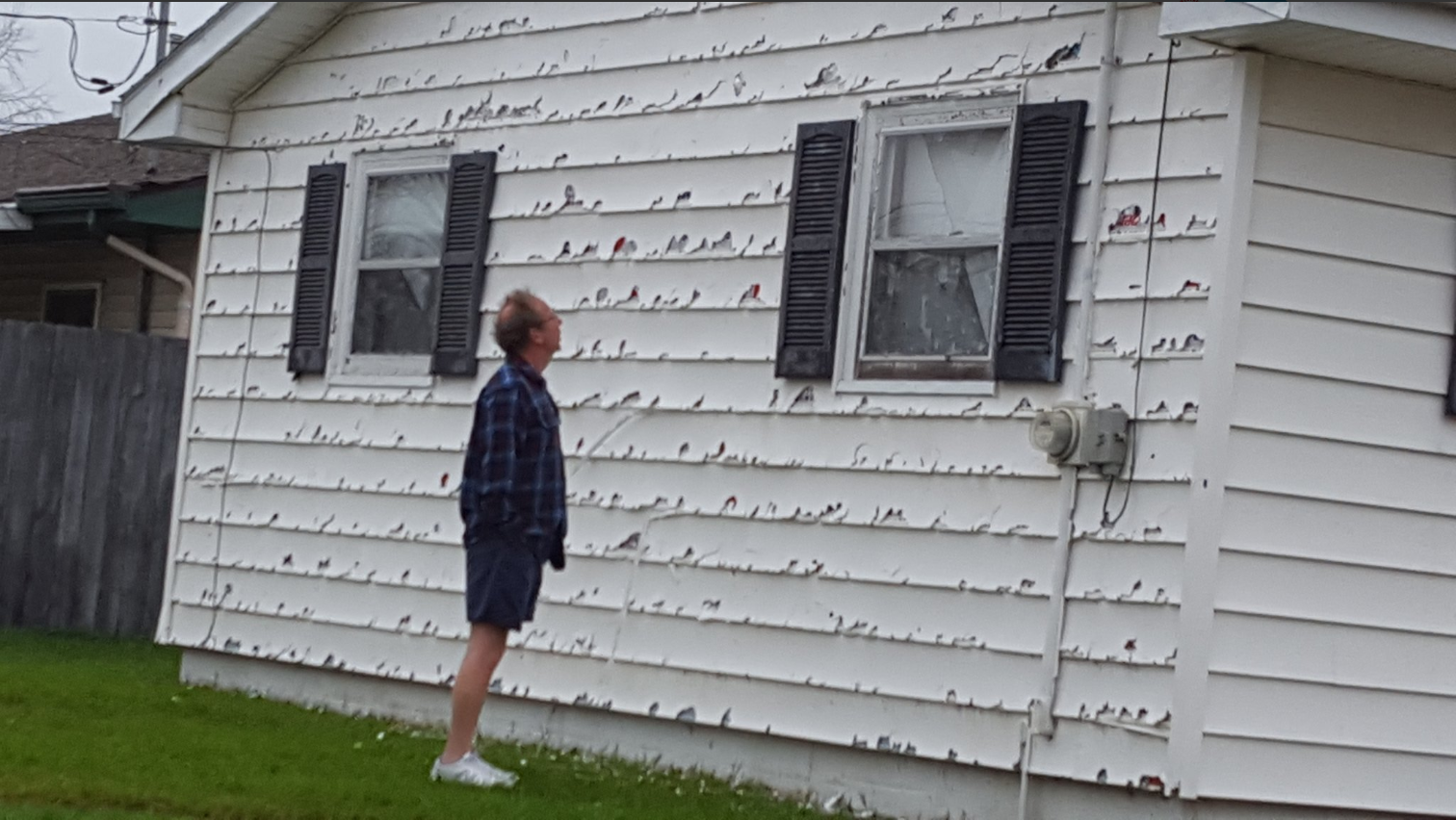
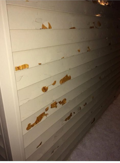
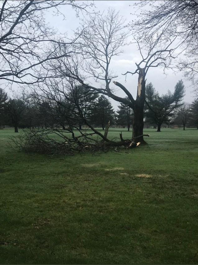
Wind driven hail did damage to siding and windows in Janesville. 58mph wind gusts were measured at the Janesville airport with ping pong ball sized hail falling. |
 |
 |
 |
| Janesville-Anna Mae Mlinar | Janesville-Shelby B | Janesville | Williams Bay-Maggie Trussler |
Hail
Wind driven hail hit Janesville with up to tennis ball sized hail occurring in Williams Bay.
 |
 |
 |
 |
|
Williams Bay-Maggie Trussler |
Genoa City-Dalton Malecki | Twin Lakes-Audra Pedersen | Twin Lakes-Lynette Rullman |
Rainfall:
3 Day Rainfall Totals and Daily Rainfall Totals
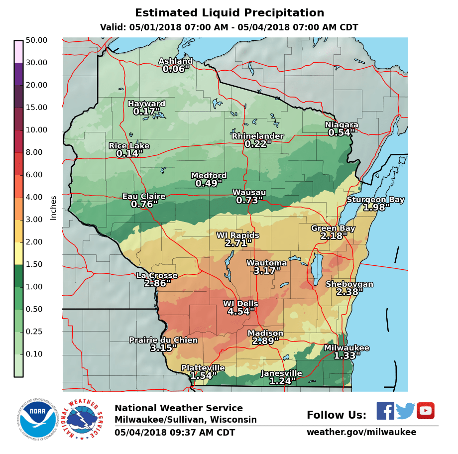 |
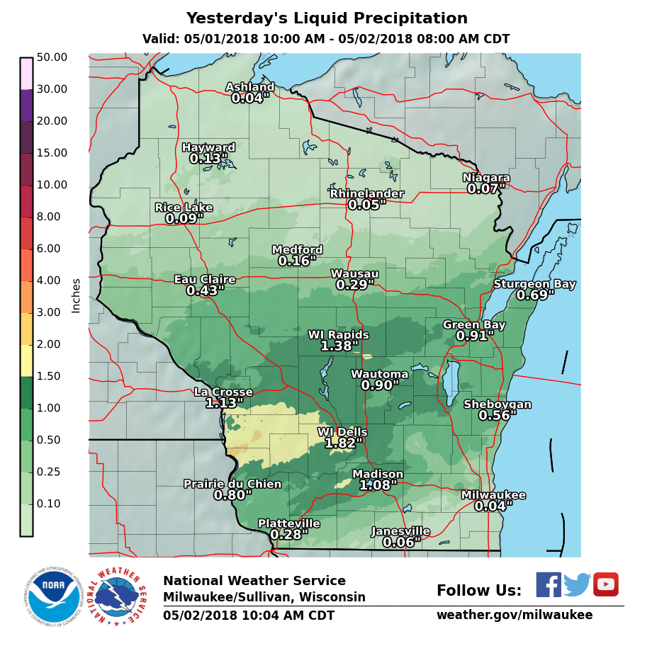 |
| 3 Day Storm Total Precipitation | Day 1 (Tuesday) Rainfall Amounts |
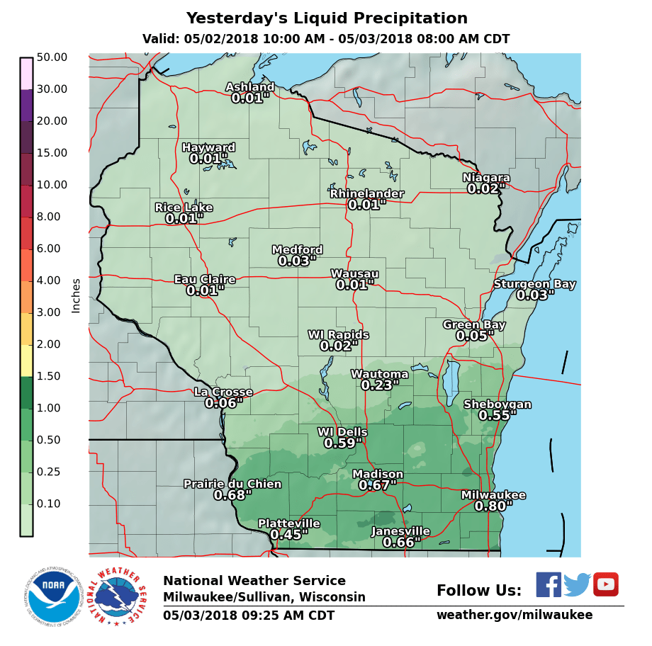 |
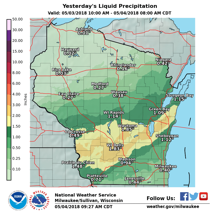 |
| Day 2 (Wednesday) Rainfall Amounts | Day 3 (Thursday-Early Friday) Rainfall Amounts |
Storm Reports
PRELIMINARY LOCAL STORM REPORT...SUMMARY
NATIONAL WEATHER SERVICE MILWAUKEE/SULLIVAN WI
133 PM CDT THU MAY 3 2018

..TIME...   ...EVENT...      ...CITY LOCATION...     ...LAT.LON...
..DATE...   ....MAG....      ..COUNTY LOCATION..ST.. ...SOURCE....
            ..REMARKS..

0700 PM     HAIL             MINERAL POINT           42.86N 90.19W
05/02/2018  M1.00 INCH       IOWA               WI   PUBLIC

            PICTURE FROM SOCIAL MEDIA.

0713 PM     HAIL             BLUE MOUNDS             43.02N 89.82W
05/02/2018  E0.25 INCH       DANE               WI   PUBLIC


0721 PM     HAIL             3 SW JANESVILLE         42.66N 89.06W
05/02/2018  M1.50 INCH       ROCK               WI   PUBLIC

            BROKEN SIDING, WINDOWS AND TORN SCREENS.
            CEDAR CREST AREA.

0732 PM     HAIL             3 N VERONA              43.03N 89.53W
05/02/2018  M0.25 INCH       DANE               WI   PUBLIC


0735 PM     HAIL             1 W VERONA              42.99N 89.56W
05/02/2018  E0.25 INCH       DANE               WI   PUBLIC


0755 PM     HAIL             EVANSVILLE              42.78N 89.30W
05/02/2018  E1.00 INCH       ROCK               WI   PUBLIC


0810 PM     HAIL             1 W WATERTOWN           43.19N 88.74W
05/02/2018  M0.75 INCH       JEFFERSON          WI   PUBLIC


0818 PM     HAIL             ASHIPUN                 43.21N 88.52W
05/02/2018  E1.00 INCH       DODGE              WI   PUBLIC

            BASED ON A PICTURE FROM SOCIAL MEDIA.

0822 PM     HAIL             3 SW JANESVILLE         42.65N 89.05W
05/02/2018  M1.50 INCH       ROCK               WI   PUBLIC


0824 PM     HAIL             2 WSW OCONOMOWOC        43.09N 88.53W
05/02/2018  E1.25 INCH       WAUKESHA           WI   PUBLIC

            THE DURATION OF THE HAIL EVENT WAS 10
            MINUTES.

0842 PM     HAIL             2 SW WAUKESHA           42.99N 88.26W
05/02/2018  E1.00 INCH       WAUKESHA           WI   TRAINED SPOTTER

            EST 55 MPH WINDS.

0843 PM     HAIL             3 S GERMANTOWN          43.20N 88.11W
05/02/2018  M0.75 INCH       WASHINGTON         WI   PUBLIC


0846 PM     HAIL             DARIEN                  42.61N 88.71W
05/02/2018  M1.00 INCH       WALWORTH           WI   PUBLIC


0847 PM     HAIL             GRAFTON                 43.32N 87.95W
05/02/2018  M0.25 INCH       OZAUKEE            WI   TRAINED SPOTTER

            WIND ESTIMATED AT 30-40MPH.

0851 PM     HAIL             FONTANA-ON-GENEVA       42.54N 88.57W
05/02/2018  E1.00 INCH       WALWORTH           WI   PUBLIC

            MPING.

0858 PM     HAIL             1 WSW WILLIAMS BAY      42.57N 88.56W
05/02/2018  M2.50 INCH       WALWORTH           WI   TRAINED SPOTTER

            CORRECTS PREVIOUS HAIL REPORT FROM 1 WSW
            WILLIAMS BAY. BROKEN WINDOW ON THE 90' DOME
            AT YERKES OBSERVATORY IN WILLIAMS BAY.

0904 PM     HAIL             2 WNW PELL LAKE         42.55N 88.40W
05/02/2018  M1.75 INCH       WALWORTH           WI   TRAINED SPOTTER


0904 PM     HAIL             5 WSW PELL LAKE         42.52N 88.44W
05/02/2018  E1.75 INCH       WALWORTH           WI   PUBLIC


0910 PM     HAIL             2 SSE PELL LAKE         42.52N 88.35W
05/02/2018  M1.50 INCH       WALWORTH           WI   PUBLIC


0912 PM     HAIL             GENOA CITY              42.50N 88.32W
05/02/2018  M1.25 INCH       WALWORTH           WI   PUBLIC
 |
Media use of NWS Web News Stories is encouraged! Please acknowledge the NWS as the source of any news information accessed from this site. |
 |