What: Marginal Risk For Severe Storms
When: Rest of Tonight
Where: South Central And Southeast Wisconsin
Hazards: Isolated Large Hail And Strong Winds Are Possible
A cold front will continue moving east overnight across Wisconsin. The front will interact with a warm, moist, and unstable airmass to trigger scattered to numerous thunderstorms across central and southern Wisconsin from the late evening through the late night and arly morning Sunday.
The below images show the surface maps valid overnight into Sunday morning:
| 7 PM This Evening | 1 AM Sunday Morning | 7 AM Sunday Morning |
 |
 |
 |
Increasing atmospheric wind shear will combine with the warm, moist and unstable airmass to bring the possibility for severe storms across southern Wisconsin overnight.
There is a Marginal Risk for severe storms across southern Wisconsin overnight.
The storms are expected to weaken with time as they slide eastward across the region later tonight. The primary hazards will be large hail and strong winds, but these threats should be isolated in nature. There are several outdoor events taking place this weekend, so make sure to keep up with the forecast for the latest information.
The latest severe weather outlook from the Storm Prediction Center for today and tonight is included below.
Click the below images to enlarge:
| Severe Thunderstorm Outlook For Wisconsin Today And Tonight | Southern Wisconsin Close Up |
 |
 |
Other Information And Links:
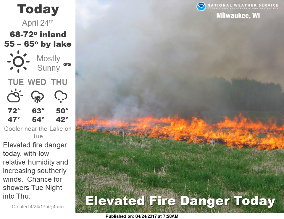
Here is the latest clickable Weather Story graphic:
Click here to send us a severe weather report.
Click here for the latest Hazardous Weather Outlook.
Click here for the Summer Weather Page.
Stay tuned for later forecasts and updates on the thunderstorms tonight.
Review safety guidelines for severe weather here.
Schultz/Wood/Miller
NWS Milwaukee/Sullivan, WI

