Overview
|
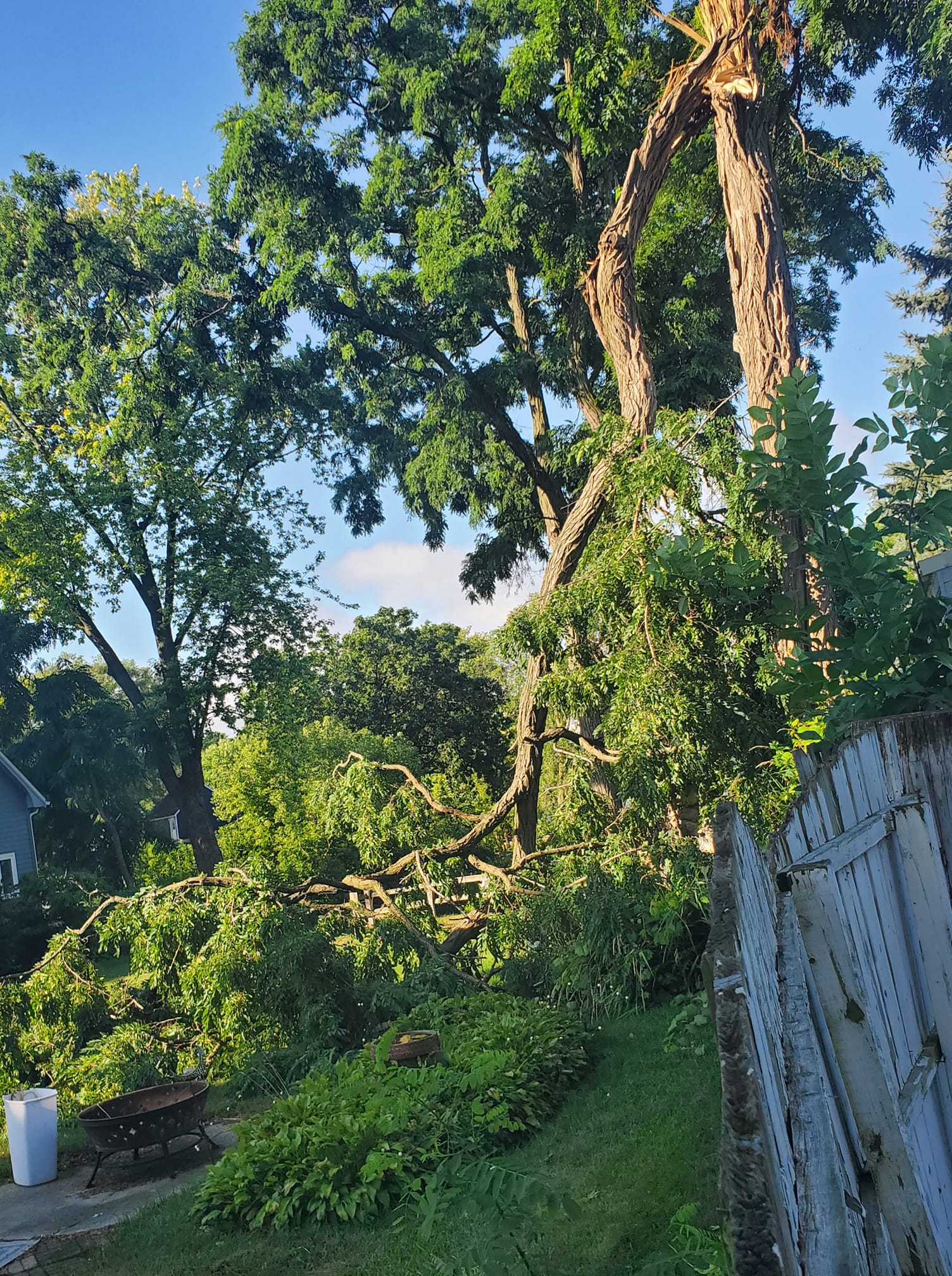
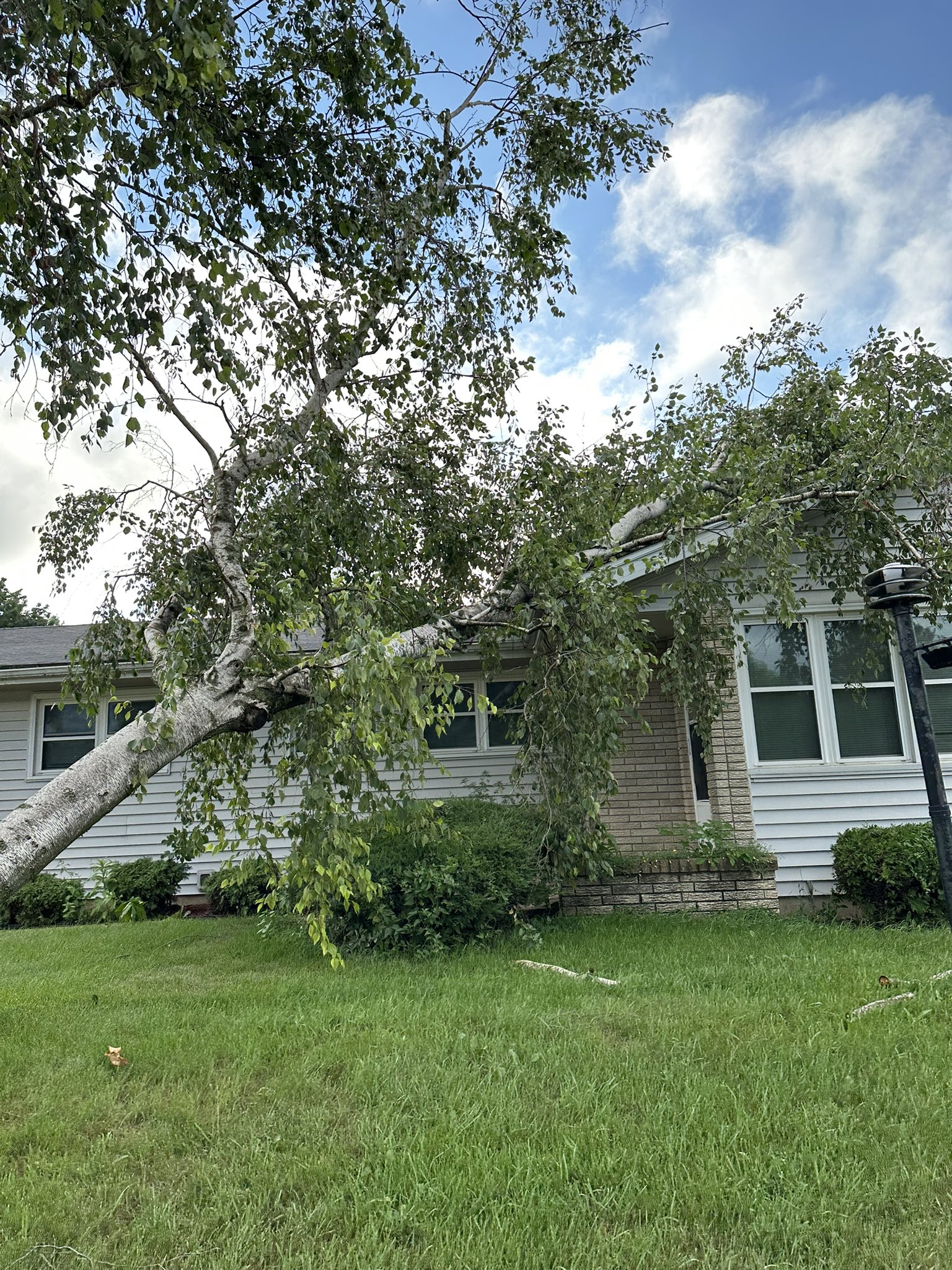
On Friday, July 28th multiple rounds of thunderstorms moved through southern Wisconsin. Several surface boundaries provided sources of lift as the environment became more unstable. Initially supercells producing large hail around 2 inches in diameter and heavy rain impacted the area before a surging line of storms moved in from the northwest. 60 to 80 mph winds within the line resulted in tree damage across a large portion of the area. |
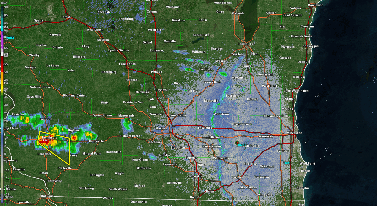 Radar from 6:13PM - 11:22PM July 28th, 2023 |
Tornadoes:
|
Tornado - 2.0 mi E of Palmyra
Track Map 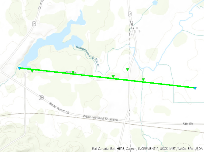 
|
||||||||||||||||
Wind & Hail:
Wind
%20-%20Lake%20WI%20%40loFromWisco.jpg) |
 |
 |
 |
| Columbia Co, Lake Wisconsin Photo: @loFromWisco | Waukesha Co, Okauchee Photo: Jane Achterberg | Dane Co, Stoughton Photo: Jaiden Panici | Dane Co, Waunakee Photo: @DeadNotSleepin0 |
Hail
 |
 |
 |
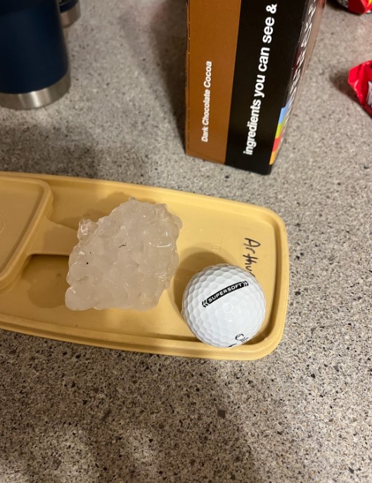 |
| Lafayette Co, between Platteville & Belmont Photo: Sally Magby | Lafayette Co, SE of Platteville Photo: Sherry Nix | Waukesha Co, Mukwonago Photo: @mradelponte | Racine Co, Waterford Photo:@BarnBurnerWI |
Storm Reports
PUBLIC INFORMATION STATEMENT
NATIONAL WEATHER SERVICE MILWAUKEE/SULLIVAN WI
136 PM CDT SAT JUL 29 2023

...SEVERE WEATHER REPORTS FROM JULY 28...

HAIL REPORTS...

LOCATION                     SIZE      TIME/DATE

...WISCONSIN...

...LAFAYETTE COUNTY...
3 W BELMONT                  2.50 IN   0725 PM 07/28
BELMONT                      2.00 IN   0727 PM 07/28
DARLINGTON                   1.00 IN   0745 PM 07/28

...RACINE COUNTY...
WATERFORD                    2.50 IN   0836 PM 07/28
1 SSW WATERFORD NORTH        2.50 IN   0840 PM 07/28
WATERFORD                    1.00 IN   0840 PM 07/28

...WAUKESHA COUNTY...
MUKWONAGO                    1.25 IN   0817 PM 07/28


HIGHEST WIND REPORTS...

LOCATION                     SPEED     TIME/DATE

...WISCONSIN...

...DANE COUNTY...
MADISON-DANE COUNTY AIRPORT  58 MPH    0947 PM 07/28

...GREEN COUNTY...
MONROE                       59 MPH    0955 PM 07/28

...GREEN LAKE COUNTY...
KINGSTON                     55 MPH    0942 PM 07/28

...JEFFERSON COUNTY...
3 SE SULLIVAN                70 MPH    1030 PM 07/28
CAMBRIDGE                    55 MPH    1011 PM 07/28

...RACINE COUNTY...
BURLINGTON                   47 MPH    1055 PM 07/28

...SAUK COUNTY...
6 W SPRING GREEN             77 MPH    0925 PM 07/28

...WALWORTH COUNTY...
EAST TROY                    58 MPH    1055 PM 07/28

...WAUKESHA COUNTY...
2 N MUSKEGO                  60 MPH    1100 PM 07/28

OBSERVATIONS ARE COLLECTED FROM A VARIETY OF SOURCES WITH VARYING
EQUIPMENT AND EXPOSURES. WE THANK ALL VOLUNTEER WEATHER OBSERVERS
FOR THEIR DEDICATION. NOT ALL DATA LISTED ARE CONSIDERED OFFICIAL.
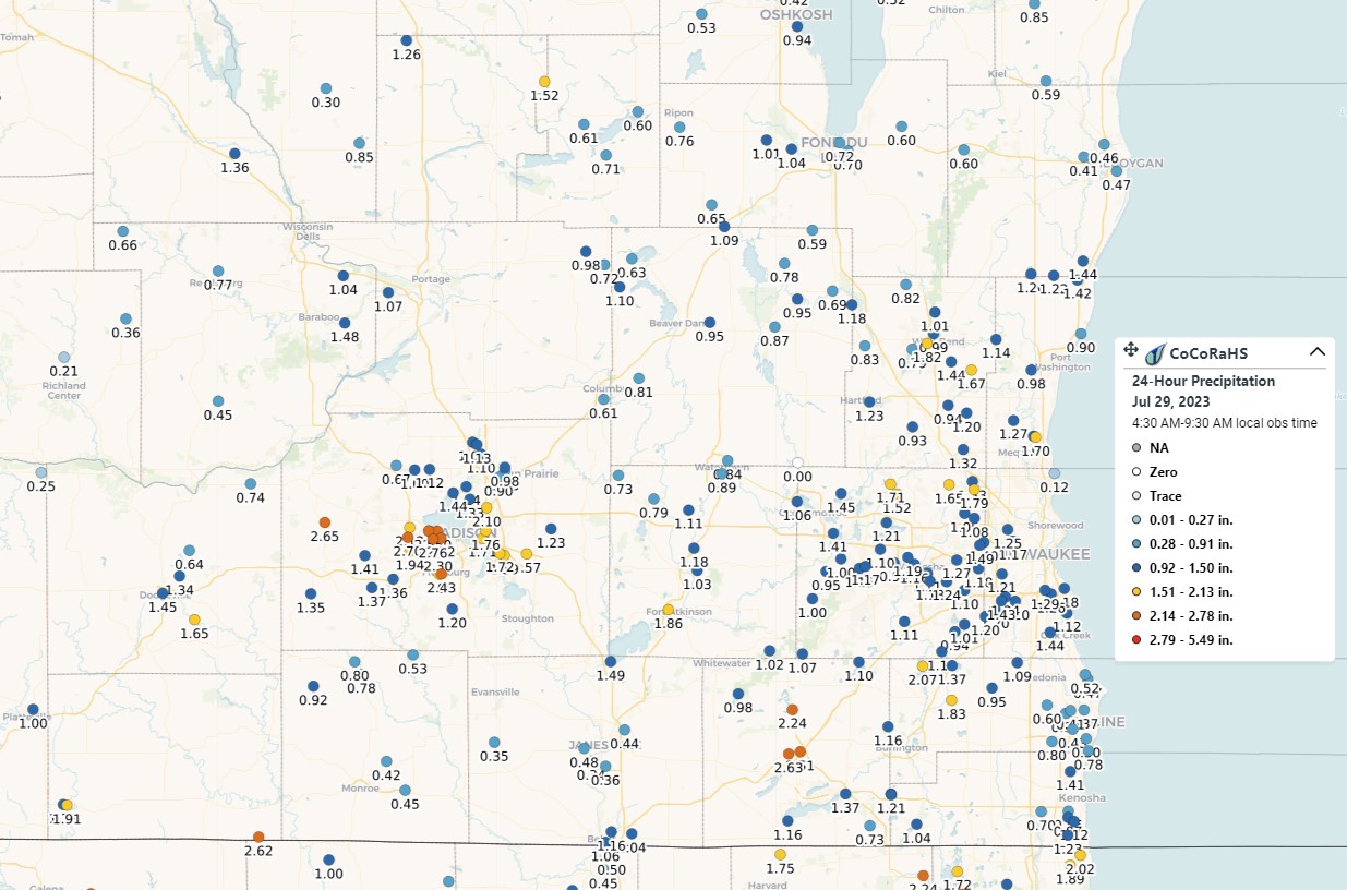
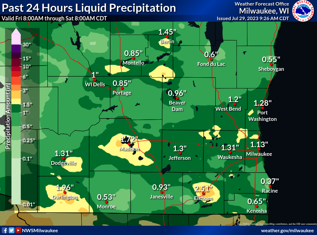
Rain Reports
The line of storms that moved in from the northwest contained heavy rainfall with rates around 2 inches per hour.
|
CoCoRaHS reports |
Map made using local ASOS, COOP, CoCoRaHS, and MRMS data. |
|---|
 |
Media use of NWS Web News Stories is encouraged! Please acknowledge the NWS as the source of any news information accessed from this site. |
|