Overview
|
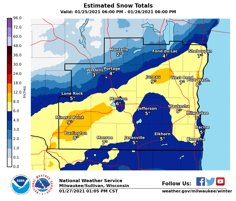
Moderate to heavy snow moved into southern Wisconsin late Monday evening, pivoting over the area and lingering through much of the day on Tuesday. The highest snowfall totals from this event occurred across southwestern Wisconsin into portions of east-central Wisconsin, where a strong area of banded snow developed and persisted early Tuesday morning. Snowfall totals within this band of heavy snow ranged from 6 to 10 inches. Closer to Lake Michigan, higher snowfall totals also occurred due to lake enhancement as winds over Lake Michigan backed to north-northeast on Tuesday. Northwest of the heavier banded snowfall, areas near the Wisconsin Dells and Montello saw significantly less snowfall. Strong, gusty northeast winds also accompanied this snow and brought increased concerns for hazardous travel. Drifting snow was observed across much of southern Wisconsin, which made snowfall measurements very difficult. This winter storm was a complex system and came with numerous forecasting challenges, including:
|
|
Snowfall & Wind
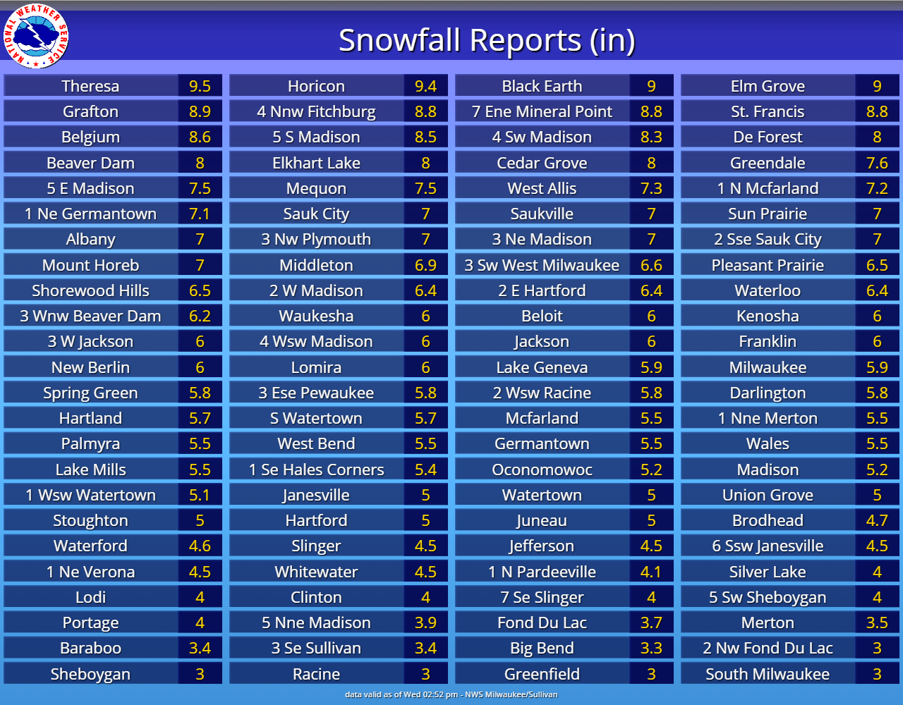
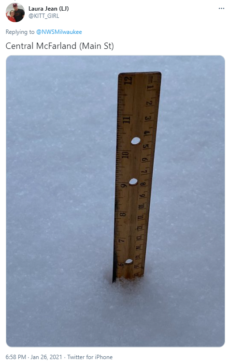
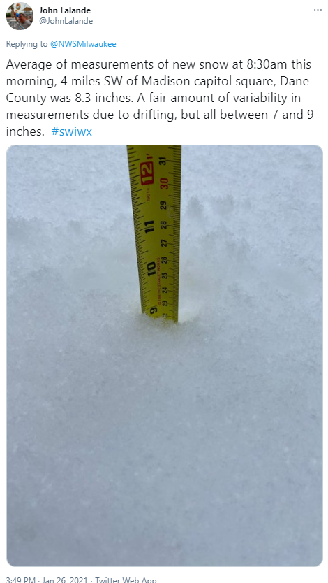
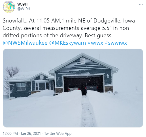
Thank you to everyone who provided snowfall reports during and after the event!
Here's how the snowfall reports stacked up across southern Wisconsin, along with peak wind gusts.
Click images to view in a larger format.
 |
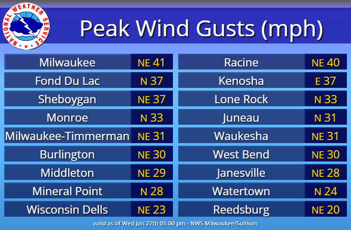 |
| List snowing specific snowfall reports by location. | Peak wind gusts during the winter storm. |
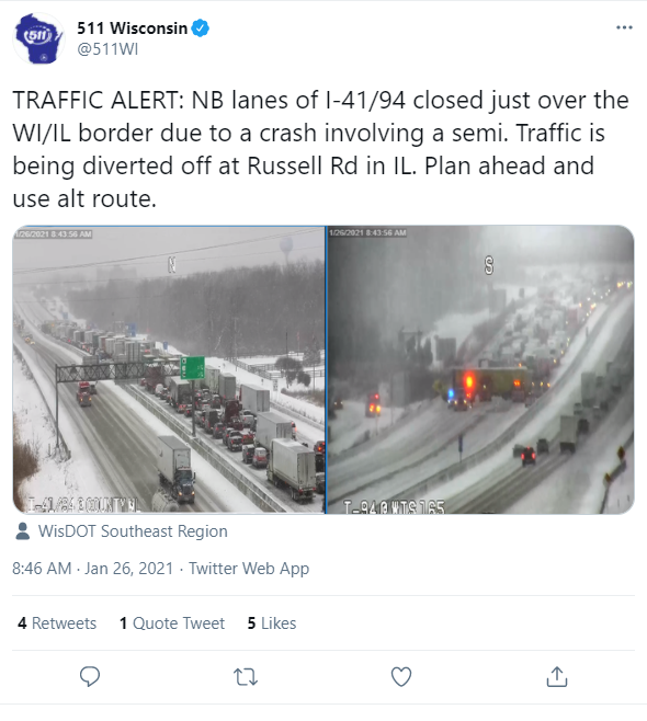
Photos & Impacts
The combination of falling snow and blowing snow caused sharply reduced visibilities, especially closer to Lake Michigan where winds gusted upwards of 30-40 mph at times. Roads became snow covered and slippery across much of southern Wisconsin, with numerous slide-offs reported. Significant drifting snow made it difficult to measure snowfall.
Click images below to view in a larger format.
 |
 |
 |
 |
Environment
As previously noted, there were significant forecast challenges with this winter storm. Here is how the environment played out, and what factors led to the shift north of the higher snowfall amounts.
Click images or loops below to view in a larger format.
.gif) |
.gif) |
.gif) |
 |
|
HREF Ensemble mean for 850mb temperatures, heights and winds. Note the nose of warm air advection that lifted into southern Wisconsin as the main 850mb low tracked just south of the Wisconsin/Illinois state line. |
HREF Ensemble mean for 700mb temperatures, heights and winds. Note the warm air advection lifting into southeast Wisconsin ahead of the weakening 700mb low aloft. |
HREF Ensemble mean for 500mb heights and winds. Note the closed mid-level low over Nebraska opening up and weakening as the mid-level wave lifted northeast over southern Wisconsin. |
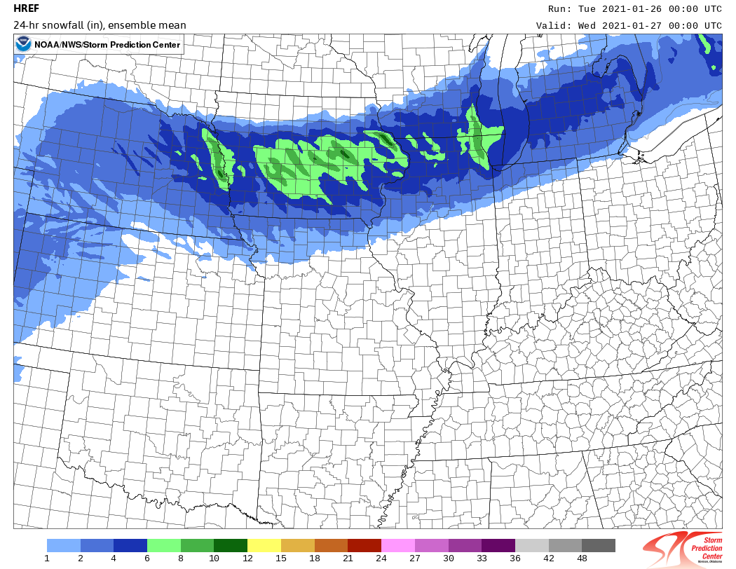
HREF Ensemble mean, model derived snowfall totals from 00Z updated high-res ensemble guidance. Note, this is an ensemble mean. A few high-res models did the northward shift of the main snow axis. |
 |
.png) |
 |
 |
|
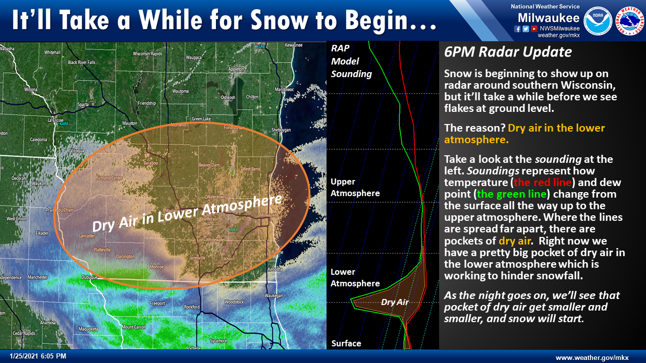
One of the complicated aspects of this forecast was how the dry air over southern Wisconsin would impact the snowfall forecast. This graphic shows some of the lingering dry air that held snow off until late Monday night and early Tuesday morning. |
As the mid-level wave lifted northeast, vorticity advection lifting into the region also aided in enhanced large-scale lift early Tuesday morning. |
Warm air advection helped enhance large-scale lift, and also played a role in sharpening mid-level frontogenesis over southern Wisconsin. This feature became the primary focus for localized lift and enhanced snowfall rates early Tuesday morning. |
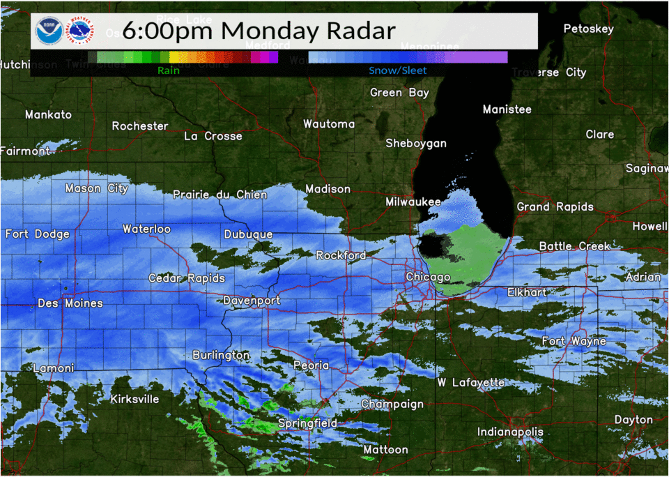
Loop of radar data from across the region showing the widespread snow lifting northeast into southern Wisconsin. |
 |
 |
 |
|
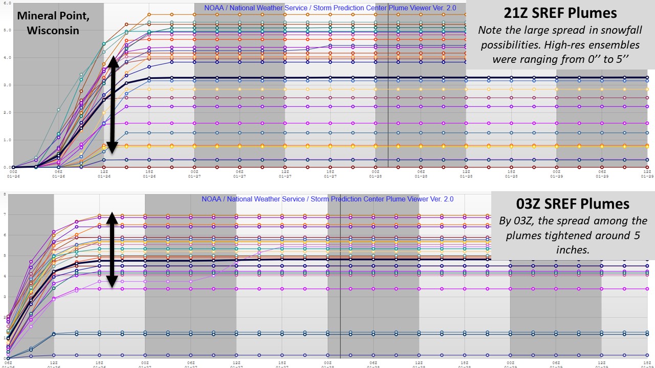
SREF plumes comparing 21Z and 03Z ensemble snowfall predictions for Mineral Point, Wisconsin. Individual ensembles are shown in various warm and cold colors. The ensemble mean is shown in black. |
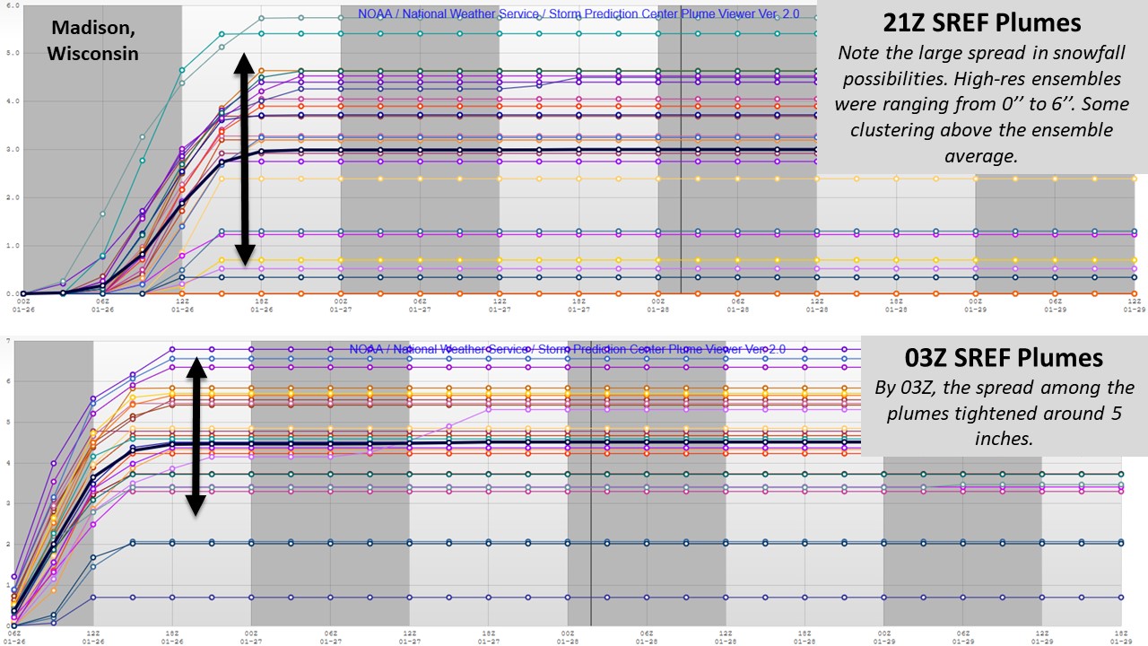
SREF plumes comparing 21Z and 03Z ensemble snowfall predictions for Madison, Wisconsin. Individual ensembles are shown in various warm and cold colors. The ensemble mean is shown in black. |
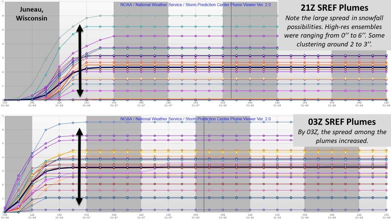
SREF plumes comparing 21Z and 03Z ensemble snowfall predictions for Juneau, Wisconsin. Individual ensembles are shown in various warm and cold colors. The ensemble mean is shown in black. |
 |
Media use of NWS Web News Stories is encouraged! Please acknowledge the NWS as the source of any news information accessed from this site. |
|