Freezing Rain, Fog, And Heavy Rainfall Continues Today
There is potential for freezing rain toward central Wisconsin and heavy rainfall and flooding in southeast Wisconsin. Dense fog at times will affect southern Wisconsin early this morning.
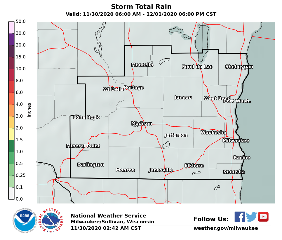
Estimated Rainfall Total as of 3 am:

Freezing Rain Potential:
A Winter Weather Advisory is in effect until 3 pm. See map below. The greatest potential for freezing rain is expected along and north of a Sauk to Fond du Lac county line today. Temperatures are sitting just below freezing at 4 am as rain is spreading over the area. This is causing freezing rain and icing to occur. Just a little ice accumulating can make travel very difficult and hazardous for both the motorist and the pedestrian. Keep up with the forecast.
Here's our latest total ice map:
 |
 |
Heavy Rainfall and Flooding:
Heavy rainfall has caused widespread ponding of water on roads. Many roads are closed. A flood warning is in effect for parts of southern WI. A flood watch is in effect for far southeast WI, which missed the first round of rain. More rain and flooding is expected through the afternoon and perhaps into the evening. Watch out for standing water in roads and low lying areas, and rising levels of creeks and rivers.
Flood Warning until 9:45 am this morning:

Here's our latest additional precipitation map:
 |
 |
Here is a link to our river gauge network across south central and southeast Wisconsin, to find the latest river stages and forecasts.
The Big Picture:

Regional Radar Imagery:
 |
 |
Local Radar:

Road Conditions:
 |
Social Media:
Facebook
Twitter
YouTube
More Information Here:
Forecast Discussion
Watches/Warning/Advisory Text
Local Storm Report Text
Hazardous Weather Outlook
Hourly Weather roundup
Wood/BSH/Cronce
NWS Milwaukee/Sullivan, WI

