Late May 16 through early May 18 proved to be a rather soggy period across southern Wisconsin as a very slow-moving low pressure system impacted the area. This system dumped anywhere from 3 to 7 inches of rain over areas generally along and east of Interstate 39 during an approximately 2 day period, with the highest amounts being recorded in counties along the Lake Michigan shoreline. With the abundance of rain falling during a relatively short period of time, areal and river flooding occurred, putting susceptible locations underwater and blocking roadways in spots. Additionally, gusty E-NE winds to 35 mph and favorable fetch over Lake Michigan caused wave heights to approach 7-10 feet. This led to a period of coastal flooding and enhanced shoreline erosion for lakeshore communities.
Below is a radar loop that encapsulates the rain event. Precipitation started late in the evening on May 16 and was driven by warm air advection and ascent due to the upper level low. This mode of precipitation production continued for much of the morning and early afternoon on the 17th, before more convective elements brought heavy rain along the advancing cold front during the afternoon hours and into the evening later in the day.

The highest rain amounts were confined to areas along the lakeshore, most notably in Sheboygan and Ozaukee counties. The map shown below shows estimated amounts based upon local storm reports.

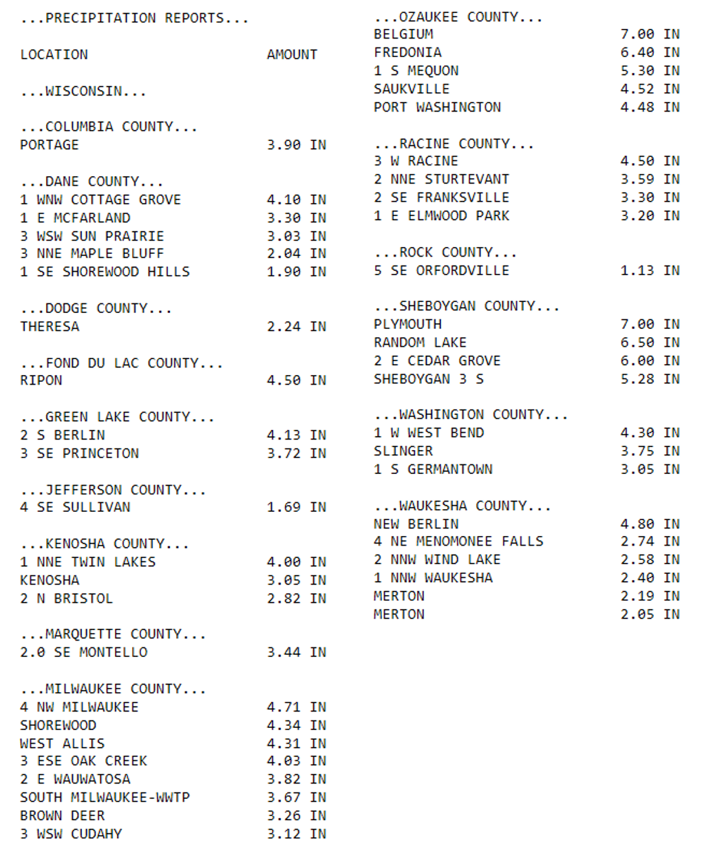
Here are some amounts from around southern WI:
Notable flooding occurred in Sheboygan as heavy rainfall caused the Sheboygan River to crest in moderate flood stage and onshore waves forced water to back up into the mouth of the river. This flooding was observed in Riverfront Park, impacted many businesses along the riverfront boardwalk, and led to closures along Broughton Drive. Localized flooding occurred in other areas along the lakeshore as well, leading to abandoned cars in Milwaukee and a water rescue in West Allis.
Precipitation also led to or is forecast to lead to minor flooding at locations along the Root, Lower Fox, and Milwaukee Rivers. The Lower Fox River at New Munster is forecast to crest near major flood stage on Wednesday.

