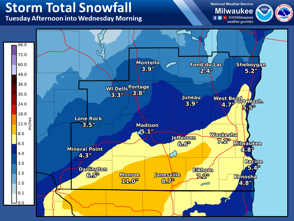
A fast-moving winter storm impacted much of southern Wisconsin during the afternoon and evening of December 29th into early December 30th. Over the span of about 10 to 12 hours, 6 to 8 inches of snow fell over much of the southern and southeastern regions of the state, leading to some dicey travel conditions throughout the area. This event also marked the first Winter Storm Warning event of the 2020-2021 winter season for southern WI. Below is a brief summary of the event.
This snowfall event was primarily driven by warm air advection from a potent 850mb jet from the south-southwest. This jet provided a steady influx of precipitation, as warm moist air from the south was lifted over the colder air in place over our area. There was also small influence from differential positive vorticity advection ahead of an open shortwave trough over Minnesota and divergence aloft in association with a jet streak circulation at 300mb. The surge of warm air advection, coupled with the upper level dynamics, allowed for good enough lift to produce snowfall rates of 1-2 inches per hour in some spots. The speed of the system was likely owed to the open nature of the 500mb wave, and its fast moving nature shortened the duration of snow over southern Wisconsin. If we would have been dealing with a closed low at 500mb in this scenario, snow totals may very well of been higher due to a slower moving system! Below are some upper level observations during the event:
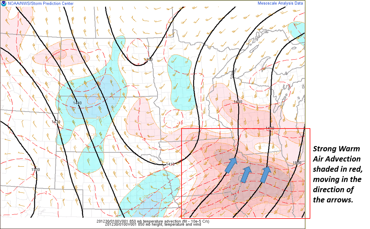
The image above depicts warm air advection in association with the low level jet at 850mb, at 7pm on December 29.
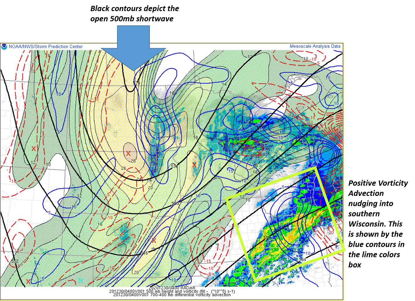
This image above shows vorticity and vorticity advection at the 500mb level along with Radar at 10pm on December 29th
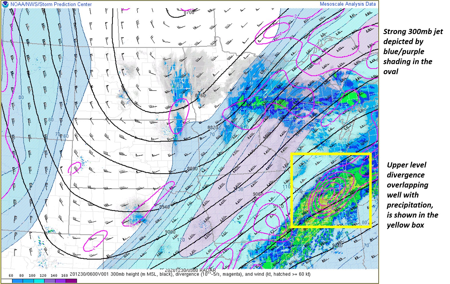
The image above shows the 300mb jet circulation with upper level divergence and radar at Midnight December 30th.
Here is a radar loop of the event from the Dec 29th to the early morning on the 30th.

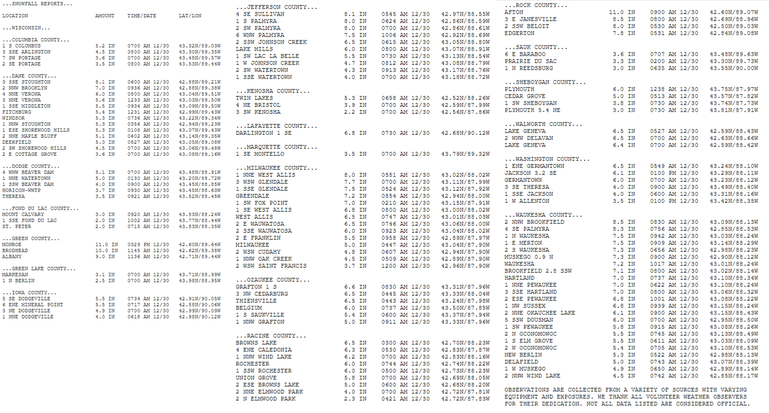
A widespread 6-8 inches of snow fell across a good portion of southern Wisconsin with a few higher amounts approaching 12 inches reported in parts of Rock and Green counties.