Late August 2018 Severe Weather and Flooding
Summary
A very warm, moist airmass combined with a series of storm systems to produce multiple rounds of flooding and severe weather across southern Wisconsin during the latter half of August. This included major flash flooding across Dane County, flooding of the Yahara chain of lakes in the Madison area. Significant flash flooding also took place at times in Watertown, and across parts of Washington and Ozaukee Counties. Strong to severe thunderstorms resulted in sporadic tree damage across the region.
Additional rainfall and severe weather is possible over the next few days. This page will be updated with additional post-event information as needed.
Total Estimated Rainfall from August 17 to August 27

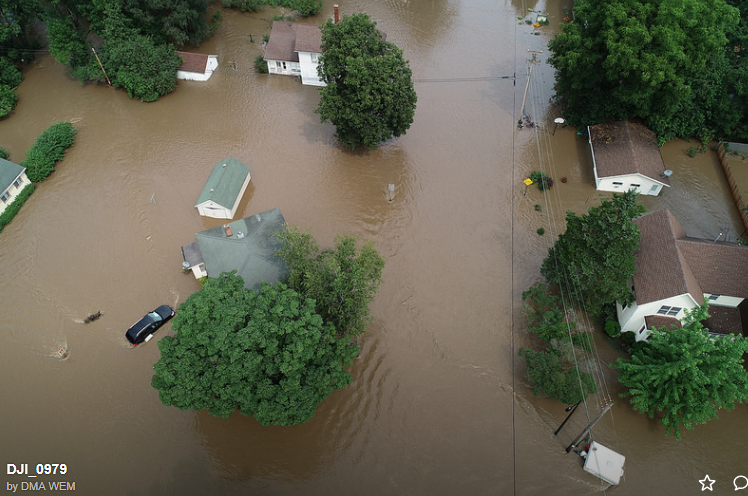
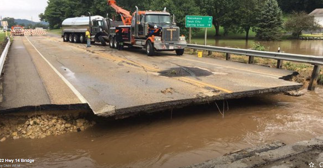
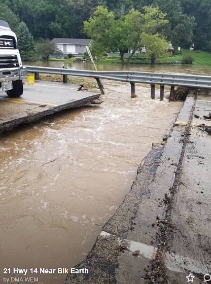
Dane County Flooding
August 20-21

Washington/Ozaukee County Flooding
August 26 and 27
Rainfall reports...
...Ozaukee County...
1 S Port Washington          9.18 in   0400 AM 08/27   Trained Spotter
Port Washington              8.50 in   0300 AM 08/27   Trained Spotter
1 ENE Saukville              6.90 in   0715 AM 08/27   CO-OP Observer
4 NE Port Washington         5.91 in   0700 AM 08/27   COCORAHS
1 E Grafton                  5.43 in   0802 AM 08/27   Public
Newburg                      5.40 in   0700 AM 08/27   COCORAHS
1 SE Thiensville             4.00 in   0300 AM 08/27   Broadcast Media

...Sauk County...
1 SSE Lake Delton            5.04 in   0613 AM 08/27   AWS

...Sheboygan County...
Random Lake                  8.40 in   1003 AM 08/27   AWS
Millhome 1 ESE               6.36 in   0903 AM 08/27   AWS
3 WNW Sheboygan              5.48 in   1003 AM 08/27   AWS
2 NNW Sheboygan              5.24 in   1003 AM 08/27   AWS
2 WNW Howards Grove          5.20 in   0734 AM 08/27   Public
Random Lake                  4.14 in   1010 AM 08/27   CWOP
Random Lake-CoCoRaHS         4.10 in   0700 AM 08/27   COCORAHS

...Washington County...
1 NE Kewaskum                7.50 in   0700 AM 08/27   Public
2 W West Bend                7.25 in   0330 AM 08/27   Public
1 W Allenton                 5.52 in   0732 AM 08/27   CO-OP Observer
3 ESE Jackson                5.48 in   0500 AM 08/27   COCORAHS
1 SSW West Bend              5.46 in   0715 AM 08/27   Public
1 NW West Bend               5.33 in   0613 AM 08/27   COCORAHS
4 W Richfield                5.00 in   0720 AM 08/27   Public
3 E Allenton                 4.75 in   0600 AM 08/27   Trained Spotter
1 ESE Hartford               4.60 in   0730 AM 08/27   CO-OP Observer
2 W Hartford                 4.60 in   0630 AM 08/27   COOP
3 W West Bend                4.49 in   0700 AM 08/27   COCORAHS
Slinger                      4.28 in   0700 AM 08/27   COOP
Slinger                      4.28 in   0741 AM 08/27   CO-OP Observer
2 NNW Richfield              4.24 in   0800 AM 08/27   COCORAHS

