Overview
|
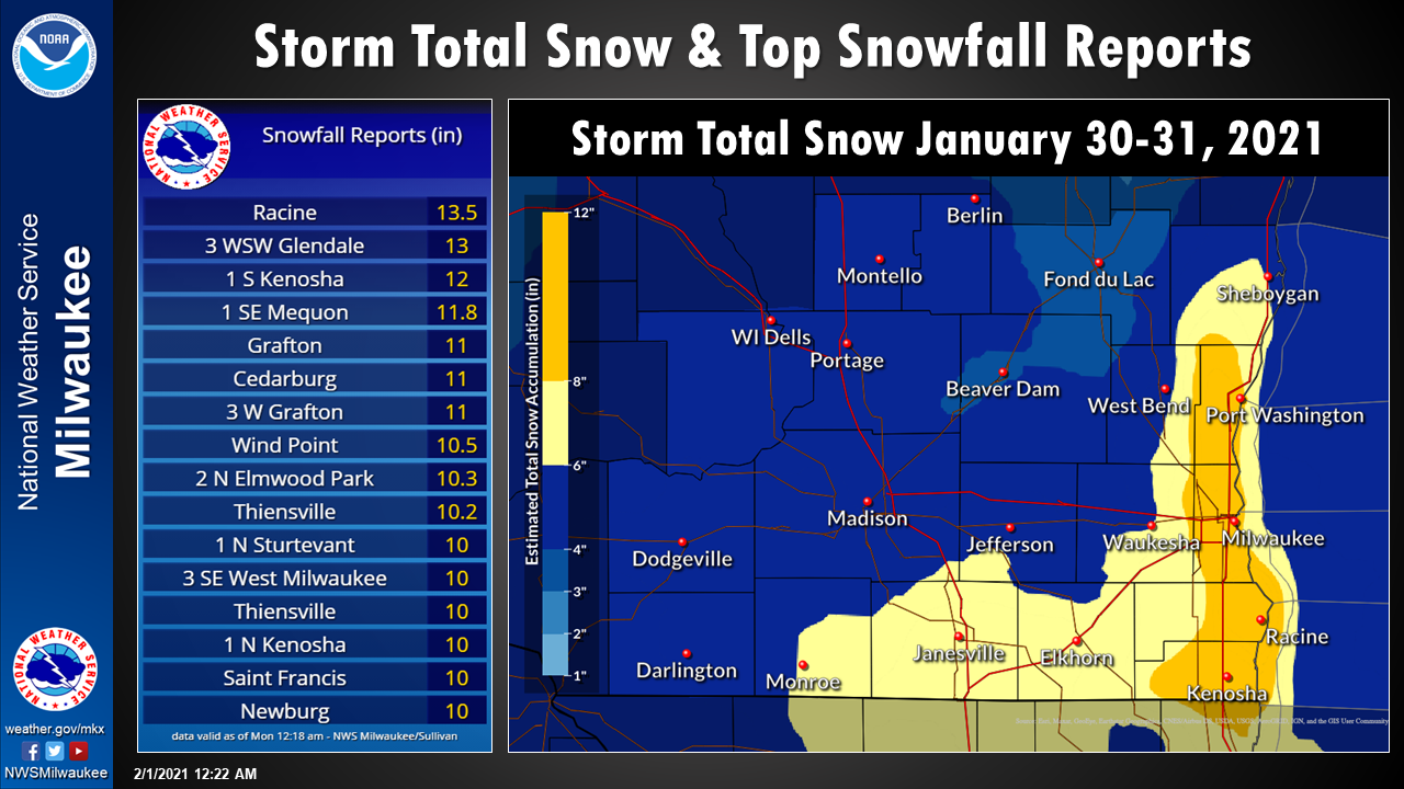
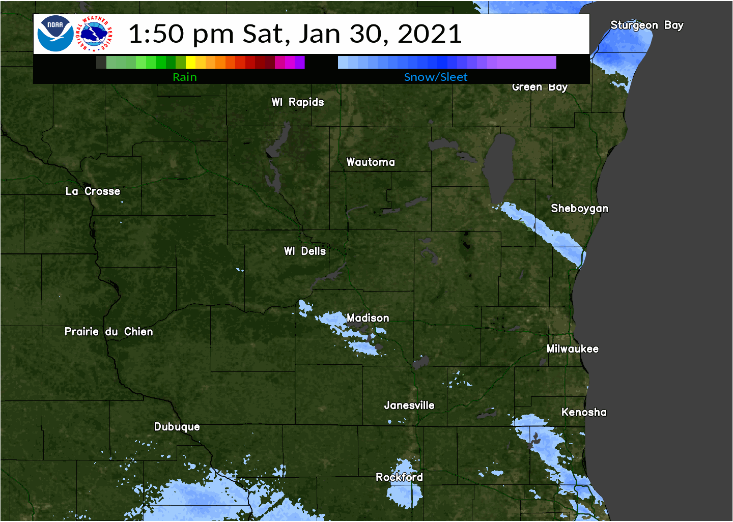
Moderate to heavy snow moved into southern Wisconsin late Saturday evening, pivoting over the area and lingering through Sunday morning. By Sunday afternoon a few moderate lake effect bands redeveloped and brought additional snowfall to Jefferson, Waukesha, Walworth, Milwaukee, Racine, and Kenosha counties. The highest snowfall totals from this event occurred near Lake Michigan where a few lake effect bands developed overnight Saturday into Sunday. Snowfall totals within this band of heavy snow ranged from 6 to 10 inches. Away from Lake Michigan snowfall totals were lower and generally ranged from 3 to 5 inches with a few higher observations mixed in. To the north in central Wisconsin snowfall totals were between 1 to 3 inches. Persistent east to northeasterly winds resulted in drifting and blowing snow with 1 to 2 foot drift noted in many locations from the ongoing snow combined with snowfall from earlier in the week. This drifting snow was observed across much of southern Wisconsin, which made snowfall measurements very difficult. The heavier and wetter snow that was observed caused plenty of traffic issues despite it being a weekend.
|
|
Snowfall & Wind
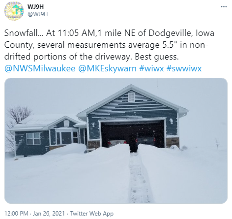
Thank you to everyone who provided snowfall reports during and after the event!
Click images to view in a larger format.
 |
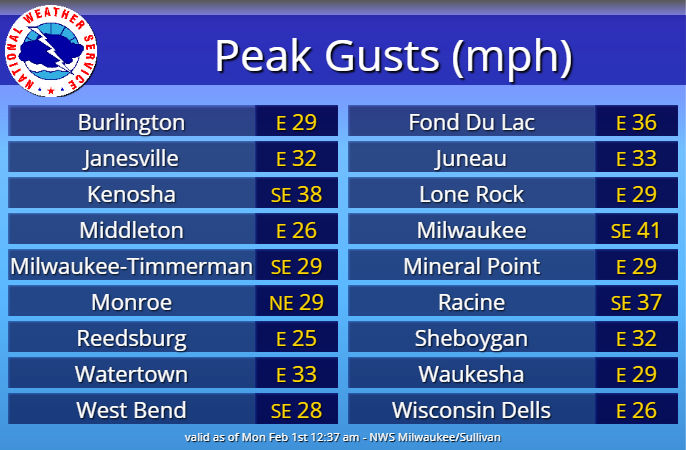 |
| Storm total snowfall map & higher snowfall reports from the winter storm. | Peak wind gusts during the winter storm. |
Photos & Impacts
Click images below to view in a larger format or in Twitter
|
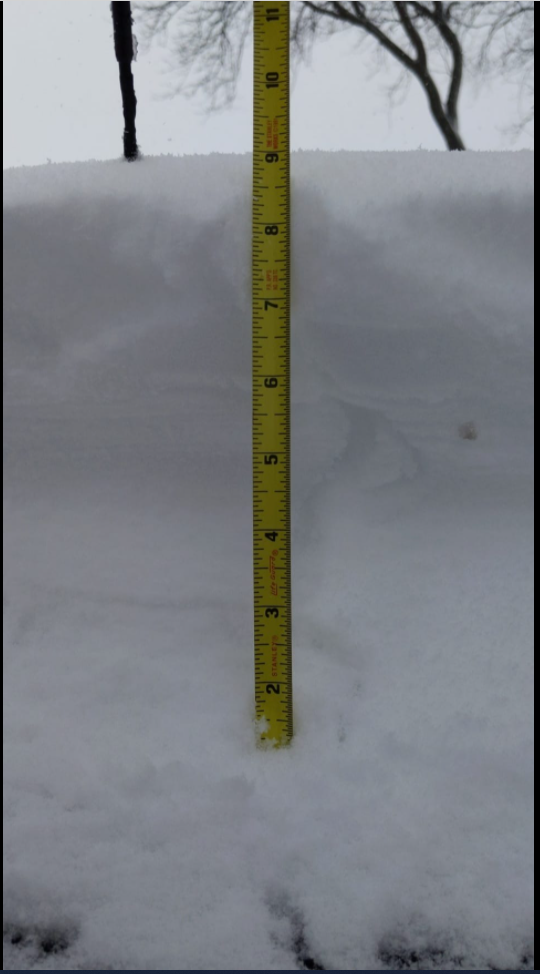
About 9 inches of snow, as of 2:15 p.m. on the south side of Milwaukee. (Near General Mitchell International Airport)
|
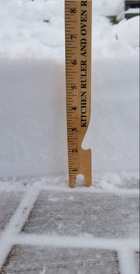
Around 6 inches of snow, as of 1:30 p.m. in Lake Geneva.
|
|
Environment
Click images or loops below to view in a larger format.
 |
 |
 |
 |
|
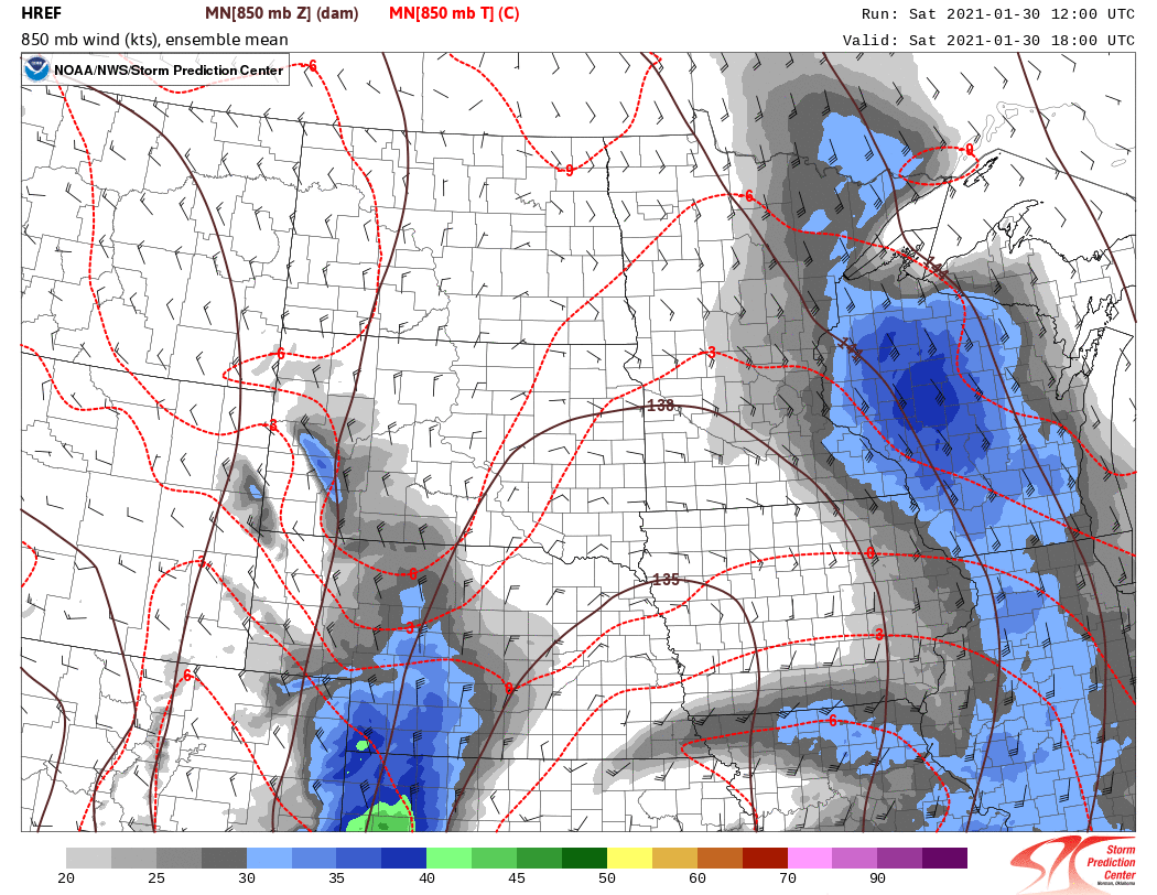
HREF Ensemble mean for 850mb temperatures, heights and winds. Note the nose of warm air advection that lifted into southern Wisconsin as the main 850mb low tracked through central Illinois. |
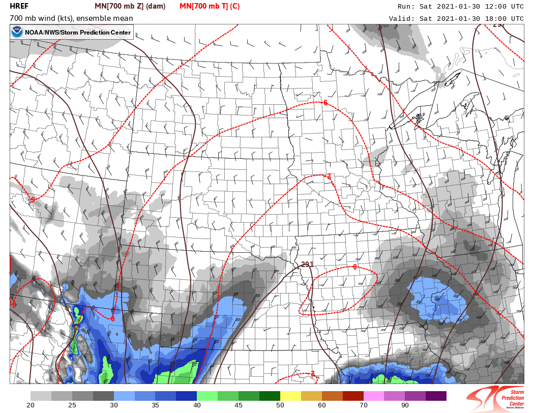
HREF Ensemble mean for 700mb temperatures, heights and winds. Note the warm air advection lifting into southeast Wisconsin ahead of the 700mb low aloft. |
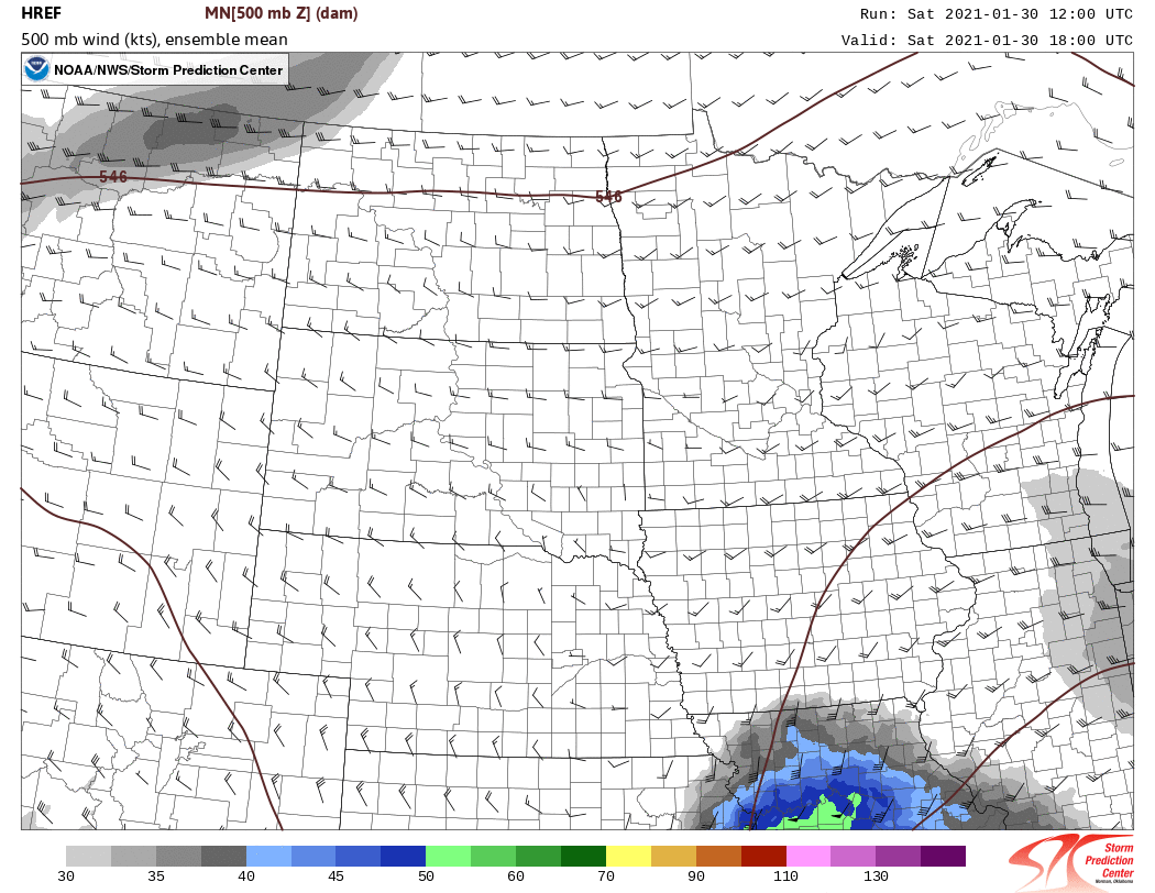
HREF Ensemble mean for 500mb heights and winds. Note mid-level wave lifted northeast over Wisconsin/Illinois state line. |
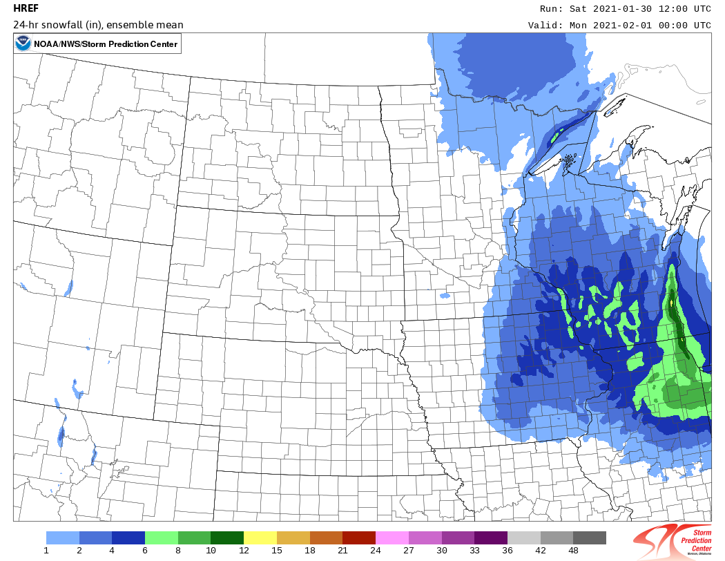
HREF Ensemble mean, model derived snowfall totals from 00Z updated high-res ensemble guidance. Note, this is an ensemble mean. A few high-res models did the northward shift of the main snow axis and greater Lake Effect snowfall. |
 |
 |
 |
 |
|
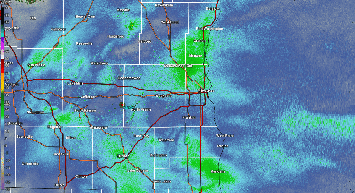
One of the complicated aspects of this forecast was how much lake enhancement/lake effect would impact snowfall totals. A loop of radar data shows the banding snowfall move in from Lake Michigan. |
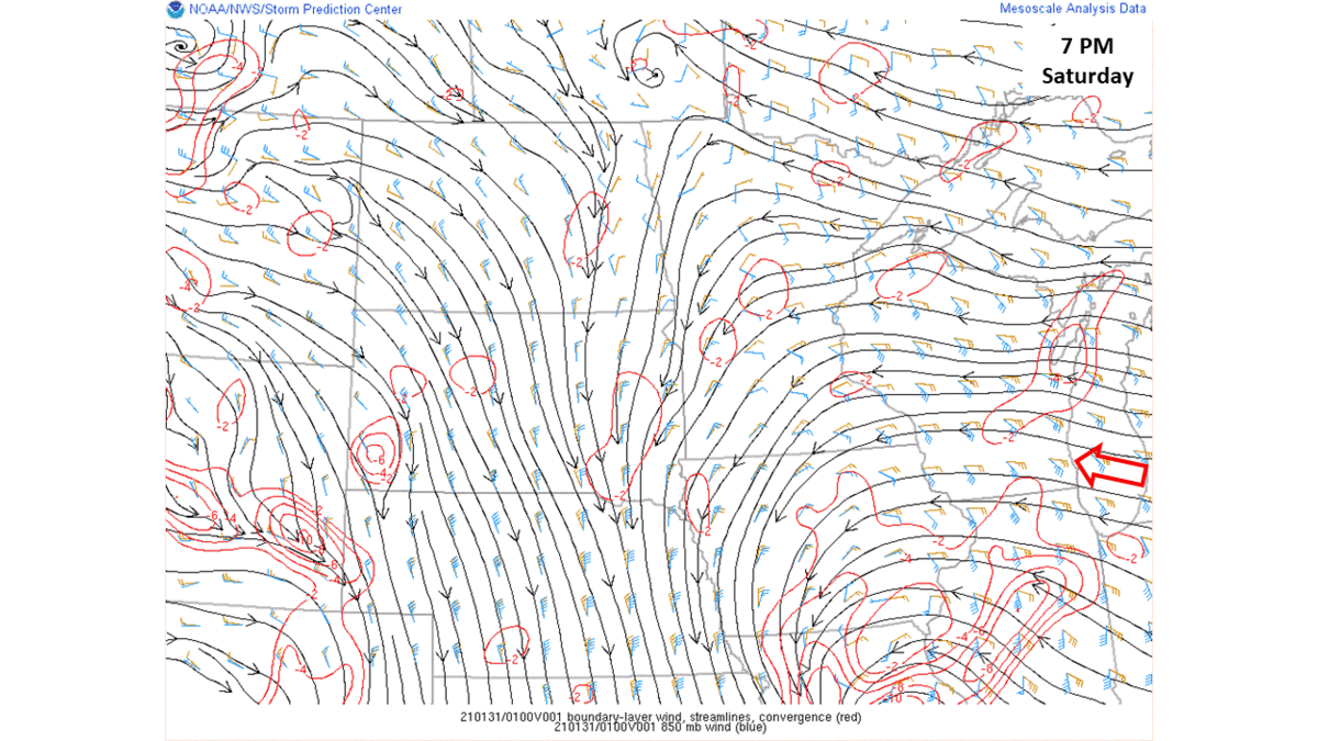
NWS Mesoscale Analysis Data for boundary layer winds and convergence. The increased convergence and easterly winds across Wisconsin kept snow showers going along the lake shore through Sunday evening. |
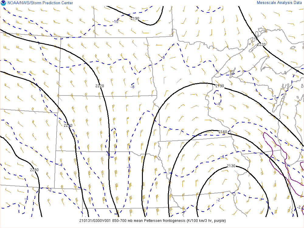
Note the purple outline of 850-700mb Frontogenesis over southeastern Wisconsin. This area of Frontogenesis supported the localized heavier banded snowfall across southeastern Wisconsin. |
Loop of radar data from across the region showing the widespread snow lifting northeast into southern Wisconsin. |
 |
Media use of NWS Web News Stories is encouraged! Please acknowledge the NWS as the source of any news information accessed from this site. |
|