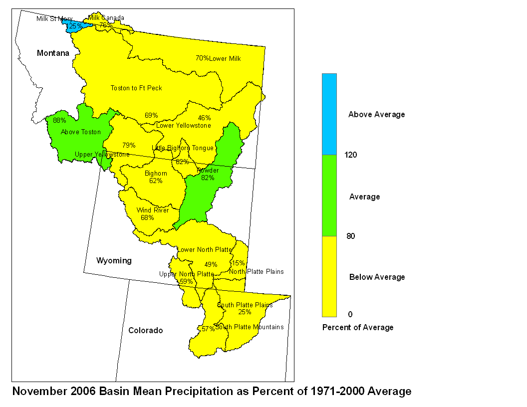
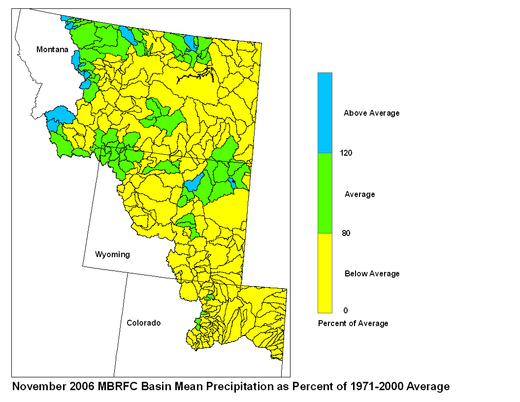
Precipitation in the Missouri Basin during November was mostly
below average to average. Precipitation in Montana was mostly
below average, with amounts ranging from zero percent of average
(no precipitation) at Miles City and Westby, MT to 353% of average
(4.16 in.) near the Continental Divide near Sula, MT. Precipitation
in Wyoming was below average with several reports of zero
precipitation to 267 percent of average (1.20 in.) 15 miles south of
Buffalo, WY. Precipitation in northeastern Colorado was below
average with reports ranging from zero at Burlington, CO to 108
percent of average (1.38 in.) near Ridgway, CO.
Basin precipitation summaries for the Missouri Basin:
Percent of
Basin Average Precipitation
Milk St. Mary 125
Milk Canada 76
Lower Milk 70
Above Toston 88
Toston to Ft. Peck 69
Upper Yellowstone 79
Wind River 68
Bighorn 62
Little Bighorn Tongue 62
Powder 82
Lower Yellowstone 46
Upper North Platte 59
Lower North Platte 49
North Platte Plains 15
South Platte Mountains 57
South Platte Plains 25
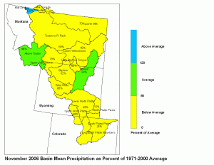
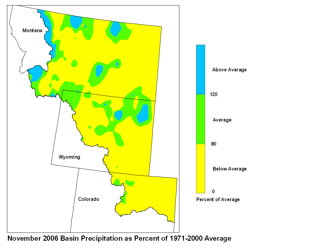
November 2006 Basin Mean Precipitation
The snowpacks are generally at about average levels for this period
in the Missouri mainstem headwaters, and in the 70 to 80
percent of average snowpack range in the Jefferson, Madison,
Gallatin, Yellowstone, other Missouri Headwaters, Bighorns, Powder,
and Tongue River basins. The Shoshone`s snowpack is 55 percent of
average for December 1. Snowpacks in the Milk and North Platte are
about average, while the South Platte has 130 percent of average
snowpack.
Stored water in the South Platte Basin as of December 1 was 73
percent of average for this time of the year. Of the four major
irrigation reservoirs in Montana, Lima Reservoir had 136 percent
average storage; Clark Canyon was holding 67 percent of average
water, Gibson Reservoir had 79 percent of average stored water and
Fresno Reservoir had 81 percent of average stored water. Of the
three major hydroelectric reservoirs in Montana, Canyon Ferry and
Fort Peck had monthend storage equal to 89 and 60 percent of
average water, respectively. Bighorn reservoir was holding 83
percent of average stored water.
Runoff during November, as indicated by U.S. Geological Survey long
term gaging stations, was well above average in the Marias and
average in the Yellowstone. The Marias River near Shelby, Montana
had 171 percent of average runoff. The Yellowstone River was
estimated to have had 95 percent of average runoff at Corwin Springs
and 93 percent of average runoff at Billings. Some areas within the
Missouri Basin in Glacier National Park flooded during November,
though most of the heavy rainfall measurements were confined to the
west side of the Continental Divide.