Precipitation in the Missouri Basin was highly variable during
August. Streamflow data indicates the flows for the month of August
were below average.
Precipitation in the Missouri Basin during Auguist ranged from below
average to above average, with Monatana and Northwestern Wyoming
reporting below average precipitation. Precipitation in Montana was
generally below average, with amounts ranging from a 7 percent of
average (0.8 in.)at Miles City 2NW to 305 percent of average (3.39 in.)
at Ekalaka 30S, Montana. Precipitation in Wyoming ranged form below
to above average with reports ranging from 0 percent of average
(0.00 in.) at Cody 12Se and Emblem to 460 percent of average (6.67 in.)
at La Grange, Wyoming. Precipitation in Northeastern Colorado was highly
variable, with reports ranging from 48 percent of average (0.86 in.) at
Briggsdale, Colorado to 236 percent of average (5.70 in.) at Antro,
Colorado.
Basin precipitation summaries for the Missouri Basin:
Basin Average Precipitation
Milk St. Mary 50%
Milk Canada 36%
Lower Milk 56%
Above Toston 45%
Toston to Ft. Peck 59%
Upper Yellowstone 40%
Wind River 75%
Bighorn 45%
Little Bighorn Tongue 39%
Powder 44%
Lower Yellowstone 58%
Upper North Platte 110%
Lower North Platte 107%
South Platte Mountains 118%
South Platte Plains 108%

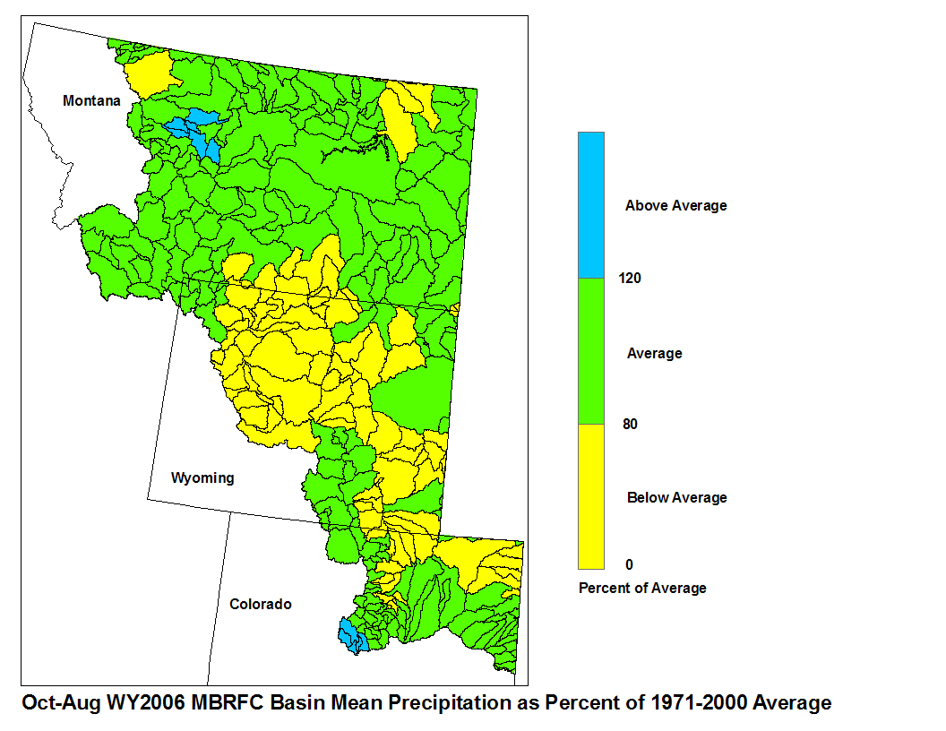
August 2006 Basin Mean Precipitation
Stored water in the South Platte Basin as of September 1 was 71
percent of average for this time of the year. Of the four major
irrigation reservoirs in Montana, Lima Reservoir had 123 percent
average storage; Clark Canyon was holding 50 percent of average water,
Gibson Reservoir had 19 percent of average stored water and Fresno
Reservoir had 57 percent of average stored water. Of the three
major hydroelectric reservoirs in Montana, Canyon Ferry and Fort
Peck had monthend storage in the average range; 95 and 61 percent
of average water, respectively. Bighorn reservoir was holding 73
percent of average stored water.
Runoff during August, as indicated by U.S. Geological Survey long
term gaging stations, was below average. The Marias River
near Shelby, Montana had 37 percent of average runoff.
The Yellowstone River was estimated to have had 63 percent of
average runoff at Corwin Springs, while at Billings, Montana
runoff was 43 percent of average.