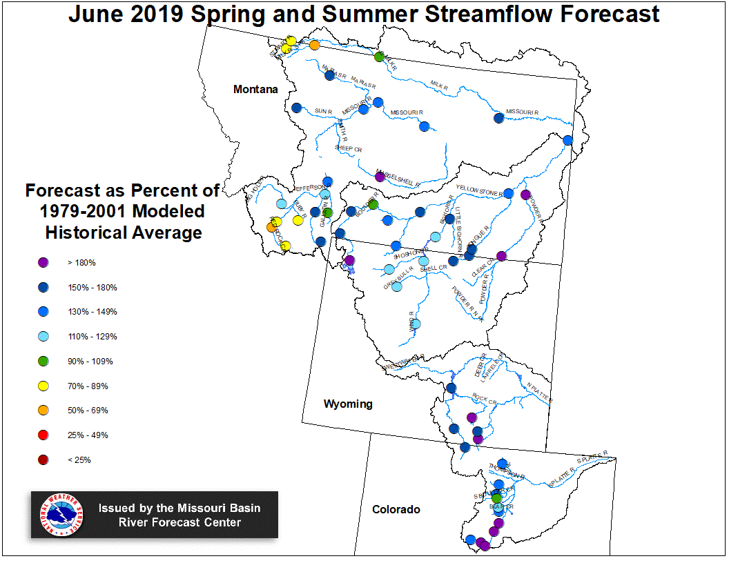
June 1, 2019 Spring and Summer Streamflow Forecasts
Upper Missouri Basin
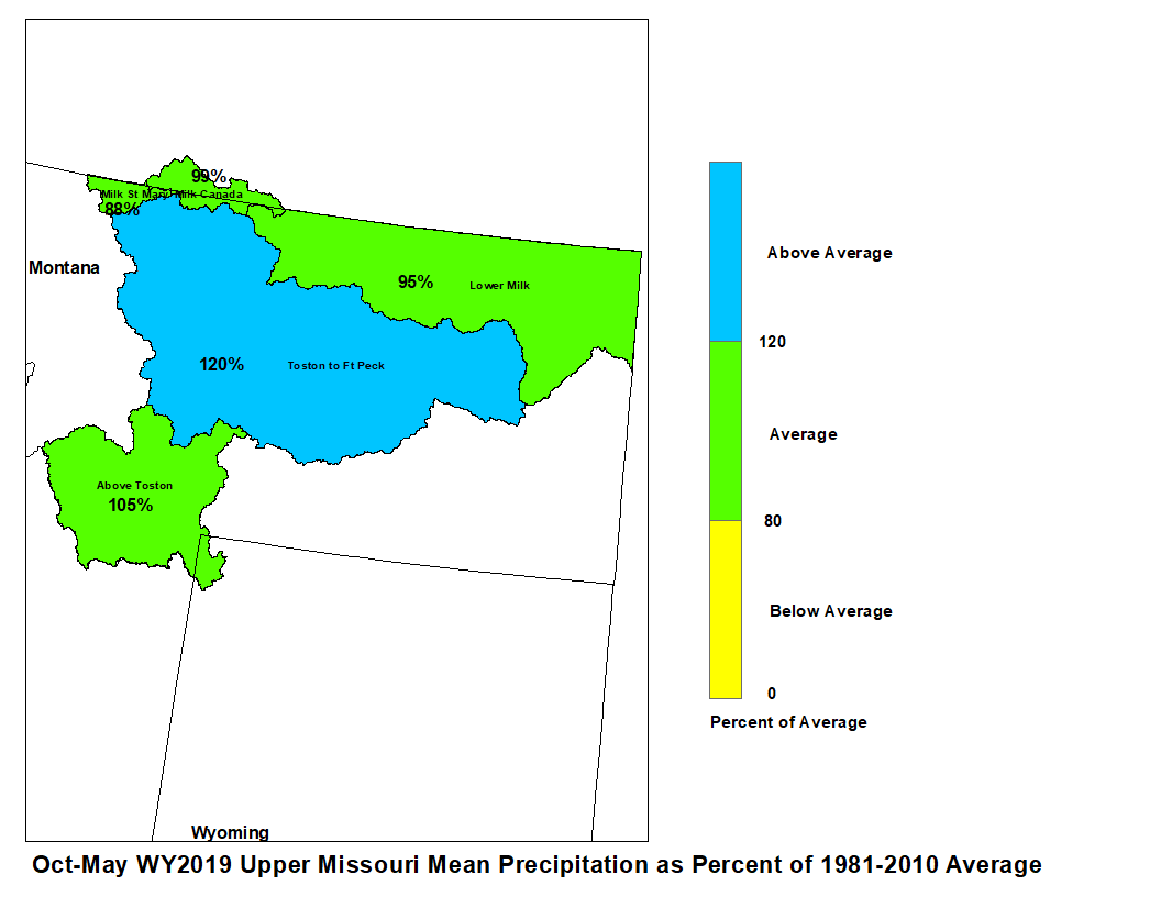
The high elevation snow pack in the Upper Missouri Basin as of June 1
was near to above average. The snow pack above Fort Peck, Montana was
123 percent. The snow pack in the St. Mary Basin was 73 percent.
May precipitation across the Upper Missouri Basin was near to above average.
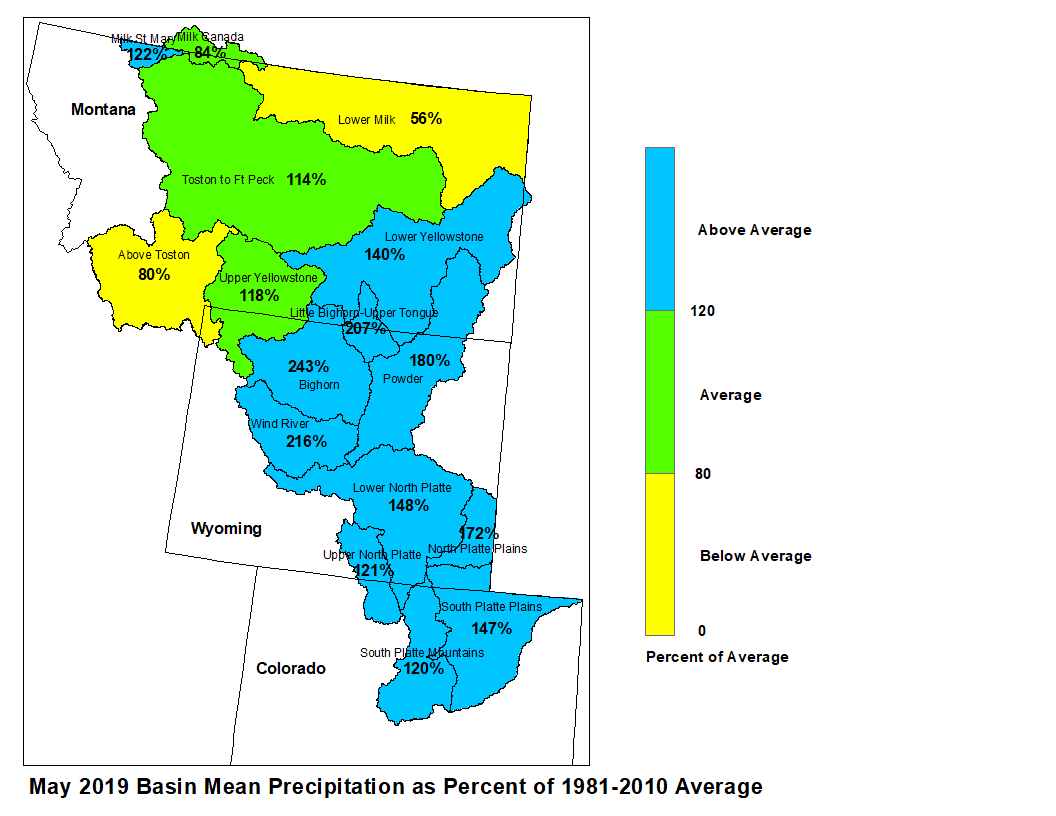
Basin precipitation summaries for the Missouri Basin include: Milk St. Mary,
122 percent; Milk Canada, 84 percent; Lower Milk, 56 percent; above Toston,
80 percent; Toston to Ft. Peck, 114 percent.
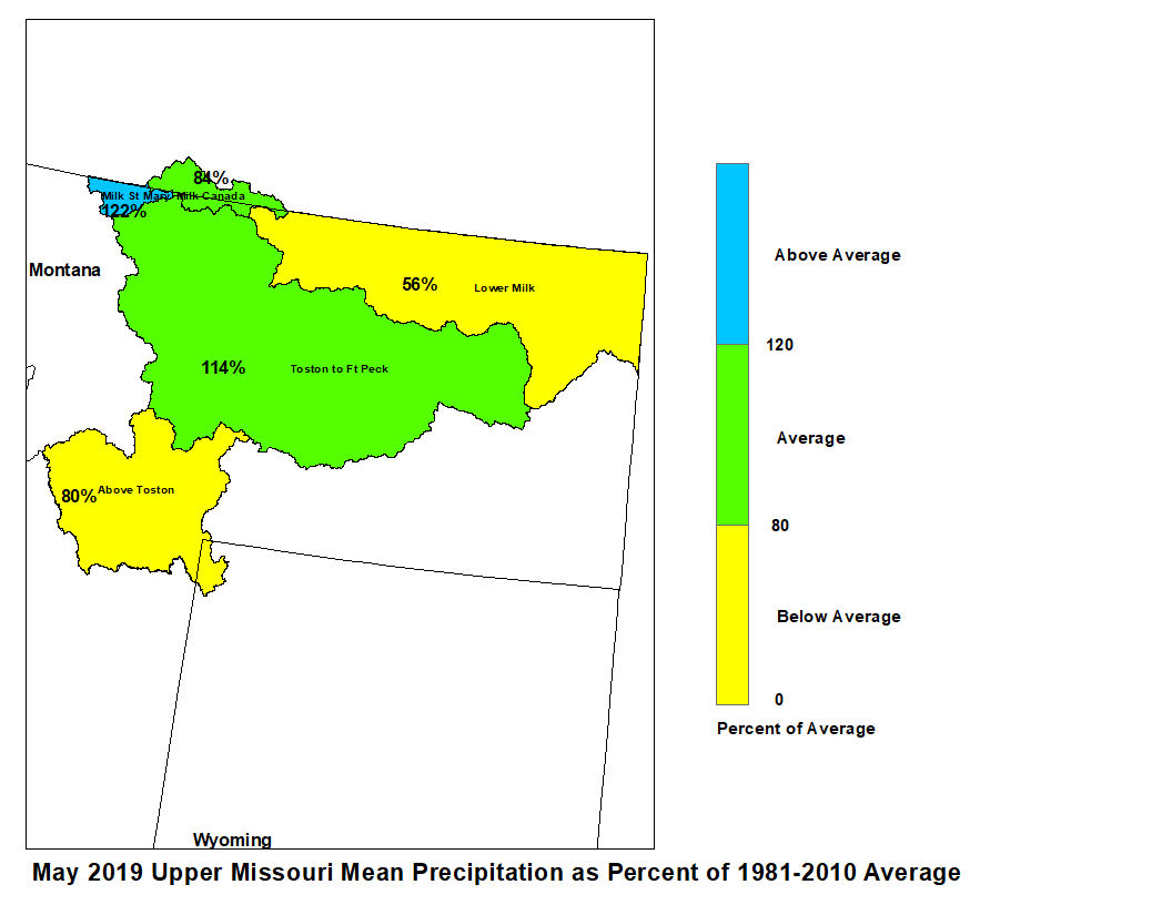
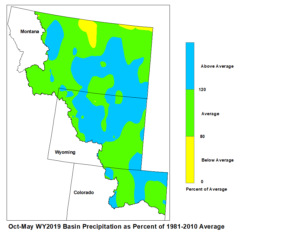
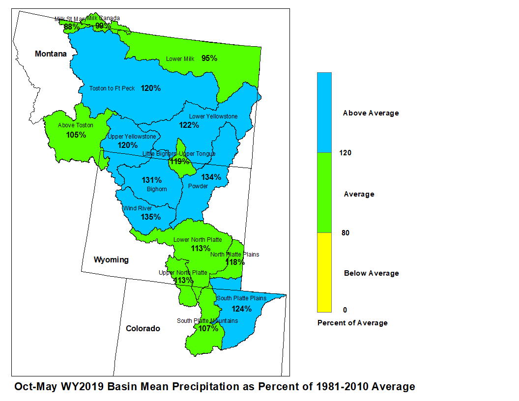
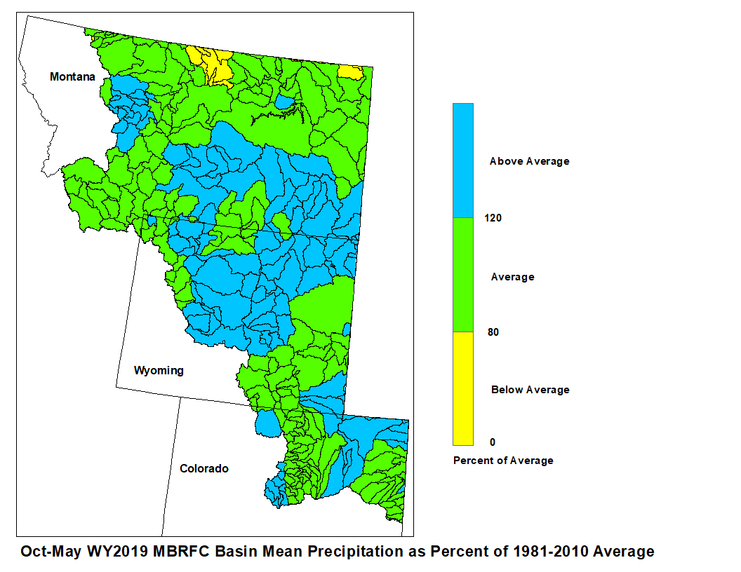
May 2019 Upper Missouri Mean Precip Oct-May WY2019 Upper Missouri Mean Precip
Stream flow in the Upper Missouri Basin is forecast to be
near to above average during the Spring and Summer.
The St. Mary River is forecast to have 85 percent of average
June-September flows. Runoff is expected to range around
140 percent of average for the Missouri Basin above Fort Peck,
Montana.
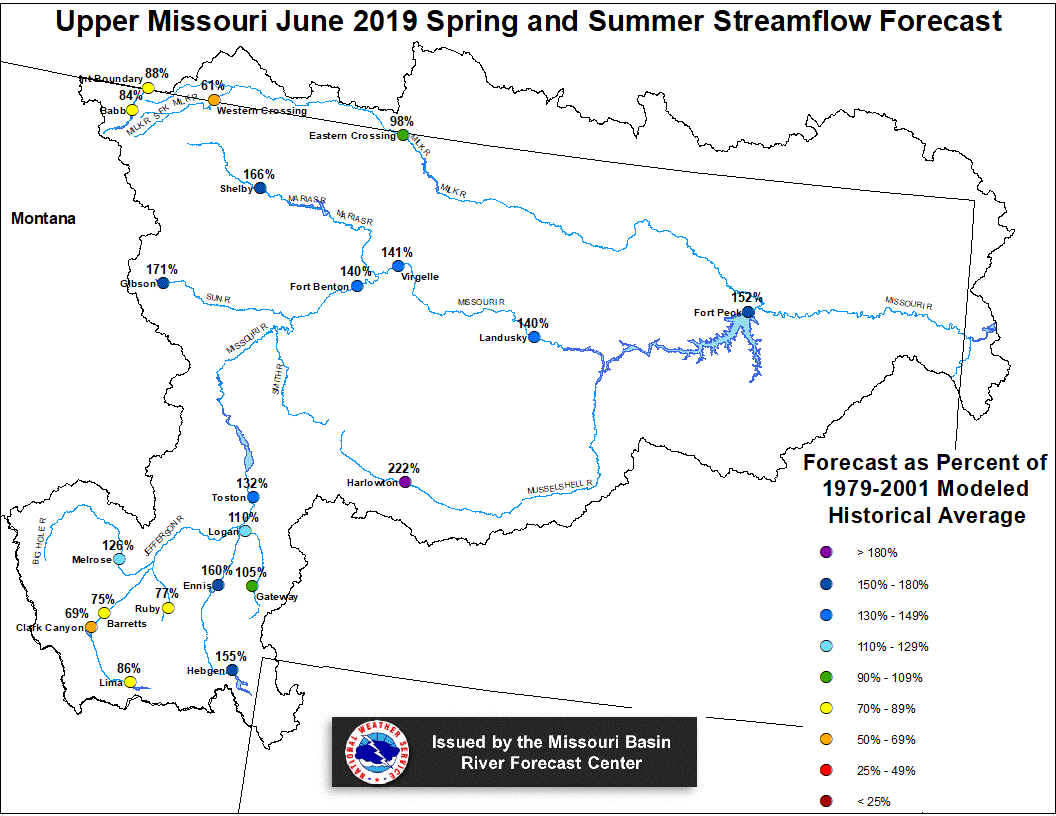
Upper Missouri June 1, 2019 Spring and Summer Streamflow Forecasts
Of the four major irrigation reservoirs in Montana; Lima
Reservoir had 118 percent average storage, Clark Canyon was
holding 119 percent of average water, Gibson Reservoir had 109
percent of average stored water, and Fresno Reservoir had
125 percent of average stored water.
The major hydroelectric reservoirs in Montana (Canyon Ferry and
Fort Peck), had monthend storage in the average to above
average range; 101 and 125 percent of average water, respectively.
Yellowstone Basin
The high elevation snow pack in the Yellowstone Basin was above average
on June 1. The snow pack in the Upper Yellowstone Basin was 133 percent
of average. The snow packs in the Wind, Bighorn, and Shoshone Basins were 301,
181, and 151 percent of average, respectively. The snow packs in the Tongue
and Powder basins were 305 and 244 percent of average, respectively.
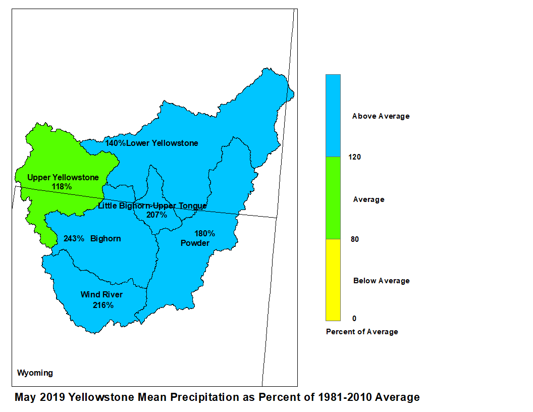
Precipitation during May was above average. The upper Yellowstone
River Basin received 118 percent of average precipitation while the
Lower Yellowstone River Basin reported 140 percent of average. The
Bighorn Basin received 243 percent of average precipitation while the
Wind River Basin received 216 percent of average. The Little Bighorn -
Upper Tongue Basin received 207 percent of average and the Powder River
had 180 percent of average precipitation.
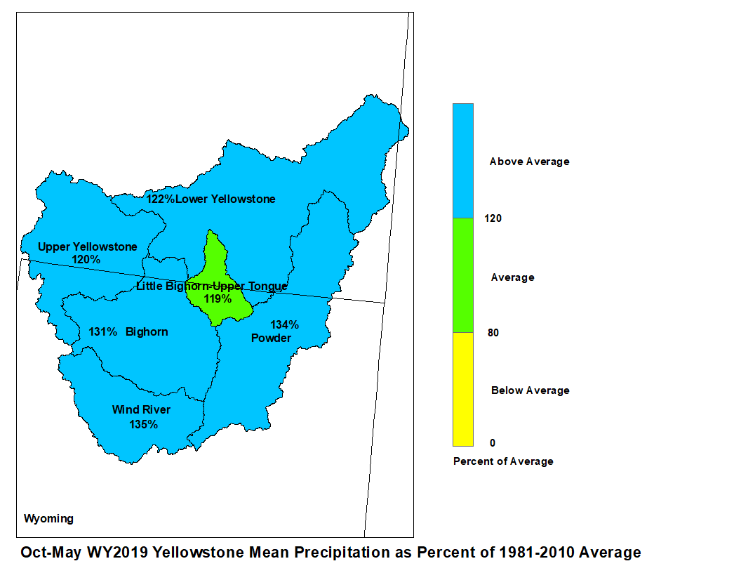
May 2019 Yellowstone Mean Precip Oct-May WY2019 Yellowstone Mean Precip
Forecast stream flow in the Yellowstone Basin is above average
for the Spring and Summer. Stream flow for the
Yellowstone River above Sidney, Montana is forecast to be about
150 percent of average. Flow in the Tongue Basin is expected to be
160 percent of average. Flows in the Powder River are expected
to be about 207 percent of average.
Monthend storage at Boysen Reservoir was 113 percent of average.
Stored water in Buffalo Bill Reservoir was 104 percent of average.
Monthend storage was 105 percent of average at Bighorn Reservoir.
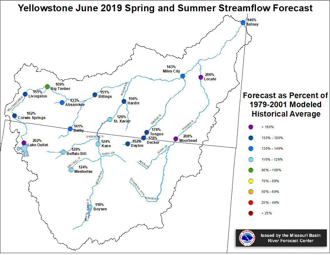
Yellowstone June 1, 2019 Spring and Summer Streamflow Forecasts
Platte Basin
The high elevation snow pack in the Upper North Platte Basin was
244 percent of average on June 1. The snow pack in the North Platte
Basin below Seminoe Reservoir was 173 percent of average. The snow
pack in the South Platte Basin was 392 percent of average.
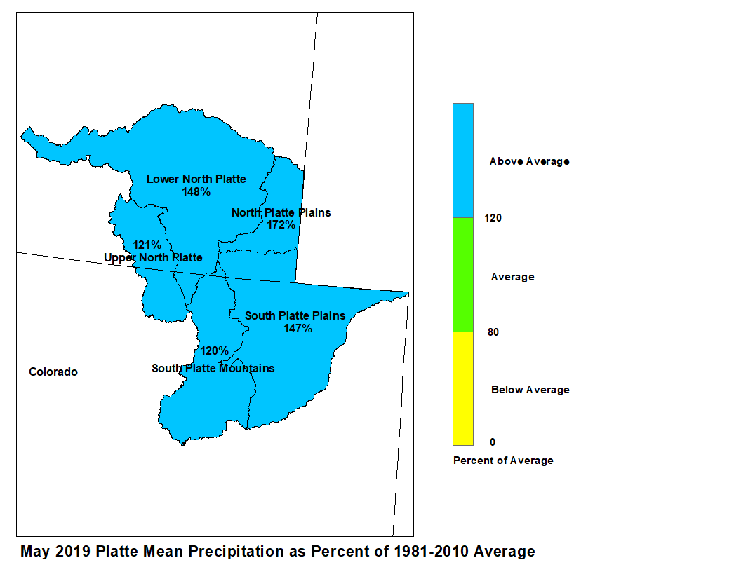
Precipitation during May in the Upper North Platte Basin was 121
percent of average. In the Lower North Platte Basin, precipitation
was 148 percent of average. The North Platte Plains below Guernsey
Reservoir had 172 percent. The South Platte Mountains had 120
percent whereas the Plains had 147 percent of average May
precipitation.
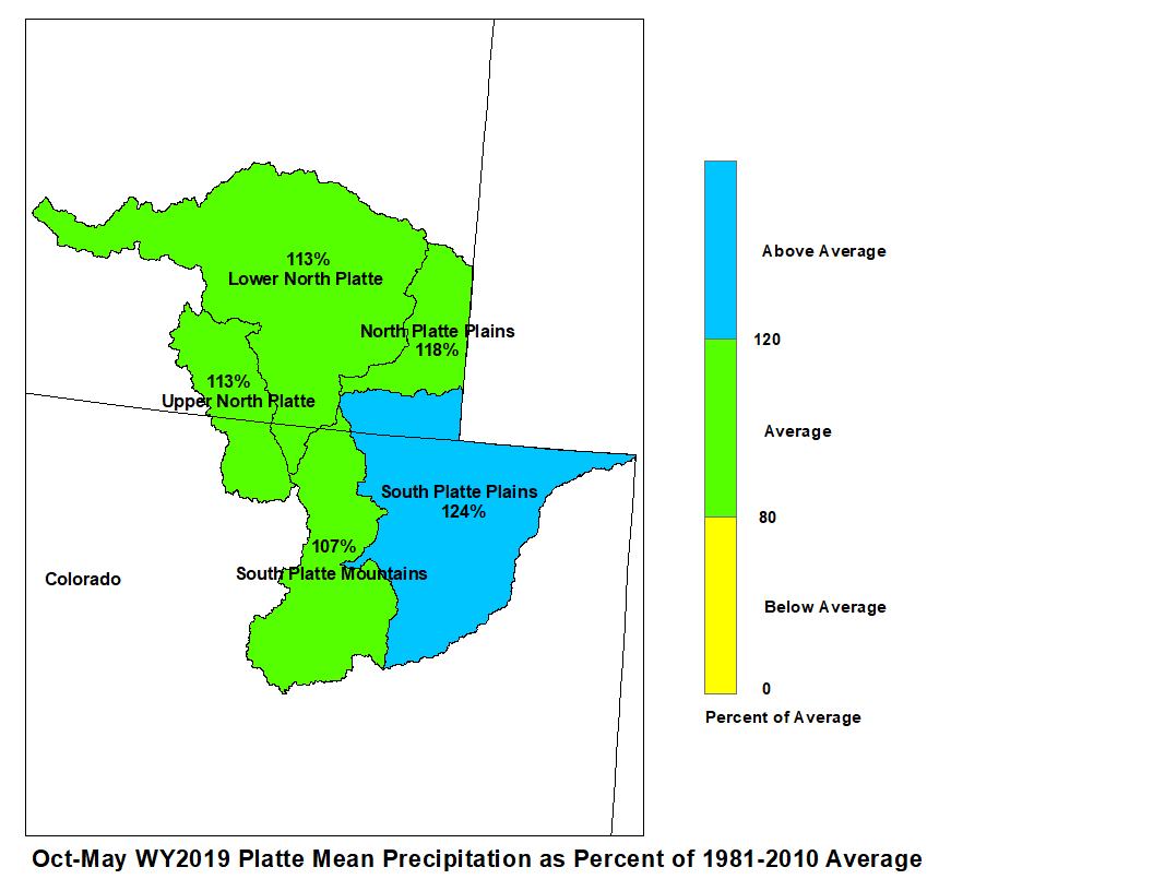
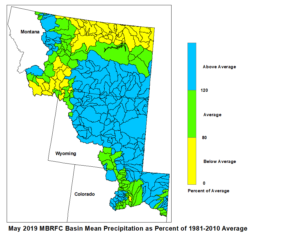
May 2019 Platte Mean Precip Oct-May WY2019 Platte Mean Precip
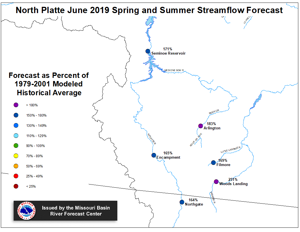
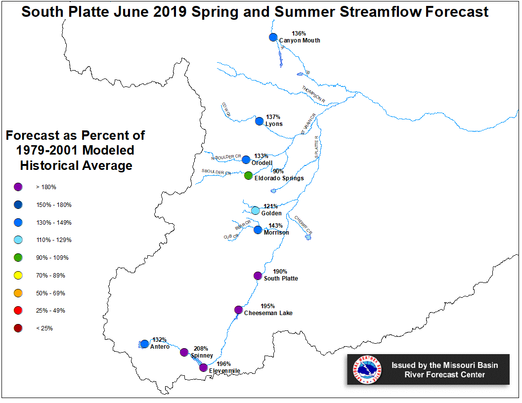
Stream flow in the Platte Basin is forecast to be above
average during the Spring and Summer. Runoff
for streams above Seminoe Reservoir are expected to be
about 175 percent of average. Streams in the South Platte
Basin above South Platte, Colorado can expect 190 percent
of average flow. For the remainder of the South Platte
basin, flows are expected near 135 percent.
Stored water in the South Platte Basin was 106 percent of average
on June 1.
North Platte Streamflow Fcst South Platte Streamflow Fcst

