June 1, 2017 Spring and Summer Streamflow Forecasts
Upper Missouri Basin
The high elevation snow pack in the Upper Missouri Basin as of June 1
was near to above average. The snow pack above Fort Peck, Montana was
100 percent. The snow pack in the St. Mary Basin was 135 percent, and the
Milk River Basin was 135 percent.
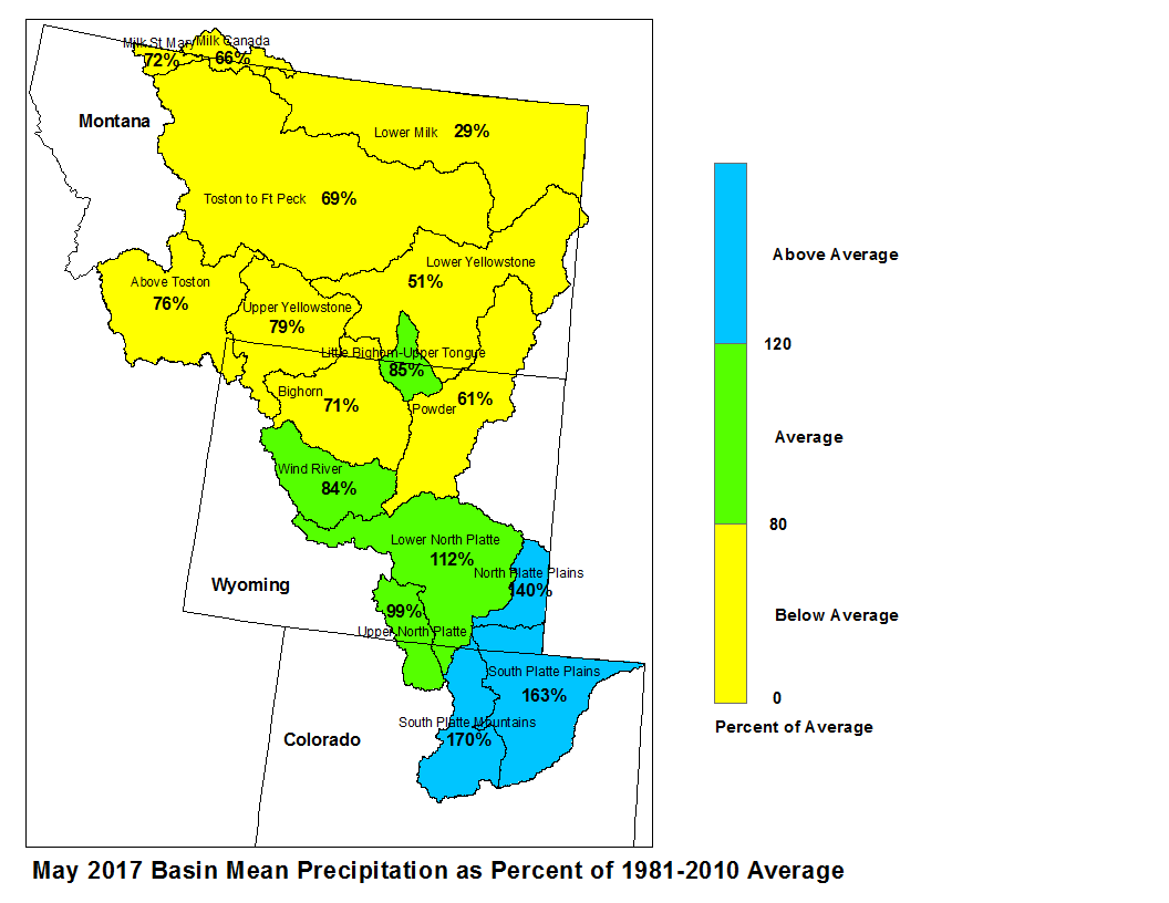
May precipitation across the Upper Missouri Basin was below average.
Basin precipitation summaries for the Missouri Basin include: Milk St. Mary,
72 percent; Milk Canada, 65 percent; Lower Milk, 29 percent; above Toston,
77 percent; Toston to Ft. Peck, 67 percent.
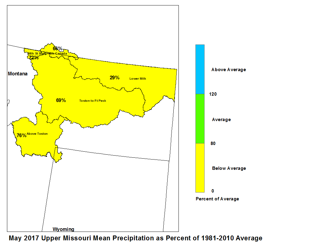
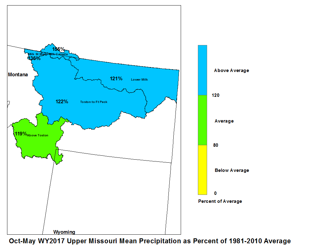
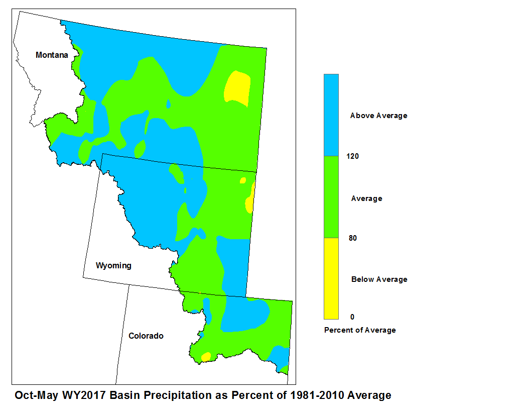
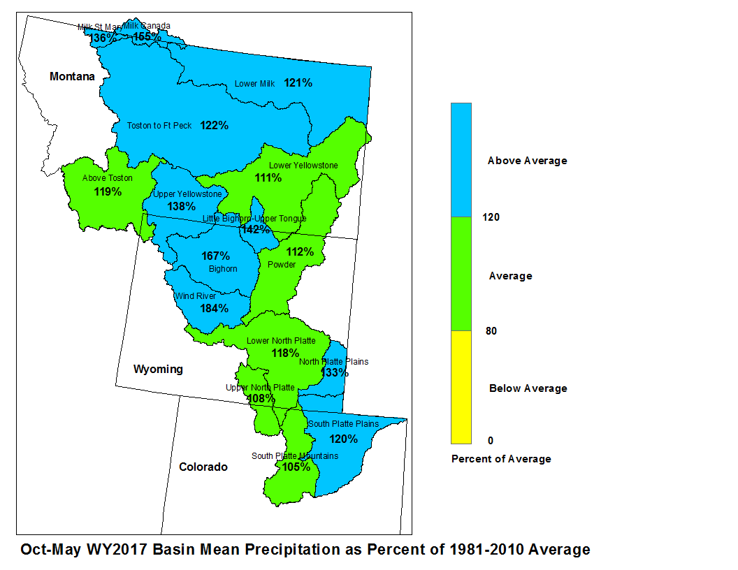
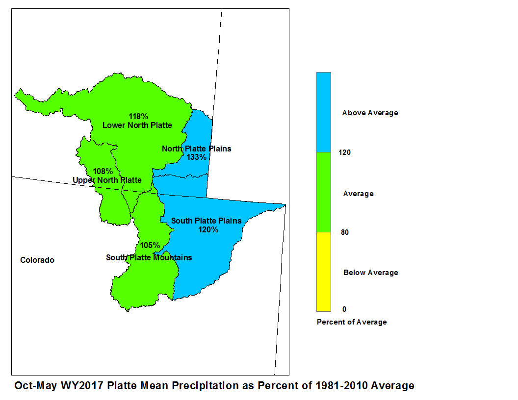
May 2017 Upper Missouri Mean Precip Oct-May WY2017 Upper Missouri Mean Precip
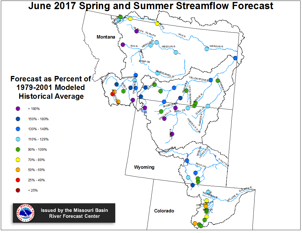
Stream flow in the Upper Missouri Basin is forecast to be
above average during the upcoming Spring and Summer.
Runoff is expected to range around 120 percent of average
for the Missouri Basin above Fort Peck, Montana.
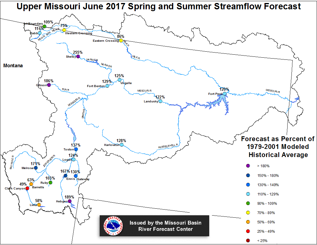
Upper Missouri June 1, 2017 Spring and Summer Streamflow Forecasts
Of the four major irrigation reservoirs in Montana; Lima
Reservoir had 123 percent average storage, Clark Canyon was
holding 104 percent of average water, Gibson Reservoir had 101
percent of average stored water, and Fresno Reservoir had
99 percent of average stored water.
The major hydroelectric reservoirs in Montana (Canyon Ferry and
Fort Peck), had monthend storage in the average to above
average range; 102 and 120 percent of average water, respectively.
Yellowstone Basin
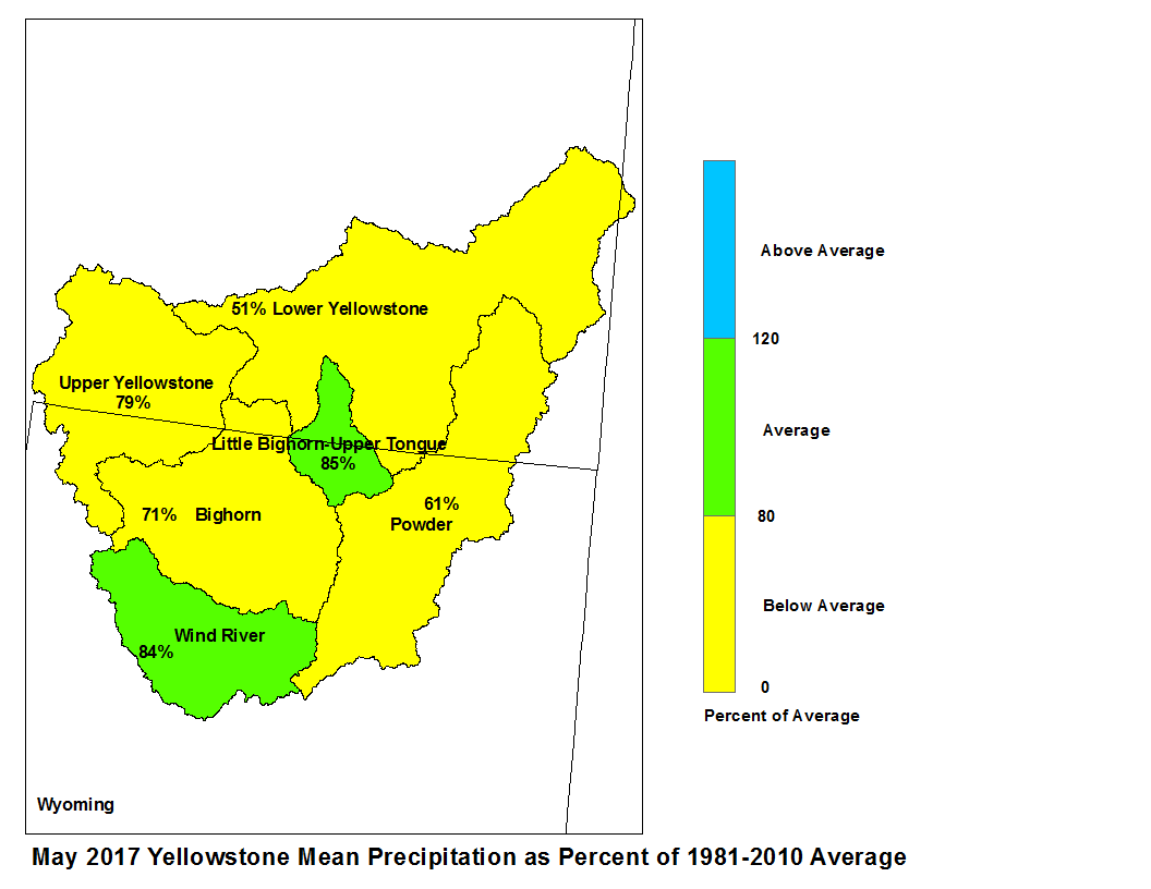
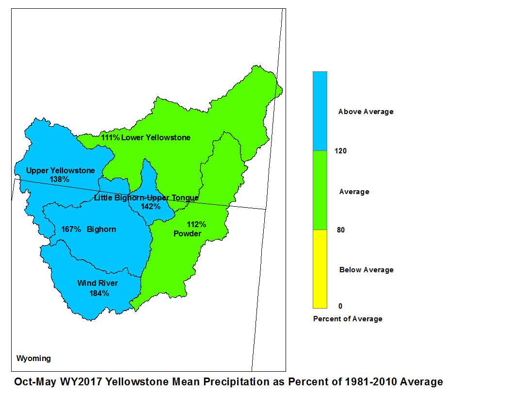
The high elevation snow pack in the Yellowstone Basin was above average
on June 1. The snow pack in the Upper Yellowstone Basin was 143 percent
of average. The snow packs in the Wind, Bighorn, and Shoshone Basins were 441,
170, and 153 percent of average, respectively. The snow packs in the Tongue
and Powder basins were 352 and 300 percent of average, respectively.

Precipitation during May was below average. The upper Yellowstone
River Basin received 79 percent of average precipitation while the
Lower Yellowstone River Basin reported 52 percent of average. The
Bighorn Basin received 71 percent of average precipitation while the
Wind River Basin received 84 percent of average. The Little Bighorn -
Upper Tongue Basin received 81 percent of average and the Powder River
had 60 percent of average precipitation.
May 2017 Yellowstone Mean Precip Oct-May WY2017 Yellowstone Mean Precip
Forecast stream flow in the Yellowstone Basin are above average
for the upcoming Spring and Summer.  Stream flow for the
Yellowstone River above Sidney, Montana is forecast to be
about 160 percent of average.  Flow in the Tongue Basin is expected
to be 103 percent of average.  Flows in the Powder River are expected
to be about 110 percent of average.

Monthend storage at Boysen Reservoir was 89 percent of average.
Stored water in Buffalo Bill Reservoir was 86 percent of average.
Monthend storage was 85 percent of average at Bighorn Reservoir.
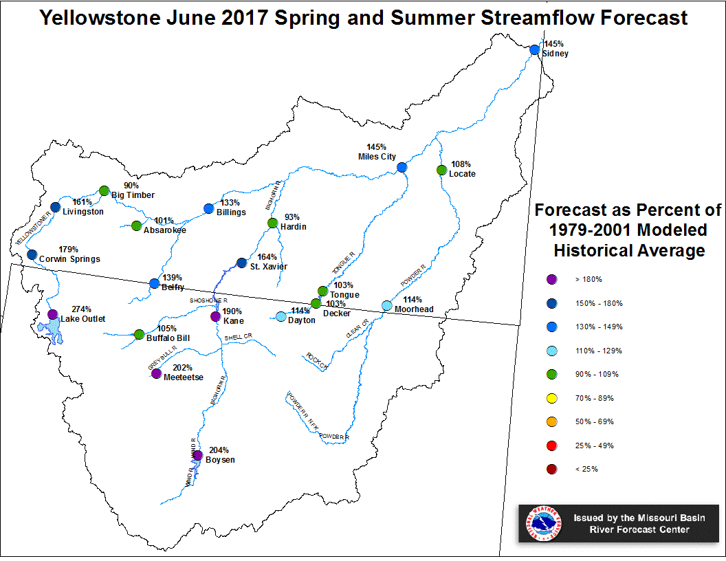
Yellowstone June 1, 2017 Spring and Summer Streamflow Forecasts
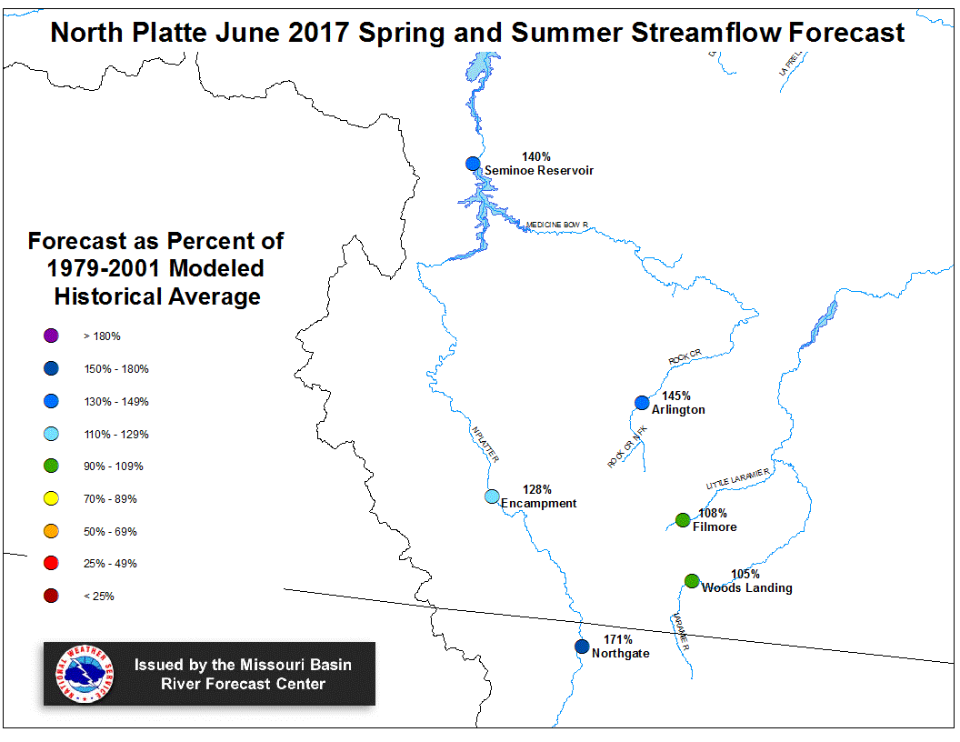
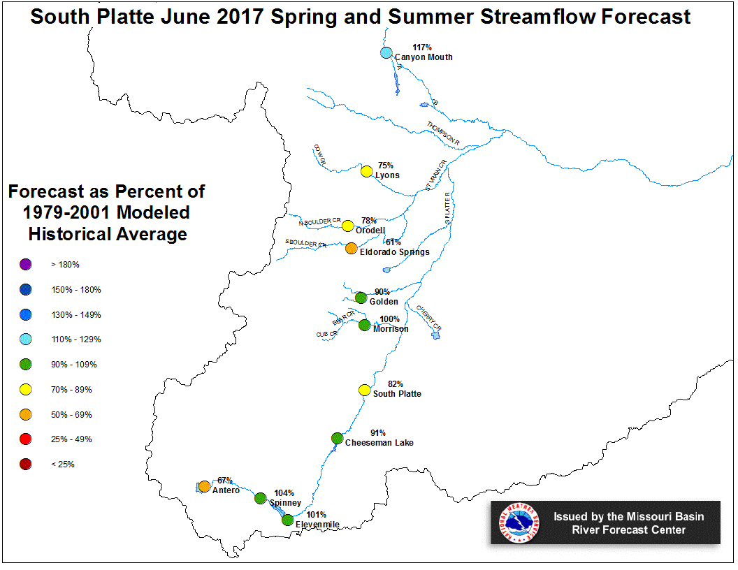
Platte Basin
The high elevation snow pack in the Upper North Platte Basin was
137 percent of average on June 1.  The snow pack in the North Platte
Basin below Seminoe Reservoir was 159 percent of average.  The snow
pack in the South Platte Basin was 177 percent of average.

Precipitation during May in the Upper North Platte Basin was 99
percent of average.  In the Lower North Platte Basin, precipitation
was 112 percent of average.  The North Platte Plains below Guernsy
Reservoir had 140 percent.  The South Platte Mountains had 170
percent whereas the Plains had 162 percent of average May precipitation.
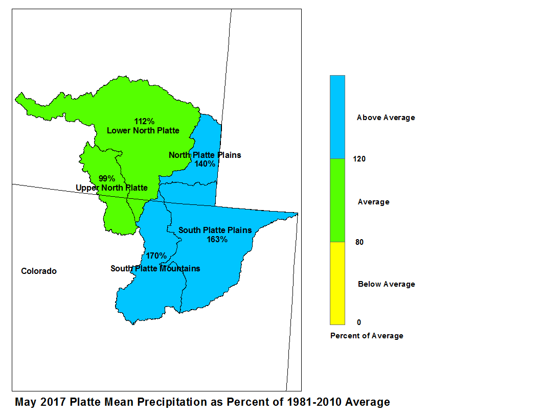
May 2017 Platte Mean Precip Oct-May WY2017 Platte Mean Precip
Stream flow in the Platte Basin is forecast to be near
average during the upcoming Spring and Summer. Runoff
for streams above Seminoe Reservoir are expected to be
about 140 percent of average. Streams in the South Platte
Basin above South Platte, Colorado can expect 98 percent
of average flow. For the remainder of the South Platte
basin, flows are expected near 85 percent.
Stored water in the South Platte Basin was 112 percent of average
on June 1.
North Platte Streamflow Fcst South Platte Streamflow Fcst