Runoff for most streams in the Missouri Basin are forecast to
be average to below average. The high elevation snow pack in the
Missouri basin is generally below average for this time of the year,
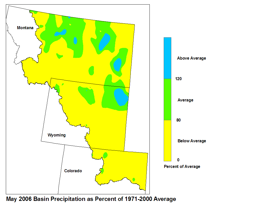
at least in part due to an early melt season. Precipitation in the
Missouri basin was at the low end of average or below average
everywhere in the forecasted basins. The Wind River Basin was the
extreme with 21 percent of average precipitation.
Upper Missouri Basin
The high elevation snow pack in the Upper Missouri Basin as of
June 1 was below average. The snow pack above Toston, Montana
was 65 percent of average. The snow pack between Toston and Fort
Peck, Montana was 42 percent. The snow pack in the St Mary and
Milk river basins was 91 percent.
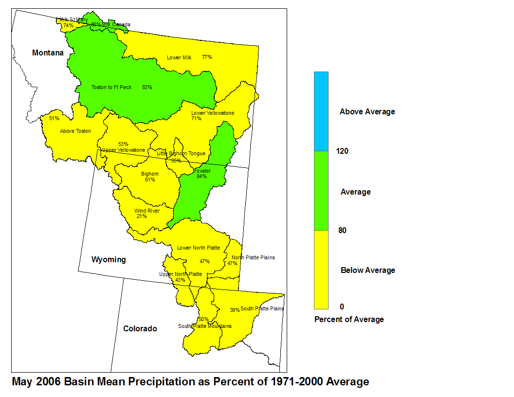
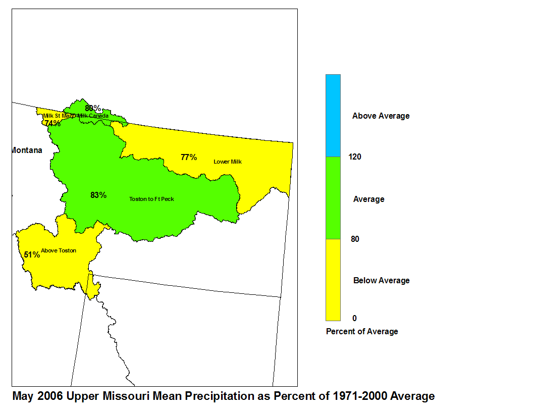
May precipitation above Toston was below average with 51 percent of
normal. From Toston to Ft. Peck precipitation was below average at 83
percent of normal. The St. Mary and Milk river basins were also below
normal with 74 and 80 percent of normal precipitation, respectively.
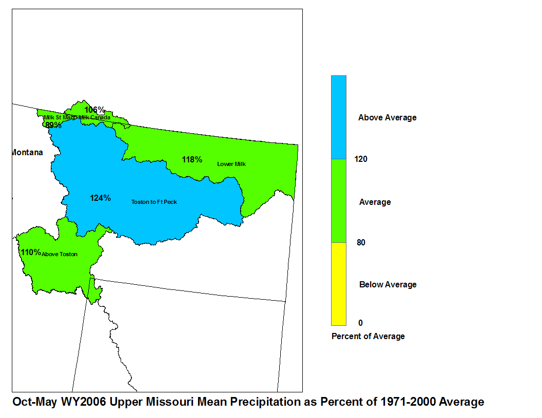
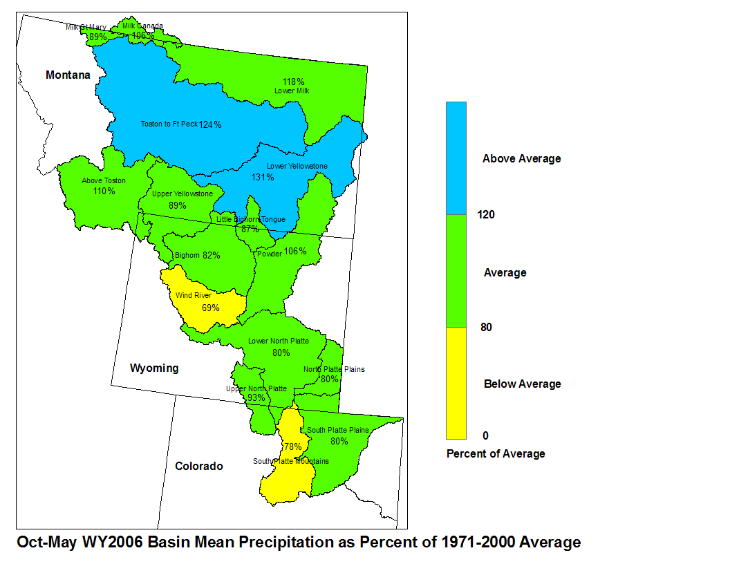
May 2006 Upper Missouri Mean Precip Oct-May WY2006 Upper Missouri Mean Precip
The St. Mary River is forecast to have 83 percent of average June-
September flows. Runoff is expected to range around 105 percent of
average for the Missouri Basin above Fort Peck, Montana. Forecasts
for the Milk River Basin call for 83 to 107 percent of average
runoff.
Of the four major irrigation reservoirs in Montana: Lima Reservoir
had 118 percent average storage, Clark Canyon was holding 68 percent of
average water, Gibson Reservoir had 108 percent of average stored
water, and Fresno Reservoir had 95 percent of average stored water.
The major hydroelectric reservoirs in Montana (Canyon Ferry and Fort
Peck) had monthend storage in the average to below average range; 94 and
63 percent of average water, respectively.
As indicated by the U.S. Geological Survey long term gaging stations,
the Marias River near Shelby, Montana had an estimated 82 percent
of average runoff in May.
Yellowstone Basin
The high elevation snow pack in the Yellowstone Basin was mostly
below average on June 1. The snow pack in the Upper Yellowstone
Basin was 53 percent of average. The snow packs in the Wind,
Bighorn, and Shoshone Basins were 24, 20, and 31 percent of
average, respectively. There were no remaining snow packs in either
the Tongue or Powder basins, making both basins below average.
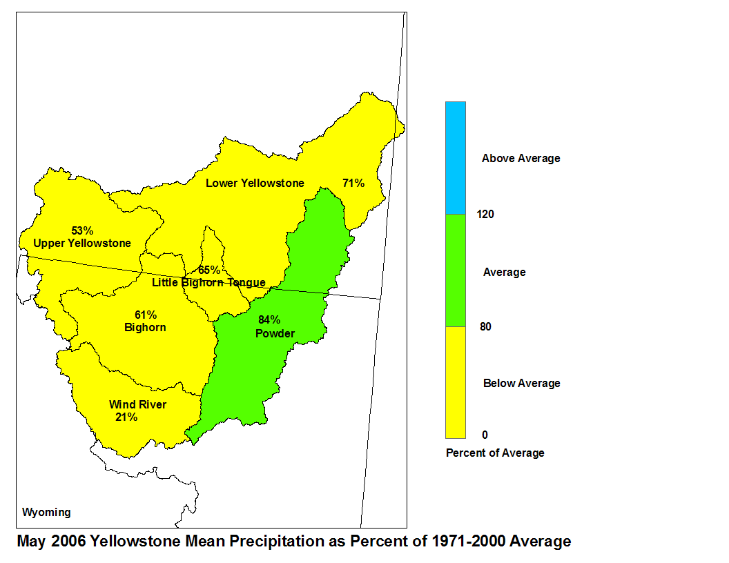
Precipitation during the month of May was about 21 percent of
average in the Wind River Basin above Boysen Reservoir, 53 percent
of average in the Upper Yellowstone Basin, 61 and 65 percent of
average in the Bighorn and Little Bighorn Basins, respectively,
84 percent of average in the Powder-Tongue basins, and 71 percent
of average in the lower Yellowstone Basin.
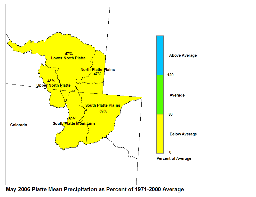
Platte Basin
The high elevation snow pack in the Upper North Platte Basin was
48 percent of average on June 1. The snow pack in the North Platte
Basin below Seminoe Reservoir was 1 percent of average. The snow
pack in the South Platte Basin was 21 percent.
Precipitation, during May, in North Platte Basin above Seminoe
Reservoir was 43 percent average. Precipitation in the North
Platte Basin between Seminoe Reservoir and Guernsey Reservoir was
47 percent of average. The North Platte basin below Guernsey
Reservoir had 47 percent of average precipitation. The high
elevations of the South Platte Basin had 50 percent of average
precipitation whereas the plains had 39 percent of average
precipitation.