Missouri River Basin Streamflow Forecast Missouri River Basin Mountain Snowpack
Upper Missouri Basin
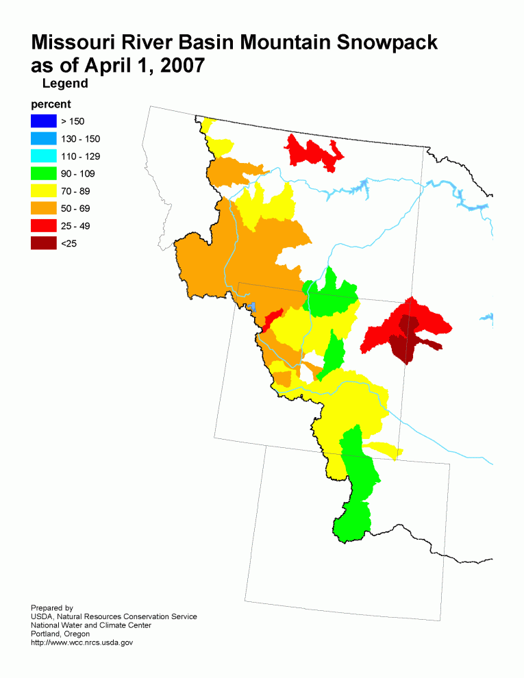
The high elevation snow pack in the Upper Missouri Basin as of
April 1 was below average.  The snow pack above Toston,  Montana
was 70 percent of average.  The snow pack between Toston and Fort
Peck, Montana was 74 percent.  The snow pack in the St Mary and
Milk river basins was 72 percent.
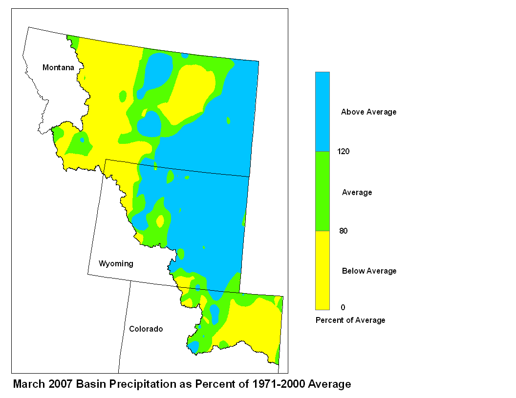
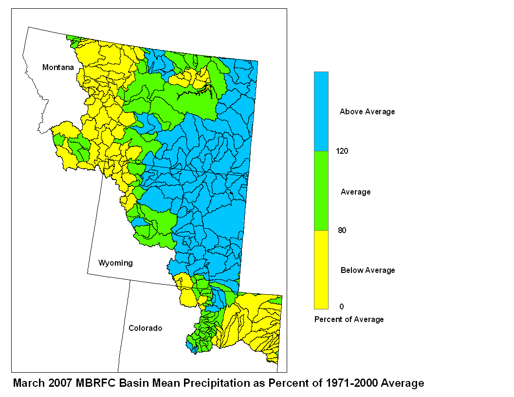
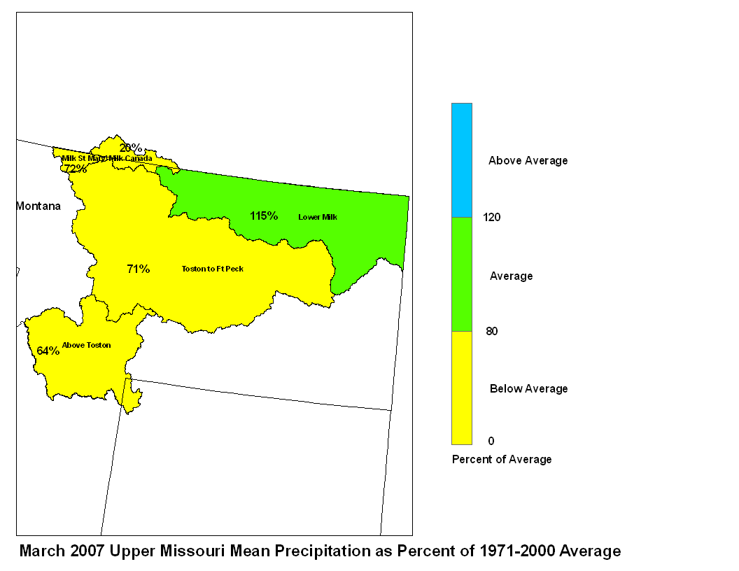
March precipitation was below average across most of the Upper
Missouri Basin.  Only the Lower Milk was above average. Basin
precipitation summaries for the Missouri Basin include: Milk St.
Mary,  72 percent; Milk Canada, 20 percent; Lower Milk, 115
percent; Above Toston, 64 percent; Toston to Ft. Peck, 71 percent.
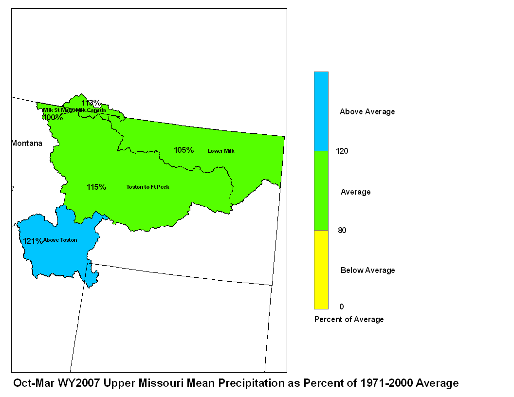
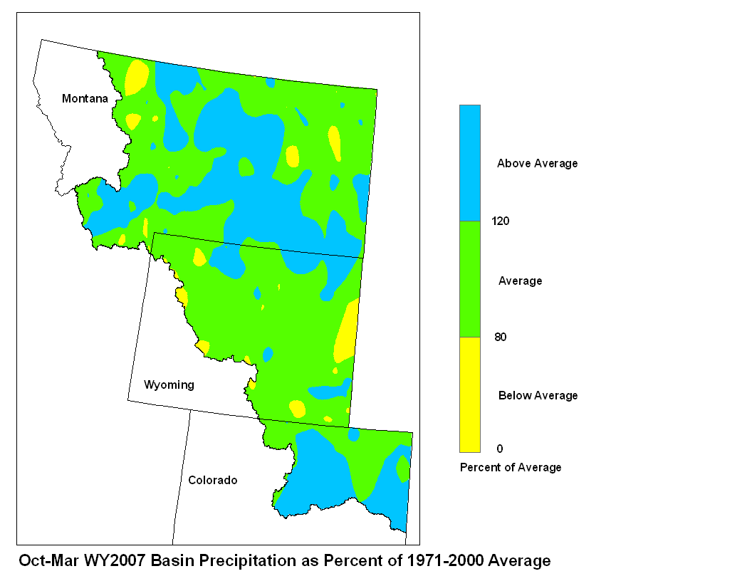
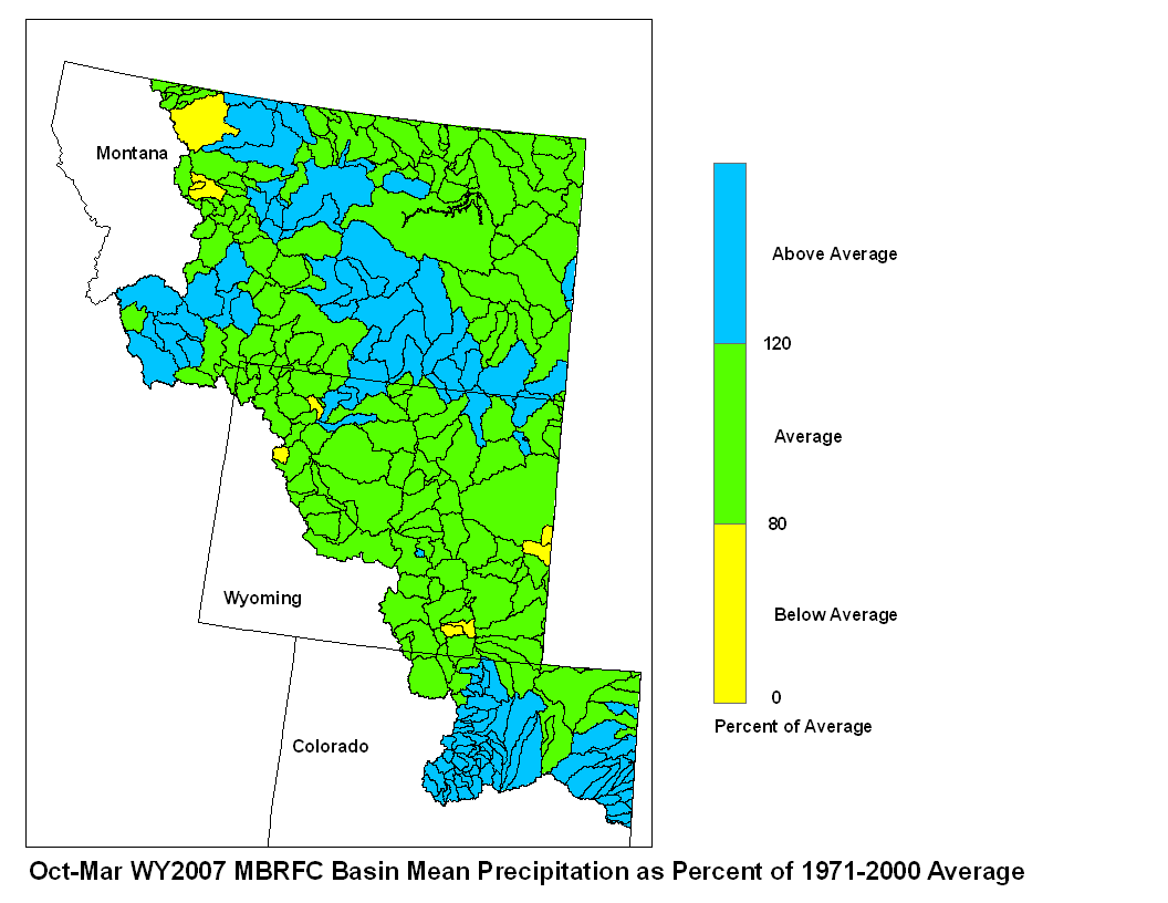
March 2007 Upper Missouri Mean Precip Oct-Mar WY2007 Upper Missouri Mean Precip
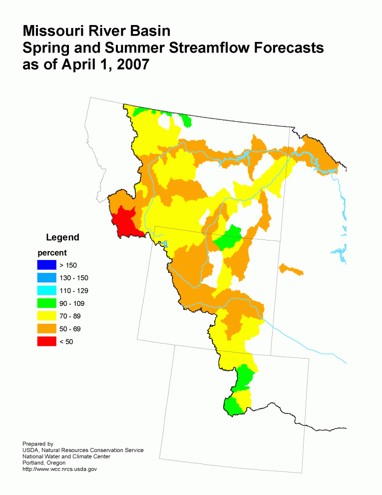
Stream flow in the Upper Missouri Basin is forecast to be below
average during the upcoming spring and summer. The St. Mary River
is forecast to have 89 percent of average April-September flows.
Runoff is expected to range around 70 percent of average for the
Missouri Basin above Fort Peck, Montana. Forecasts for the Milk
River Basin call for around 95 percent of average spring summer
runoff.
Of the four major irrigation reservoirs in Montana: Lima Reservoir
had 126 percent of average storage, Clark Canyon was holding 83
percent of average water, Gibson Reservoir had 112 percent of
average stored water, and Fresno Reservoir had 100 percent of
average stored water. The major hydroelectric reservoirs in
Montana (Canyon Ferry and Fort Peck) had monthend storage in the
average to below average range; 107 and 57 percent of average
water, respectively.
As indicated by the U.S. Geological long term gaging stations,
the Marias River near Shelby, Montana had an estimated 112 percent
of average runoff in March.
Yellowstone Basin
The high elevation snow pack in the Yellowstone Basin was mostly
below average on April 1. The snow pack in the Upper
Yellowstone Basin was 67 percent of average. The snow packs in
the Wind, Bighorn, and Shoshone Basins were 70, 75, and 62 percent
of average, respectively. The snow packs in the Tongue and Powder
basins were 103 and 90 percent of average, respectively.
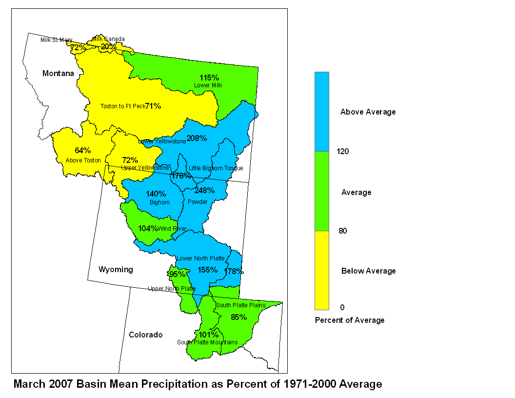
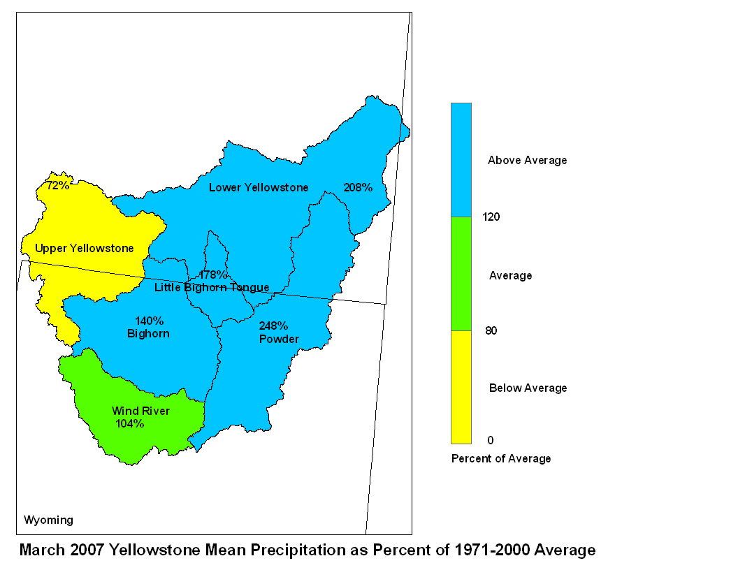
Precipitation for the month of March varied from small but well
above average amounts at low elevations to well below average in
some critical, high elevation Yellowstone sub-basins. Precipitation
was about 104 percent of average in the Wind River Basin above
Boysen Reservoir, 140 percent of average in the Bighorn Basin, and
178 percent of average in the Little Bighorn/Tongue Basin. The
Powder River Basin received 248 percent of average March precipi-
tation, bringing it to a slightly above average 111% for the water
year. March precipitation was 72 percent of average in the upper
Yellowstone Basin (above Billings) and 208 percent of average in
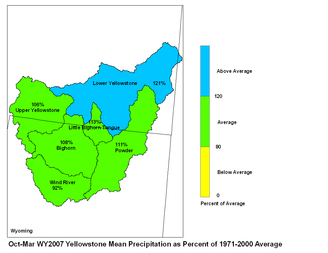
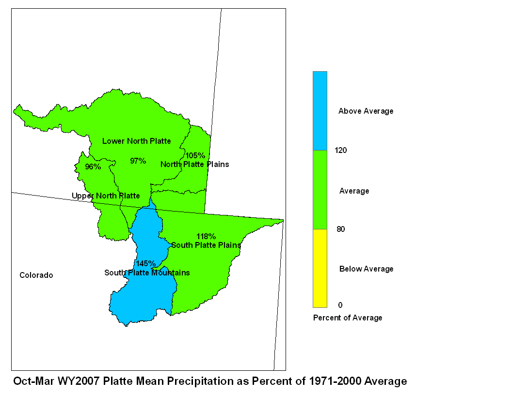
the Lower Yellowstone Basin. For the water year to date, only the
Wind and North Platte Basins are below 100 percent of average
precipitation, and they are near average. Average to above average
seasonal precipitation has not resulted in above average snowpacks
in most basins.
Stream flow in the Yellowstone Basin is forecast to be mostly below
average during the upcoming spring and summer. Runoff at Billings
Montana is expected to be 79 percent of average, with a probable
range between 53 and 105 percent of average. Stream flow for the
Wind-Bighorn Basin above St. Xavier, Montana is forecast to be 61
percent of average with a probable range of 17 to 90 percent of
average flow in sub-basins. Flow in the Tongue Basin is expected
to be 96 to 102 percent of average with a reasonably likely range
of 55 to 136 percent of average flow. Flows in the Powder River
are expected to be about 62 percent of average with a reasonably
likely range of 18 to 109 percent.

Monthend storage was 65 percent of average in Boysen Reservoir and
97 percent of average in Buffalo Bill Reservoir in Wyoming.
Monthend storage was 97 percent of average at Bighorn Reservoir on
the Wyoming/Montana border. The USGS characterizes statewide
reservoir storage in Montana as mostly near normal.

Runoff during March in the Yellowstone River was 114 percent
of the 1971 to 2000 average at Corwin Springs and 95 percent
of that average at Billings.
Platte Basin
The high elevation snow pack in the Upper North Platte basin was
77 percent of average. The snow pack in the North Platte Basin
below Seminoe Reservoir was 84 percent of average. The snow pack
in the South Platte Basin was 100 percent of average.
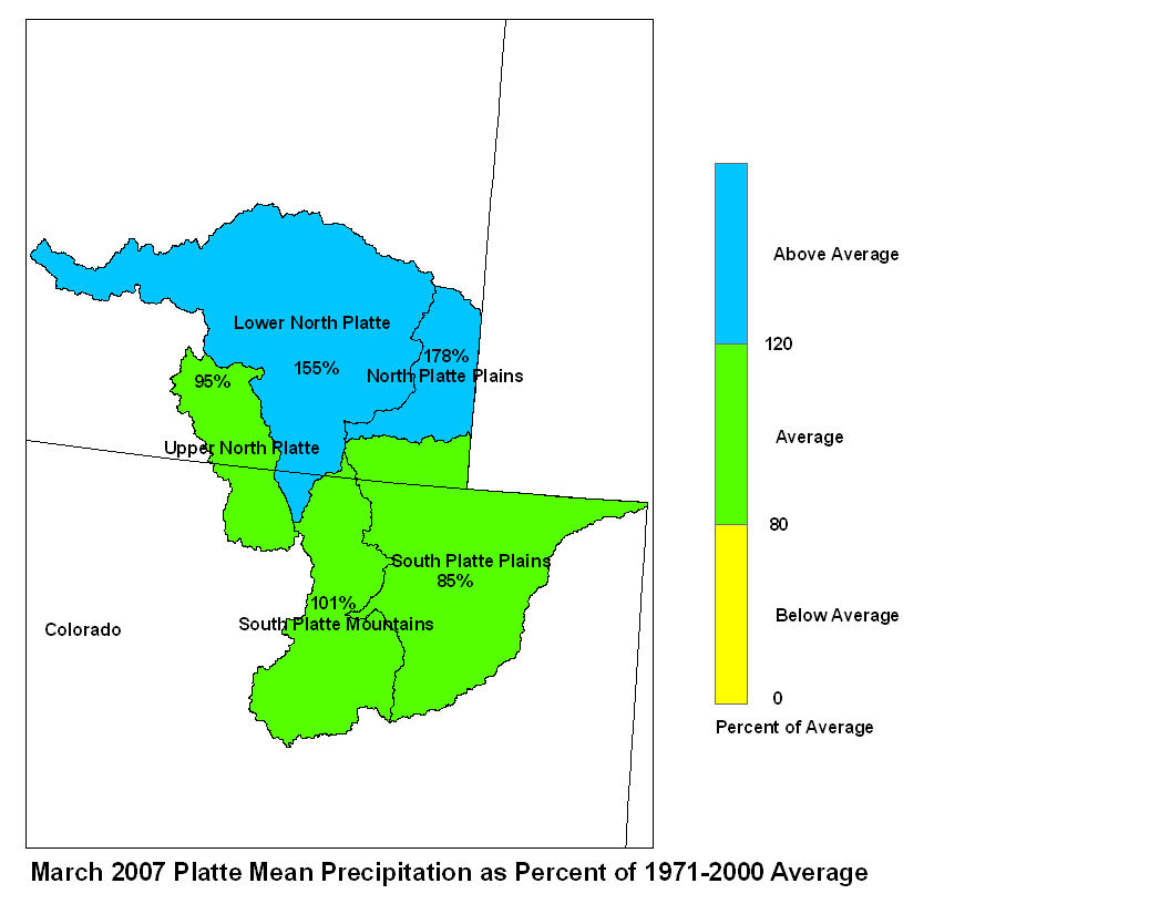
Precipitation across the Platte Basin was average to above average
for the month of March. Precipitation in the North Platte Basin
above Seminoe Reservoir was 95 percent of average. In the North
Platte Basin between Seminoe Reservoir and Guernsy Reservoir
precipitation was 155 percent of average. The North Platte Basin
below Guernsy Reservoir had 178 percent of average precipitation.
The high elevations of the South Platte Basin had 101 percent of
average precipitation whereas the plains had 85 percent of average
March precipitation.
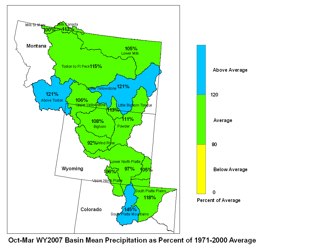
March 2007 Platte Mean Precip Oct-Mar WY2007 Platte Mean Precip
Stream flow in the Platte basin is forecast to range from below
average to above average during the upcoming spring and summer.
Runoff for streams above Seminoe Reservoir are expected to be about
74 to 75 percent of average.  Stream flows for the North  Platte
below Seminoe Reservoir are forecast to be 56 to 72 percent of
average, except for the Laramie River which forecast to have runoff
93 percent of average runoff.  The South Platte Basin above South
Platte, Colorado can expect about 82 to 92 percent of average flow.
For the remainder of the South Platte Basin flows are expected to
be about average.

Stored water in the North Platte Basin as of April 1 was 63 percent
of average.