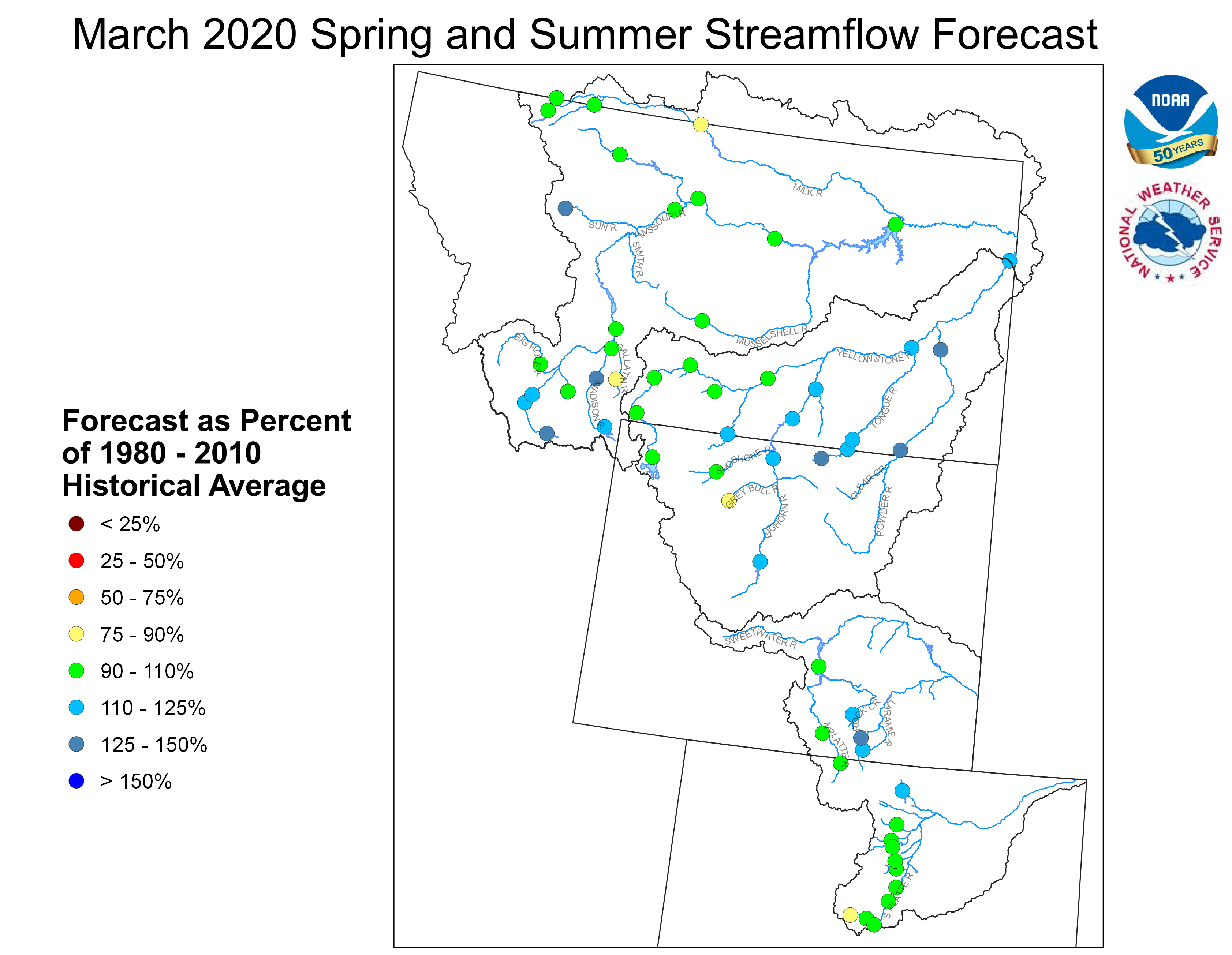
March 1, 2020 Spring and Summer Streamflow Forecasts
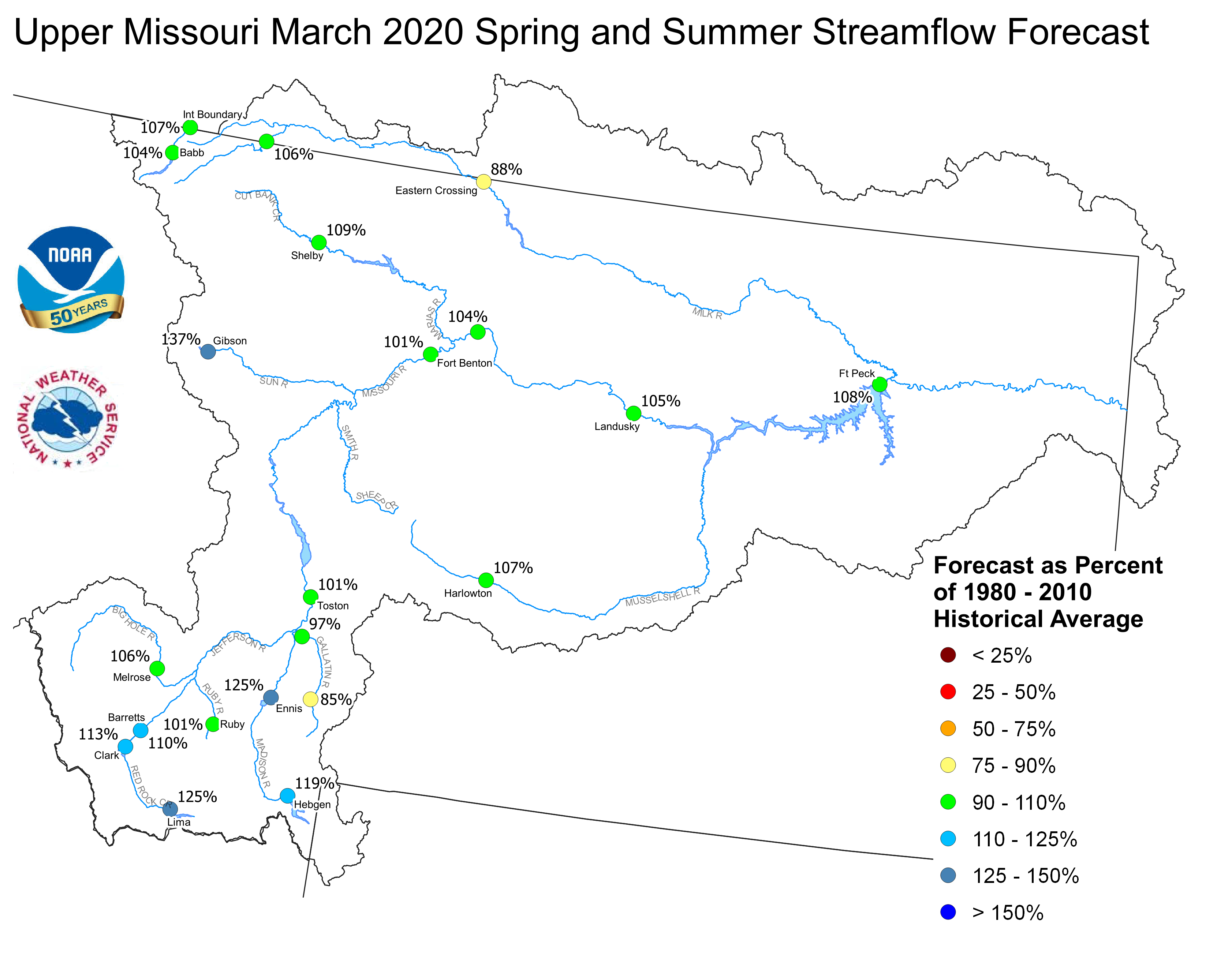
Upper Missouri Basin
The high elevation snow pack in the Upper Missouri Basin as of March 1 was near to above average. The snow pack above Fort Peck, Montana was 122 percent. The snow pack in the St. Mary Basin was 124 percent, and the Milk River Basin was 165 percent.
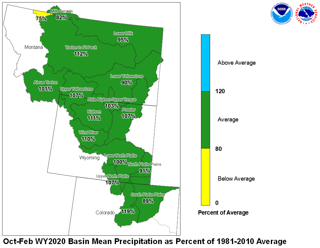
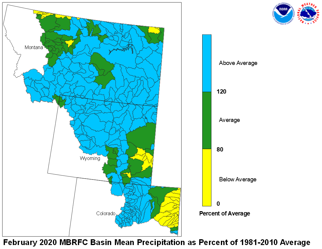
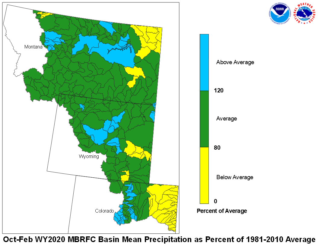
February precipitation across the Upper Missouri Basin was above average. Basin precipitation summaries for the Missouri Basin include: Milk St. Mary, 69 percent; Milk Canada, 69 percent; Lower Milk, 159 percent; above Toston, 184 percent; Toston to Ft. Peck, 147 percent.
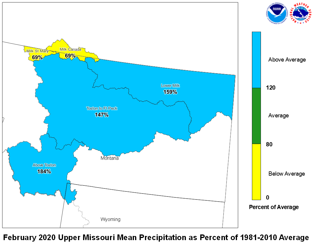
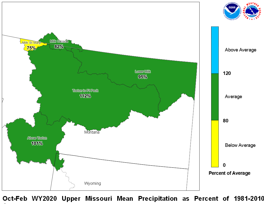
February 2020 Upper Missouri Mean Precip Oct-Feb WY2020 Upper Missouri Mean Precip
Stream flow in the Upper Missouri Basin is forecast to be near average during the upcoming Spring and Summer. The St. Mary River is forecast to have 105 percent of average April-September flows. Runoff is expected to range around 104 percent of average for the Missouri Basin above Fort Peck, Montana.
Upper Missouri February 1, 2020 Spring and Summer Streamflow Forecasts
Of the four major irrigation reservoirs in Montana; Lima Reservoir had 162 percent average storage, Clark Canyon was holding 118 percent of average water, Gibson Reservoir had 50 percent of average stored water, and Fresno Reservoir had 147 percent of average stored water.
The major hydroelectric reservoirs in Montana (Canyon Ferry and Fort Peck), had monthend storage in the average to above average range; 99 and 118 percent of average water, respectively.
Yellowstone Basin
The high elevation snow pack in the Yellowstone Basin was above average on March 1. The snow pack in the Upper Yellowstone Basin was 113 percent of average. The snow packs in the Wind, Bighorn, and Shoshone Basins were 105, 128, and 111 percent of average, respectively. The snow packs in the Tongue
and Powder basins were 121 and 132 percent of average, respectively.
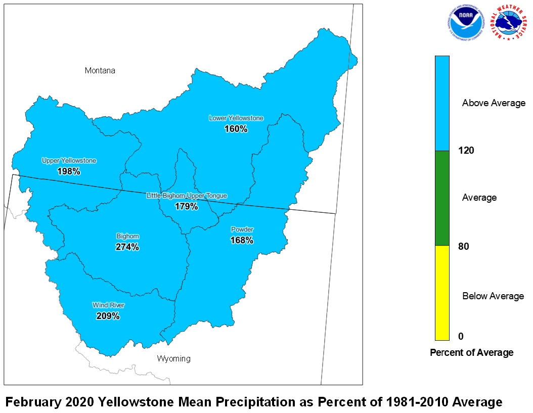
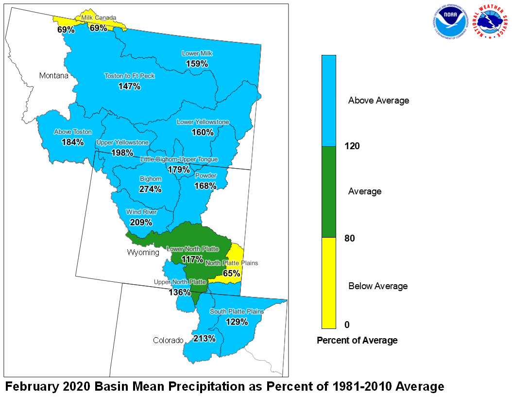
Precipitation during February was above average. The upper Yellowstone River Basin received 198 percent of average precipitation while the Lower Yellowstone River Basin reported 160 percent of average. The Bighorn Basin received 274 percent of average precipitation while the Wind River Basin received 209 percent of average. The Little Bighorn - Upper Tongue Basin received 179 percent of average and the Powder River had 168 percent of average precipitation.
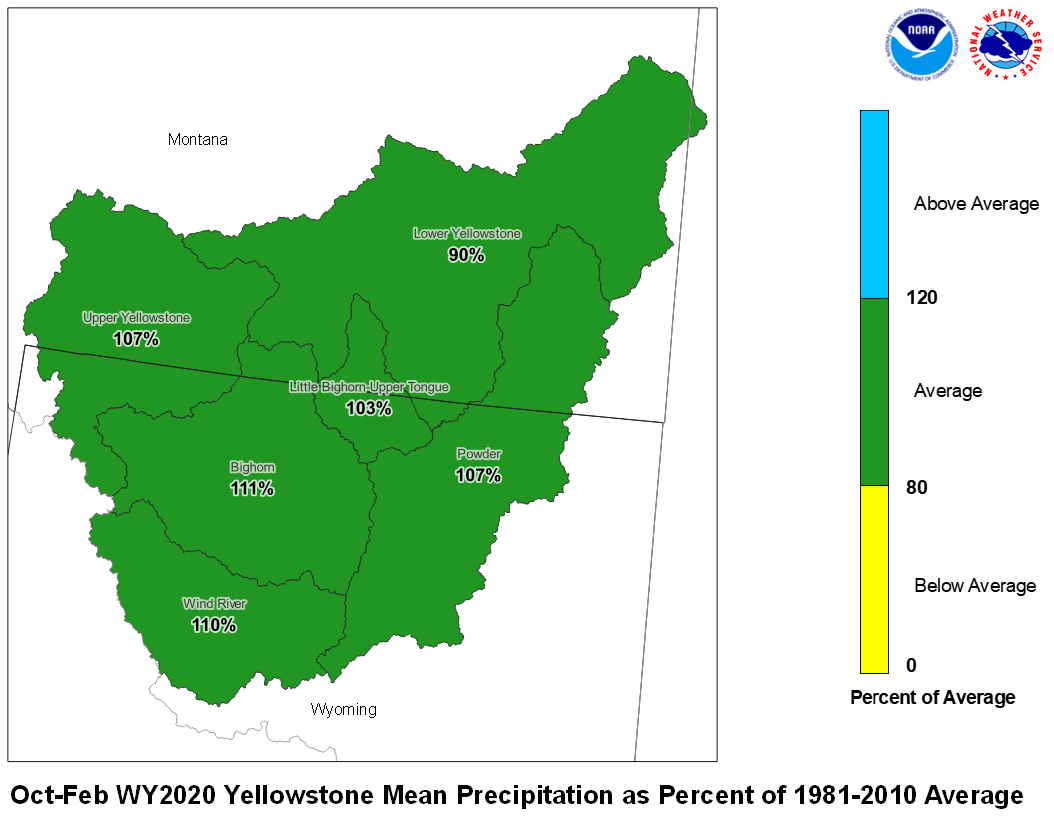
February 2020 Yellowstone Mean Precip Oct-Feb WY2020 Yellowstone Mean Precip
Forecast stream flow in the Yellowstone Basin is near average for the upcoming Spring and Summer. Stream flow for the Yellowstone River above Sidney, Montana is forecast to be about 108 percent of average. Flow in the Tongue Basin is expected to be 115 percent of average. Flows in the Powder River are expected to be about 133 percent of average.
Monthend storage at Boysen Reservoir was 112 percent of average. Stored water in Buffalo Bill Reservoir was 133 percent of average. Monthend storage was 103 percent of average at Bighorn Reservoir.
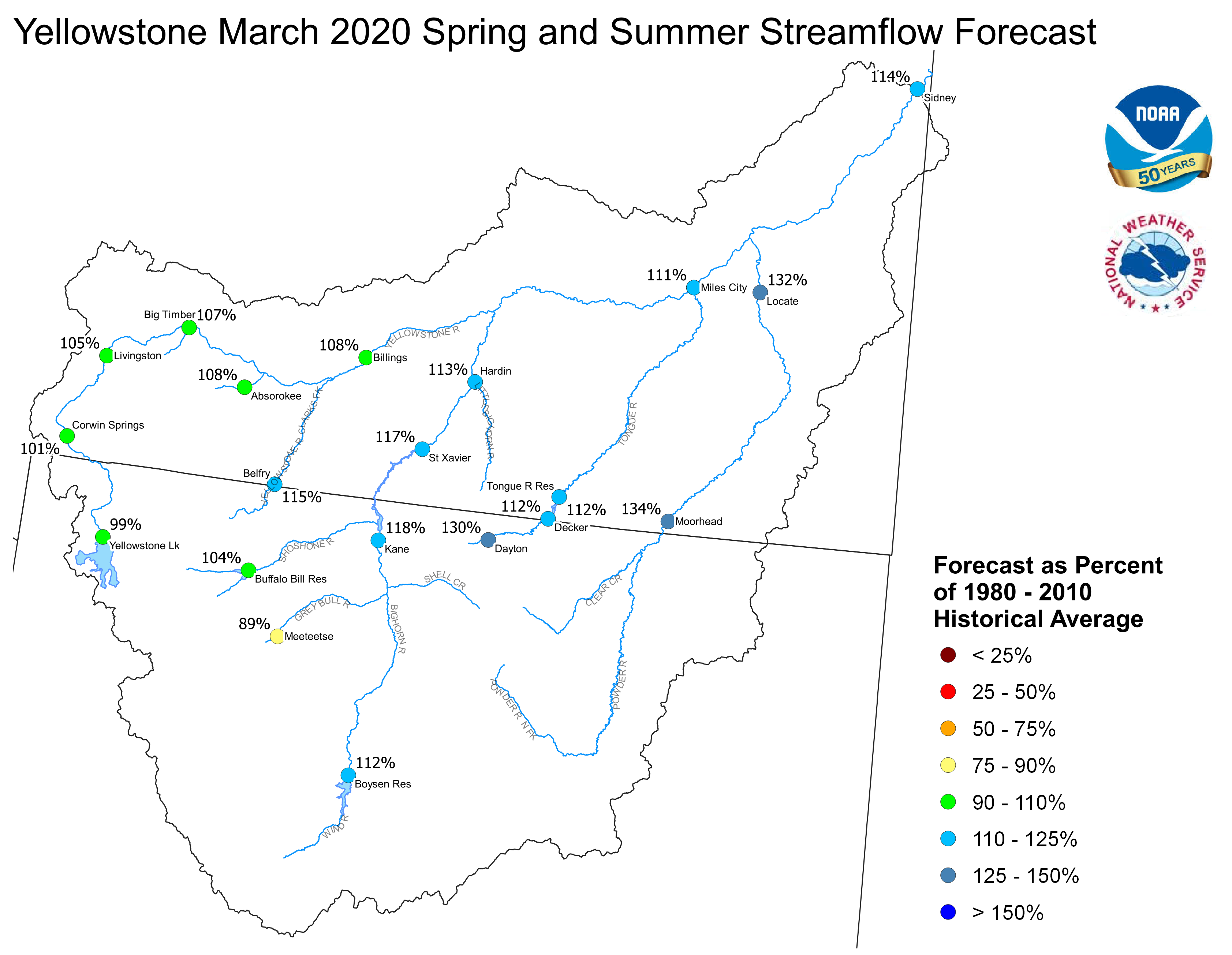
Yellowstone February 1, 2020 Spring and Summer Streamflow Forecasts
Platte Basin
The high elevation snow pack in the Upper North Platte Basin was 118 percent of average on February 1. The snow pack in the North Platte Basin below Seminoe Reservoir was 118 percent of average. The snow pack in the South Platte Basin was 132 percent of average.
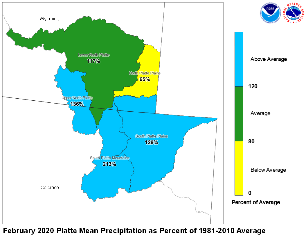
Precipitation during February in the Upper North Platte Basin was 136 percent of average. In the Lower North Platte Basin, precipitation was 117 percent of average. The North Platte Plains below Guernsy Reservoir had 65 percent. The South Platte Mountains had 213 percent whereas the Plains had 129 percent of average February precipitation.
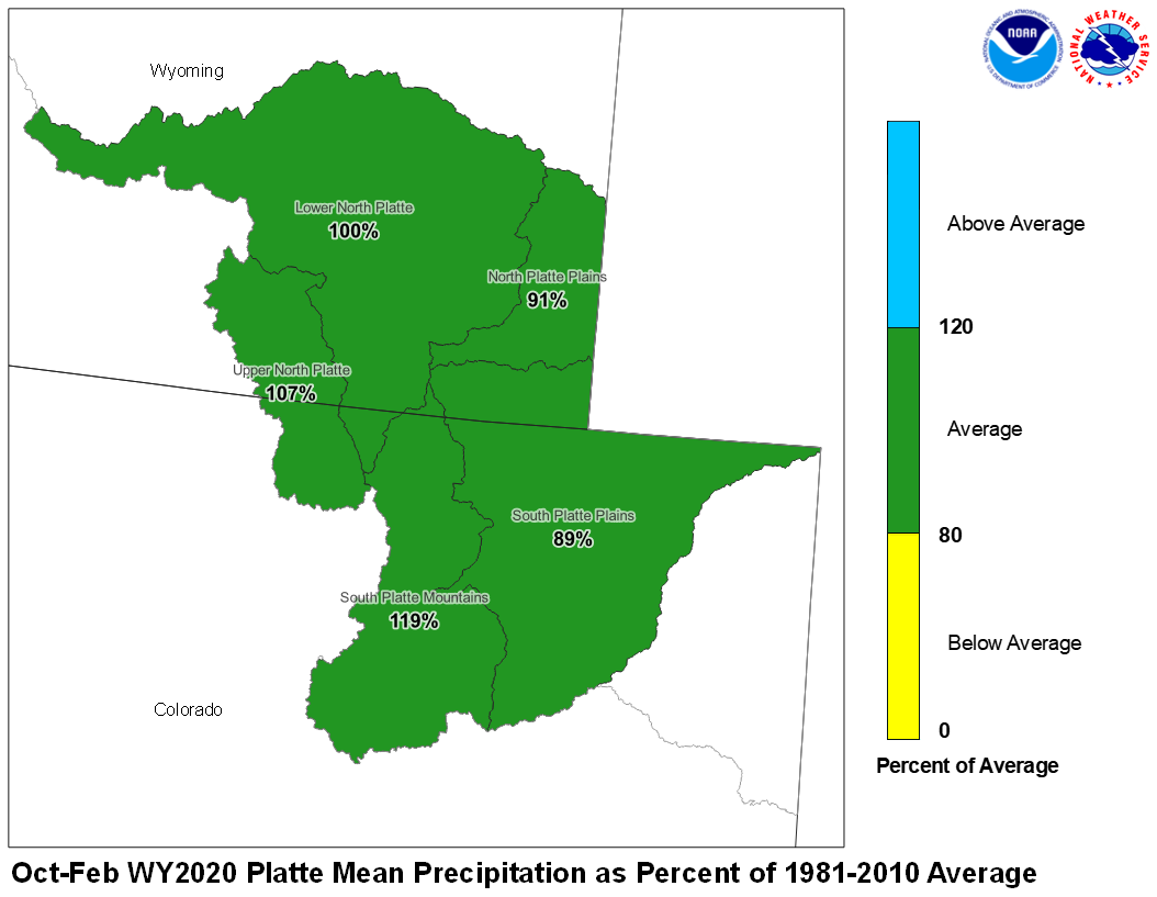
February 2020 Platte Mean Precip Oct-Feb WY2020 Platte Mean Precip
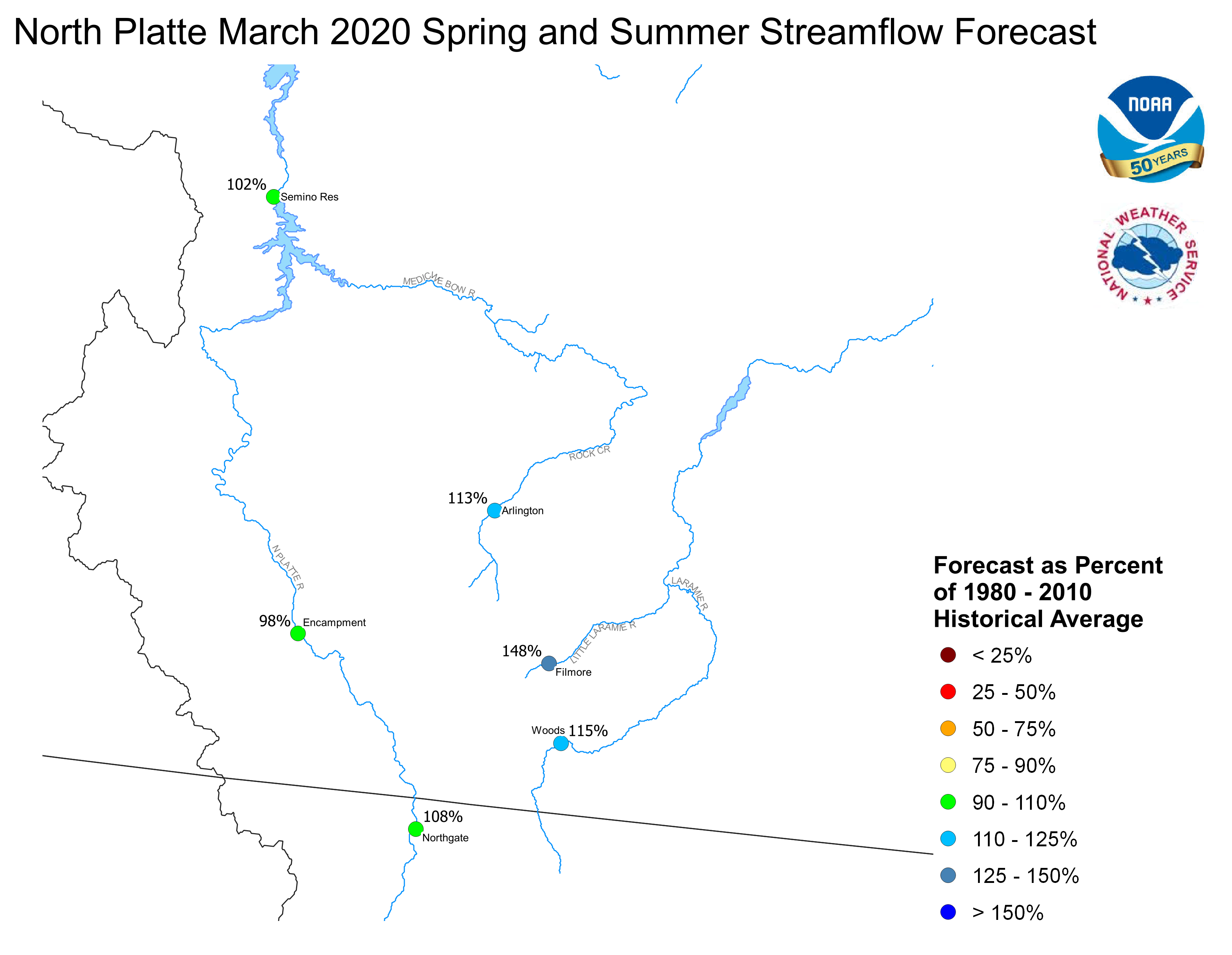
Stream flow in the Platte Basin is forecast to be below average during the upcoming Spring and Summer. Runoff for streams above Seminoe Reservoir are expected to be about 108 percent of average. Streams in the South Platte Basin above South Platte, Colorado can expect 98 percent of average flow. For the remainder of the South Platte basin, flows are expected near 100 percent.
Stored water in the South Platte Basin was 112 percent of average on March 1.
North Platte Streamflow Fcst South Platte Streamflow Fcst


