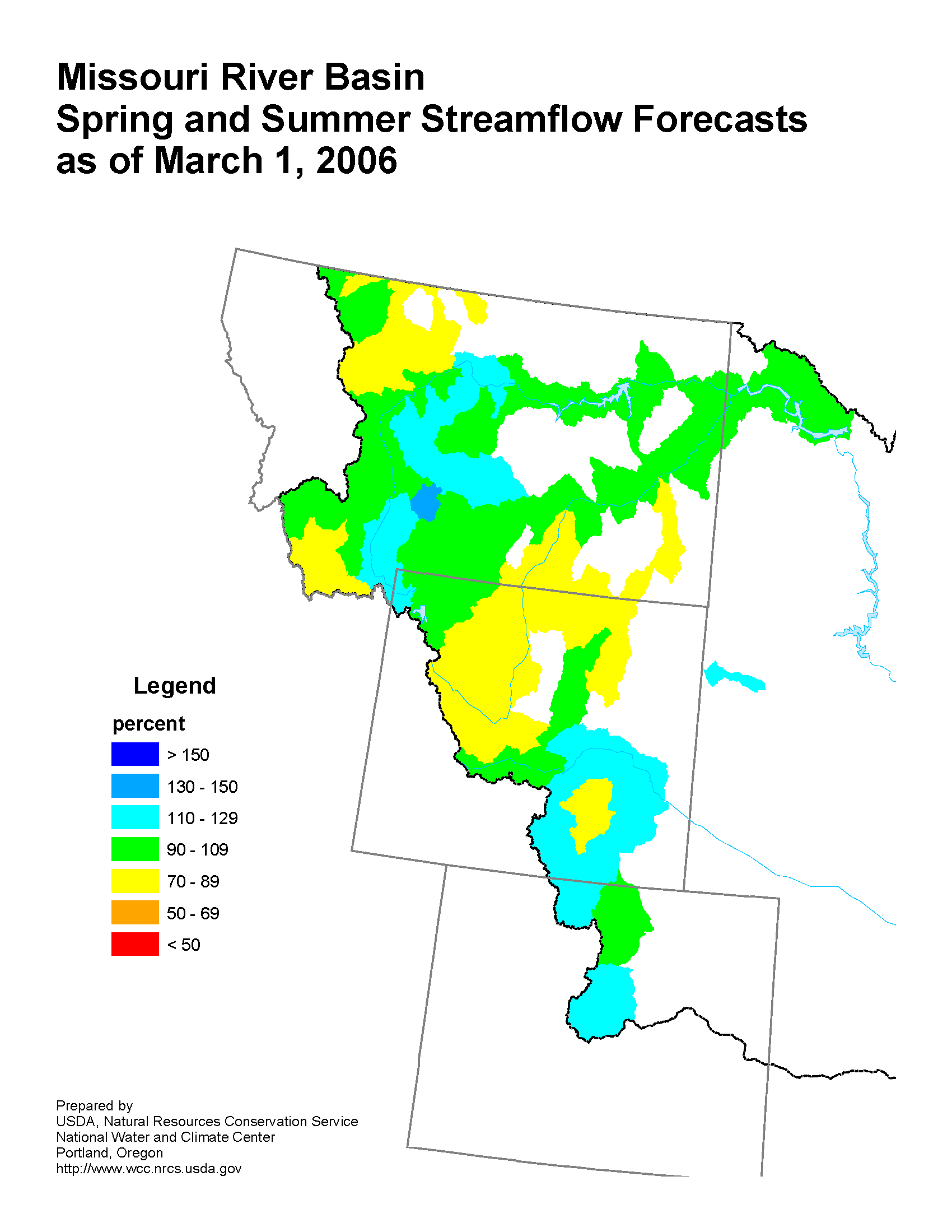
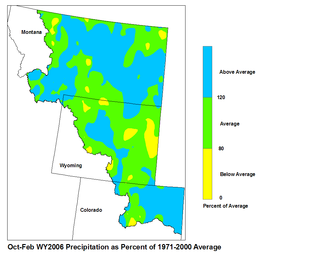
Runoff for most streams in the Missouri River Basin are forecast to be average to slightly below average. The high elevation snow pack in the Missouri Basin ranged from average to below average for this time of year.
 |
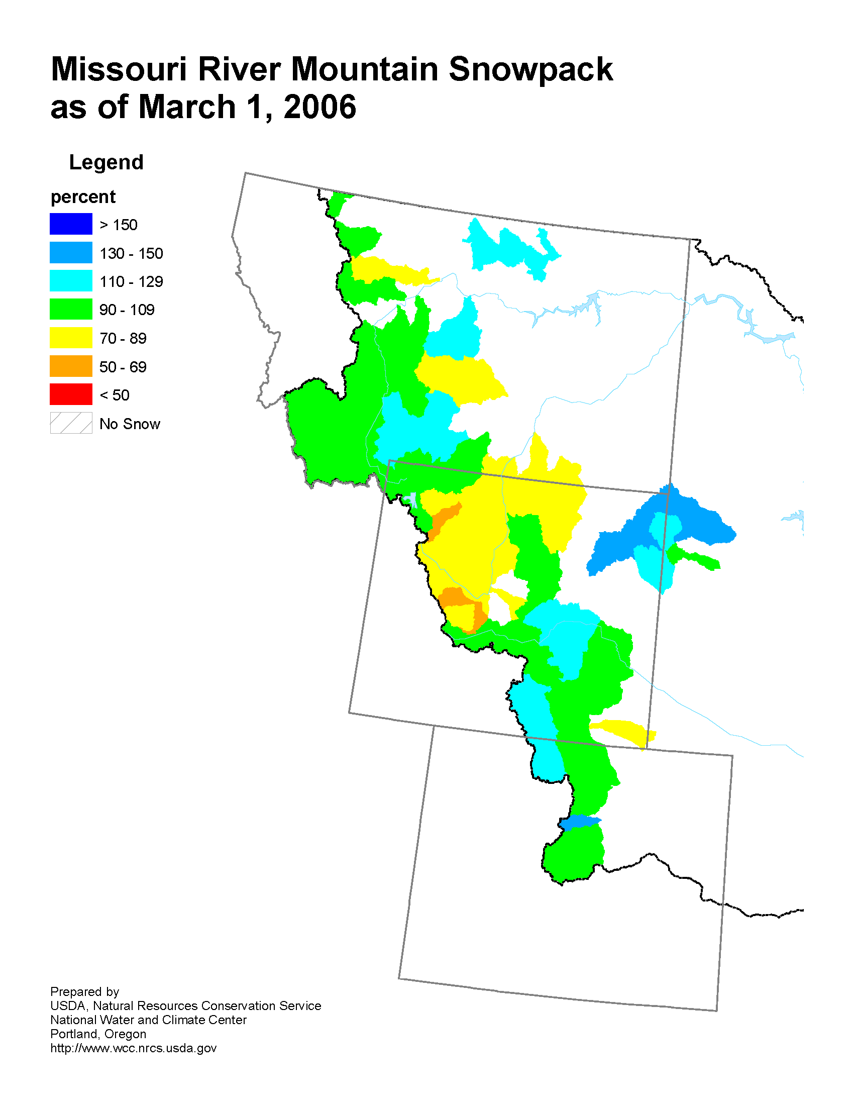 |
| Missouri River Basin Streamflow Forecast | Missouri River Basin Mountain Snowpack |
Upper Missouri Basin
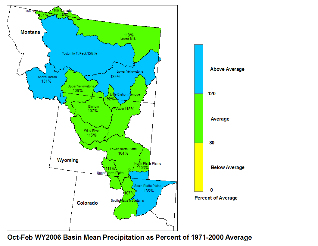
The high elevation snow pack in the Upper Missouri Basin as of March 1st was average. The snow pack above Toston, Montana was 109 percent of average. The snow pack between Toston and Fort Peck, Montana was 104 percent. The snow pack in the St. Mary and Milk River Basins was 101 percent.
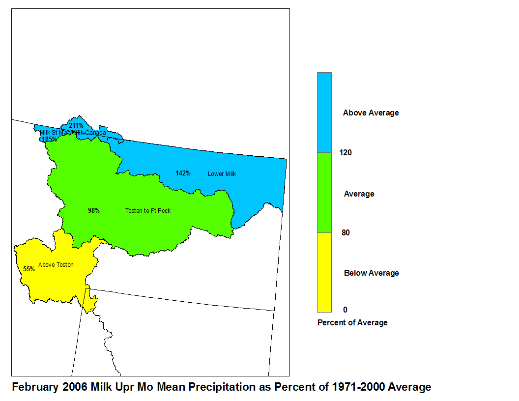
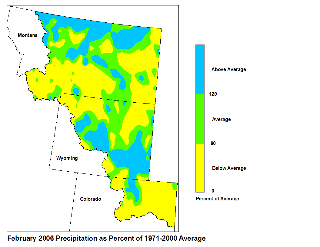
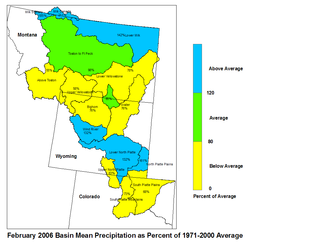
February precipitation above Toston was below average at 56 percent of normal. From Toston to Ft. Peck, precipitation was variable, with the overall average at 111 percent of normal. The St. Mary and Milk River Basins experienced above normal precipitation, 185 and 212 percent of normal respectively.
 |
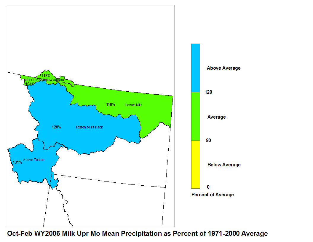 |
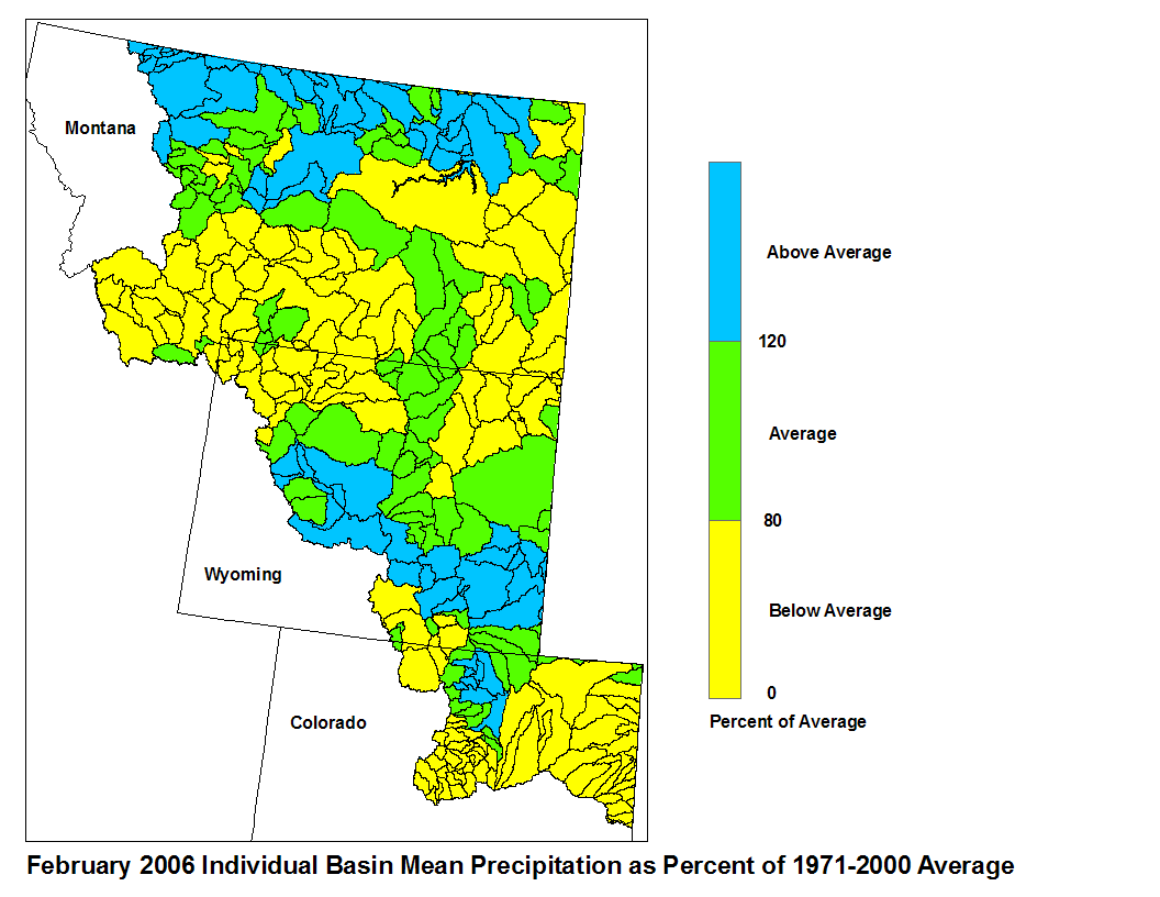
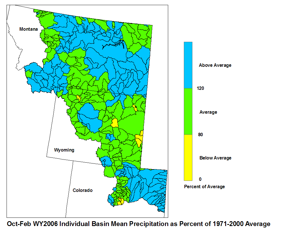
| Feb 2006 Milk/Upr MO Mean Precip | Oct-Feb WY2006 Milk/Upr MO Mean Precip |
Stream flow in the Upper Missouri Basin is forecast to be average during the upcoming spring and summer. The St. Mary River is forecast to have 91 percent of average April-September flows. Runoff is expected to range around 108 percent of average for the Missouri Basin above Fort Peck, Montana. Forecasts for the Mild River Basin call for around 88 percent of average spring/summer runoff.
Of the four major irrigation reservoirs in Montana; Lima Reservor had 109 percent average storage, Clark Canyon was holding 67 percent of average water, Gibson Reservoir had 28 percent of average stored water, and Fresno Reservoir had 94 percent of average stored water. The major hydroelectric reservoirs in Montana (Canyon Ferry and Fort Peck) had monthend storage in the average to below average range; 88 and 61 percent of average water respectively.
As indicated by the U.S. Geological Survey long term gaging stations, the Maries River near Shelby, Montana had an estimated 70 percent of average runoff in February.
Yellowstone Basin
The high elevation snow pack in the Yellowstone Basin was mostly near average on March 1st. The now pack in the Upper Yellowston Basin was 104 percent of average. The snow packs in the Wind, Bighorn, and Shoshone basins were 88, 86, and 81 percent of average respectively. The snow packs in the Tongue and Powder Basins were 87 and 102 percent of average respectively.
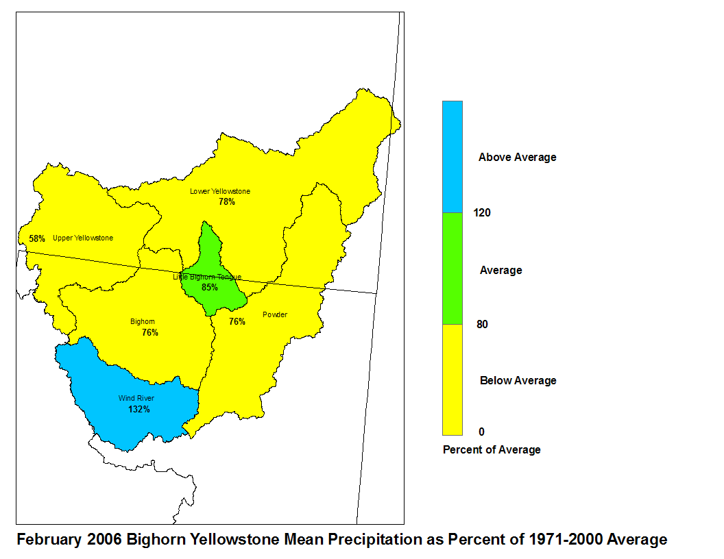
Precipitation during the month of February was about 130 percent of average in the Wind River Basin above Boysen Reservoir, and mostly below average elsewhere in the Yellowstone Basin, with a minimum of about 60 percent of average above Billings, Montana.
Platte Basin
The high elevation snow pack in the Upper North Platte Basin was 113 percent of average on March 1st. The snow pack in the North Platte Basin below Seminoe Reservoir was 105 percent of average. The snow pack in the South Platte Basin was 107 percent of average.
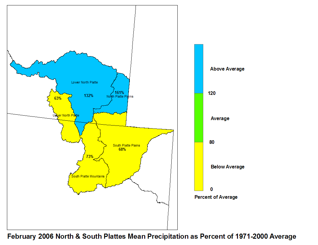
Precipitation during February in the North Platte Basin above Guernsy Reservoir was 118 percent of average, although the headwaters area had below average precipitation. The South Platte Basin below Guernsy Reservoir had 161 percent of average precipitation. The high elevations of the South Platte Basin had 73 percent of average precipitation, whereas the plains had 68 percent of average precipitation.
 |
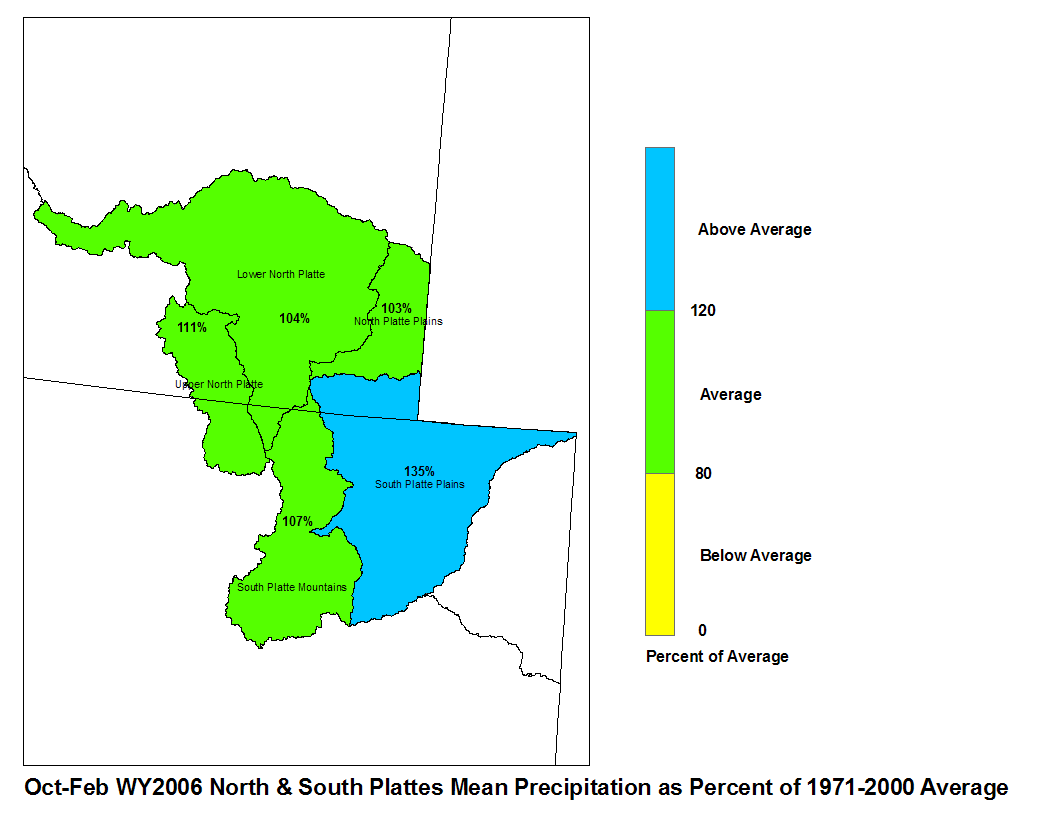 |
| February 2006 North and South Platte Mean Precip | Oct-Feb WY2006 North and South Platte Mean Precip |
Stream flows in the Platte Basin are forecast to be slightly above average during the upcoming spring and summer. Runoff for streams above Seminoe Reservoir are expected to be between 115 and 130 percent of average. Stream flow for the North Platte below Seminoe Reservoir is forecast to be between 75 and 115 percent of average. The South Platte Basin above South Platte, Colorado can expect about 115 percent of average flows. For the remainder of the South Platte Basin, flows are expected to be between 100 and 115 percent of average.
Stored water in the North Platte Basin as of March 1st was 68 percent of average. South Platte Basin had 93 percent of average stored water.

