Missouri Basin, Pleasant Hill
River Forecast Center
HEFS Long Range Graphics
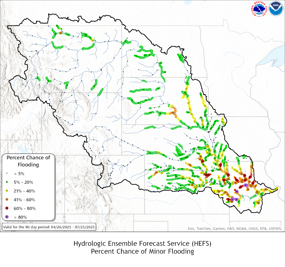
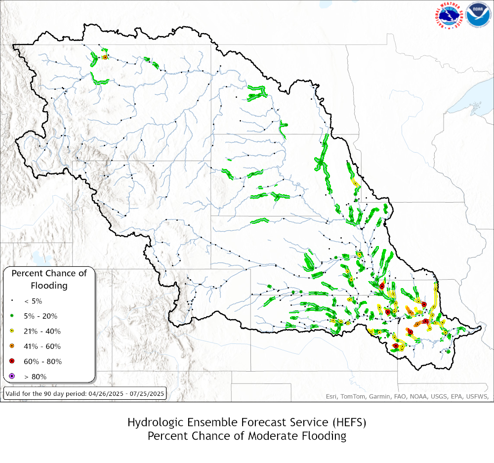
| HEFS Flood Probability Maps | ||
| Minor Flood Stage | Moderate Flood Stage | Major Flood Stage |
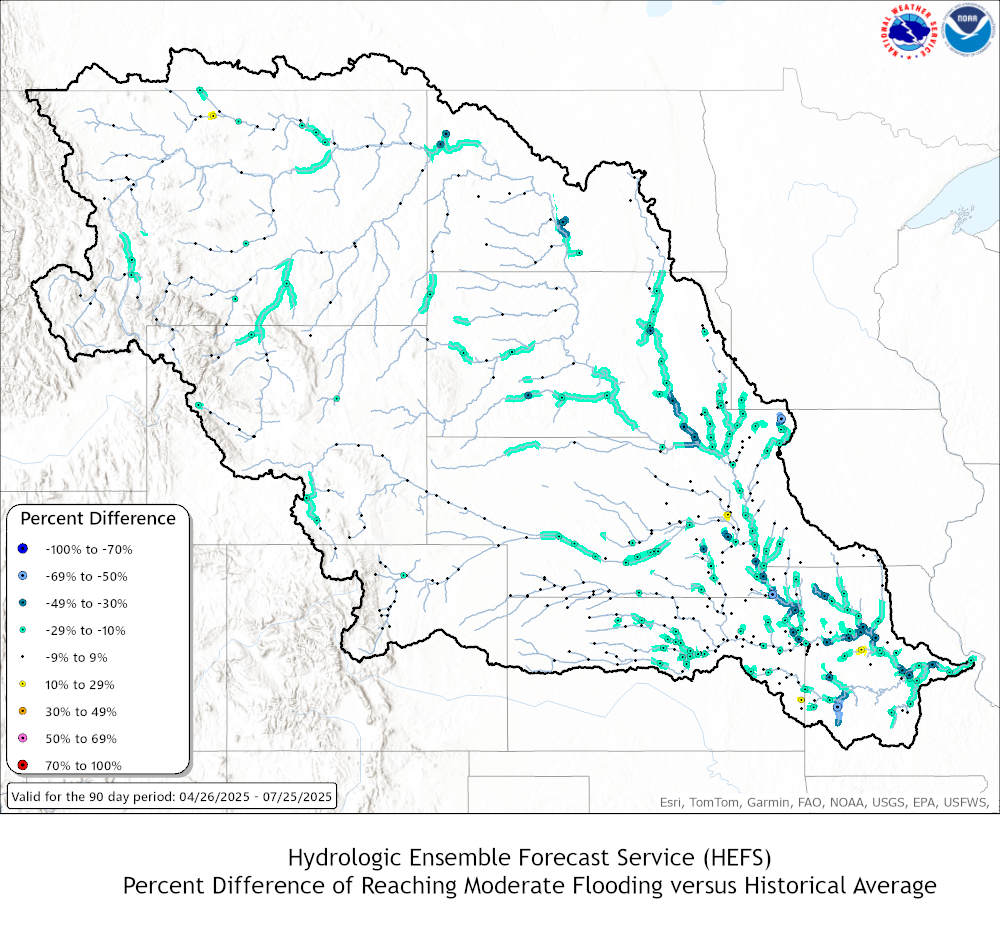
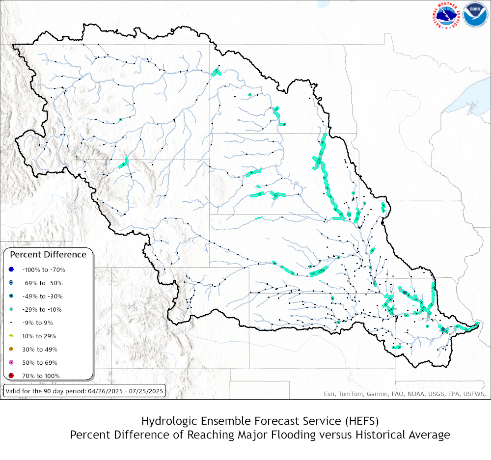
| HEFS vs Historical Flood Probability Difference Maps | ||
| Minor Flood Stage | Moderate Flood Stage | Major Flood Stage |
| HEFS vs ESP Flood Probability Difference Maps | ||
| Minor Flood Stage | Moderate Flood Stage | Major Flood Stage |
| Graphics & Summaries | |
|
|
|
|
|
|
|
|
|
|
|
|
|
|
|
|
|
|
|
|
|
|
|
|
|
|
|
|
|
|
|
|
|
|
|
|
|
|
|
|
|
|
|
|
|
|
|
|
|
|
|
|
|
|
|
|
|
|
|
|
|
|
|
|
|
|
|
|
|
|
|
|
|
|
|
|
|
|
| MBRFC HEFS Outlook - 90 Day | ||
| HEFS Probabilities of Exceeding: | ||
| Minor | Moderate | Major |
 |
 |
 |
| Difference between HEFS and historical probabilities: | ||
| Positive Values = More Likely Negative Values = Less Likely | ||
| Minor | Moderate | Major |
 |
 |
 |
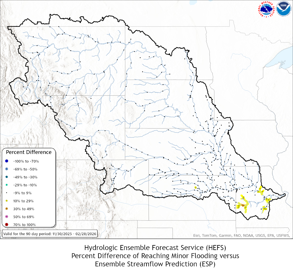
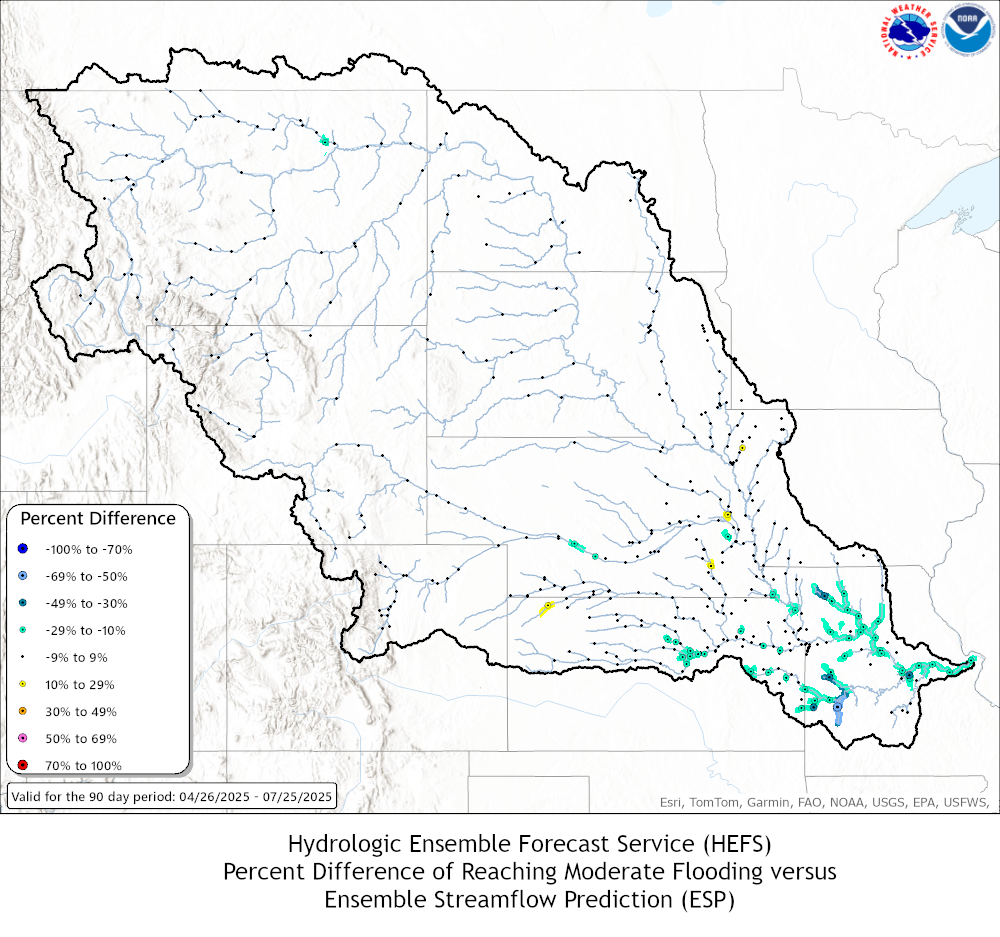
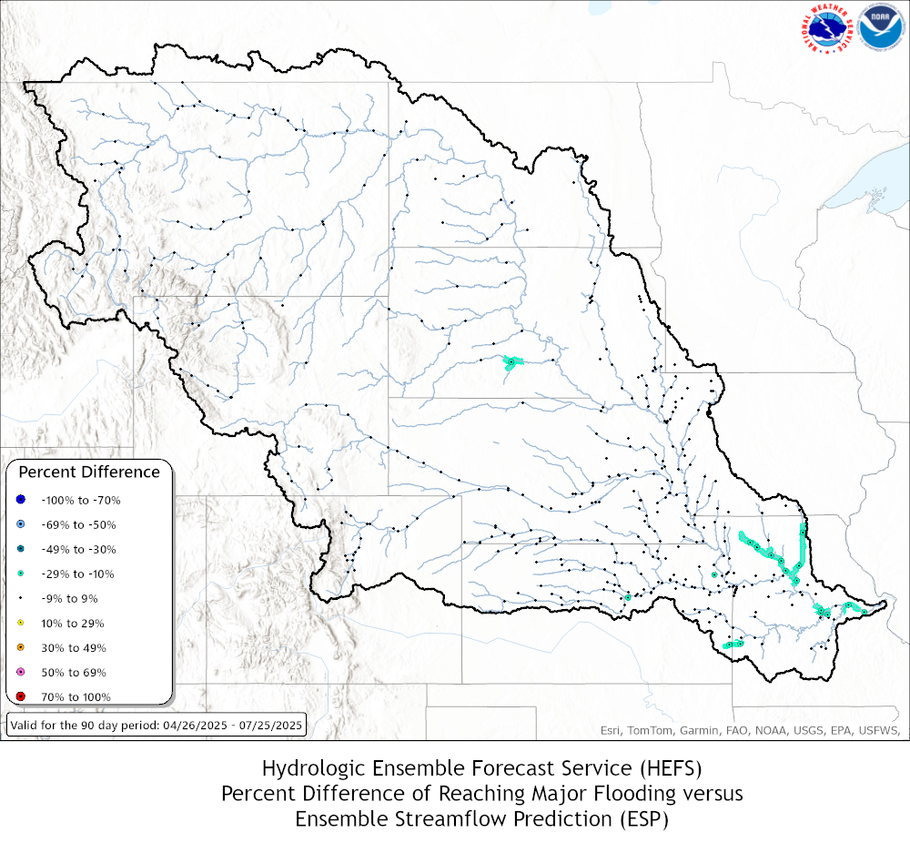
| Difference between HEFS and ESP probabilities: | ||
| Positive Values = HEFS has higher probability than ESP Negative Values = HEFS has a lower probability than ESP | ||
| Minor | Moderate | Major |
 |
 |
 |
US Dept of Commerce
National Oceanic and Atmospheric Administration
National Weather Service
Missouri Basin, Pleasant Hill
1803 North 7 Highway
Pleasant Hill, MO 64080-9421
Comments? Questions? Please Contact Us.

