
Widespread life-threatening flash and urban flooding will continue to pose a significant threat to life and property in south-central Texas. Catastrophic fiver flooding, with rapid rises on small streams, arroyos, and typically dry washes, is expected. Monsoonal showers persist across the Great Basin and Southwest with greatest flash flooding in southern Arizona. Read More >
346
AXUS71 KLWX 101104
DGTLWX
DCC001-MDC001-003-005-009-013-015-017-021-023-025-027-031-033-037-
043-510-VAC003-013-015-043-047-059-061-069-079-091-099-107-113-
125-137-139-153-157-165-171-177-179-187-510-540-600-630-660-683-
790-820-840-WVC003-023-027-031-037-057-065-071-171115-

Drought Information Statement
National Weather Service Baltimore MD/Washington DC
704 AM EDT Fri Jul 10 2026

For the latest Drought Information Statement from the National
Weather Service in Baltimore MD/Washington DC, see:
www.weather.gov/media/lwx/DGT/DGT_LWX_07092026.pdf

For the latest accessible, text-only Drought Information
Statement from the National Weather Service in Baltimore
MD/Washington DC, see:
www.weather.gov/media/lwx/DGT/DGT_LWX_07092026.txt

National Weather Service Baltimore MD/Washington DC Drought
Information Statement web page:
www.weather.gov/lwx/DroughtInformationStatement

$$
Current drought status for our area: (Graphics update every Thursday)

Graphics by State:


Modeled Soil Moisture Percentiles, courtesy University of Washington: (click to enlarge)

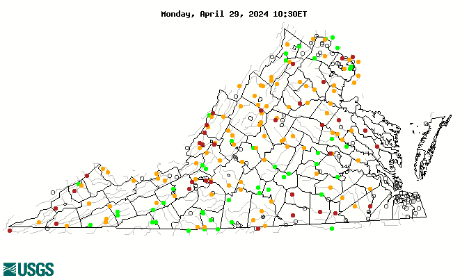
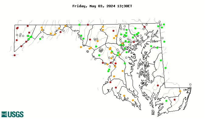
Streamflow Percentiles: (graphics update daily)
Outlook
Rainfall (or melted snowfall), in inches, for the next seven days: (graphic updates twice daily)

Seasonal Drought Outlook:


 Coastal Flood
 FAQ
FAQ