Latest Aviation Discussion:
.AVIATION /01Z SUNDAY THROUGH THURSDAY/...
While CIGs at most terminals are VFR, when showers pass through
they drop to MVFR. Northerly winds around 5-10kts through the
overnight.
Any lingering MVFR CIGs lift the second half of the overnight.
VFR conditions are expected Sunday, although northwesterly
winds increase again with gusts to around 20 kt.
A weak disturbance will pass through Sunday night which could
produce a few showers or sprinkles, but it is unlikely
ceilings/visibility are reduced. The next frontal system will
approach Monday evening. Showers are possible along with a few
thunderstorms...highest chance at MRB and lowest at CHO.
Westerly winds blowing 15 to 20 knots and gusting 20 to 30 knots are
expected at all terminals Tuesday through early Wednesday afternoon.
Winds diminish Wednesday evening, blowing our of the northwest 5 to
10 knots.
AVIATION...ADS/AVS/CPB
Update as of: 925 PM EDT Sat Apr 12 2025
This discussion and more can be found in the Area Forecast Discussion.
Aviation Forecasts
The National Weather Service (NWS) Weather Forecast Office (WFO-LWX), in Sterling, VA has responsibility for six Terminal Aerodrome Forecasts or TAFs in Virginia, Maryland and the eastern West Virginia panhandle. Click on each map below to view the latest decoded TAF Note: maps are not for official aviation use. FAA VFR charts are available here.
REAGAN NATIONAL (DCA)
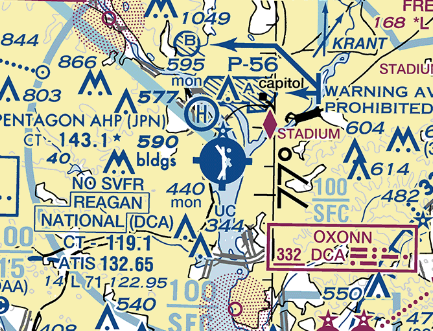
TERMINAL FORECAST (DCA)
24 HRS OF OBSERVATIONS
FAA DETAILS
TABULAR FORECAST
DCA TAF BOARD
DULLES (IAD)
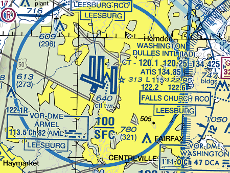
TERMINAL FORECAST (IAD)
24 HRS OF OBSERVATIONS
FAA DETAILS
TABULAR FORECAST
IAD TAF BOARD
BALTIMORE (BWI)
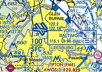
TERMINAL FORECAST (BWI)
24 HRS OF OBSERVATIONS
FAA DETAILS
TABULAR FORECAST
BWI TAF BOARD
CHARLOTTESVILLE (CHO)
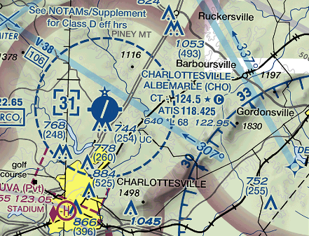
TERMINAL FORECAST (CHO)
24 HRS OF OBSERVATIONS
FAA DETAILS
TABULAR FORECAST
CHO TAF BOARD
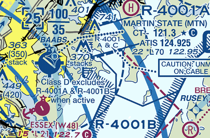
MARTIN STATE (MTN)
TERMINAL FORECAST (MTN)
24 HRS OF OBSERVATIONS
FAA DETAILS
TABULAR FORECAST
MTN TAF BOARD
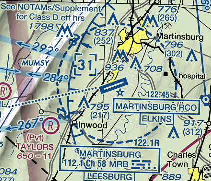
MARTINSBURG (MRB)
TERMINAL FORECAST (MRB)
24 HRS OF OBSERVATIONS
FAA DETAILS
TABULAR FORECAST
MRB TAF BOARD
Center Weather Service Unit Products
The Leesburg VA Center Weather Service Unit (CWSU/ZDC) covers the NWS Sterling, VA County Warning Area. Use the buttons on the map or....CLICK HERE to view ZDC's web site. For complete AVIATION WEATHER CENTER products click here.
Interactive Aviation Map (mouse over & CLICK for Observations)
See Complete MESONET MAP & OBS
Decoded/Raw Text
- 24 hour decoded observations for Virginia Portion of our CWA...
- 24 hour decoded observations for Maryland Portion of our CWA...
- 24 hour decoded observations for West Virginia Portion of our CWA...
Surface Weather Maps
Wind Rose Data
- Washington Reagan-National (DCA) wind rose data...
- Dulles International (IAD) wind rose data...
- Baltimore-Washington International (BWI) wind rose data...
Miscellaneous


 Coastal Flood
 FAQ
FAQ