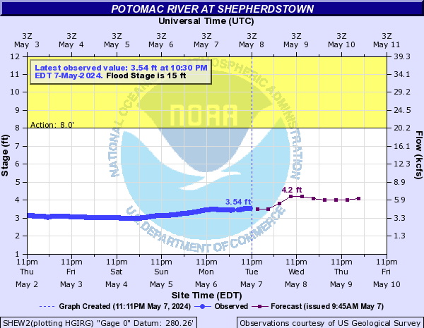
River Forecast and Warning Services have resumed on the Potomac River at Shepherdstown!
In September 2016, the long-term stream gauge on the Potomac River at Shepherdstown was returned to service by the United States Geological Survey, after funding was obtained to resume observation services. There had been no observations at Shepherdstown since 2004, and at that time the location was downgraded to a categorical-only forecast. In 2010, warning services were also discontinued due to changes which require a forecast crest in order to issue a river flood warning.
 With observations having resumed, the National Weather Service has resumed providing routine forecasts, as well as warning services, as of Wednesday, November 23rd, 2016. Forecasts will be issued daily, extending out 72 hours. Warnings will be issued when the 15 foot flood stage is expected to be exceeded. Once forecasts are official, the information can be found on our Advanced Hydrologic Prediction Service website.
With the addition of this forecast point in the Potomac River, the areas covered by river flood warnings have been adjusted. The forecast point at Williamsport -- which previously covered all areas of the river in Berkeley County, WV and adjacent areas of Washington County, MD -- will now extend from the Morgan/Berkeley County border to just downstream of Interstate 81.
The Shepherdstown forecast point will extend from just downstream of Interstate 81 to near the mouth of Antietam Creek, including portions of Berkeley, Jefferson, and Washington Counties. The Harpers Ferry forecast point will extend from near the mouth of Antietam Creek to the Washington/Frederick County border. Visit this link to see an approximate map of these new warning areas.
Interests near the river in Berkeley...Jefferson...and Washington Counties should pay close attention to the text of flood warnings when they are issued, since multiple warning locations will cover the counties after these changes take effect, and only some portions of the river may be expected to flood in a given event. The Shepherdstown section of the river is much more likely to flood in a given high water event than Williamsport or Harpers Ferry.
If you have any questions about this resumed forecast and warning service, please contact Senior Service Hydrologist Jason Elliott.