
Thunderstorms, some severe, may produce heavy to excessive rainfall and isolated flooding over portions of the Southern Plains today and Saturday. Dry conditions, combined with gusty winds and low relative humidities will continue to support an elevated to critical fire weather threat in the Desert Southwest into to early next week. Read More >
Click here to access track, with damage points, and pictures in zoomable GIS.
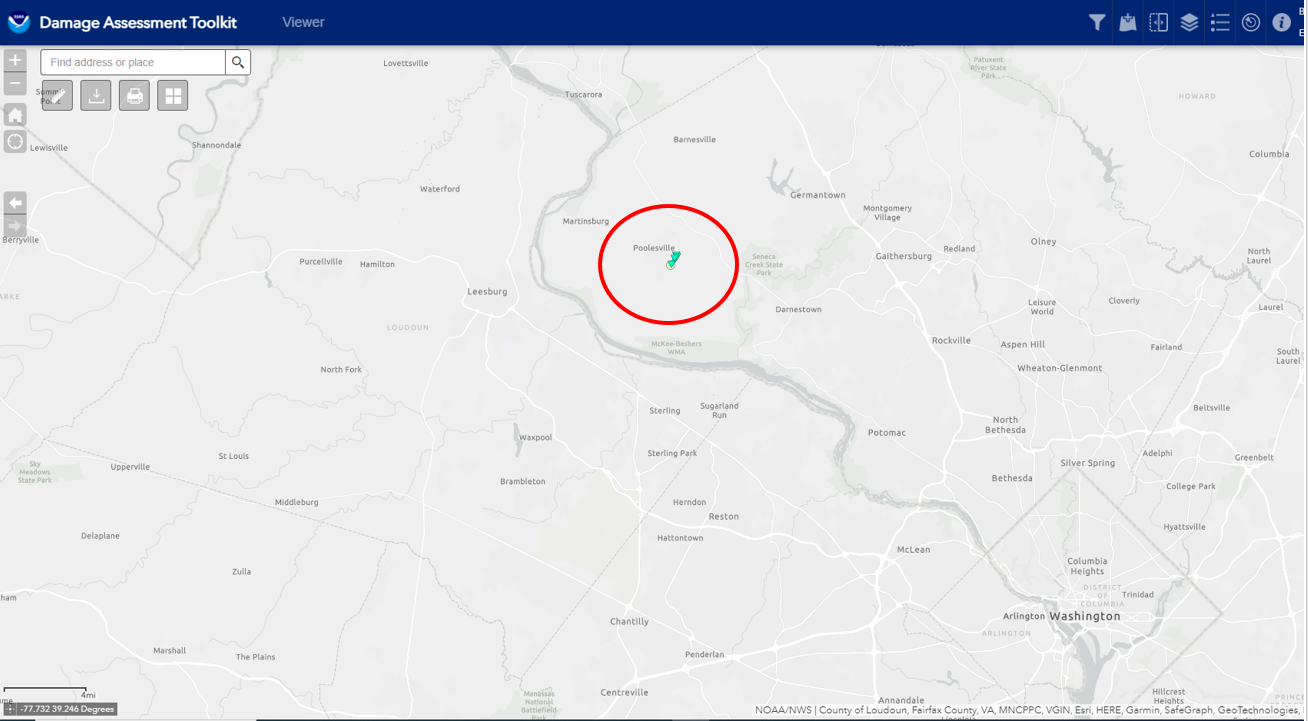
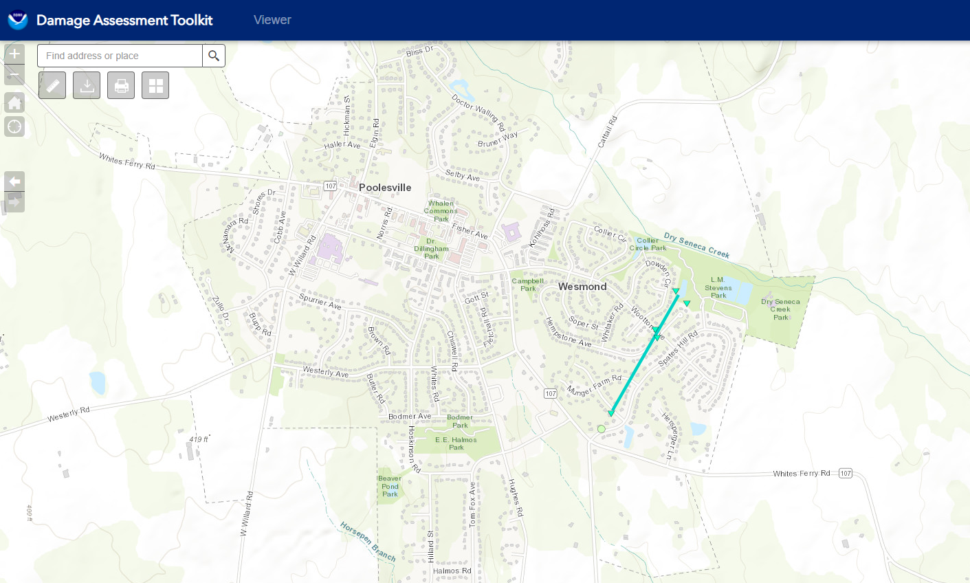
Public Information Statement
National Weather Service Baltimore MD/Washington DC
1217 PM EDT Mon Apr 24 2023

...NWS Damage Survey for 22 April 2023 Tornado in Poolesville MD...

.Tornado...

Rating:                 EF-0
Estimated Peak Wind:    75 mph
Path Length /statute/:  0.4 miles
Path Width /maximum/:   50 yards
Fatalities:             0
Injuries:               0

Start Date:             04/22/2023
Start Time:             158 PM EDT
Start Location:         Poolesville / Montgomery County / MD
Start Lat/Lon:          39.1355 / -77.4009

End Date:               04/22/2023
End Time:               159 PM EDT
End Location:           Poolesville / Montgomery County / MD
End Lat/Lon:            39.1411 / -77.3968

On Saturday afternoon at 158 PM EDT, an EF-0 tornado touched
down in Poolesville, MD.  This tornado was brief, only being
on the ground until 159 PM EDT. It had estimated 75 MPH winds
with a path length of 0.4 miles and path width approximately 50
yards.

Damage was sporadic along its path.  The first evidence of
damage was near the intersection of Fisher Avenue and Spates Hill
Road, where a residence in the 17000 block of Spates Hill Road
had 3 cedar trees blown down in a unidirectional orientation.
This was likely the rear flank downdraft of the storm that
initiated the formation of the tornado.

The first evidence of tornadic damage was in 17100 block of
Campbell Farm Road.  Here, several single family home residences
suffered tree damage, with downed and snapped trees, along with
an air conditioning unit and a temporary metal trailer moved from
their foundations.

The tornado briefly lifted before producing damage to trees near
the intersection of Wootton Avenue and Hempstone Court. Here,
large limbs of trees were snapped in different directions, along
with trees being uprooted in a direction opposite of the storm
motion.

The tornado again lifted, before touching down again for the final
time at the interface between the western portion of L.M. Stevens
Park and the backyards of several single family homes along the
19100 block of Dowden Circle.  Here, there were two softwood trees
uprooted falling to the northwest, with another softwood tree snapped.
One utility shed was damaged by a tree that fell into it.  One
home incurred damage with a large limb blew onto the deck.  A
wooden fence was blown over to the northwest. Leaf debris was
observed on all four sides of one of the residences. An apple tree
was snapped, with the loose top coming to rest towards the east,
which was the opposite direction of other damage in that immediate
area.

The National Weather Service extends thanks to several members of
the public who provided damage accounts.

&&

EF Scale: The Enhanced Fujita Scale classifies tornadoes into the
following categories:

EF0.........65 to 85 mph
EF1.........86 to 110 mph
EF2.........111 to 135 mph
EF3.........136 to 165 mph
EF4.........166 to 200 mph
EF5.........>200 mph

NOTE:
The information contained in this statement is preliminary and
subject to change pending final review of the event and publication in
NWS Storm Data.

$$


 Coastal Flood
 FAQ
FAQ