
Extremely critical fire weather (Level 3 of 3) including high winds and very dry conditions is expected this afternoon and evening for central and southern New Mexico into far west Texas. Isolated to scattered severe thunderstorms are possible mainly this evening into early morning Monday across parts of the Great Plains. Large to very large hail, damaging winds, and a few tornadoes possible. Read More >
Being Weather Prepared
What IS going on?
A) Where is lightning?
https://branch.nsstc.nasa.gov/PUBLIC/DCLMA/html/updating_lightning_250km.html
* Lightning detectors can help supplement this if desired.
For a broader view/more options: https://branch.nsstc.nasa.gov/PUBLIC/DCLMA/
B) Map of Observations around the Region:
https://www.wrh.noaa.gov/mesowest/gmap.php?zoom=8&extents=36.63955,-79.403687,40.084162,-75.119019&density=1
C) Where are the storms/precipitation?
Of course there are MANY places to get radar information. Here is one:
https://www.srh.noaa.gov/ridge2/?rid=NAT&pid=N0Q&lat=38.745510325102295&lon=-78.0139206640625&zoom=8&frames=1&fs=0
D) What about observing weather at my spot?
There are many places to purchase a weather station that can monitor weather for your spot. A simple internet search, or trip to your local mega-store will give you several options. We in the government are not allowed to recommend any company over another. Of course a weather observation station will only measure what is ongoing. It will not help you very much to know what is coming.
What should we EXPECT?
A) Any weather threats over the next 7 days? This is a good link to check daily for a weather heads-up.
[Important Note: this would not include the threat of non-severe thunderstorms; although that would be in the forecasts below]
- for Baltimore/Washington Metro and points south & east
https://forecast.weather.gov/showsigwx.php?warnzone=DCZ001&warncounty=DCC001&firewxzone=DCZ001&local_place1=Washington%20DC&product1=Hazardous+Weather+Outlook&lat=38.88785&lon=-77.03246
- for areas north and west of Baltimore/Washington metro
https://forecast.weather.gov/showsigwx.php?warnzone=WVZ050&warncounty=WVC027&firewxzone=WVZ050&local_place1=3%20Miles%20ESE%20Purgitsville%20WV&product1=Hazardous+Weather+Outlook&lat=39.22485&lon=-78.87534
B) NWS Forecast
- Go to https:/www.weather.gov/washington:
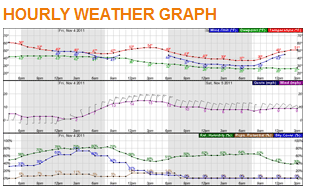
If desired, you can your get an hour-by-hour forecast if you scroll down the forecast page until you see this graphic on the right side of the screen. Click on it.
Note: This winds forecast will not account for gusts from thunderstorms. This is the "general" wind.
C) Main NWS Baltimore/Washington web page: (a springboard to everything weather)
https://www.weather.gov/washington
E) Mobile phone site: (easy weather info for the small screen)
https://mobile.weather.gov
Are you a boater?
You can get a forecast for the waters the same way as above at weather.gov/washington . Just click on the map where you will be (or a few spots along your route).
Buoy data to see what is currently going on over the waters can be found here:
https://www.ndbc.noaa.gov/maps/Chesapeake_Bay.shtml
Note that conditions can change quickly as you travel along our waters. Differences of waves and winds can be substantial as the fetch that they have to work with changes quickly along our complex coastline.
Most of the battle is heading out informed and staying informed.
Special Marine Warnings are issued by the NWS when there is the potential for gusty wind over 35mph (typically with an approaching storm). The amount of advance notice for the wind gust typically ranges from 30 to 90 minutes, but can be shorter/longer if required. Have a way to receive them (see above).
One of the biggest killers in our area for boaters is cold water. If you are out on the water when the water temperature is cool (below 70), know that you are floating on danger. If anything happens to capsize or swamp your vessel while you are on cool or cold water, you can be in a deadly situation very quickly – even if you are a strong swimmer. This is of particular concern in the spring when the air can be quite warm (driving people to their boats) while the water is cold (and dangerous). Hypothermia can shut your body down quickly. Be doubly aware of weather threats & forecast conditions/changes when the water is cool.
Do you live by a major freshwater river or tidal waters?
F) Freshwater River & Tidal Flooding: Will high tides or high river levels affect us?
River Levels/Tidal Levels we forecast for:
https://water.weather.gov/ahps2/forecasts.php?wfo=lwx
All sites that measure a water level:
https://water.weather.gov/ahps2/index.php?wfo=lwx
How can we be ALERTED for threatening weather?
A) I would highly recommend a NOAA Weather Radio in your ops centers. They will generally be silent (unless you want to listen to the forecast), and then alert immediately when a Special Marine Warning (potential of winds >35mph), Severe Thunderstorm Warning (expectation of winds >55mph at or very nearby your site), Tornado Warning, etc. is issued by the NWS for the District. I can help you set it up if you have any trouble, but they typically come with pretty good instructions. You can get them on-line or at many "big-box"-type or electronics stores. They're not very expensive either.
B) "When thunder roars, head indoors" - Basically when you start to hear the thunder, you are close enough to be struck by the first "outside-the-storm" lightning bolts. Risk increases as the storm nears.
C) Apps that will send you alerts for weather threats. There are many available out there. I would try to ensure that you get one that will send you an immediate alert anytime a NWS warning is issued for your spot.
D) Important Educational Note to convey to your people:
- When the NWS issues a WATCH, that means there is the POTENTIAL of a threat (Think of a yellow light. Keep a watch out, be ready).
- When the NWS issues a WARNING, that means the threat is EXPECTED (Red light; Take action).
E) Being safe is being aware of what is coming, rather than what is already there. While your observation station you are thinking of buying will help keep an eye on what the winds are locally there for you, for most of the quick-hitting summer threats, if you're observing it, it's often too late.
What will we do when alerted?
A) Plans with triggers. Of course, none of this will help if you don't have
- plans of what you will do
- with known well-defined triggers that will activate these plans.
Being aware is half the battle, but as the Indiana State Fair stage collapse showed in 2011 ( https://www.youtube.com/watch?v=SRkdwrmzYXg ), the second, equally important half is acting upon notification of a threat. Know what your threats are, and what you will do for each. Some of the possible threats to have a plan for:
1) Severe Thunderstorms & Tornadoes: If the NWS issues a Severe Thunderstorm Warning or a Tornado Warning for my spot for the expectation of damaging winds at or very close to us, what are our actions? Keep in mind you generally will only have 10-45 minutes of advance notice [more like 5-20 minutes for a tornado]. So, your plan will need to be able to be completed quickly. If driving, do not travel in wooded areas during a warning. Trees and large branches falling down are a major danger. Find shelter from the storm in a sturdy structure, on the lowest floor away from windows. Again, falling trees are a deadly threat.
2) Non-severe thunderstorms: The only way to be safe is to follow the rule, “When Thunder Roars, Go Indoors”. If you can hear the thunder, you are close enough to be struck by the lightning shooting out ahead of the storm – typically the most dangerous strikes. Wait 30 minutes after the last sound of thunder to go back out.
3) Flooding: This threat kills more people than any other, partly because it can come in so many ways:
Flash flooding (rapid rises & white-water from torrential rain)
River flooding (slow inundation by major rivers)
Tidal flooding (including hurricane storm surge/Nor’easters/& onshore winds)
Slow inundation of low spots from long periods of sustained rain.
Is your spot at risk for any or all of these? If you are in a low area, or even a flat area, you probably are – even if it hasn’t happened before. Beware of the rare, extreme once in 100 year event (or even 1 in 500 year)! It will come eventually. If you live near a stream, drainage ditch, or event just a low spot, be ready to moving quickly to higher ground if needed. Be especially cautious while driving through areas that may have flooding. You can quickly drive into low areas where water covers the road – especially at night. Lastly, keep kids (and yourself) a safe distance away from flooded areas. The flood waters hide threats underwater, and moving water can easily & quickly sweep anyone off their feet and into deadly flood waters. If you live near tidal waters, or near a major freshwater river, be ready to evacuate if need be from extreme tides/river levels that can also rise quickly.
4) Hurricane/Tropical Storm/or remnants of one: These are all potentially 4 threats in one. Don’t think that winds are the only concern. While these are rated on their wind strength, the rating says nothing about the other threats. The four threats are:
Flooding (from torrential rain): This is usually our biggest threat. Tremendous amounts of rain can be produced by these tropical systems – especially if it is slow moving. Agnes in the 1970s was one of the most deadly & damaging storms to our region in recent decades, and it was “only” a Tropical Storm (as rated by the winds) when it was over our area.
Tidal Flooding: Often the biggest threat to people along tidal shores. Most of the fatalities from storms like Sandy in 2012 and Katrina in 2005 occur from tidal flooding (otherwise known as Storm Surge). You can think of this like a somewhat slower tsunami. For those along the Bay or the Atlantic, the water rises up and can take everything along the shoreline that it inundates (often with large battering waves on top). For those along the many smaller tidal rivers along the Bay, the rising water is often gentler, but still immensely damaging from inundation and possible drownings.
Tornadoes: Tropical systems like these are a large organized cluster of thunderstorms. Thunderstorms can (in the right conditions) produce tornadoes. So, it goes to reason that these systems can produce tornadoes. While most of the damage from the other threats is more widespread, tornado damage is localized in small areas, but can be substantial.
Wind: This is what most people think of when a hurricane or tropical storm approaches, but it often (though not always) is the least damaging of the threats. Wind is one of the biggest threats near the landfalling region, and on the right side of the storm (relative to the way it is moving). But, the winds tend to diminish quickly after landfall. That said, it takes less wind here to do damage than it does in the hurricane-hardened areas along the Gulf shores and Florida. Isabel was a tropical storm as it passed over our area, and it produced widespread power outages (some of which lasted for days) and hundreds of downed trees.
To summarize all of the above. To be weather prepared:
A) Always be aware of the forecast, & any potential weather threats. Check it frequently, as it can change at any time.
B) Be able to get NWS warnings quickly when issued for your spot...optimally, have a few ways.
C) Have plans with triggers for what you will do when various types of threats are expected.
Contacts:
A) If all of the above fails, you can contact your local National Weather Service’s forecasters to get any weather info not contained above thru:
1) Phone: (703) 996-2200 [extension 0 to talk to a forecaster]
2) Social Media:
Twitter: @NWS_BaltWash
Facebook:
www.facebook.com/US.NationalWeatherService.BaltimoreWashington.gov
You Tube: NWSBaltWashDC
3) E-mail: LWX-report@noaa.gov
B) If you have any questions about the general principles about being weather prepared, contact your NWS Warning Coordination Meteorologist, Chris Strong, at; christopher.strong@noaa.gov or kenneth.widelski@noaa.gov.
Additional Education:


 Coastal Flood
 FAQ
FAQ