|
April 16th: Severe Storms Across the South Plains
|
|
|
 |
|
Tulia was particularly hard hit with extremely heavy rain and hail. Hail clogged drains and caused extensive flooding in town and along Interstate 27. (Click on images to view larger versions. Image credit: Jimmy Simpson, Canyon, TX. Courtesy of David Oliver, NewsChannel 10 Amarillo)
|
|
|
|
A satellite image from 3:30 pm on the 16th shows thunderstorms erupting across the South Plains. Many of these storms would produce severe weather including large hail, tornadoes, and flooding rains (Image Credit: West Texas Mesonet).
|
Note: This page last updated 19 April 2009 to include damage survey and additional images/information.
***CLICK HERE FOR DAMAGE SURVEY INFORMATION***
A strong upper level storm system approaching West Texas interacted with returning Gulf moisture to produce an outbreak of severe thunderstorms across the South Plains beginning Thursday afternoon and lasting well into the night-time hours. The storms produced large hail, a few tornadoes, and heavy rainfall. To view the local storm report please click HERE.
|
|
|
The image above shows some of the more significant severe weather reports from April 16th. Please click on the image to view a larger version. Locations are approximate, please see the local storm reports for more details.
|
|
|
|
The image above shows all the hail swaths on April 16th as estimated by the Lubbock Radar. The "hotter" colors indicate large hail. Please click on the image to view a larger version.
|
ADDITIONAL IMAGES AND VIDEO:
|
|
 |
|
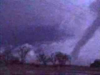
The two images above show three tornadoes that briefly touched down just after 5 pm CDT inbetween Idalou and Lorenzo near U.S. Highway 62/82. The images are courtesy Shane Adams (https://www.passiontwist.com/41609chase.htm).
|
 |
 |
| Digitally enhanced pictures of a tornado that touched down near the Lubbock/Hale county line the evening of April 16th. The images are courtesy of Bruce Haynie. |
|
|
|
Click on the image or HERE to view a five minute video of the hail that fell in southwest Lubbock taken from the house of a NWS employee. The video is approximately 17 Mb in size and is in Windows Media Video (wmv) format. A browser plugin may be required to view the file. For second video of hail falling on the south side of Lubbock CLICK HERE (~16 Mb, in QuickTime Movie [MOV] format).
* These videos are no longer available on the website due to lack of storage space. Please contact our office for further information.
|
|
|
 |
|
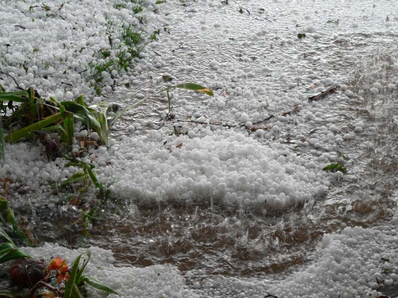
Pictures of hail in southwest Lubbock on 16 April 2009. Click on the images for a larger view.
|
|
|
|
|
The Texas Tech West Texas Mesonet has also put together a summary of the event - click HERE to go to their site.
|
|


