EF0 to EF1 Tornado moves across northwest Lubbock County to northwest of County Line in Hale County.
A National Weather Service Damage Assessment Team on Friday, April 17, surveyed damage from a tornado that moved across northwest Lubbock County Thursday evening, April 16th. This tornado developed around 9 pm near U.S. Highway 84 one mile east of the Lubbock-Hockley County line. It then moved northeast around 4 miles, before curving back to the north northwest where it crossed Highway 597 around 1 mile west of County Line.
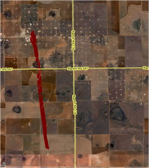
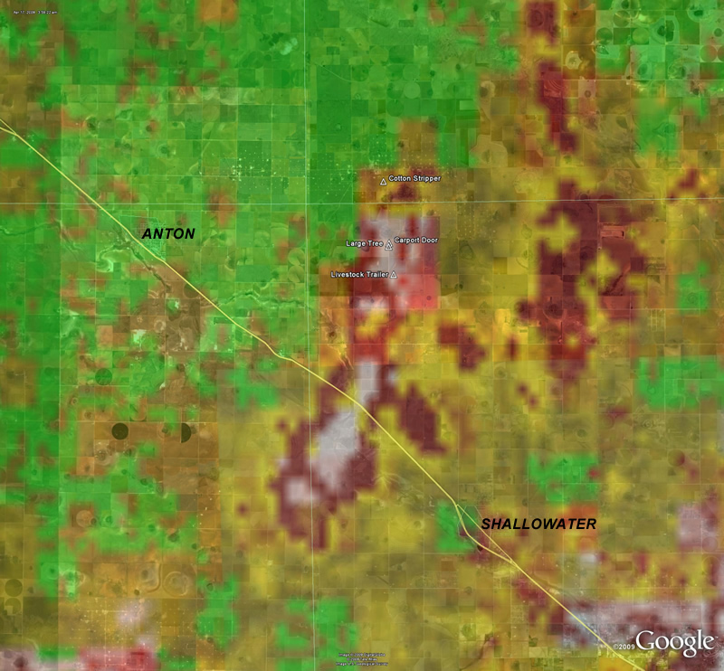
Damage Path of EF0-EF1 tornado that moved north northwest across extreme northwest Lubbock County into southwestern Hale County around 9 to 915 pm,
Tuesday evening, April 16th. Click on the image for a larger view.
|
|
|
|
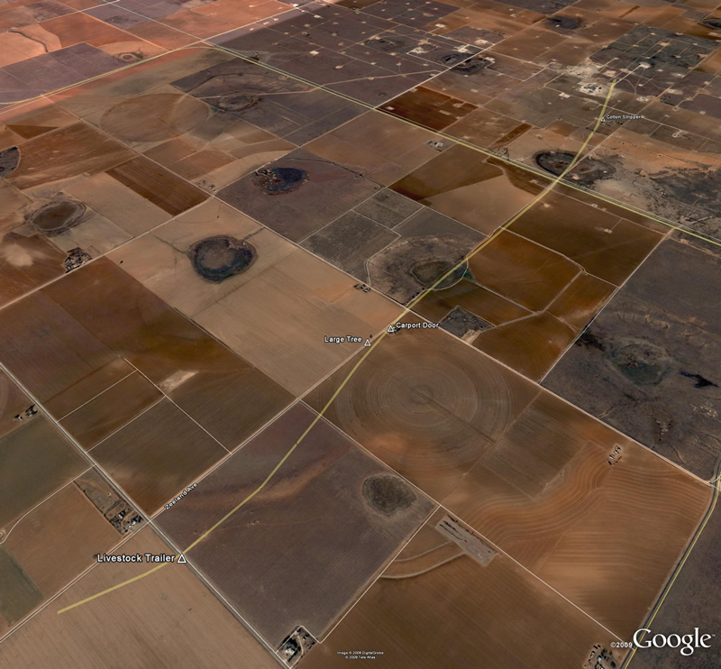
| The image above shows the track of the parent circulation of the tornado as estimated by the Lubbock Radar. The White and Red colors indicate the strongest circulation. The surveyed damage is also shown on the image. Click on the image for a large version. | The image above shows a closer view of the surveyed damage locations and an approximate track of the tornado. The damage location correspond to the images below. Click on the image for a large version. | |
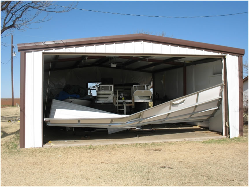
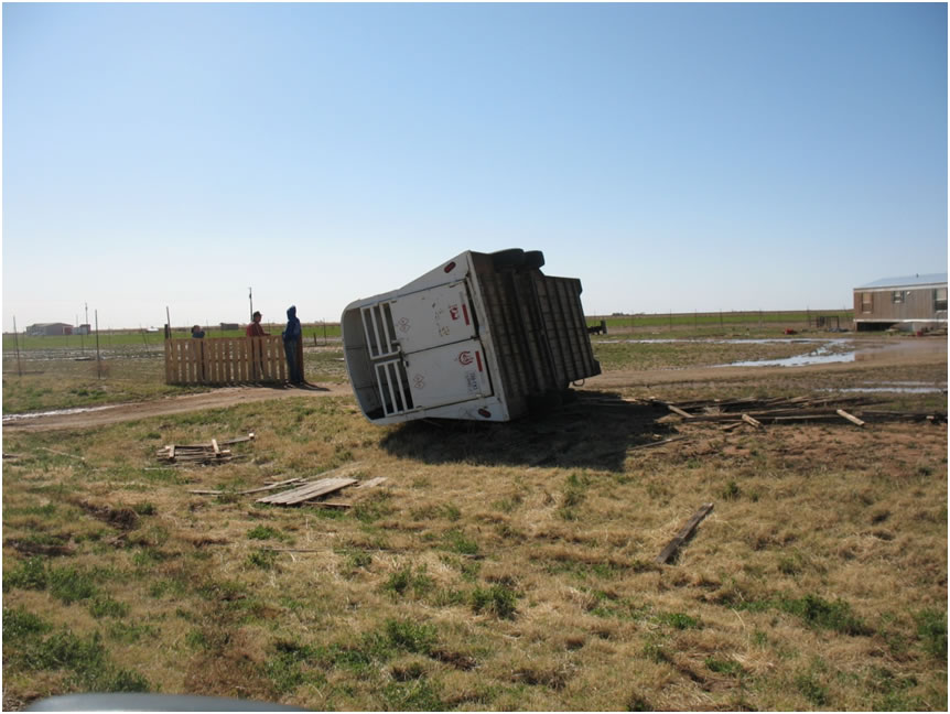
This tornado blew down at least a dozen power poles, and caused roof damage to one mobile home, and severely damaged several outbuildings. It also tossed a livestock trailer around 50 yards, and blew a cotton stripper basket around 250 yards in southwestern Hale County.
 |
 |
 |
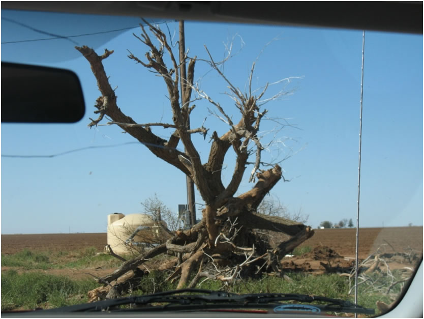 |
Above are some pictures of the damage caused by the tornado. Click on the images for a larger view.

