
October 29, 1883
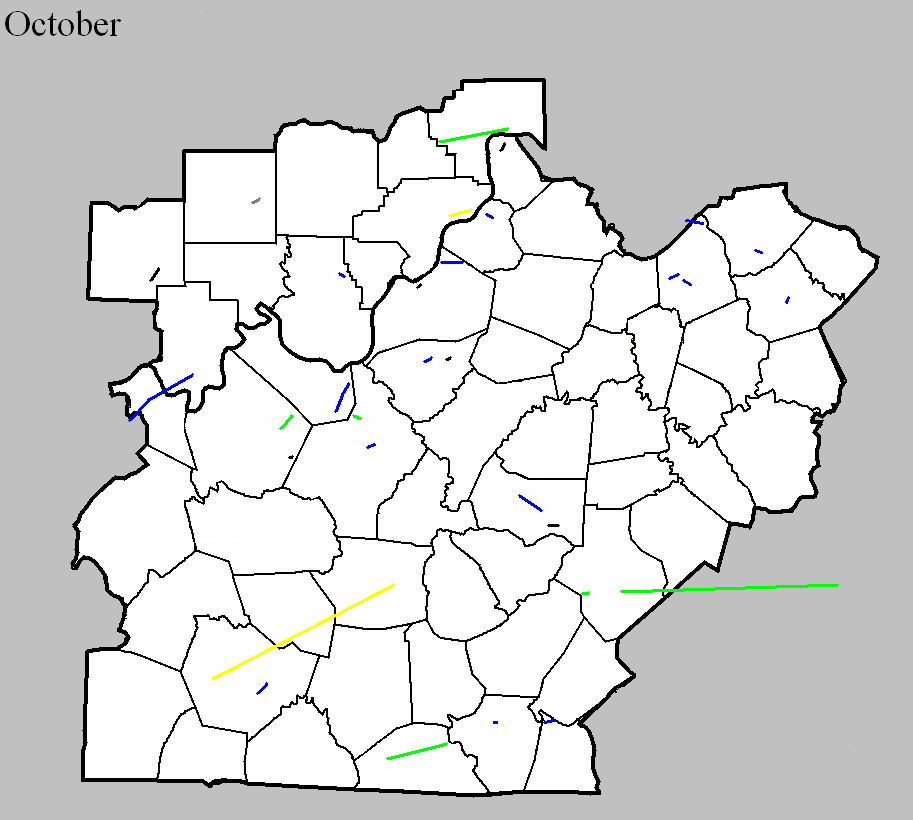
Counties: Bourbon
F-scale: F1
Deaths: 2
Injuries: 1
Path width:
Path length: 6 miles
Time: 2:00am
Grazulis Narrative: Tornado moved from "Husto" to "Kinney Station". Two people were killed in one rural building. Most of the path was through dense forest.
NWS Notes: While Lexington newspapers listed the many farms that were struck by the tornado (or its attendant straight-line winds), no road names and few references to nearby towns were given. However, Grazulis's "Kinney Station" was likely Kenney Station, which today is Monterey, located 4 miles southwest of Paris. "Husto" was possibly Huston, named for a local landowner with that name, though it is unclear exactly where Huston was located, though it may have been where Paris sits today. Lexington newspapers stated that the "cyclone did great damage," including unroofing J. L. Taylor's clothing store across the street from the courthouse in Paris. Warehouses were unroofed along Stoner's Creek. G. W. Bedford's barn was blown down, and an old stone house on the Clay Farm was destroyed, killing two people inside the house (Maria Johnson and a young boy). The Morris Gass Farm also received damage. The cyclone moved from south to north "over the lower edge" of Paris. Several buildings were unroofed. The warehouse of Mr. Tarr was completely destroyed. "Several church spires were bent, while the dome on the courthouse rocked to and fro at an alarming rate. The track of the cyclone was very narrow." It appears that tornadoes may have also struck Franklin, Anderson, and Fayette Counties on this day.
October 16, 1925
Counties: Warren, Edmonson, Hart
F-scale: F3
Deaths: 1
Injuries: 44
Path width: 300 yards
Path length: 45 miles (probably a family of tornadoes)
Time: 4:00pm
Notes: A family of tornadoes and downbursts moved from six miles west of Bowling Green to beyond Munfordville. Homes were wrecked near Kuykendall's Store west of Bowling Green and in Davenport on Barren River Pike. Three houses and four barns were blown into the Barren River at Thomas Landing, injuring ten people. A car was blown off the road, over a fence, and into a field. The vehicle landed on its tires and the driver survived, despite the top half of the car getting sheared off. Additional damage occurred in the Richardsville area. In Edmonson County, barns and a hotel were torn apart near Mammoth Cave National Park, along with the home of a cave tour guide. In Hart County the tornado and its attendant straight-line winds mowed down a path five miles wide. Three people were injured as houses were unroofed and barns destroyed. Canmer and Woodsonville were the hardest struck districts. Seven barns were blown down near Munfordville.
October 31, 1934
Counties: Casey, Lincoln, Pulaski (and on into Rockcastle and Laurel)
F-scale: F2
Deaths: 6
Injuries: 32
Path width: 300 yards
Path length: 45 miles (probably a family of skipping tornadoes)
Time: 5:30pm
Narrative: A complex series of tornadoes and downbursts produced over $350,000 damage in a nine-county area of central Kentucky. The destruction of forty barns in Hart County and damage to 57 homes in Taylor County was likely from straight-line downburst winds. The likelihood of tornado involvement seemed to begin near Gilpin, continued east, passing south of Eubank, and ending in northern Laurel County. One person died in a home near Gilpin. A mother and four children died in one home on the Laurel County side of the Rockcastle River, fifteen miles northwest of London. Their home, which was destroyed, caught fire and only one child could be rescued. Most of the injuries were in the Gilpin-Mount Olive area.
October 10, 1959
Counties: Orange
F-scale:
Deaths:
Injuries:
Path width:
Path length:
Time: 11:15pm
Noted discrepancies: SPC gives a path length of 1/10 of a mile...NCDC gives nothing. SPC gives a path width of 10 yards, NCDC gives nothing. The lack of an F-scale is frustrating. Storm Data mentions that the tornado was small and the worst damage seems to have been the destruction of a barn. It also apparently hit a cemetery and "toppled 50 tombstones". It struck on IN 56 midway between Paoli and Millersburg. Would guess it was an F1, but more research is needed to get a better idea of this tornado's f-scale.
October 7, 1965
Counties: Jefferson IN
F-scale: F2
Deaths:
Injuries:
Path width:
Path length:
Time: 6:00pm
Noted discrepancies: SPC and NCDC list this as an F2...Grazulis does not list it.
Notes: Storm Data says this tornado touched down one mile west of Kent and moved east for two miles.
October 24, 1967
Counties: Dubois
F-scale: F3
Deaths:
Injuries:
Path width:
Path length:
Time: 3:45pm
Noted discrepancies: SPC and NCDC list this as an F3, Grazulis does not list it. SPC gives a path length of 1/10 of a mile and a width of 10 yards...NCDC gives nothing for either.
Notes: Hard to believe and F3 tornado with a path length and width as small as what SPC gives. Also hard to believe the NWS would give it an F3 rating and Grazulis would only give it an F1 or less. Something odd here. The only damage described in Storm Data done directly by the tornado is the destruction of a concrete poultry house south of Dubois on IN 162 (which also sounds weird since IN 162 is not in close proximity to Dubois and is nowhere near the lat/lon given by SPC/NCDC). Additional research necessary.
October 1, 1977
Counties: Harrison IN
F-scale: F1
Deaths: 1
Injuries: 1
Path width: 40 yards
Path length: 1/2 mile
Time: 7:00am
Grazulis narrative: Moved southeast, hitting a rural mobile home eight miles northeast of Corydon, blowing it apart, killing a man, and scattering debris for almost a mile. The side of a two-story home was torn off.
Noted discrepancies: SPC and NCDC list this as an F1, Grazulis says F2.
October 1, 1977
Counties: Marion
F-scale: F1
Deaths:
Injuries:
Path width:
Path length:
Time: 8:00am
Noted discrepancies: None
October 1, 1977
Counties: Fayette
F-scale: F1
Deaths:
Injuries:
Path width:
Path length:
Time: 8:00am
Noted discrepancies: SPC's beginning lat/lon is in Scott County KY. Cannot plot this tornado without further research.
October 1, 1977
Counties: Hardin
F-scale: F2
Deaths: 0
Injuries: 0
Path width: 30 yards
Path length: 2 miles
Time: 4:00pm
Grazulis narrative: A new brick home was destroyed and the neighboring home was unroofed in a brief touchdown in Radcliff.
Noted discrepancies: SPC and NCDC list this as an F2, Grazulis calls it an F3. SPC and NCDC time it at 4:00pm, Grazulis and Storm Data 6:00pm. SPC, Grazulis, and NCDC list the path width at 30 yards, Storm Data says 1 yard.
October 4, 2002
Counties: Jefferson KY
F-scale: F1
Deaths:
Injuries:
Path width: 50 yards
Path length:
Time: 5:47pm
Noted discrepancies: SPC lists a path width of 17 yards, NCDC and Storm Data say 50 yards.
Notes: Storm Data says this tornado touched down on the Ohio River 8.4 miles northeast of Louisville, moved through the Springhurst area of Louisville, struck the Indian Springs Country Club, and lifted 12.6 miles northeast of Louisville. Wonder if this formed in the remnants of Hurricane Lili?
October 18, 2007
Counties: Jefferson, KY
EF-scale: EF0
Deaths: 0
Injuries: 0
Path width: 75 yards
Path length: Less than 440 yards
Time: 7:10pm EDT to 7:11pm EDT
Notes: Touched down at the Kroger's store at 2200 Brownsboro Road. Windows were blown out, a cart corral was blown into a vehicle, and a power pole was blown down.
October 18, 2007
Counties: Hancock, Perry
EF-scale: EF1
Deaths: 0
Injuries: 0
Path width: 220 yards
Path length: 14 miles (skipping)
Time: 6:18pm CDT to 6:45pm CDT
Notes: This tornado touched down along the Daviess County line near Gatewood and did primarily tree and power line damage as it headed northeast. The tornado lifted slightly and passed over Hawesville as a funnel cloud (though 75 mph winds still did damage in town). The tornado came back to earth just on the other side of Cannelton and proceeded northeast into the Hoosier National Forest, damaging the Girl Scout Camp on Cann Heights Road and lifting at Plock Knob.
October 18, 2007
Counties: Clark, IN
EF-scale: EF3
Deaths: 0
Injuries: 0
Path width: 440 yards
Path length: 5 miles (skipping)
Time: 10:03pm EDT to 10:09pm EDT
Notes: Began on Bull Creek Road west of Vesta where it scoured the ground. Moving northeast, it devastated a home near Hibernia when the two-story house was blown completely off of its basement foundation and destroyed. Two large barns, a silo, and a stable were also destroyed on the same property. The tornado lifted just shy of the Ohio River near the end of Fulton Road.
October 18, 2007
Counties: Breckinridge
EF-scale: EF2
Deaths: 0
Injuries: 0
Path width: 300 yards
Path length: 3 miles
Time: 9:26pm CDT to 9:33pm CDT
Notes: Touchdown was a mile east-northeast of Stinnettsville. The tornado moved northeast and produced major damage in Rosetta where it destroyed the Fountain of Faith Church. A 4500 pound tractor was moved seven feet and a 16-foot trailer was wrapped around a tree. The tornado lifted near the intersection of KY 333 and M. H. Dowell Road.
October 18, 2007
Counties: Dubois
EF-scale: EF0
Deaths: 0
Injuries: 0
Path width: 125 yards
Path length: 2 miles
Time: 9:27pm EDT to 9:30pm EDT
Notes: The door of a house was blown out about four miles northeast of Ferdinand, near the start of the tornado path. A barn was damaged about a half mile
south of Kyana, near the end of the damage path. Over 100 large oak trees were snapped off or uprooted in the Ferdinand Forest.
October 18, 2007
Counties: Meade
EF-scale: EF1
Deaths: 0
Injuries: 0
Path width: 300 yards
Path length: 2.5 miles
Time: 10:50pm EDT to 10:55pm EDT
Notes: This tornado began one mile northeast of Flaherty, damaged buildings at the intersection of US 60 and KY 1882, and lifted in western Fort Knox near Camp Carlson.
October 18, 2007
Counties: Bullitt
EF-scale: EF1
Deaths: 0
Injuries: 0
Path width: 200 yards
Path length: 2.5 miles (skipping)
Time: 11:20pm EDT to 11:26pm EDT
Notes: Damage was done to homes in the south end of Brooks along Meadowbrook Drive, Clearbrook Drive, Hillbrook Drive, Bells Mill Road, and Hill Creek Road.
October 19, 2007
Counties: Marion
EF-scale: EF0
Deaths: 0
Injuries: 0
Path width: 50 yards
Path length: 0.5 mile
Time: 1:36am EDT to 1:38am EDT
Notes: Touched down just northwest of Bradfordsville and moved east across the north side of town. A mobile home was rolled over and trees and power lines were blown down.
October 9, 2009
County: Breckinridge
EF-scale: EF0
Deaths: 0
Injuries: 0
Path width: 100 yards
Path length: 0.5 mile
Time: 2:20am - 2:21am CDT
Notes: Several mobile homes were damaged and trees were snapped on Lyons-Daughtery Road. Two barns were destroyed.
October 9, 2009
County: Monroe
EF-scale: EF2
Deaths: 0
Injuries: 0
Path width: 880 yards
Path length: 15.6 miles
Time: 1:20pm - 1:36pm CDT
Notes: This tornado touched down near Flippin and inflicted EF-1 damage on trees between Flippin and Mud Lick. After Mud Lick the tornado strengthened and damaged homes, barns, and trees on its way to Rockbridge.
October 9, 2009
County: Casey
EF-scale: EF2
Deaths: 0
Injuries: 0
Path width: 95 yards
Path length: 1.5 miles
Time: 2:36pm - 2:38pm EDT
Notes: Several structures were badly damaged as the tornado moved along KY 70 from Elm Drive to KY 206.
October 26, 2010
County: Trimble
F-scale: EF0
Deaths: 0
Injuries: 0
Path width: 20 yards
Path length: 1.2 miles
Time: 11:35am to 11:37 am EDT
Notes: This small tornado struck just southwest of Milton. The twister damaged the roofs of several outbuildings when it touched down. It struck a home on Liberty Road where it ripped the front porch off the home and flipped the detached metal garage. Neighboring homes on either side were undamaged.
October 26, 2010
Counties: Bullitt
F-scale: EF0
Deaths: 0
Injuries: 0
Path width: 75 yards
Path length: 0.1 mile
Time: 11:51am EDT
Notes: An EF-0 tornado struck Bogard Lane about four miles southwest of Mount Washington at 11:51am. The path was 150 yards long and 75 yards wide. A well-constructed concrete workshop was heavily damaged with a 3500 pound roof blown 45 yards away. A 125 pound chimney was blown 60 yards away. Insulation was found in nearby trees.
October 26, 2010
Counties: Warren
F-scale: EF1
Deaths: 0
Injuries: 0
Path width: 60 yards
Path length: 2.2 miles
Time: 11:08am CDT
Notes: A tree was uprooted at the beginning of the track. As the tornado crossed Cemetery Road it damaged a home. A barn was unroofed near the end of the track. Damage was intermittent along the 2.2 mile long, 60 yard wide path.
October 6, 2014
County: Cumberland
EF-Scale: EF1
Deaths: 0
Injuries: 0
Path width: 100 yards
Path length: 0.2 mile
Time: 6:02pm CDT
Notes: Two hundred trees were uprooted on a ridge top near the end of Dug Road north of Burkesville.
October 6, 2014
County: Clinton
EF-Scale: EF1
Deaths: 0
Injuries: 0
Path width: 150 yards
Path length: 2.3 miles
Time: 6:13pm - 6:17pm CDT
Notes: This tornado struck about 11 miles NNW of Albany in the northwest tip of Clinton County. Numerous trees were snapped or uprooted. The only non-tree damage was to power poles along US 127. A couple in a vehicle on US 127 was trapped when trees fell across the highway both north and south of them.
October 7, 2014
County: Oldham
EF-Scale: EF1
Deaths: 0
Injuries: 0
Path width: 50 yards
Path length: 0.1 mile
Time: 2:50pm - 2:51pm EDT
Notes: A barn, several outbuildings, and two trees were damaged.
October 7, 2014
County: Scott, KY (from Owen)
EF-Scale: EF1
Deaths: 0
Injuries: 0
Path width: 150 yards
Path length: 4.1 miles
Time: 3:45pm - 3:50pm EDT
Notes: Most of the damage was to trees. The only structural damage was to a small home on the top of a hill near South Rays Fork Road. The porch roof was ripped from the home and thrown over the building, there was significant roof damage, and an above-ground pool was destroyed.
October 7, 2014
County: Scott, KY
EF-Scale: EF1
Deaths: 0
Injuries: 0
Path width: 150 yards
Path length: 2 miles
Time: 3:48pm - 3:49pm EDT
Notes: This tornado caused minor damage to the roofs of two houses and significant damage to the roof of another house. A small outbuilding was also destroyed.
October 7, 2014
County: Scott, KY
EF-Scale: EF1
Deaths: 0
Injuries: 0
Path width: 150 yards
Path length: 3.6 miles
Time: 3:50pm - 3:52pm EDT
Notes: Mostly tree damage occurred with this tornado. Near the end of its path two small barns were destroyed and two homes sustained roof damage.
October 7, 2014
County: Harrison, KY
EF-Scale: EF1
Deaths: 0
Injuries: 0
Path width: 275 yards
Path length: 3.9 miles
Time: 4:05pm - 4:10pm EDT
Notes: This tornado exhibited multiple vortices as it damaged or destroyed several outbuildings and barns. Significant numbers of large trees were snapped and/or uprooted as the tornado crossed US 27.
October 7, 2014
County: Bourbon
EF-Scale: EF1
Deaths: 0
Injuries: 1
Path width: 60 yards
Path length: 1.7 miles
Time: 4:12pm - 4:13pm EDT
Notes: Touchdown occurred near the Vine Street loop where damage was done to homes' roofs and siding. One woman was pulled out of her house and landed on her porch. Power lines and many trees were downed, some of which fell on homes. Tree and house damage also occurred at the end of Windamere Lane, and warehouses were damaged just before the tornado lifted at US 460.
October 31, 2018
County: Hardin
EF-Scale: EF1
Deaths: 0
Injuries: 0
Path width: 80 yards
Path length: 2.5 miles
Time: 5:39pm - 5:43pm EDT
Notes: This brief, skipping tornado touched down initially as an EF0 near the east end of Labrador Way in a subdivision 1.5 miles south of Rineyville Elementary School. It did minor roof damage to two homes, tossed a trampoline into a neighboring home, causing siding damage, and pushed a large travel trailer onto a minivan, heavily damaging both. Mud was spattered onto the north-facing front of the home, where a porch column support was also moved slightly. From here it travelled east-northeast, snapping tree limbs as it skipped over mainly open pastureland until it reached Thomas Road. On the west side of Thomas Road, the tornado reached its greatest intensity and size, with winds of 100 mph. Here it damaged four outbuildings, completely destroying two - the largest being a 30 x 50 structure. The debris pattern from the four outbuildings and nearby trees with snapped trunks and limbs showed clear cyclonic rotation. Metal roofing and siding material were scattered nearly a quarter of a mile to the east-northeast, with some of it lofted into the trees of a heavily wooded area. Other building debris from the largest structure was blown to the northwest, and the south and east-facing walls of a number of structures were spattered with leaves and other ground-based vegetation. Three east-facing garage doors of one of the outbuildings were blown in, and damage was sustained to the vehicles in the driveway from downed tree limbs. Three homes in the area sustained roof and siding damage, including a 2x4 from one of the outbuildings blown through an exterior wall. The tornado became elevated as it continued east-northeast from Thomas Road, snapping a few tree limbs in a wooded area before briefly touching down one last time on Rineyville Road, where it littered the highway with tree limbs and tore the front porch off a home, vaulting the roof over the house into the back yard. Security cameras from a business next door captured the damage occurring as a wall of wind and water that occurred in less than half a minute. No further damage occurred to the east of this location as the tornado dissipated.


 Weather Story
 Weather Map
 Local Radar