Louisville, KY
Weather Forecast Office
May 8, 2009
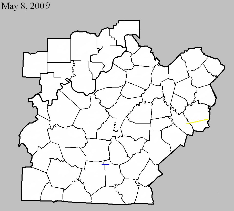
Counties: Barren and Metcalfe
EF-scale: EF1
Deaths: 0
Injuries: 0
Path width: 30 yards
Path length: 4 miles (skipping)
Time: 3:04pm CDT - 3:11pm EDT
Notes: The tornado touched down just east of Hiseville on Buck Williams Road. A home and a small outbuilding were damaged, and numerous trees were uprooted. A piece of tin roofing ended up wrapped around a tree 500 yards to the east across an open field. The tornado peaked in intensity on a farm just north of Sexton Lane. Three outbuildings and a well-constructed barn were derstroyed. Debris from these structures was found up to 300 yards to the east in a pond. In Metcalfe County, south of Center, a pole barn was uplifted and scattered across a field.
May 8, 2009
Counties: Garrard and Madison
EF-scale: EF3
Deaths: 2
Injuries: several, some serious
Path width: 150 yards
Path length: 22 miles
Time: 4:55pm EDT - 5:19pm EDT
Notes: The tornado touched down in eastern Garrard County south of Nina on Bethel Road. The first damage observed was of EF1 intensity, and the tornado grew to EF2 intensity before reaching the Madison County line. The second home in the path of the tornado was badly damaged and a paper bill from the home was lifted into the tornado and carried 35 miles to the northeast into Powell County, landing in the yard of a National Weather Service employee. The tornado peaked at EF3 intensity near the intersections of KY 52 and KY 1295 in Madison County. A mobile home was picked up, thrown, and disintegrated by the tornado. Two adults were killed and thrown into a nearby pond. Five other occupants of the mobile home were injured. One person became paralyzed from the neck down, and a 4 year old child suffered a fractured skull and broken leg. The tornado then weakened and crossed the Blue Grass Army Depot, doing minor damage. The twister finally lifted near the end of Drowning Creek Road northeast of Waco.
Current Hazards
Hazardous Weather Outlook
Storm Prediction Center
Submit a Storm Report
Advisory/Warning Criteria
Radar
Fort Knox
Evansville
Fort Campbell
Nashville
Jackson
Wilmington
Latest Forecasts
El Nino and La Nina
Climate Prediction
Central U.S. Weather Stories
1-Stop Winter Forecast
Aviation
Spot Request
Air Quality
Fire Weather
Recreation Forecasts
1-Stop Drought
Event Ready
1-Stop Severe Forecast
Past Weather
Climate Graphs
1-Stop Climate
CoCoRaHS
Local Climate Pages
Tornado History
Past Derby/Oaks/Thunder Weather
Football Weather
Local Information
About the NWS
Forecast Discussion
Items of Interest
Spotter Training
Regional Weather Map
Decision Support Page
Text Products
Science and Technology
Outreach
LMK Warning Area
About Our Office
Station History
Hazardous Weather Outlook
Local Climate Page
Tornado Machine Plans
Weather Enterprise Resources
US Dept of Commerce
National Oceanic and Atmospheric Administration
National Weather Service
Louisville, KY
6201 Theiler Lane
Louisville, KY 40229-1476
502-969-8842
Comments? Questions? Please Contact Us.


 Weather Story
 Weather Map
 Local Radar