Louisville, KY
Weather Forecast Office
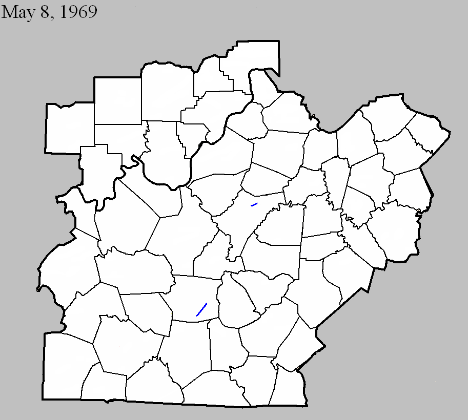
May 8, 1969
Counties: Nelson
F-scale: F1
Deaths:
Injuries:
Path width:
Path length:
Time: 5:00pm
Noted discrepancies: SPC gives a path length of 1/10 of a mile and a width of 10 yards...NCDC gives nothing for either.
Notes: Storm Data says this tornado destroyed two barns in the Fairfield area.
May 8, 1969
Counties: Hart
F-scale: F1
Deaths: 0
Injuries: 1
Path width: 100 yards
Path length: 9 miles
Time: 6:15pm
Grazulis narrative: Moved northeast from three miles northeast of Horse Cave, to Uno, and on to Hardyville. Several houses and five barns were demolished. Most of the house damage was caused by falling trees.
Noted discrepancies: SPC and NCDC rank this as an F1, Grazulis gives it an F2. SPC and NCDC give it a path length of 9 miles, Grazulis and Storm Data give 8 miles. SPC and NCDC lat/lons start the tornado east of Horse Cave...Grazulis starts it northeast of Horse Cave.
Notes: Storm Data says this tornado struck three miles northeast of Horse Cave, and then to Uno and Hardyville, crossing KY 541 about two miles west of US 31E. However, KY 541 is in Breathitt County. Probably meant KY 571.
Current Hazards
Hazardous Weather Outlook
Storm Prediction Center
Submit a Storm Report
Advisory/Warning Criteria
Radar
Fort Knox
Evansville
Fort Campbell
Nashville
Jackson
Wilmington
Latest Forecasts
El Nino and La Nina
Climate Prediction
Central U.S. Weather Stories
1-Stop Winter Forecast
Aviation
IDSS Forecast Points
Air Quality
Fire Weather
Recreation Forecasts
1-Stop Drought
Event Ready
1-Stop Severe Forecast
Past Weather
Climate Graphs
1-Stop Climate
CoCoRaHS
Local Climate Pages
Tornado History
Past Derby/Oaks/Thunder Weather
Football Weather
Local Information
About the NWS
Forecast Discussion
Items of Interest
Spotter Training
Regional Weather Map
Decision Support Page
Text Products
Science and Technology
Outreach
LMK Warning Area
About Our Office
Station History
Hazardous Weather Outlook
Local Climate Page
Tornado Machine Plans
Weather Enterprise Resources
US Dept of Commerce
National Oceanic and Atmospheric Administration
National Weather Service
Louisville, KY
6201 Theiler Lane
Louisville, KY 40229-1476
502-969-8842
Comments? Questions? Please Contact Us.


 Weather Story
 Weather Map
 Local Radar