Louisville, KY
Weather Forecast Office
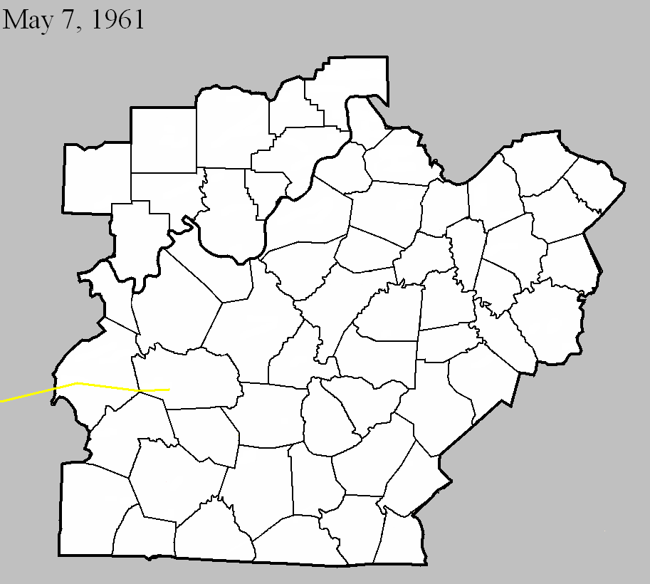
May 7, 1961
Counties: Ohio, Grayson (from Hopkins and Muhlenberg)
F-scale: F3
Deaths:
Injuries:
Path width:
Path length:
Time: 9:25am
Grazulis narrative: Skipped east-northeast from Madisonville to Bremen, Moorman, and on to Beaver Dam. The Moorman High School gym was unroofed and a small home fell over.
Noted discrepancies: SPC and NCDC rank this as an F3, Grazulis gives it an F2. Grazulis does not include Grayson County. SPC, Storm Data, and NCDC give a time of 9:25am, Grazulis give 8:15am. SPC and NCDC give a path length of 58 miles, Grazulis give 35 miles (skipping), Storm Data gives 60 miles. SPC and NCDC give a path width of 880 yards, Storm Data says 1320 yards, Grazulis says 200 yards. This tornado is very oddly listed at the NCDC website. NCDC lists Hopkins County at 9:25am, then two entries for Muhlenberg County (one at 9:36am and the other at 9:41am), then two entries for Ohio County (one at 9:48am and the other at 9:56am), then one entry for Grayson County (at 10:17am). All entries have identical f-scale and path widths values. Storm Data begins the tornado in McLean County, and thereafter agrees with SPC. The NCDC end lat/lon of the first Muhlenberg tornado is the same as the NCDC begin lat/lon of the second. Similarly, the NCDC end lat/lon of the first Ohio tornado is the same as the NCDC begin lat/lon of the second. All lat/lons are roughly in alignment with each other and with the Grayson County lat/lons. Will plot a single tornado as close to the given lat/lons as possible. In the LMK CWFA, only Centertown and Beaver Dam (both Ohio County) are mentioned in the Storm Data narrative. More research would be nice, especially to determine if this tornado did continue into Grayson County or not.
Current Hazards
Hazardous Weather Outlook
Storm Prediction Center
Submit a Storm Report
Advisory/Warning Criteria
Radar
Fort Knox
Evansville
Fort Campbell
Nashville
Jackson
Wilmington
Latest Forecasts
El Nino and La Nina
Climate Prediction
Central U.S. Weather Stories
1-Stop Winter Forecast
Aviation
IDSS Forecast Points
Air Quality
Fire Weather
Recreation Forecasts
1-Stop Drought
Event Ready
1-Stop Severe Forecast
Past Weather
Climate Graphs
1-Stop Climate
CoCoRaHS
Local Climate Pages
Tornado History
Past Derby/Oaks/Thunder Weather
Football Weather
Local Information
About the NWS
Forecast Discussion
Items of Interest
Spotter Training
Regional Weather Map
Decision Support Page
Text Products
Science and Technology
Outreach
LMK Warning Area
About Our Office
Station History
Hazardous Weather Outlook
Local Climate Page
Tornado Machine Plans
Weather Enterprise Resources
US Dept of Commerce
National Oceanic and Atmospheric Administration
National Weather Service
Louisville, KY
6201 Theiler Lane
Louisville, KY 40229-1476
502-969-8842
Comments? Questions? Please Contact Us.


 Weather Story
 Weather Map
 Local Radar